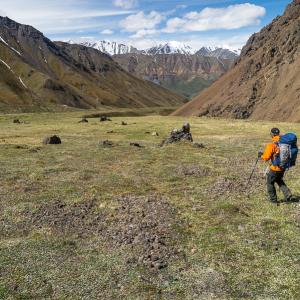
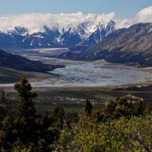
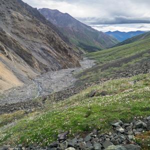
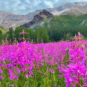
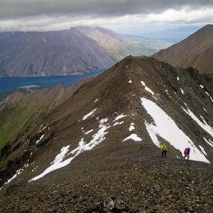
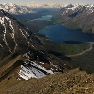
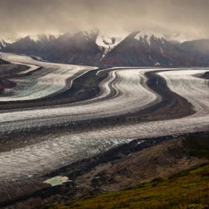
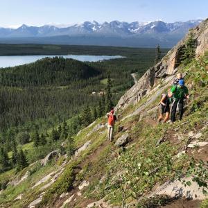
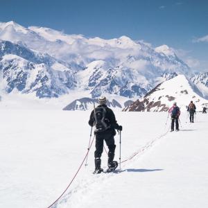
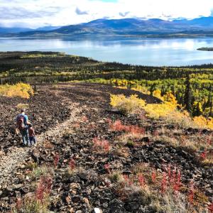
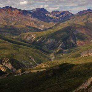
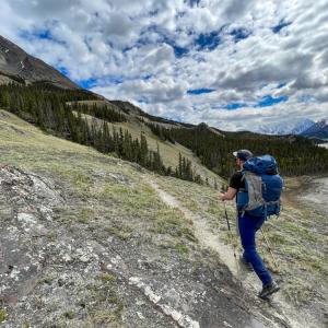
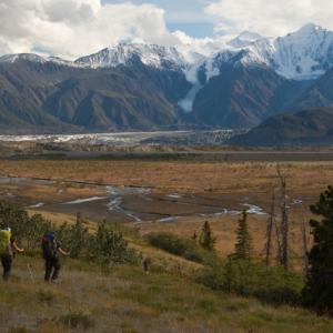
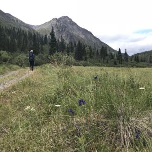
Kluane National Park
Distance: 27 km
Elevation Gain: 1255 m (4117 ft)
Time: 10.5 hours
Difficulty: Very Difficult
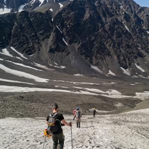
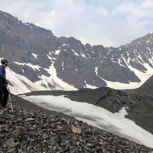
This circuit route takes you off the beaten track of the popular Auriol Trail, taking you across a moraine, up to a mountain saddle, down a glacier and across a beautiful alpine plateau. This hike is best suited to setting up a base camp at the Auriol Trail backcountry campground or somewhere higher in the alpine.
NOTE: The route has changed slightly, as described below, due to a recent landslide and rock avalanche. The mountains and landscapes are changing and you may encounter different conditions along the route than described here.
Elevation Gain: 1255 m (4117 ft)
Time: 10.5 hours
Difficulty: Very Difficult
This circuit route takes you off the beaten track of the popular Auriol Trail, taking you across a moraine, up to a mountain saddle, down a glacier and across a beautiful alpine plateau. This hike is best suited to setting up a base camp at the Auriol Trail backcountry campground or somewhere higher in the alpine.
NOTE: The route has changed slightly, as described below, due to a recent landslide and rock avalanche. The mountains and landscapes are changing and you may encounter different conditions along the route than described here.
Distance: 42 km
Elevation Gain: 1634 m (5361 ft)
Time: 10.5 hours
Difficulty: Very Difficult
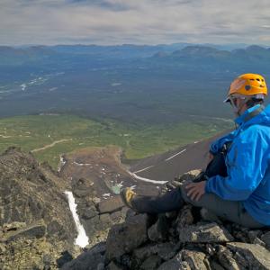
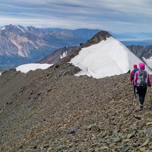
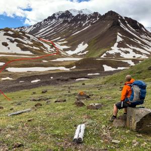
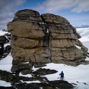
Auriol Peak is an impressive rocky peak, perched high between Quill Peak and Mount Martha Black within the Auriol Range. This route is accessible from the popular Auriol Trail in Kluane, and is best combined with camping at least one night either at the Auriol Trail backcountry campground or further into the alpine.
Elevation Gain: 1634 m (5361 ft)
Time: 10.5 hours
Difficulty: Very Difficult
Auriol Peak is an impressive rocky peak, perched high between Quill Peak and Mount Martha Black within the Auriol Range. This route is accessible from the popular Auriol Trail in Kluane, and is best combined with camping at least one night either at the Auriol Trail backcountry campground or further into the alpine.
Distance: 15 km
Elevation Gain: 367 m (1204 ft)
Time: 4.5 hours
Difficulty: Easy
The Auriol Trail is close to Haines Junction and is a popular day and beginner overnight hike. The actual trail itself does not go above tree level, but an extended hike from the trail into the alpine is highly recommended. Add 5 km and 430 m elevation gain if you hike into the alpine.
Distance: 24 km
Elevation Gain: 1017 m (3337 ft)
Time: 2-3 days
Difficulty: Moderate
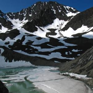
Bock's Lake is tucked amongst beautiful mountains and moraines. The route up the creek is straightforward but can be tricky depending on the water levels. It is long as a day hike so camping at the lake is recommended, plus there are many side trips from the lake with incredible views.
Elevation Gain: 1017 m (3337 ft)
Time: 2-3 days
Difficulty: Moderate
Bock's Lake is tucked amongst beautiful mountains and moraines. The route up the creek is straightforward but can be tricky depending on the water levels. It is long as a day hike so camping at the lake is recommended, plus there are many side trips from the lake with incredible views.
Distance: 55 km
Elevation Gain: 2123 m (6965 ft)
Time: 4-5 days
Difficulty: Moderate
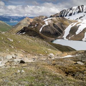
This route connects Bock's Lake to Congdon Creek via the Duke River. It requires some route finding, but it is a fantastic multi-day hike through some amazing terrain in Kluane National Park.
Elevation Gain: 2123 m (6965 ft)
Time: 4-5 days
Difficulty: Moderate
This route connects Bock's Lake to Congdon Creek via the Duke River. It requires some route finding, but it is a fantastic multi-day hike through some amazing terrain in Kluane National Park.
Distance: 22 km
Elevation Gain: 915 m (3002 ft)
Time: 8 hours
Difficulty: Moderate
This trail follows an old road up into the alpine, ending above the Sheep Creek Valley. The road is long but the ascent is gradual and aside from its length is an easy hike. Note there is a creek crossing. The views along the trail stretch down the Slims River Valley all the way to the toe of the Kaskawulsh glacier. At the end of the trail, the views of Red Castle Ridge and the Upper Sheep Creek Valley are an added reward. Backcountry camping is prohibited in this area.
Distance: 26 km
Elevation Gain: 661 m (2169 ft)
Time: 1-2 days
Difficulty: Moderate
Congdon Creek winds its way into the mountains. It is a great access point to explore deeper into Kluane. You could hike this as a long day trip, but it is much better as an multi-day trip, and you can even connect to the Bullion Plateau or the Bock's Lake areas.
Distance: 75 km
Elevation Gain: 2314 m (7592 ft)
Time: 4 days
Difficulty: Moderate
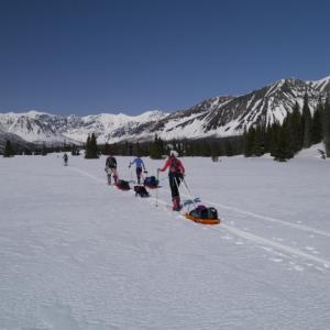
This multi-day trail circles through and around the Dalton Range in Kluane National Park. The trail can be hiked or skied from either end, although if you are skiing it, starting at the Mush Lake side allows you to keep the wind at your back when you reach Kathleen Lake. There is a mountain pass to climb during the middle of the trip, but the elevation gain isn't difficult. The view of the impressive Dalton Range mountains almost never leaves your sight.
Elevation Gain: 2314 m (7592 ft)
Time: 4 days
Difficulty: Moderate
This multi-day trail circles through and around the Dalton Range in Kluane National Park. The trail can be hiked or skied from either end, although if you are skiing it, starting at the Mush Lake side allows you to keep the wind at your back when you reach Kathleen Lake. There is a mountain pass to climb during the middle of the trip, but the elevation gain isn't difficult. The view of the impressive Dalton Range mountains almost never leaves your sight.
Distance: 82 km
Elevation Gain: 2452 m (8045 ft)
Time: 4-6 days
Difficulty: Moderate
This trail is a beautiful multi-day trek in the southern portion of Kluane National Park, starting and ending at either Kathleen Lake or Mush Lake Road. The trail itself is a combination of single-track trail, old mining roads, and a 4-wheel drive road. The trail traverses spectacular lakeshores, mountain passes, creek valleys, wildflower meadows and alpine plateaus. It involves multiple creek crossings, some which can be significant depending on the conditions. There are no established backcountry camping facilities, though Parks Canada does designate some parts of the trail as 'no camping zones' due to significant bear activity. Registration with Parks Canada is required. Note a large portion of the hike is along old mining roads, with limited views, though the scenery along the lakes, expansive meadows, and alpine sections of the trail (Cottonwood Pass and Dalton Pass) make up for it.
Distance: 16 km
Elevation Gain: 1375 m (4511 ft)
Time: 8.5 hours
Difficulty: Very Difficult
This is a fun hike for those looking for something more challenging. This route follows the same trail as King's Throne but takes you to a higher, more rocky summit with some amazing views. It is definitely not for those scared of heights or rock scrambling, as you get a heavy dose of both of these and at many times it feels more like a 'climb' than a 'hike'.
Distance: 108 km
Elevation Gain: 4730 m (15518 ft)
Time: 7 - 9 days
Difficulty: Difficult
The Dän Zhùr (Donjek) route is a challenging multi-day hike that crosses a variety of terrain: tussock plateaus, mountain passes, glacier viewing and numerous creek and river crossings. The mighty Donjek Glacier near the halfway point of this route is a highlight. Weather is a major factor on this hike, which affects water levels for creek crossings.
Distance: 6 km
Elevation Gain: 39 m (128 ft)
Time: 1.5 hours
Difficulty: Easy
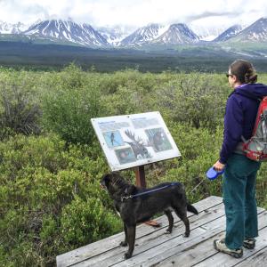
This trail is a pleasant flat walk along the Dezadeash River Valley in Haines Junction, with great views of the Auriol Range and nice boardwalks and interpretive signage along the way. The trail would be great for anytime of year, including for cross country skiing/nordic touring or fat tire bike riding in the winter.
Elevation Gain: 39 m (128 ft)
Time: 1.5 hours
Difficulty: Easy
This trail is a pleasant flat walk along the Dezadeash River Valley in Haines Junction, with great views of the Auriol Range and nice boardwalks and interpretive signage along the way. The trail would be great for anytime of year, including for cross country skiing/nordic touring or fat tire bike riding in the winter.

Distance: 36 km
Elevation Gain: 2341 m (7680 ft)
Time: 2-3 days
Difficulty: Moderate
This is a multi-day hike that takes you behind Mount Decoeli to a high sub-alpine plateau. The route is varied between creek crossings, rock moraines and tussocks. There are multiple places to camp along the route, and a day hike the next day or overnight trip to Kimberley Meadows is also an option.
Distance: 15 km
Elevation Gain: 1250 m (4101 ft)
Time: 8 hours
Difficulty: Difficult
The King's Throne is truly a majestic site when viewed from the shores of Kathleen Lake. It is one of the more popular day hikes in Kluane National Park, with breathtaking views of the surrounding valleys and Kathleen Lake below. The route described goes to the summit, though many people opt to save their knees and stop once they reach the seat of the throne (at the top of the rock glacier, about two thirds up).
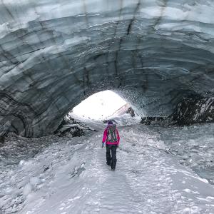
Distance: 13 km
Elevation Gain: 545 m (1788 ft)
Time: 4 hours
Difficulty: Easy
Once a well-kept secret by the locals, this hike went viral as scores of Yukoners and tourists have since flocked to this accessible ice cave (which is really a tunnel). The route is easy to follow up a creek bed, which takes you right to the cave, with its huge arch of blue ice. There are stunning views of the Kluane Mountain Range on the way to make this a pleasant hike for all skill levels. NOTE: Only the winter route has been recorded. NOTE as of Summer 2019, the cave has collapsed.
Distance: 29 km
Elevation Gain: 1950 m (6398 ft)
Time: 15 hours
Difficulty: Very Difficult
UPDATE 2022 - THE START OF THIS ROUTE VIA THUNDEREGG CREEK HAS BEEN WASHED OUT - SEE ROUTE DESCRIPTION.
Mount Archibald is the highest point in a group of mountains between the Dezadeash River and the Jarvis River. The southeast ridge is an interesting scramble with views of surrounding glaciers. The summit offers a view down into the Kluane Icefields, including Mount Logan. This hike is rated very difficult due to the exposure, scrambling and distance.
Distance: 15 km
Elevation Gain: 1324 m (4344 ft)
Time: 6.5 hours
Difficulty: Difficult
Mount Decoeli is a pyramidal peak you can see from Haines Junction. From the summit on a clear day you get a sweeping view of the mountains, valleys, and icefields of Kluane National Park.
Elevation Gain: 1324 m (4344 ft)
Time: 6.5 hours
Difficulty: Difficult
Mount Decoeli is a pyramidal peak you can see from Haines Junction. From the summit on a clear day you get a sweeping view of the mountains, valleys, and icefields of Kluane National Park.
Distance: 36 km
Elevation Gain: 1705 m (5594 ft)
Time: 16 hours
Difficulty: Very Difficult
Mount Martha Black is the highest peak within the Auriol Range, accessed via the Auriol Trail. This route is an excellent entry level mountaineering trip with varied terrain and a variety of skills required - glacier travel and up to Class 5 scrambling (rope, harnesses and helmets a must). It's a fair distance and elevation to cover, best completed with overnight stays in the beautiful alpine flower covered plateau.
NOTE: The route has changed slightly, as described below, due to a recent landslide and rock avalanche. The mountains and landscapes are changing and you may encounter different conditions along the route than described here.
Distance: 6 km
Elevation Gain: 750 m (2461 ft)
Time: 4 hours
Difficulty: Moderate
This route connects Nines Creek North and Nines Creek South. It is a great route if you want to either hike both Nines Creek North and Nines Creek South, or if you want to hike Nines Creek South and do somewhat of a loop route. The views from the saddle are worth the extra effort.
Distance: 24 km
Elevation Gain: 775 m (2543 ft)
Time: 2-3 days
Difficulty: Moderate
Nines Creek North leads up the Nines Creek North valley towards Nines Peak, an impressive glaciated mountain. The alpine area at the end of the valley is great to explore, and there is a pass that overlooks the Duke River and the mountains beyond. Although there a few creek crossings, this is a great overnight hike.
Distance: 22 km
Elevation Gain: 940 m (3084 ft)
Time: 2-3 days
Difficulty: Moderate
Nines Creek South weaves its way up through two small canyons before widening out. The wide creek valley is easy hiking surrounded by beautfiul Kluane mountains. Near the end of Nines Creek South, where the creek splits, you can climb to a spectacular alpine area with many little lakes and large mounds to explore (highly recommended). If just hiking Nines Creek South (not to the lakes), it is 8.4 km (one way) with 540 m elevation gain. Hiking to the lakes adds 2.4 km (one way) and 400 m elevation gain (about 1.5 hours extra one way).
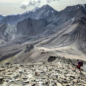
Distance: 22 km
Elevation Gain: 842 m (2762 ft)
Time: 8-10 hours
Difficulty: Difficult
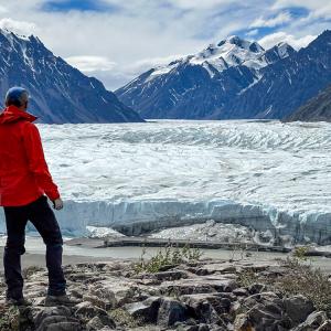
The view of the Kaskawulsh Glacier from the plateau on top of Observation Mountain is stunning. From the viewpoint, you can see the glacier converge around Kaskawulsh Mountain and run straight below you and down the valley. The hike is long and you have to get to the end to enjoy the view, but what a view!
Elevation Gain: 842 m (2762 ft)
Time: 8-10 hours
Difficulty: Difficult
The view of the Kaskawulsh Glacier from the plateau on top of Observation Mountain is stunning. From the viewpoint, you can see the glacier converge around Kaskawulsh Mountain and run straight below you and down the valley. The hike is long and you have to get to the end to enjoy the view, but what a view!
Distance: 4 km
Elevation Gain: 714 m (2343 ft)
Time: 4 hours
Difficulty: Difficult
A very steep hike with rewarding views of Pine Lake and the Kluane Front Ranges. There is some infrastructure at the top including a heli-pad, fire-lookout tower, and various communication towers.
NOTE: This hike does pass within Category B Settlement Lands of the Champagne and Aishihik First Nations. Please respect their rules and land.
Distance: 7 km
Elevation Gain: 140 m (459 ft)
Time: 4 hours
Difficulty: Easy
Pikatak Nunatak is a great half-day trip from a camp on the glacier near Mount Queen Mary. There is no technical climbing, but there are some crevasses near the base of the nunatak. The view of Mount Logan from the top of the nuntak is spectacular.
Distance: 2 km
Elevation Gain: 176 m (577 ft)
Time: 1.5 hours
Difficulty: Easy
This is one of the easiest trails in Kluane National Park making it fun for the whole family with interpretive signage and a benched viewing area near the top. The views of Dezadeash Lake and surrounding mountains are beautiful.
Elevation Gain: 176 m (577 ft)
Time: 1.5 hours
Difficulty: Easy
This is one of the easiest trails in Kluane National Park making it fun for the whole family with interpretive signage and a benched viewing area near the top. The views of Dezadeash Lake and surrounding mountains are beautiful.
Distance: 15 km
Elevation Gain: 1100 m (3609 ft)
Time: 6.5 hours
Difficulty: Moderate
A classic Kluane Park hike which offers views of the Slim's River Valley, Kluane Lake, and the mountains around the area. Sheep and grizzlies can often be sighted in the area, so bring binoculars to view them from a distance. If you decide not to hike the ridge to the first summit viewpoint, then the total distance is 10 km (return). However, the view from the top of the ridge overlooking Kluane Lake is spectacular. See Sheep Mountain for the trail up the north ridge of the mountain.
Please note that during lambing season (May 1 to June 15) there’s a closure of the route beyond the 5 km mark. Ensure that you turn back at the KM 5 post, at the end of the trail overlooking Forty-eight Pup Creek.
Distance: 51 km
Elevation Gain: 60 m (197 ft)
Time: 3 days
Difficulty: Easy
This trail leads you along the east side of the Slim's River, where you can camp beside a lake and do a day hike towards the Kaskawulsh Glacier. The distance to the camping spot (15 km, 4.5 hours) is shorter than on Slim's River West Trail, and there are no large creeks to cross, making it for an easier option. However, you can't get as close to the Kaskawulsh Glacier as you can on Slim's River West. It is still a fantastic location to camp and day hike with Kluane mountain vistas, and you can see the Kaskawulsh Glacier from camp.
CURRENT WARNING: Expect and be prepared for extreme dust conditions. Significant dust storms occur in this area, reducing visibility and affecting local air quality. Visitors should bring eye protection and a face covering, such as an N95 mask, to protect their eyes, mouth and nose during dust exposure. When possible, move camp outside the affected area. Call the Kluane National Park Visitor Centre to check on conditions before you go: 1-867-634-5134.
Distance: 46 km
Elevation Gain: 115 m (377 ft)
Time: 3 days
Difficulty: Moderate
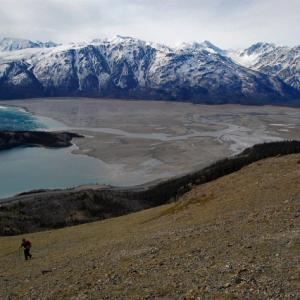
This trail follows along the west side of the Slim's River and ends up at a campsite about 2 kms from the toe of the Kaskawulsh Glacier. You are hiking into the heart of Kluane, so the mountains around you never cease to impress. Plan on camping at least 2 nights if you want to get a better view of the glacier. The trail along the river is long but relatively flat with a few damp sections and a couple of creek crossings.
CURRENT WARNING: Expect and be prepared for extreme dust conditions. Significant dust storms occur in this area, reducing visibility and affecting local air quality. Visitors should bring eye protection and a face covering, such as an N95 mask, to protect their eyes, mouth and nose during dust exposure. When possible, move camp outside the affected area. Call the Kluane National Park Visitor Centre to check on conditions before you go: 1-867-634-5134.
Elevation Gain: 115 m (377 ft)
Time: 3 days
Difficulty: Moderate
This trail follows along the west side of the Slim's River and ends up at a campsite about 2 kms from the toe of the Kaskawulsh Glacier. You are hiking into the heart of Kluane, so the mountains around you never cease to impress. Plan on camping at least 2 nights if you want to get a better view of the glacier. The trail along the river is long but relatively flat with a few damp sections and a couple of creek crossings.
CURRENT WARNING: Expect and be prepared for extreme dust conditions. Significant dust storms occur in this area, reducing visibility and affecting local air quality. Visitors should bring eye protection and a face covering, such as an N95 mask, to protect their eyes, mouth and nose during dust exposure. When possible, move camp outside the affected area. Call the Kluane National Park Visitor Centre to check on conditions before you go: 1-867-634-5134.
Distance: 8 km
Elevation Gain: 120 m (394 ft)
Time: 2 hours
Difficulty: Easy
St. Elias Lake is a short hike with great rewards. There is a backcountry campground at the lake, which is nestled between tall mountains. This trail is great for beginner backcountry camping because it is a short trail to a campground with amenities. It is also great to do with kids.
Distance: 13 km
Elevation Gain: 966 m (3169 ft)
Time: 6 hours
Difficulty: Difficult
This route takes you to the top of a mountain plateau dotted with impressive rock formations that make you feel like you're in another world. A tor is a prominent rock or pile of rocks on top of a hill, and the tors on this hike offer lots of exploring or even bouldering opportunities if you're into that kind of thing. There are also great views of the Kluane Front Ranges towards Haines Junction and the Aishihik and Dezedeash River valleys. Note Dall sheep can often be seen in the area. NOTE: This hike falls within Category B Settlement Lands of the Champagne & Aishihik First Nation. Please respect their rules and land.
Distance: 10 km
Elevation Gain: 1163 m (3816 ft)
Time: 6 hours
Difficulty: Difficult
This trail is much steeper and more strenuous than the Sheep Creek Trail, but you get a view overlooking Kluane Lake and the surrounding mountains the entire time. You don't get a view down the Slims River as you do on the Sheep Creek Trail. This area is closed during the lambing season from May 1 to June 15. Outside of this period you still need to practice safe viewing from a distance of 50 m.
Distance: 14 km
Elevation Gain: 215 m (705 ft)
Time: 3.5 hours
Difficulty: Easy
UPDATE 2022 - THIS ROUTE HAS BEEN WASHED OUT - See Route Comments below.
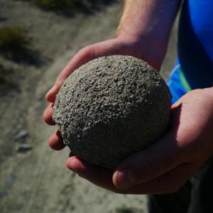
Thunderegg Creek is a nice, short hike in Kluane, which follows along an old exploration road with open views of the Alsek Valley and surrounding mountains. There is not much elevation gain as you hike through stunted stands of aspen and balsam poplar, ending up near the base of a large cutbank of Thunderegg Creek, which holds the famous 'thundereggs' (the sphere-shaped rocks) this area is known for.
Elevation Gain: 215 m (705 ft)
Time: 3.5 hours
Difficulty: Easy
UPDATE 2022 - THIS ROUTE HAS BEEN WASHED OUT - See Route Comments below.
Thunderegg Creek is a nice, short hike in Kluane, which follows along an old exploration road with open views of the Alsek Valley and surrounding mountains. There is not much elevation gain as you hike through stunted stands of aspen and balsam poplar, ending up near the base of a large cutbank of Thunderegg Creek, which holds the famous 'thundereggs' (the sphere-shaped rocks) this area is known for.
Distance: 4 km
Elevation Gain: 214 m (702 ft)
Time: 2 hours
Difficulty: Moderate
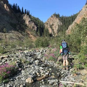
Williscroft Canyon is a spectacular and unique hike in the Kluane Lake area of Kluane National Park. Huge canyon walls reach up above a beautiful clear, cobble and boulder strewn creek. The reward at the end of the canyon is a huge boulder lodged within a narrowing in the canyon walls, with a small waterfall running below it. Under most water level conditions, be prepared to cross the creek regularly.
Elevation Gain: 214 m (702 ft)
Time: 2 hours
Difficulty: Moderate
Williscroft Canyon is a spectacular and unique hike in the Kluane Lake area of Kluane National Park. Huge canyon walls reach up above a beautiful clear, cobble and boulder strewn creek. The reward at the end of the canyon is a huge boulder lodged within a narrowing in the canyon walls, with a small waterfall running below it. Under most water level conditions, be prepared to cross the creek regularly.