Total Distance: 26 km
Return Time: 1-2 days
Elevation Gain: 661 m
Difficulty: Moderate
Region: Kluane
Traditional Territory: KFN, WRFN
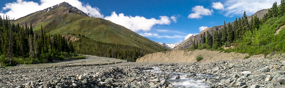
Congdon Creek winds its way into the mountains. It is a great access point to explore deeper into Kluane. You could hike this as a long day trip, but it is much better as an multi-day trip, and you can even connect to the Bullion Plateau or the Bock's Lake areas.
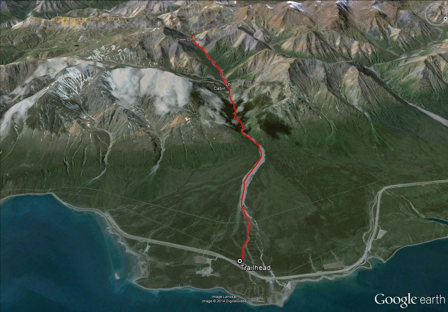
Drive 87 km north of Haines Junction on the Alaska Highway. About 250 m south of the Congdon Creek Campground you will see a small gravel road on your left (west side). You can park on the road just off the highway. Depending on conditions, you may be able to drive 1.5 km up the gravel road.
Note: Congdon Creek is technically on the border of the Kluane Wildlife Sanctuary and Kluane National Park. Towards the end of the valley you are within the park boundary and backcountry overnight registration is mandatory.
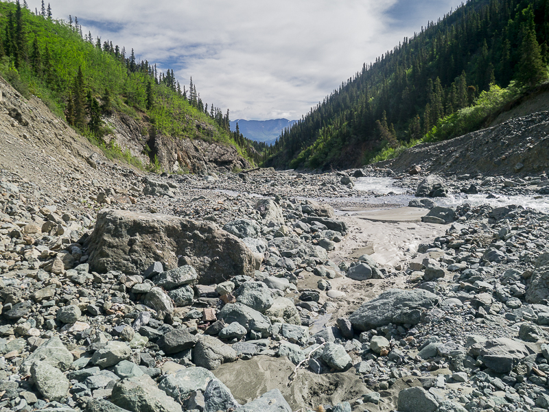
Start by following the gravel road for about 1.5 km. It is easy walking and easy to follow. You will eventually reach the wide creek bed of Congdon Creek with obvious signs of mining. You can follow the creek bed most of the way up.
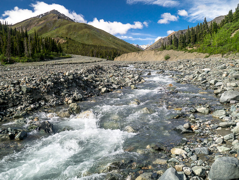
As you approach the mountains, the creek bed will start to narrow and you may be forced to cross Congdon Creek at times.
After 8 km, there is a small cabin on your right (north) in the trees. Don't plan on staying the night there, it is in very poor shape.
Near the end of the route, after about 12 km, the canyon narrows enough that you may be forced to walk on the hillside on your left (south). It is fairly easy walking and is open alpine.
The route ends in a wide open area with a confluence of creeks. To your right (north) leads to a pass below Right On Mountain towards Dickson Creek. This would be a good objective if you are only spending one night in the area. To your left (south) leads towards Red Castle Ridge and Bullion Plateau, which would be a multi-day route leading out near Sheep Creek.
If you are camping at the end of the route described here, there is a small patch of ground in a group of vegetation on the northwest side. Otherwise you can camp on the sand and gravel if you can find a flat spot.
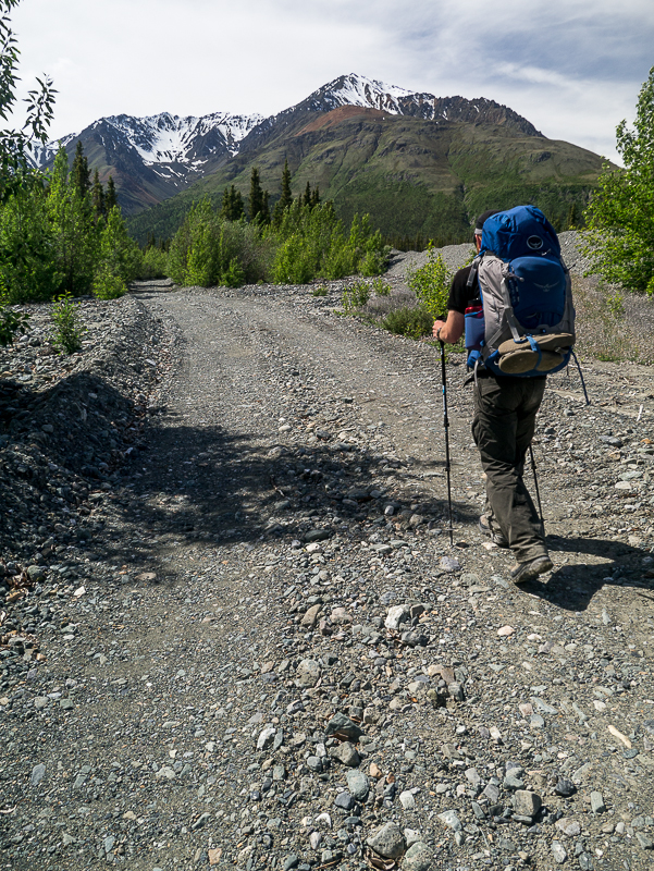
The route starts off by following a gravel road.
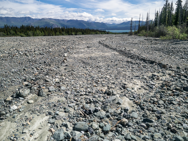
After leaving the gravel road, you will reach the wide creek bed of Congdon Creek.
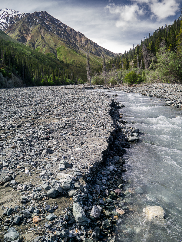
The creek bed starts to narrow as you reach the mountains.
Further up the creek, you may be forced to cross as it meanders.
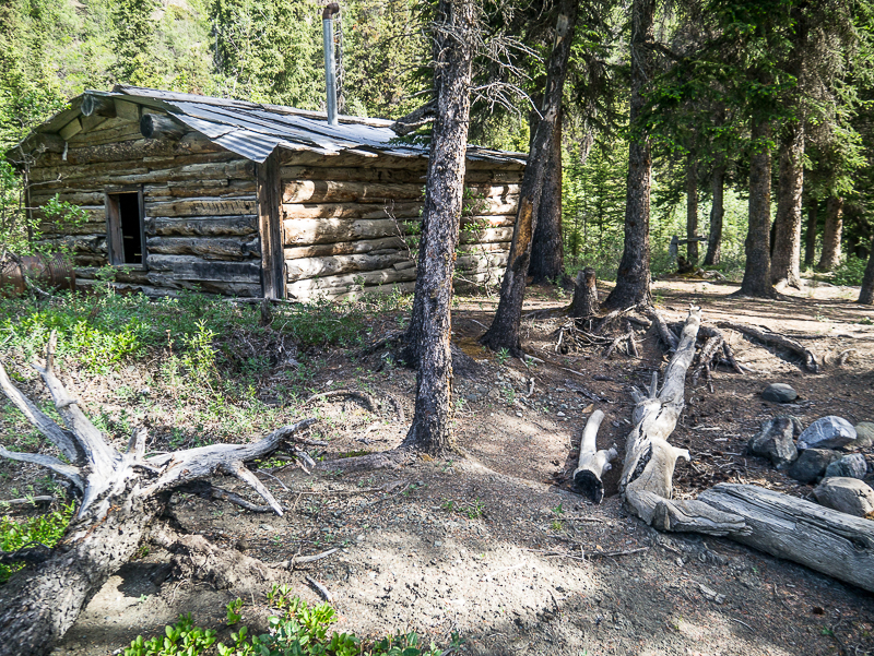
The cabin, about 8km up the trail. Not worth staying in.
The scenery is beautiful as you hike up Congdon Creek.
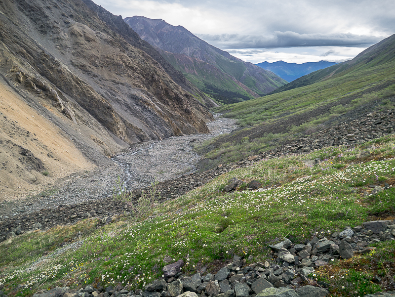
Near the end of the trail, you may be forced to climb the hillside to avoid any narrow canyons.
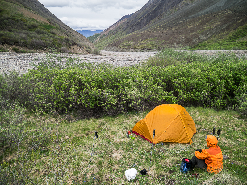
You may have to explore in order to find a flat camping spot at the confluence of the creeks.
Ernie July 28, 2023
Started this hike on July 27, 2023 - got about 2 km in and came across mama grizzly and cub and decided to turn back. Mama watched us as we backed away and then just kept doing whatever she was doing with the youngster.
Amanda June 27, 2023
June 24-25, 2023. Chosen for lack of incline for an overnight hike, it was the right amount of effort for newbies. The road was drivable, water plentiful. Water flow was strong and thigh deep in places (in later afternoon with temps around 20). We crossed the creek 6 or 7 times, sometimes in quick succession. Cabin was a good stop to rest out of the wind. Thanks for the route!
