Total Distance: 10 km
Return Time: 2.5 hours
Elevation Gain: 78 m
Difficulty: Easy
Region: Whitehorse
Traditional Territory: KDFN, TKC
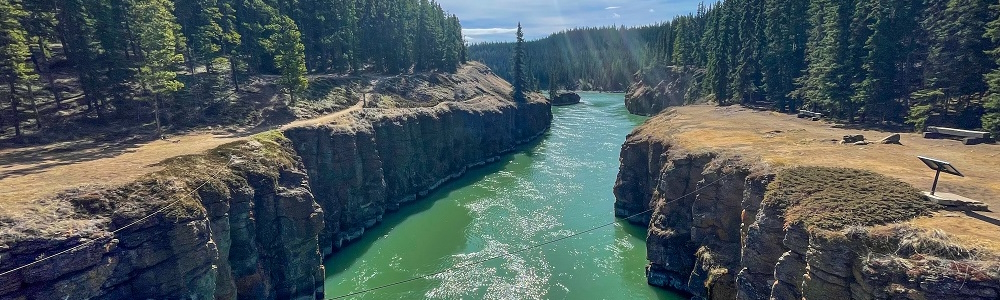
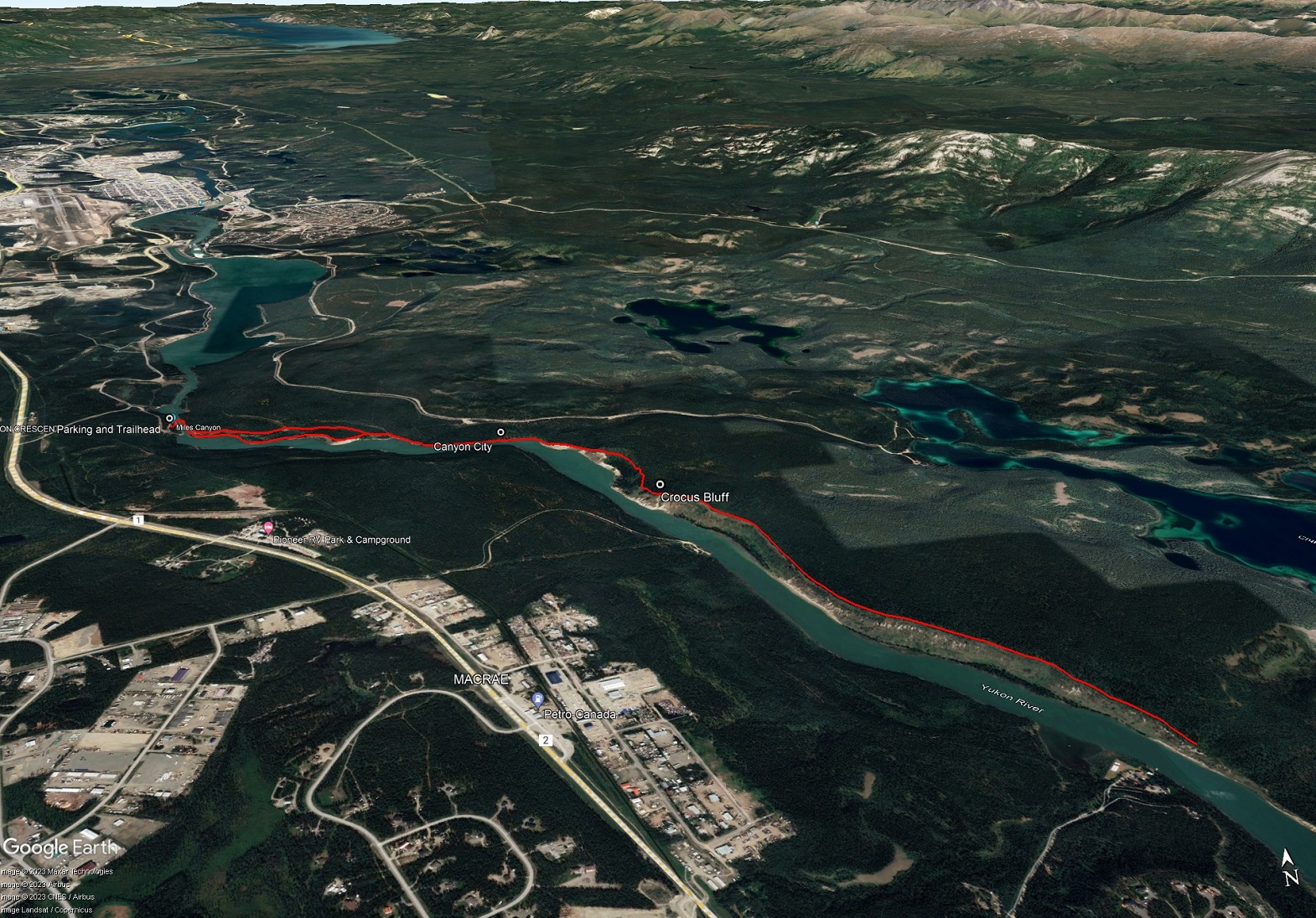
Starting at the iconic Kwanlin (aka Miles Canyon), this trail hikes along the beautiful green waters of the Yukon River. The hike described here includes parts of the Canyon City Trail and the Yukon River Trail.
Drive south on the Alaska Highway from Whitehorse and take a left on the Miles Canyon Road. In a couple hundred meters, follow the sign for Miles Canyon, taking the road to the right. This road will take you to the parking area and trailhead. The Miles Canyon Road can also be accessed from the lower end in Whitehorse off of Robert Service Way. Just take a left after the Yukon Energy plant and then go right at the stop sign. Follow the road until you see signs for Miles Canyon to the left. This takes you to the same trailhead as above.
Note the Miles Canyon Road is closed typically from October to May each year. Alternate access through Riverdale via Nistulin Drive to Chadburn Lake Road is also possible. Drive about 4 km down the Chadburn Lake Road until you see a larger parking area on the right with a big trail sign kiosk. Follow the trail from here to the Miles Canyon suspension bridge where the hike starts.
From the parking area, the trail drops down several sets of stairs to the cliffs above the canyon and the suspension bridge.
Once across the bridge, turn right and you have the choice to follow either the Lower Canyon City Trail or the Upper Canyon City Trail. Note they meet up again in about 1 km so you can also choose to take one trail on the way there and the other on the way back. The lower trail hugs along the beautiful cliff edge and riverbank, while the Upper Trail sticks more to the forest.
After the Lower Trail rejoins the Upper Canyon City Trail, the trail follows above the river. There's a bench to rest on shortly after that and another trail junction to the left that comes from the Chadburn Lake Road and the closest parking area to Canyon City. Canyon City is 2 km from the trailhead.
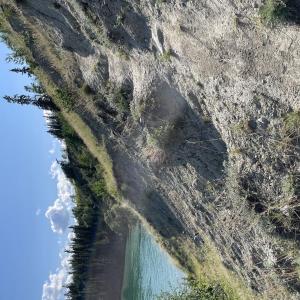
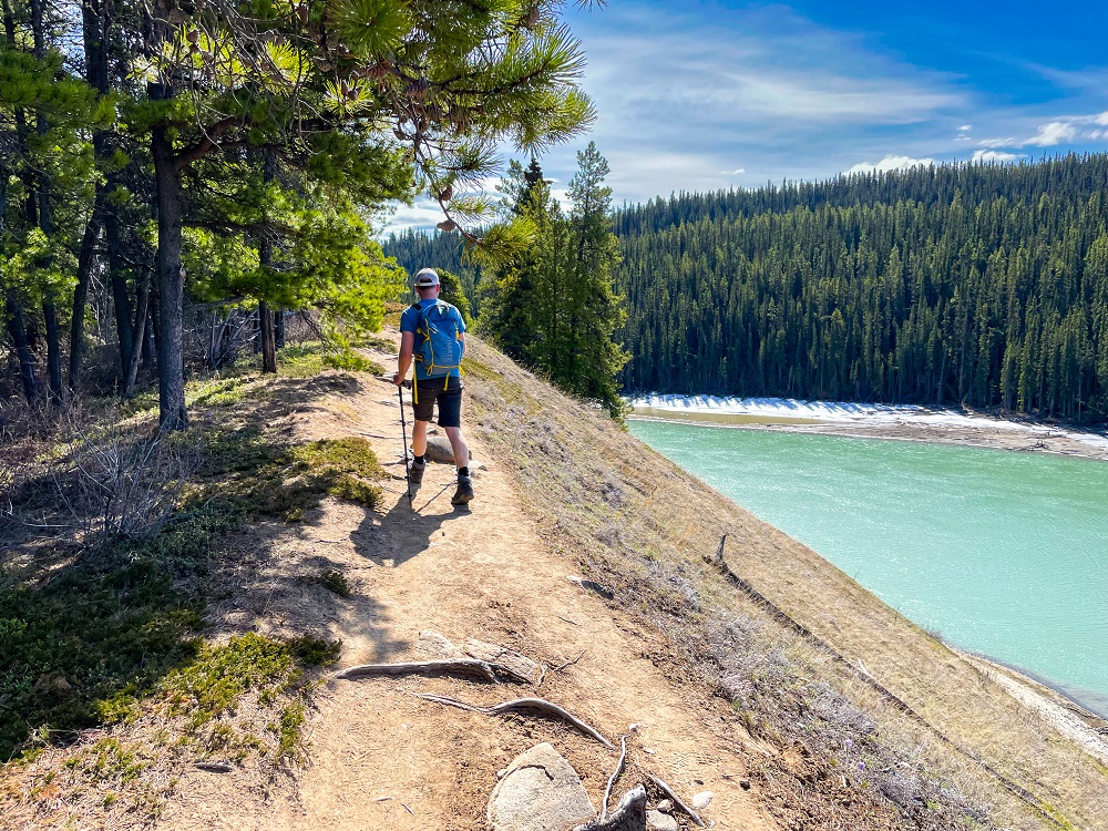
After Canyon City, the Yukon River Trail continues east-southeast and starts to climb up quite high above the river. About 1 km after leaving Canyon City, and about 70 m elevation gain, you reach a high point on the cliffs at an open bluff. This bluff is covered in crocuses in the spring and is always a delight! Hence why we call it Crocus Bluff.
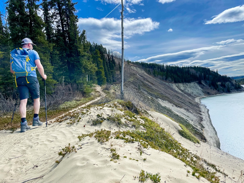
From Crocus Bluff, the trail continues with little to no elevation gain along the open cliffs high above the river. After 2.2 km from Crocus Bluff, there is a good turnaround spot before the trail drops down again. Enjoy the views and return the way you came. Or continue farther down the trail to add a longer hike. The trail is in good condition until near the Wolf Creek confluence with the Yukon River.
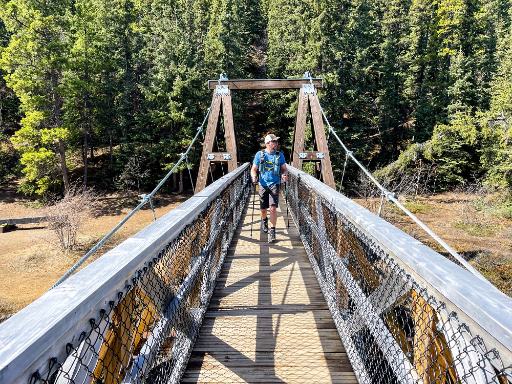
The trail starts out by crossing a suspension bridge over the Yukon River over 'Kwanlin' (aka Miles Canyon).
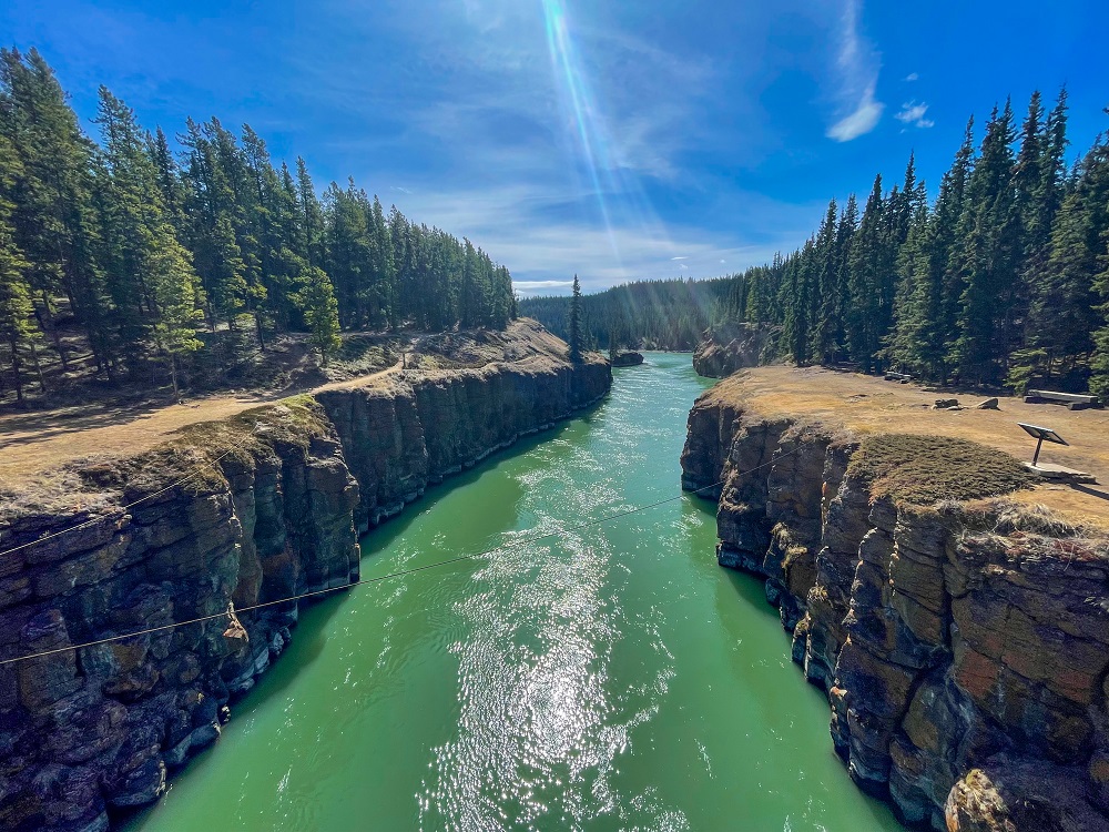
The view up the Yukon River from the suspension bridge.
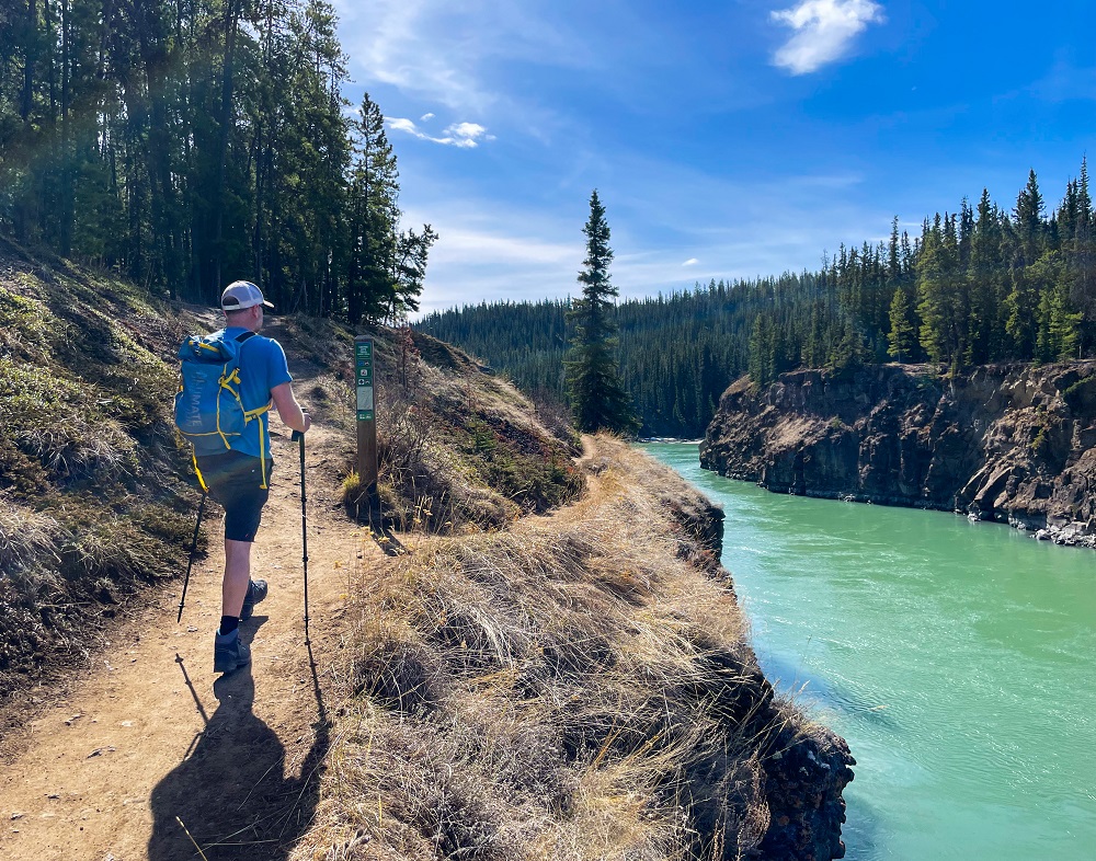
Shortly after the bridge you can choose to follow either the Lower Canyon City or Upper Canyon City trail.
The trail along the Lower Canyon City Trail hugs closer to the river with awesome views the whole way. It meets up with the Upper Canyon City Trail after about 1 km.
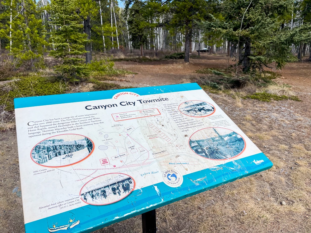
You reach Canyon City 2 km from the trailhead.
After Canyon City, the trail continues as the 'Yukon River Trail' and it climbs up about 70 m to some high cliffs.
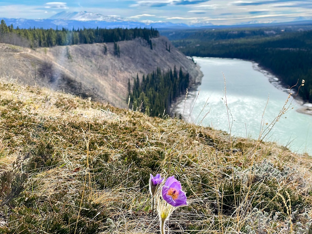
At the top of the high cliffs is a beautiful open bluff, plentiful with crocuses in the spring (early May). The trail continues along the cliff top for another 2.2 km until it drops down again. This is a good place to break and turn around.
Frenchie June 6, 2025
An easy trail to follow, offering a plethora of splendid views above the Yukon River, with manageable elevation gain. A real treat-of-a-hike! Conditions today were dry with good footing; few bugs.
Created a loop hike by turning into the forest along Log Trail, passing by Chadburn Lake, and along Chadburn Lake Rd./ski trails, to end back at Miles Canyon. (Used the All Trails app for this routing; roughly 15 kms, loop).

Rod July 2, 2023
If you want to do the full loop via returning on the tramway trail, be advised that there is a section of this trail that should be considered very technical.
The trail is almost washed completely out for approximately 100’, and the slope is very steep, do not take children on this trail.