Total Distance: 10 km
Return Time: 4 hours
Elevation Gain: 563 m
Difficulty: Moderate
Region: White Pass
Traditional Territory: CTFN, TRTFN
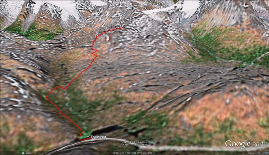
The winter route to Taiya SW3 (SW3 refers to the peak 3 kms southwest of Taiya Peak) starts off with a gentle ski tour and is followed by a mellow ascent up to a broad ridge. Feather Peak stays in view most of the way up, and you'll never get tired of the mountain vista from the top of the ridge. You can see the jagged peaks across the Chilkoot Trail and the mountains back towards the highway are equally impressive.
From Whitehorse, drive south to the Carcross cutoff and turn right onto the Klondike Highway. After 71 km you will reach Canadian Customs. Another 12 km past customs there is a pull-out on the right-hand (west) side of the road.
Only the winter route has been recorded.
The beginning of this route is the same as Feather Peak. If you are looking up towards Feather Peak from the parking lot, Taiya SW3 is the ridge on the right (north) side of the creek canyon.
From the parking lot, descend down to the flat section below. If you are skiing, you can either ski down with your skins on, or put your skins on at the bottom. If there are snowmobile or ski tracks, you can follow them, otherwise start heading up the gentle terrain. You may notice a small waterfall and creek canyon as you climb, keep this to your right.
Just under 2 kms up, the small canyon disappears and then reappears higher up again. You can turn directly to your right (north) here and start gently ascending the small ridge. An alternative route is to continue skiing further up and turn right after the canyon ends.
Soon you will come to the base of the Taiya SW3 ridge which may have a few rocks exposed. Stay slightly to the left (just to the right of the exposed rocks) and zigzag your way up. You will have to cut across one very short section which is at an angle of about 25 degrees and is the steepest part of the whole route. After crossing it, head directly up to the left (south) towards the rocks.
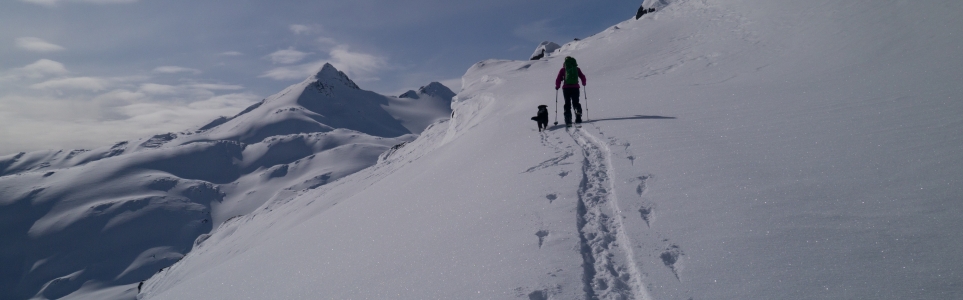
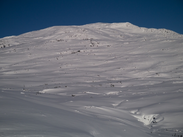
Once you reach the left (south) section of the ridge, the going is easier. Keep heading up until you reach the top of the flat, broad ridge. You can soak in the views from here and either descend the same way, or continue up to the true summit of Taiya SW3 which is about another 2 kms to the north-west.
Snowshoeing - Add another 1.5 or 2 hours to this route if you are snowshoeing.
Nordic Ski Touring - Half of this route is a ski tour. The other half (ascending the ridge) may be too steep for nordic touring skis. Instead, you could continue skiing up the plateau to the left of the Taiya SW3 ridge.
Alpine Ski Touring / Splitboarding - This route starts off as a ski tour, but ascending and descending the actual ridge requires skins. You'll be able to get some turns in from the top of the ridge to the base of it, and you should be able to ski most of the way back to the highway.
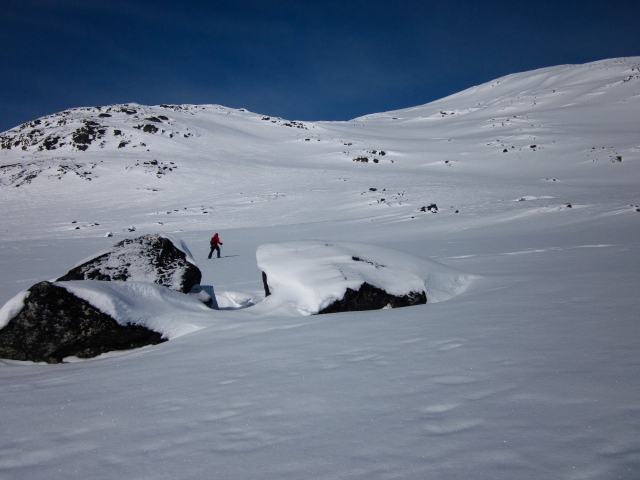
Looking to the top of the broad ridge from the parking lot.
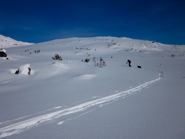
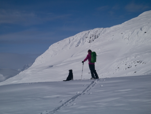
Heading up the gentle, open slope towards the base of the ridge.
At the base of the ridge, stay just to the right of the exposed rocks that are up on the left.
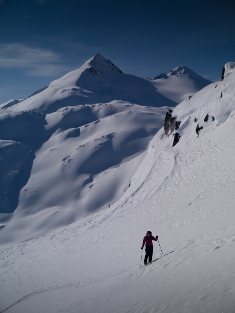
The steeper section of the route, with Feather Peak in the background.
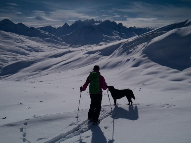
Looking at the mountain vistas back towards the highway.
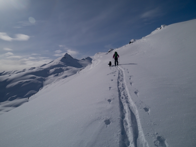
Once on the ridge above the rocks, the route becomes gentle again.
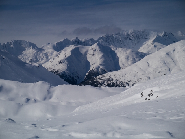
The reward from the top of the ridge is the fantastic view of the jagged peaks across the Chilkoot Trail.
In the distance is the true summit of Taiya SW3, which you can continue to if you want an even better view.
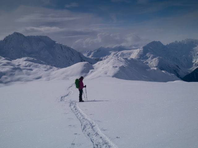
The top of the broad ridge is fairly flat and there are mountains in every direction.