Total Distance: 7 km
Return Time: 4 hours
Elevation Gain: 500 m
Difficulty: Moderate
Region: Tombstone
Traditional Territory: THFN
This gorgeous route in Tombstone Territorial Park lies just north of Mount Boyle and Mount Adney, and has the added benefit of a well-trodden horse trail to help you cross the tussock plateau. The hike up to the main ridge is steep but short and then it is a great ridge walk among the tors and rock spires with amazing views in every direction.
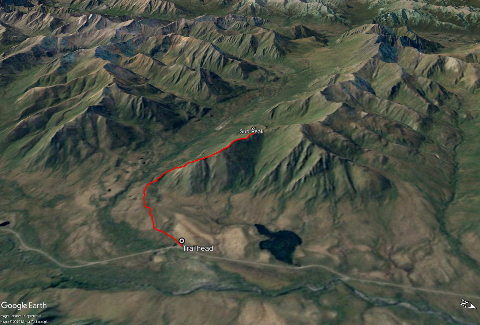
Drive north on the Dempster Highway to around kilometre 91. There is a small pullout on the left, about 150 m after a horse stable (on the right). The trailhead starts at the south end of the parking area, where a light trail can be found going through a small gravel pit.
NOTES ABOUT BAKCOUNTRY TRAVEL OFF-TRAIL IN TOMBSTONE TERRITORIAL PARK:
This is a route, not a trail. It is advised that you are experienced in route finding, backcountry travel, and are well prepared and self-reliant. Choose durable ground and spread out to prevent creation of new trails on the fragile tundra vegetation and permafrost. Avoid wet or muddy areas where possible and stick to higher group and follow ridgelines.
Registration is mandatory for camping within the park. Please visit the Tombstone Interpretive Centre to acquire the correct park permits, and receive up-to date information on trail conditions, closures and wildlife activity.
Park approved bear-resistant canisters are mandatory (only hard shell, not soft bags) for all backcountry camping. Dogs must be on a leash at all times and fires are not permitted.
----------------------
Follow the trail through the gravel pit and pick up a well-worn horse trail through the shrubs. This trail will take you across the tussock plateau to the base of Rake Mountain. There can be some wet and muddy sections on the trail to navigate through, and of course watch out for fresh horse poop. Side note, this horse trail is used to access the Foxy Creek Valley and beyond to Auston Pass, the Cloudy Range and West Blackstone River.
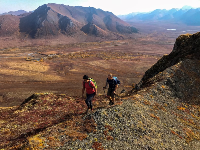
Once the trail takes you closer to the base of the mountain, you will be able to see some small, rolling ridges leading up the south side of the mountain. This is where you can leave the horse trail and pick your way up and through some minor bushwacking to gain the ridge. There are many small trails that you can follow through the bushes.
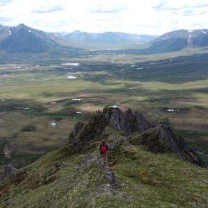
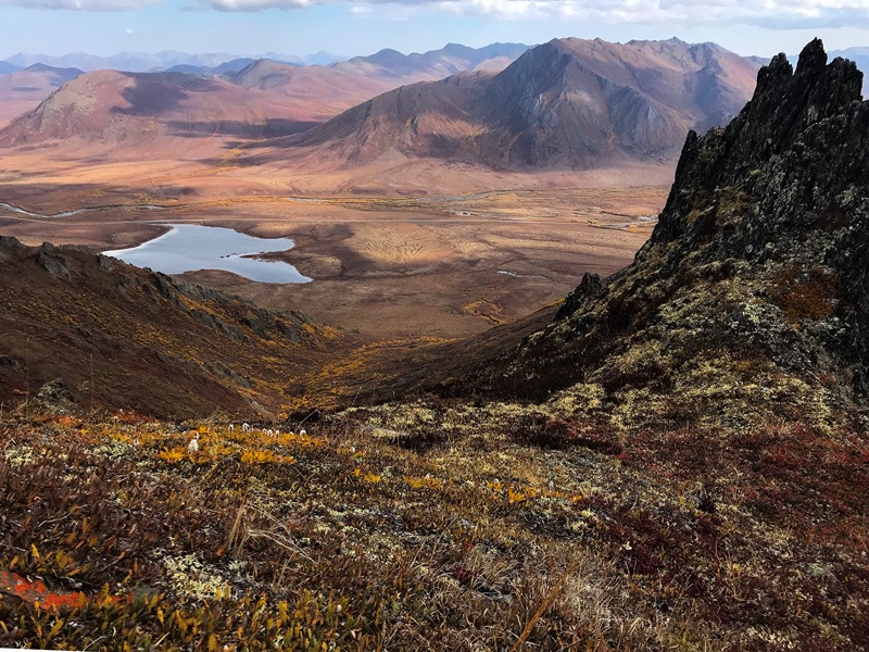
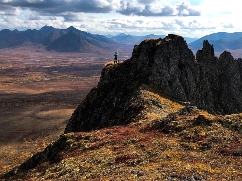
It doesn't take long until you reach the open alpine and can hike among the tors. The steepness also eases up as you get higher on the ridge. The tors and rocky spires look very dramatic against the expansive views up and down the East Blackstone Valley and Dempster Highway. Add some excitement to your hike by clambering and scrambling along the rocky spires of the ridge, or if you don't like steep rock you can easily navigate around them on the grass and lichen covered slopes.
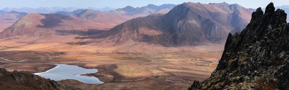
The route described here takes you to a prominent point on the ridge with awesome views down the Foxy Creek Valley. The peaks further to the west are as follows, Mount Auston, Blackstone Mountain (the obvious dark coloured rocky peak), and then Waterfall Mountain, which all face south along the Foxy Creek Valley. If you want a longer hike, see the extended hike option below. Otherwise, return the way you came up.
EXTENDED HIKE OPTION
To reach the true summit of Rake Mountain, continue following the ridge north, which heads down slightly and then back up another 100 m elevation gain to the summit. Add 2 km (return) to the distance and another 1-1.5 hours.
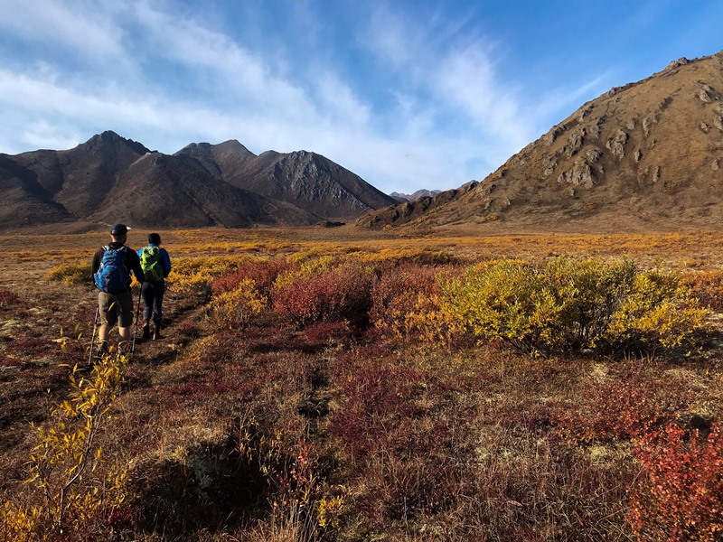
Hiking on the horse trail that leads to the base of the mountain.

The south face of the mountain. There are some vegetated sections but it is relatively easy bushwacking.
Once on the ridge it's easy walking.
The view looking northeast.
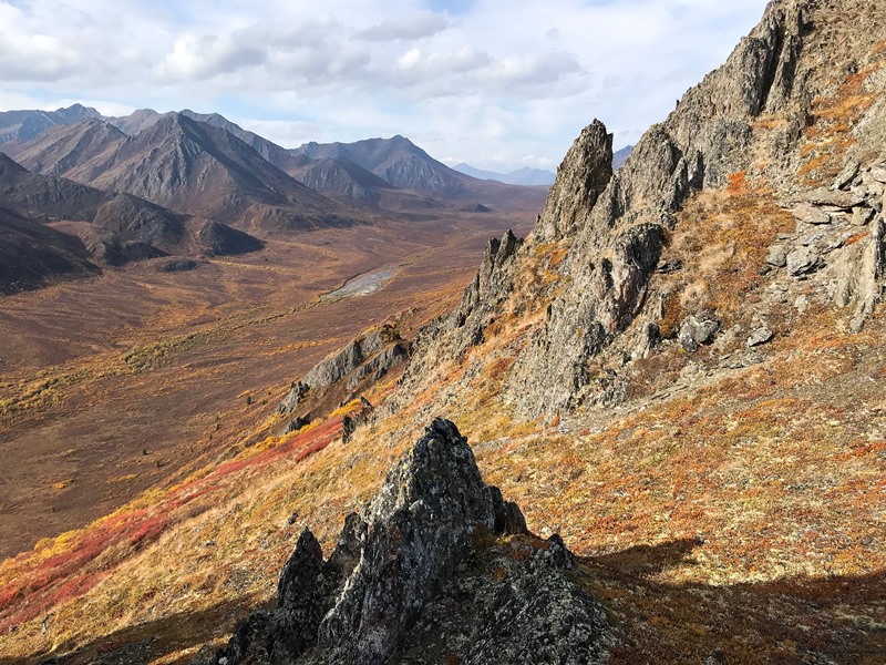
The view looking up the Foxy Creek Valley towards Auston Pass.
The rocky spires provide spectacular foregrounds to the wide-open valleys of the East Blackstone area.
Sharina July 26, 2024
Hiked this on a 25 degree late July day and it was hot, but spectacular! We were glad to find a bit of shade behind some of the rock spires. Nothing like a ridge walk with 360 degree views 🙂

Kyle July 9, 2020
Great hike! And typical tombstones hike there’s lots to explore once at the summit.
Horse trail is easy to follow at the start and once at the base of the mountain you can kinda go anyway you want up the mountain.
360 views at the top and also of the lake to the north.
Lots of nice tors and rocky spires to climb, the mountain itself along with Adney and Boyle nearby are steep.
Saw a moose as well across the highway.