Total Distance: 4 km
Return Time: 1.5 hours
Elevation Gain: 183 m
Difficulty: Moderate
Region: White Pass
Traditional Territory: TRTFN, CTFN
This hike is an easy way to get out and explore the alpine in the White Pass. You can hike up to a small ridge that has an international border marker which separates Canada from the USA. Hiking up even further offers a view down the valley towards Skagway. While the route is short, it is quite steep in places and route finding is required, as such it is rated as Moderate. Note this hill is named 'Outhouse Hill' because it is near the main viewpoint off the highway with outhouses.
From Whitehorse, drive south on the Alaska Highway to the Carcross Cutoff and turn right onto the South Klondike Highway. After 71 km you will reach the Canadian Customs. Another 11 km past customs there is a pull-out on the left-hand side of the road with outhouses.
The trail starts from the pull-out at the opposite end from the outhouses. There are many small braided paths, but try to stick to a main one. Later, there is no defined trail, so spread out to minimize damage to the flowers and lichen. The easiest way up the first ridge is near the small saddle (refer to the GPS map). It can be steep in places depending on how you find your way up the main ridge.
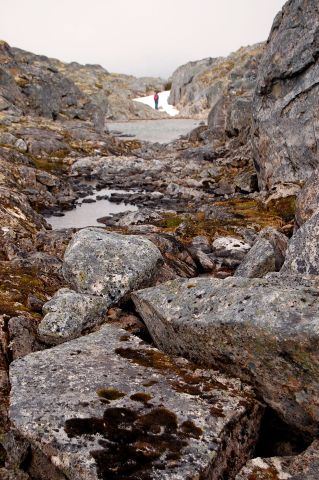
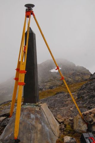
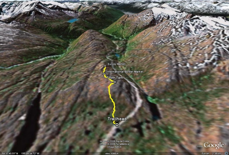
On top of the first small summit is a tooth-shaped tarn. This is a nice place to relax or soak your feet on a sunny day. Follow the ridge to the second small summit which has an international border marker on it. From here, continue along the ridge to the obvious third summit. On top of the third summit is a survey marking mounted in a rock. Follow the same route back to the trailhead.
It is possible to camp up on the hill near one of the lakes, though it could be tricky to find a large enough, flat spot to set up your tent, depending on the size.
To stay out of the way of avalanches, you can head straight from the pull-out towards Summit Lake. As long as you don't skirt near the mountains, you'll be perfectly safe. There are many gullies, so it will be up and down at times. If you continue walking straight towards the mountains at the far side, you will meet up with the White Pass & Yukon Route railway.
The first ridge as seen from the trailhead.
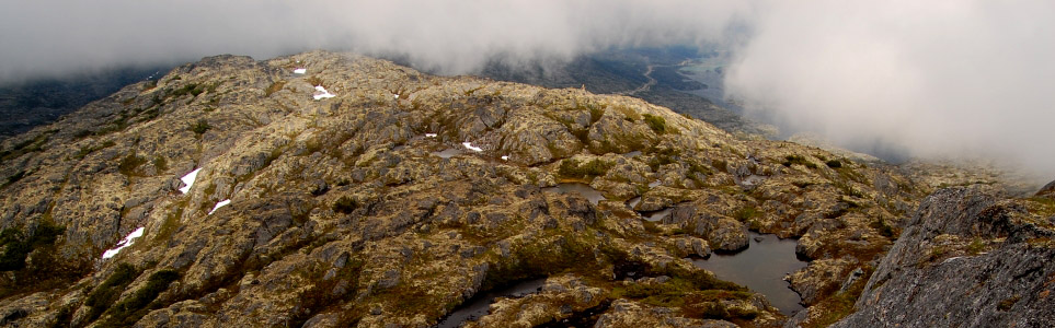
Rocky boulders and alpine tarns spot the landscape.
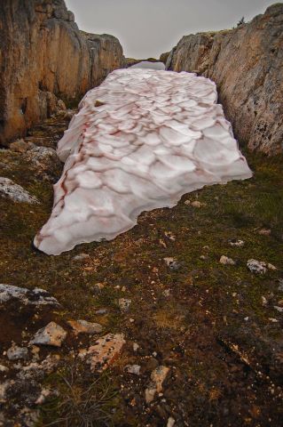
Late-melting snow, hidden between two rocky ledges.
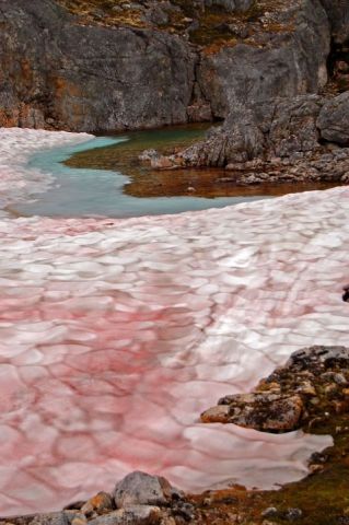
Watermelon snow - reddish snow caused by green algae with a red pigment.
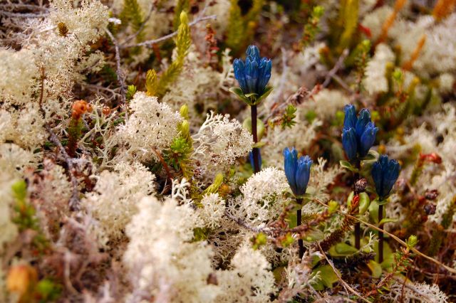
The unnatural colour of blue amongst the lichen garden - Inky Gentians.
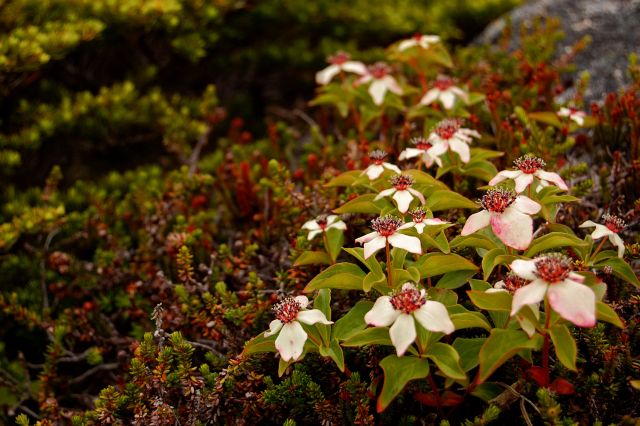
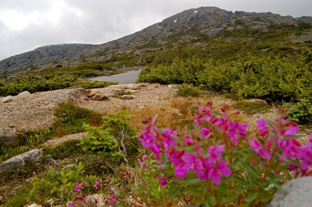
Dogwood blooming in late July.
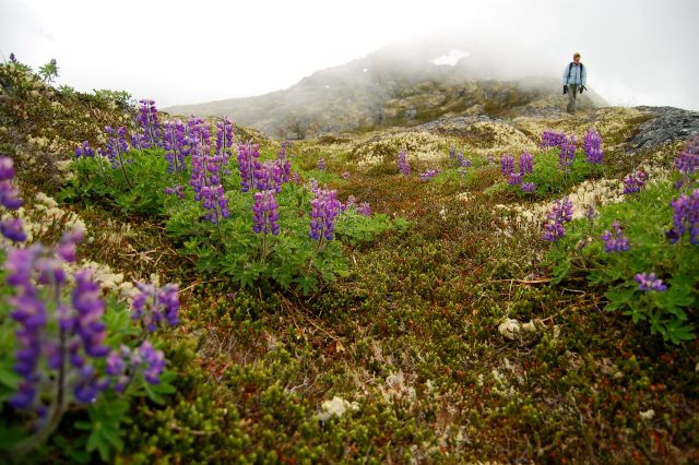
Beautiful bouquets of Lupins under a ghostly sky.
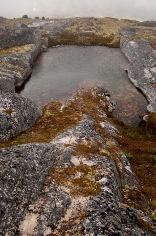
Tooth tarn - shaped like a giant molar.
The international border marking which seperates Canada from the USA.
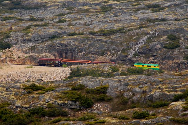
The White Pass train running along in the distance.
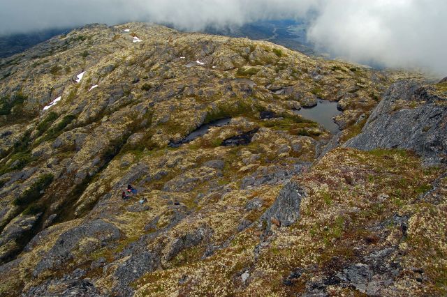
Looking towards the trailhead from the 3rd 'summit' on the trail.
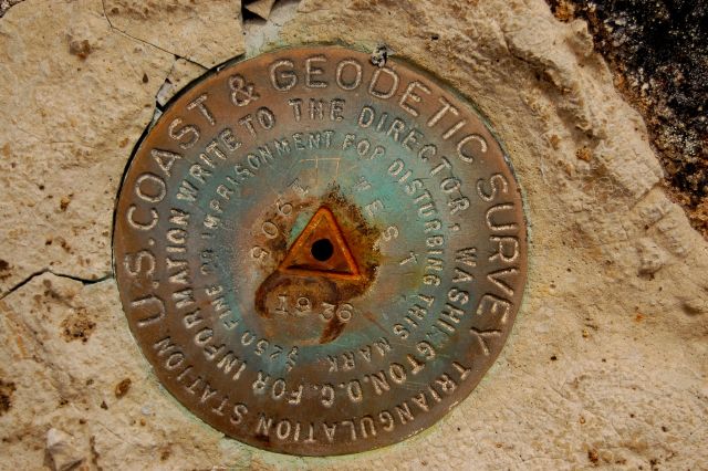
Survery marking on top of the 3rd summit.
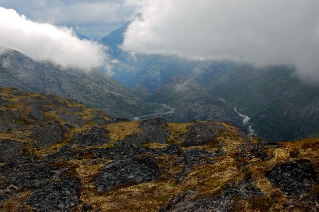
Looking towards Skagway.
Frozen trees and frozen land.
The sun only appears for a short time above the mountains in winter.
Alastair Cook September 28, 2019
It's always great to do a hike you've never done before, and especially up in the White Pass area. The day was on the cool side, but gloriously sunny, which for me is an ideal combination. The trail is somewhat vague, but as long as you know which general direction you are heading in, you will be OK. It also helps to be able to see the highway for the most part on the return part of the hike. This is reassuring. Other than that, a spectacular, panoramic hike, and a nice length.
Gordon June 30, 2018
Hiked part of it today, halfway up I got so interested in the lichen moss and alpine flowers that the summit didn’t matter. What an awesome ecosystem.
Sarah July 8, 2017
This is a great hike; I've done it many times. Although there is no clear trail, it is not too hard to find your way. However, unlike what suggest the directions...I haven't found one main path. Just stick to whichever path you find and then I recommend heading straight for the top of the hill, whichever way seems the easiest for you. Today I hiked to the right (West) of the suggested route and it worked well. Once at the top of the hill just continue until you see the international divider. Have fun!
Trevor August 31, 2016
We also tried this trail on a sunny August 28, 2016, but also could not find a proper route. After seeing the area and studying the map I might be inclined to try again, but there does seem to be a lot of bushwhacking (of the scrub spruce sort) and it seems hard not to trample all the plant life and lichen. A fascinating alpine landscape though.
Andrea August 30, 2016
I do not recommend this hike. There was absolutely no discernible trail. Like nothing after just a few feet of gravel near the parking. We didn't have the GPS map, and never figured out what saddle they were talking about. Complete bushwhacking and lots of water to cross. At least the brush is low, so you can hike for a while and know which way to head back to your car.
