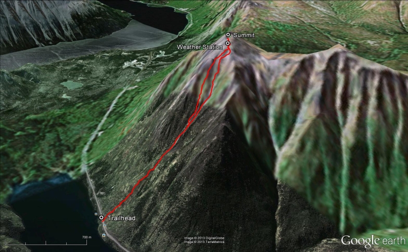
Total Distance: 4 km
Return Time: 4.5 hours
Elevation Gain: 1055 m
Difficulty: Difficult
Region: Carcross
Traditional Territory: CTFN, TRTFN
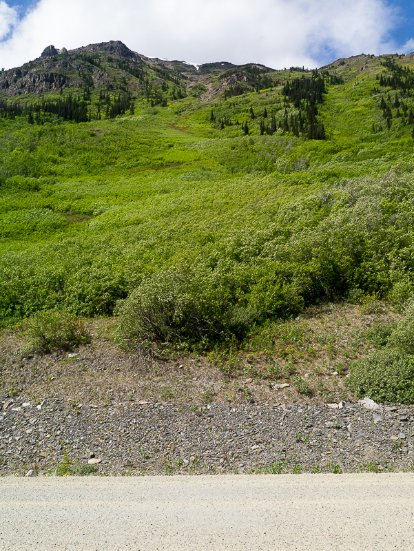
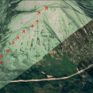
Mount Racine is a prominent peak at the south end of Tagish Lake's Windy Arm with sweeping views also over to Tutshi Lake and the surrounding mountains. The route is a direct one, straight up the main avalanche path, which is the quickest way to the top and also avoids the most bushwacking.
From Carcross, continue on the South Klondike Highway towards Skagway, Alaska. Once you reach the Yukon/BC border (there is a large pullout and sign here), continue driving for another 1.4 km until you see a prominent avalanche path on the right side of the highway. This is the trailhead. Find a safe place to park on the side of the highway. Note this hike is just after the Dail Peak trailhead.
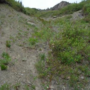
This route follows the avalanche path up to the summit. The first part of the route requires some bushwhacking up through the base of the avalanche path. The bushwhacking takes about 45 minutes and is not very pleasant. Most of the vegetation is willow and high-bush cranberry, and this route may be something to avoid during berry season, so as not to run into foraging bears.
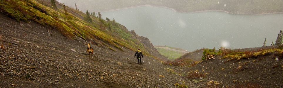
The vegetation becomes sparser after roughly 200 m elevation gain, and the ground underfoot becomes a mix of bedrock and small gravel. Continue up through a series of gullies, straight up the mountain. Try to stick to vegetation, because the loose scree can be difficult to walk up. It is relentlessly steep the entire way up the mountain.
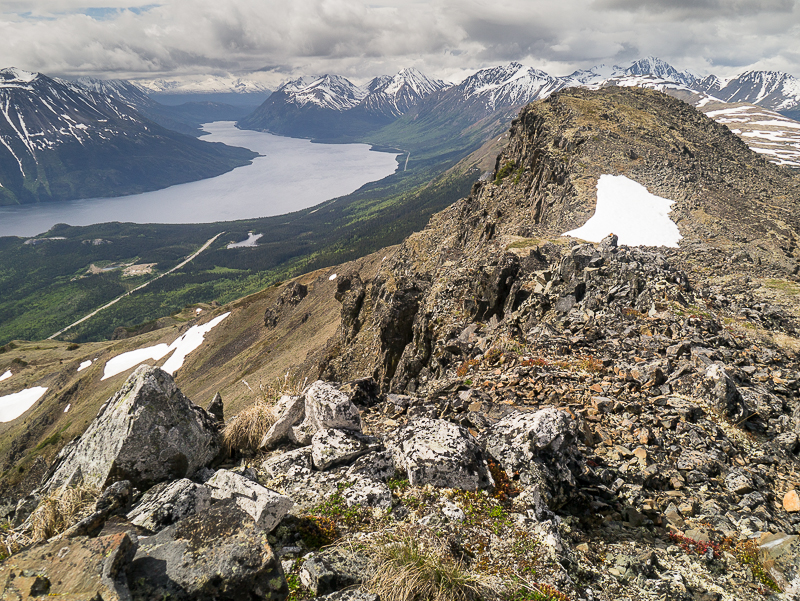
The landscape opens up as you gain elevation, with the occasional large, rocky outcrop to navigate around. Near the top of the mountain there is a weather station, and the summit is another 150 m to the southwest. There are some impressive rock pinnacles along the south side of the summit. Enjoy the views if the weather cooperates, before switching gears and heading back down.
The easiest way down is to follow one of the main gullies, either the way you came up or a large one to your left (looking downhill). Look for those nice tracts of small sized scree, which cushion each step, carrying you downhill. Or if there's any snow remaining, glissade down the snow if you feel comfortable doing so.
Looking up the avalanche path from the highway.
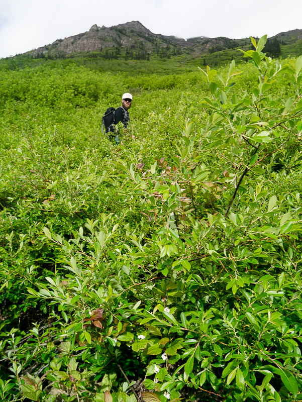
The bushes are very thick at the beginning.
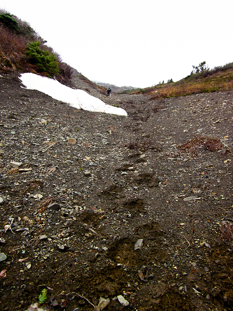
Hiking up the gully on the soft scree.
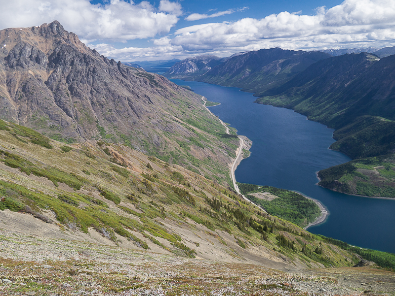
Looking north up Windy Arm of Tagish Lake with Dail Peak on the left.
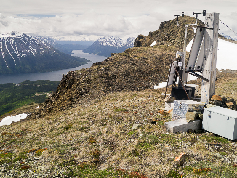
The weather station on top of the ridge, and the summit in the background.
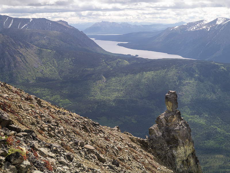
The view of Tutshi Lake to the east.
Looking south down Tutshi Lake from the summit.
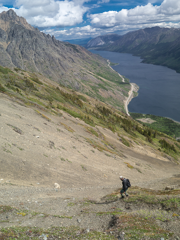
Hiking down the soft scree. The trail is steep!
Mack June 27, 2021
We did this hike on June 27, 2021. It is relentlessly steep! The brush at the beginning of the hike is overhead and extremely thick. It is also all bending downhill, which makes the ascent really difficult, but it's much easier coming down. We found some clearings after about 250m and followed them up to the bottom of the avalanche path. I applaud anybody who can finish this hike in 4 hours. A grind but worth the beautiful views of Dail Peak and Windy Arm at the top.
Lindsey July 15, 2020
Beautiful view from the top but the bushwhacking took us almost 1.5 hours as the willows are extremely dense this time of year. We have two dogs sized medium and small that had a lot of difficulty (they are troopers though). The scree was steep, we wish would have walked up the ridge on right side of the gully. We came down this ridge which was quite pleasant. The wildflowers were beautiful! We are usually fast hikers and do the hikes in less time than suggested on this site but this one took us almost 5.5 hours instead due to the grueling bushwhacking. We enjoyed it but will not do it again.
Maggie May 24, 2020
This hike is TOUGH. The bushwhack is truly brutal (wear long pants for this part) and the scree is challenging to climb. Some of our crew were very fearful and it was a bit sketchy. We believe we went up the wrong avalanche path. I wouldn't say its as obvious as the directions say it is. Also, we never saw the weather station so we were off by one or two gullies. If you are going to attempt this I would make sure you are with a fit group. Views are gorgeous and phenomenal. I just wouldn't do it again. :)
Boris September 21, 2018
We approached the mt from the gravel pit half way up the long hill that takes you to Tutshi Lake. We crossed the creek and followed the ravine on a game trail. Finally we went straight up the Mt. The first part was grueling and steep. The last third up the mt was less steep and very pleasant walking. I would recommend coming down the same route unless your knees are very young and supple.
Terry June 18, 2014
Was curious about the route, did it last year. It's the same route that they actually have on here. Personally its a grueling hike, just because of how the brush is at the beginning, you can find patches of open space so best to scout from below first. The way down isn't that bad, its very steep, but...at least you are walking with the willows rather then against. Worth hiking, at least once, amazing views and good chance to see wildlife on other side.