Total Distance: 10 km
Return Time: 5 hours
Elevation Gain: 1215 m
Difficulty: Difficult
Region: Annie Lake
Traditional Territory: KDFN, CTFN
This is a challenging hike in the beautiful Annie Lake Region, along a formidable ridgeline to the summit. There is over 1,200 m elevation gain so this hike is rated as difficult, but the views are amazing along the way of the Annie Lake Region. NOTE: The area falls within Category A Settlement Lands of both the Kwanlin Dun First Nation and Carcross Tagish First Nation. Please respect their rules and land.
Please avoid hiking this trail from April 1-June 15 to avoid disturbing the sheep during lambing season.
From Whitehorse, drive south on the Alaska Highway to the Carcross Cutoff and turn right onto the South Klondike Highway. Drive on the South Klondike Highway for about 17 km and turn right onto the Annie Lake Road. After 17 km on the Annie Lake Road, you will reach the north end of Annie Lake (which looks more like a large marsh). Drive another kilometre, and just after a bend in the road to the left, watch for a side road to your right. This is the same road to the Red Ridge hike. Drive down this side road for 1.7 km until there is a fork in the road. Take the fork to the left and park shortly afterwards where the road ends. Note it is advisable that you have a vehicle with higher clearance for this side road off the Annie Lake Road, as it is quite rutted.
UPDATE 2022 - THERE IS A FLAGGED TRAIL NOW TO THE BASE OF THE RIDGE.
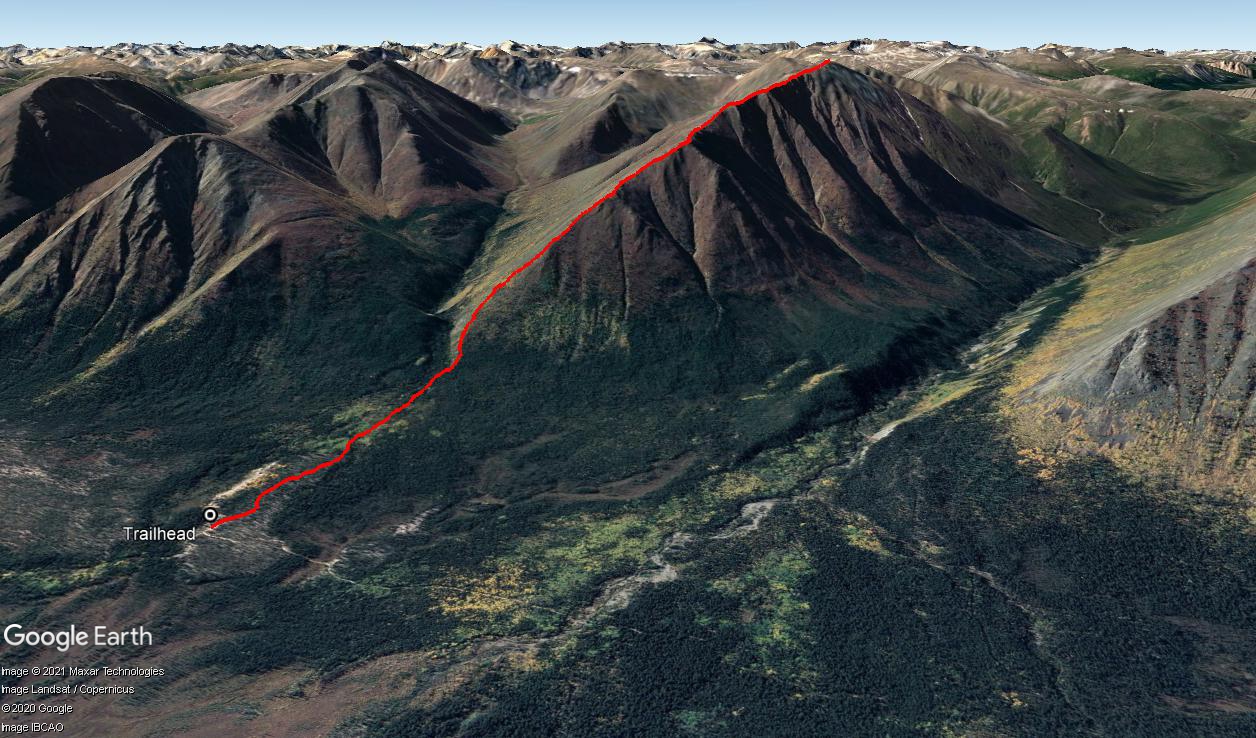
From the parking area, head west and pick your way through the trees towards the southern base of Mount Perkins. Ignore the ATV trail that also heads west from the parking area, as it eventually leads towards Perkins Creek and does not take you to the base of the mountain. The approach through the forest is relatively easy walking and is a mix of open lichen and pine forest at first and then aspen and spruce forests.
After about 1 kilometre from the trailhead, you will cross a small cutline that runs basically north-south. Keep heading west as the route starts to gain more and more elevation. As you get closer to the base of the ridge, you will find a small footpath. Follow this trail as it starts to contour along the south (left) side of the ridge high above the creek. It then climbs steadily up through the trees, and eventually comes out above treeline. It is steep going at times. It is just over 1 kilometre and 320 m elevation gain from the cutline to the treeline.
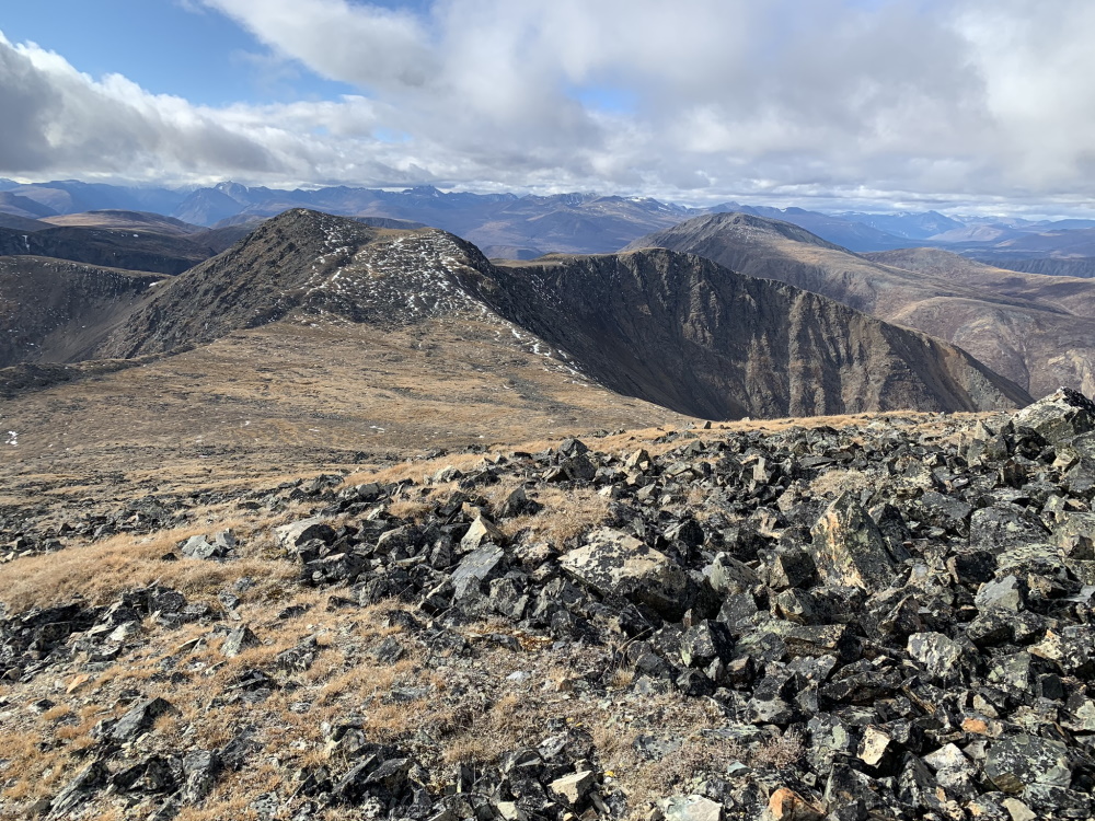
Once you reach treeline, it is a steep 240 m climb up to the first false summit. The route is straightforward after this, just keep hiking up along the rocky ridge until you reach the top. It may seem like a never-ending climb, but the views are great along the way, looking back along the ridge towards Annie Lake. The north facing side of Mount Perkins is quite dramatic, with rocky cliffs and rock pinnacles, as you look down towards Red Ridge. Watch for mountain sheep and always give wildlife a wide berth.
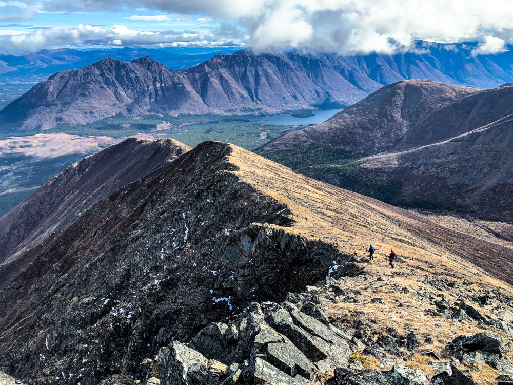
Once at the summit of Mount Perkins, you have even better views of the mountains to the west and can dream up some extended hiking options in this beautiful area. Return the way you came down.
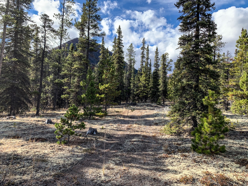
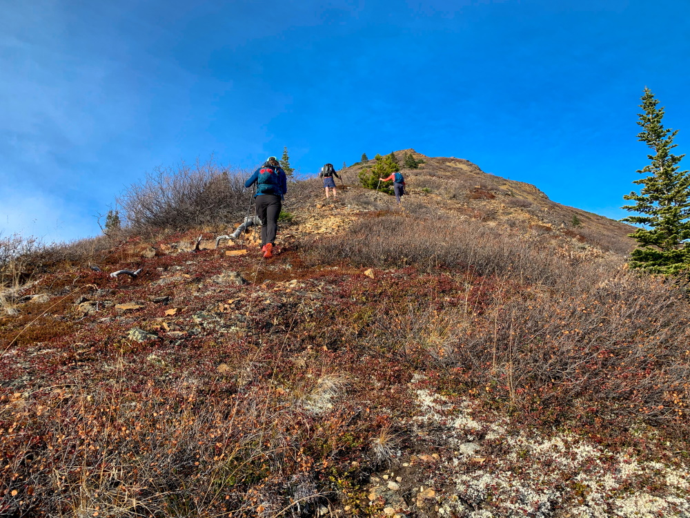
Head west through the trees from the trailhead until you reach the base of the ridge.
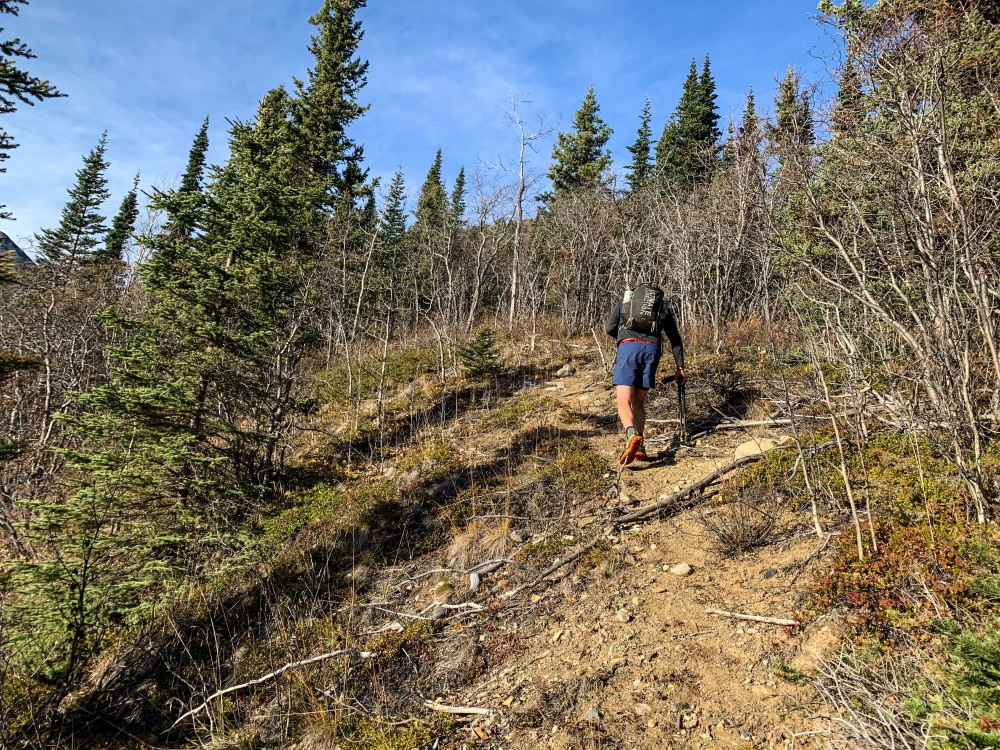
You'll reach a trail near the beginning of the ridge on the south side of the mountain.
Hike up from the treeline to the false summmit.
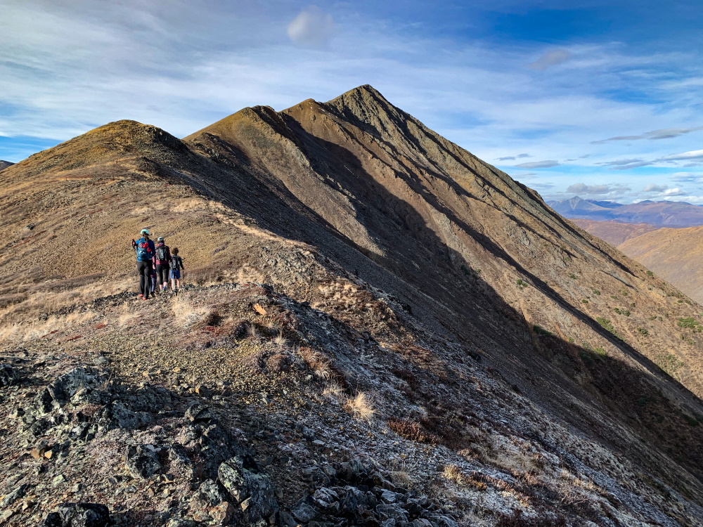
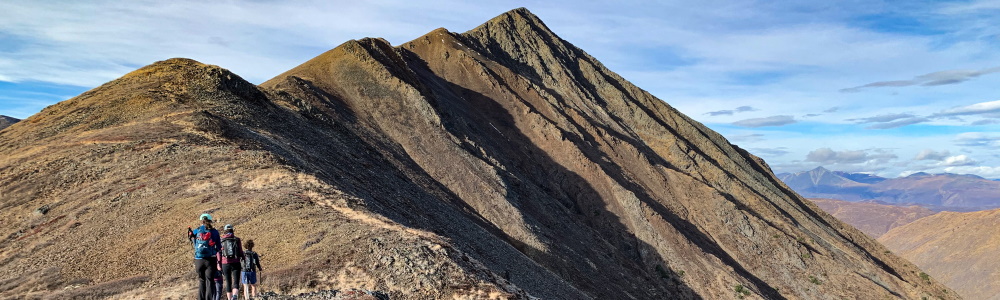
Once past the false summit it's easy hiking along the epic ridgeline of Mount Perkins.
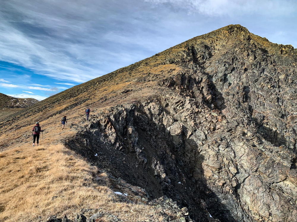
The final climb to the summit.
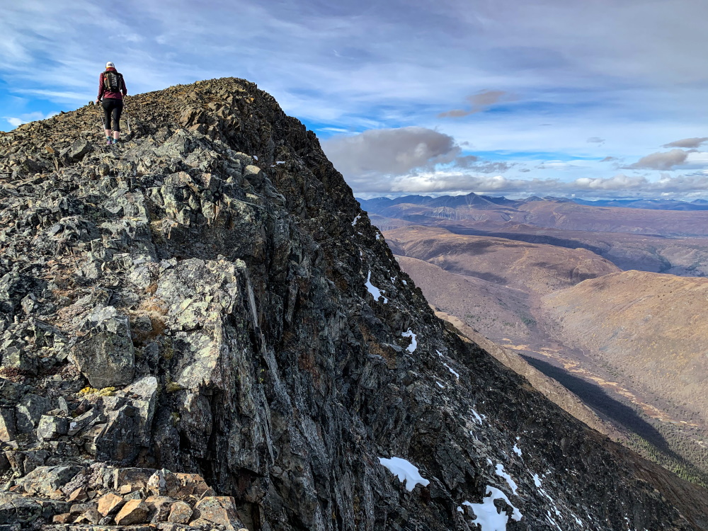
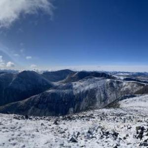
Views looking west from near the summit.
Views from the summit looking southwest. There is lots of potential for extended exploration from the summit, connecting to various other ridges and peaks.
Views looking down towards Annie Lake with Gray Ridge in the background.
AB July 7, 2025
Hiked Mount Perkins on July 6, 2025. Beautiful, steep hike. The ridge and views were stunning, and there were so many wildflowers! Directions were good for driving there and the trail; flagging tape was helpful to find and stay on the trail below the treeline. Having the GPS tracks downloaded was helpful for referencing and getting us back on the trail when we missed the flagging tape! Hiked it in 5.5 hours total with many stops for photos, and lunch at the summit. No animal sightings, but many sheep droppings along the ridge.

Tyler September 3, 2023
Spectacular views at the top; nice fall colours with a little snow at the top. Well worth the super steep climb (and descent). Pretty easy navigation with it flagged. We were 4.5 hours (including lunch at the top), but we were moving pretty quick and are all experienced hikers. Budget more time if you want a more leisurely climb.
Nicole August 12, 2023
Challenging physically but the view is amazing! Beautiful, sunny day. Make sure to bring lots of water. I agree, plan for a 7h hike. The trail is flagged and quite easy to follow. Enjoy!
jeanne October 7, 2022
A fantastic hike, with stellar views. Albeit the flagging is becoming faded but certainly an asset. The only consideration - allow for 7 - 7.5 hours to the summit & return.
YT May 23, 2022
The route in to Perkins has now been flagged/blazed, so no need for a GPS. Follow the ATV trail on your left as you leave the Red Ridge road after the short, sandy uphill after Perkins creek. Follow this ATV trail on the left of the Pine forest. Its sandy and the trail becomes fainter and fainter. You'll pick up some green flagging and follow this all the way in to the Sheep trail which has been cleaned out/marked. Cairns on the steep up hill hello delineate the route. Now that one route is established, if everyone helps clean it out a little bit on the way in and out, the route should become pretty well established and keep everyone on the same path.
Marianna October 24, 2021
We hiked Mount Perkins today Oct 24, 2021, only up to the false summit. It was a gorgeous day, it wasn’t hard to find the trail with GPS. We started late so didn’t have the time to go all the way up and in the snow it was slower anyway. The snow was helpful on the way down to buffer the steep descent. I only had crampons and gaiters on. Great direction, made the hike so much easier, it was our first time there.