Total Distance: 8 km
Return Time: 2-3 hours
Elevation Gain: 292 m
Difficulty: Easy
Region: White Pass
Traditional Territory: TRTFN, CTFN
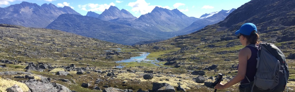
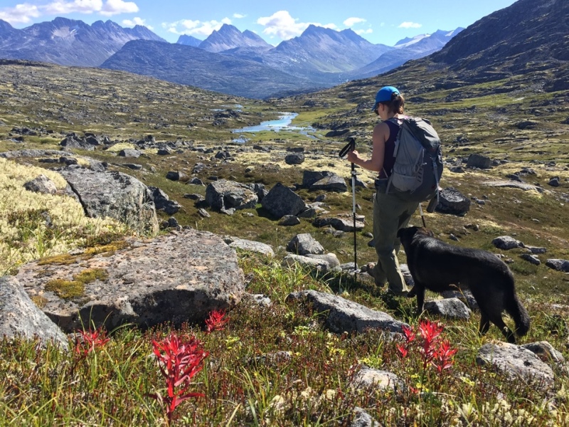
This hike is a real alpine treat, with easy walking along a beautiful fast-flowing creek with waterfalls, surrounded by mountains. As long as you can survive the very steep but short descent from the highway and the initial creek crossing to reach the main trail, then the rest of the hike is a walk in the park. The 'international' aspect of the hike is because the route starts on the Canadian side of the border and then crosses into the United States. Since the views don't change too much along the route you can easily make this a shorter or longer hike. If you add another 1 km (one way) you can look over into the next valley towards the Chilkoot Trail.
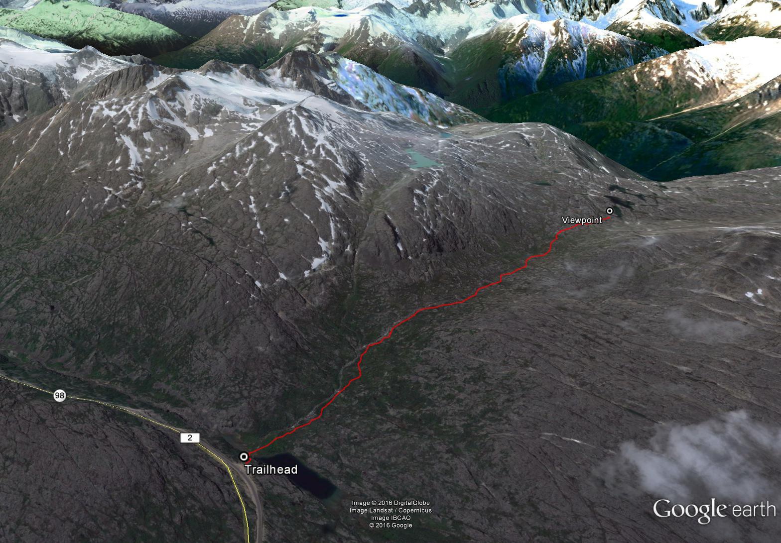
From Whitehorse, drive south to the Carcross Cutoff and turn right onto the South Klondike Highway. After 71 km you will reach Canada Customs. Another 12 km past customs there is a pull-out on the right-hand side of the road. The pull-out has a lake below it with a waterfall entering from the other side. This is the same parking lot as for the Feather Peak hike. There is an avalanche information sign in the parking lot.
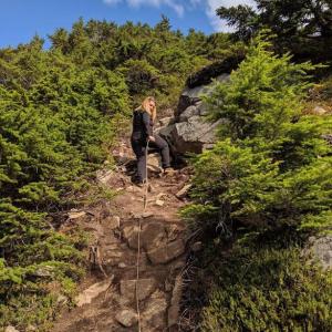
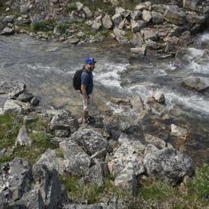
Follow a rough trail from the pull-out down from the highway. It is very steep so take extra caution. At the bottom (40 m descent), there will be a wide creek to cross at the outlet of a small lake. Depending on the time of year the water could be quite high. Later in the summer after much or all of the snow has melted in the alpine, it can easily be crossed over some rocks. If earlier in the season, the water may be a lot deeper (thigh high). Once on the other side, a trail can be found leading to the right side of the first waterfall. Note you may need to cross another small branch of the creek coming off the waterfall.
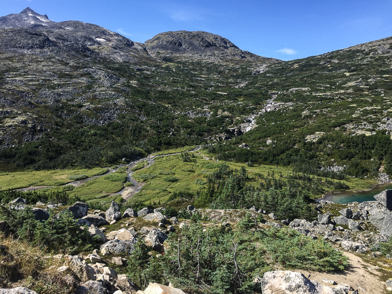
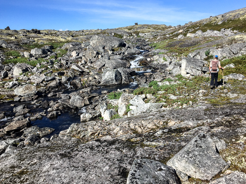
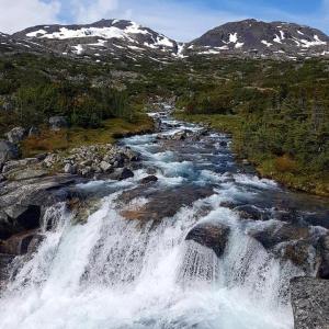
The trail climbs gradually through the subalpine, with a few trail branches that eventually join to one trail so don't worry about getting lost. The trail continues along the right (north) side of the creek with nice lookouts and resting/picnic spots beside the falls along the way. Once out of the subalpine trees, the trail continues for several kilometers into the alpine, remaining on the right side of the creek. Again the elevation gain is very gradual and the walking easy.
If you continue far enough you can get views of the back of Feather Peak with its little glacier as well as the impressive peaks of Mount Cleveland. The terrain does become a little rockier and undulating towards the end, but still makes for easy walking. If you continue even farther to the saddle, you can start to see into the next valley towards the Chilkoot Trail with some very impressive glaciers in the distance.
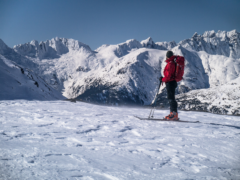
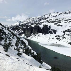
In the winter this is a really nice snowshoe and Nordic ski tour, suitable for even cross country skiing depending on the snow. The area is heavily used by snowmobiles, so there may often be a hard packed trail.
It is also not necessary to stay on the right side of the creek (like in the summer), as you can take the most direct route and likely shave off some time and distance.
View of the route from the parking area. The trail follows the right side of the creek the entire way.
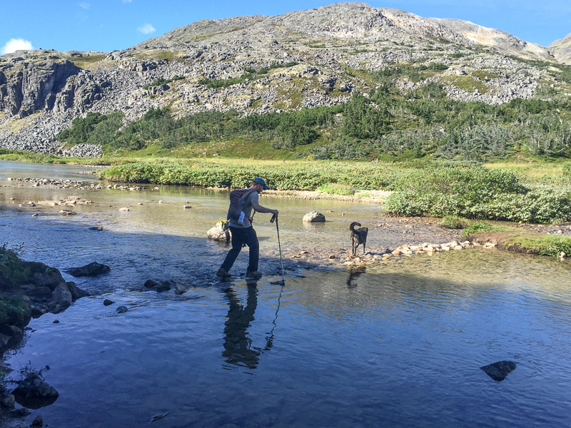
The creek crossing at the start of the trail (this is the only creek crossing along the way).
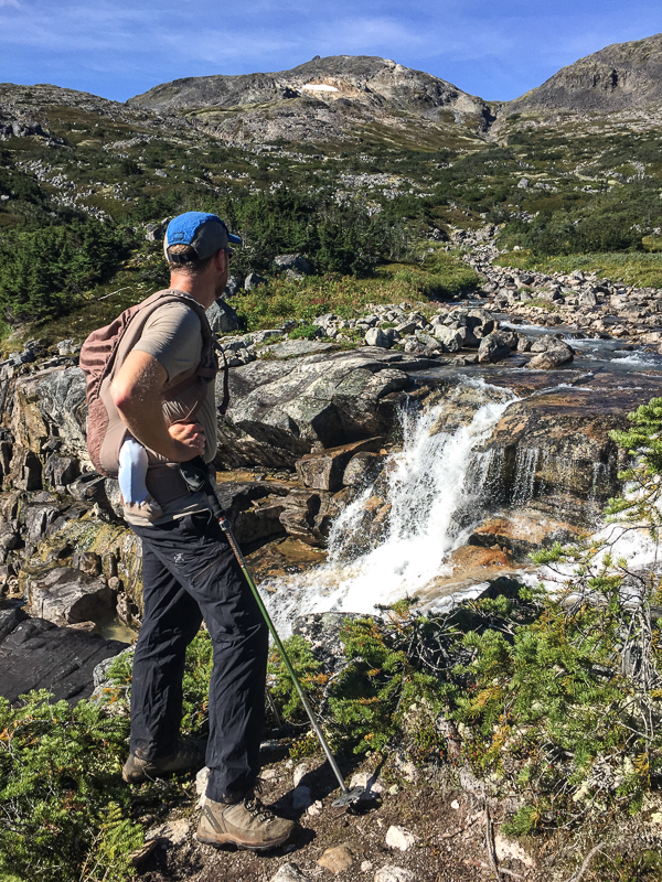
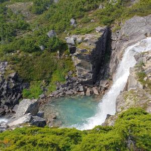
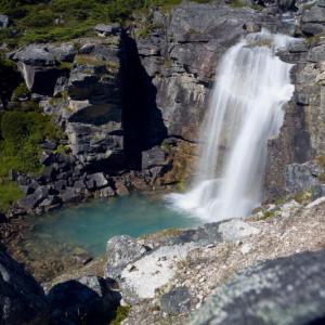
Admiring one of the many waterfalls along the trail.
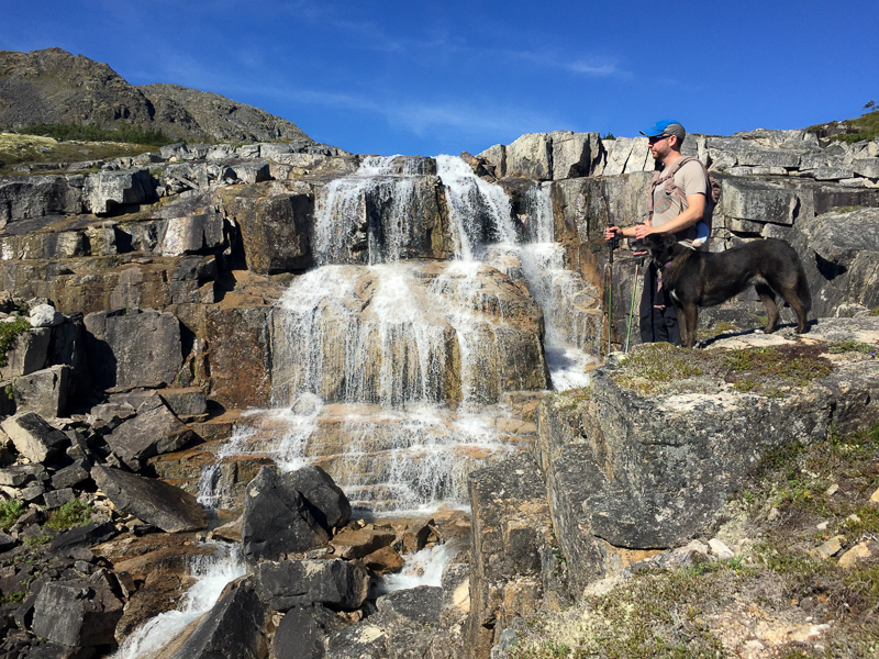
Cooling off in the mist of one of the falls.
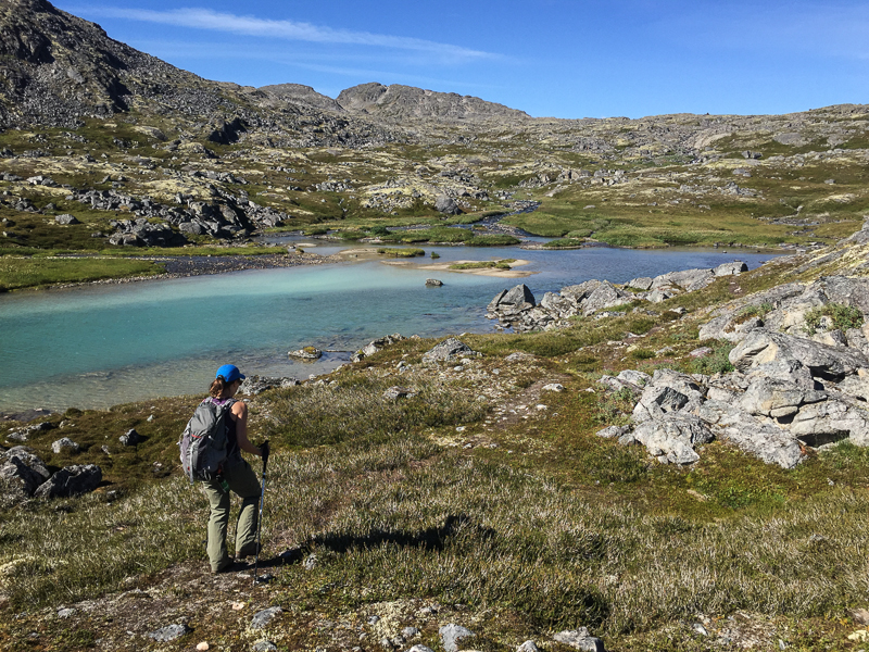
There are several small, beautiful lakes along the creek as well.
The terrain gets more rocky and undulating towards the end of the route.
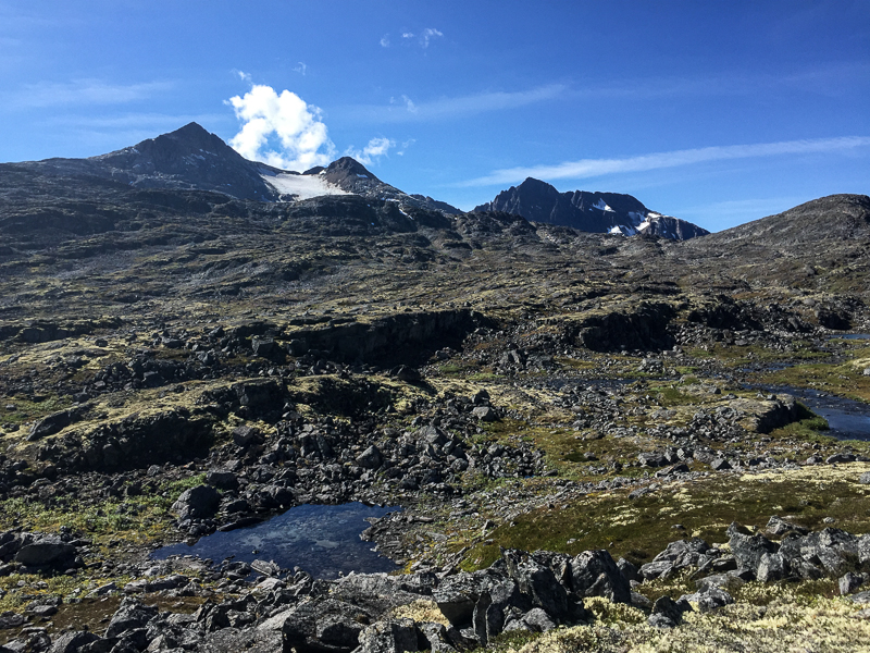
The view of Feather Peak and Mount Cleveland.
Following the trail back towards the highway, with views to the east.
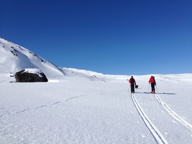
In the winter, the creek is covered in ice and snow and there is no need to stay on one side of the creek or other. Follow your own route (the path of least resistance).
Towards the end of the trail you get views of the back of Feather Peak and Mount Cleveland.
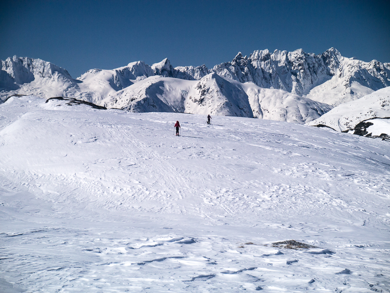
As you reach the saddle, the views across into the Chilkoot Trail and surrounding mountains open up.
Admiring the view from the saddle, looking across to the Chilkoot Trail valley and it's towering peaks and glaciers.
Erica September 2, 2019
Simply a gorgeous area. We did notice, though, that it appears most of the water is actually traveling down the pass toward Skagway. Likely its own legend re: splitting in two directions will live in infamy regardless of the facts, LOL.
FYI, I have CFS and felt kind of shaky on the steep descent the last time we tried it. I was only wearing hiking sandals, which may have contributed. I just couldn't go any further without feeling like I was going to fall, even with walking poles.
But we brought out Xtra Tuffs this time and I made it all the way down and through the ropes, no problem! If you have issues like mine, just take your time.
The rest is easy. We only hiked to the first falls this time due to time constraints, but I would love to complete the trail in the future. Just stunning terrain.
Michele August 28, 2019
Water levels quite high on August 27 after quite a bit of rain. Gorgeous even on a cloudy day. Interesting scramble down from the pull out with the rope. Helpful!
Ray July 19, 2019
It was my first hike coming to the Yukon, and it was on Canada day. It is a great trail to start off. It is truly a treat for your eyes and you do not have to worry about carrying extra litres of water since the water coming down from the mountains are the clearest and purest you could ever have. Unfortunately, I was not able to hike the all the way to the last hill where Chilkoot trail can be seen from. I lost one of my socks passing the creek and my foot were full of blisters. Lesson learnt: bring extra pair of socks! I will hike this again on 3rd of August all the way through up! Happy hiking!

Danielle July 15, 2019
Has anyone had success hiking this trail with dogs? Wondering about the steepness and the scree near the summit....
Thanks!
Chelsea Pardy July 5, 2019
Amazing, such beautiful views once you get past the steep descent. The ropes really help to get down the steep hill.
Jo June 30, 2019
water levels aren't high - ankle to mid calf deep. (June 29, 2019)
Stephanie Buchanan June 16, 2019
Anyone been out in the last couple of weeks? It is June 16th, 2019. Hoping to do with kids soon and not to have really deep snow nor water.......
Amanda May 16, 2019
Beautiful spot, knee deep snow, unless you have snow shoes, wait until the snow melts. Drove out to Skagway instead where it’s all melted:
Deb April 17, 2019
Has anyone been there in the last few weeks? Any idea if the trail is still snow covered or wet, etc.? Thanks.
Jennifer August 19, 2018
Did this hike late August and water levels were low enough to not need water shoes. Great little hike, but it is definitely very popular. There was easily over 50 people on the trail that day. If you’re looking for solitude, this might not be the hike for you.
Squanga GIrl June 29, 2018
We hiked this on the 21st. The first part is challenging with ropes to help you down the hill (Thank you to the saint who put them in place!). The water level was mid thigh and VERY refreshing to say the least. We just took flip flops and crocks to cross and left them on the other side to dry while we hiked. This hike is very beautiful and peaceful with the water rushing beside you. We found it very difficult to keep track of the trail once we were up in the alpine but the walking was relatively easy... maybe not great if you have weak knees. Hiking poles aren't necessary but we did find ourselves using them just to keep ourselves steady as we scrambled through the rocky alpine. On our way back we came across some people who chose to go around the lake crossing. This added quite a bit of time to their hike but if the steep hill is too daunting for you this is a possibility. Head back down highway towards rest stop and head in from there.
Andrew Cremata August 7, 2017
Great access to the alpine with the least amount of effort. I highly recommend extending the hike until you overlook the Chilkoot Trail. Great spot for lunch and it only adds an hour to the hike. However, I would only make this extension when the weather is good.
Dee July 31, 2017
Hiked this on July 23. Met a few groups of hikers who advised to go all the way to the end for majestic views. There is not a clear route once you are far back into the alpine, where it becomes a little steeper and there is lots of shale to climb. A storm with lots of fog was rolling in and so we turned around without seeing into the final valley.
Even without that, it was a great hike and would highly recommend it! The creeks were passable without getting feet too wet, and the views are beautiful.
Susan T June 25, 2017
Steep descent from road to creek crossing.
We switched into alternate shoes for getting across creek (hid them in bushes for creek crossing at end of hike).
Beautiful gradual uphill hike alongside rushing creek, with several waterfalls.
Top of creek is a big area - didn't make it all the way to look over on to Chilkoot - but would have been an easy hike, if we had the time.
We were glad we chose a dry day, slightly overcast.
Rainy day would have been muddy with lots of slippery rocks.
