Total Distance: 15 km
Return Time: 4 hours
Elevation Gain: 655 m
Difficulty: Moderate
Region: Atlin
Traditional Territory: TRTFN
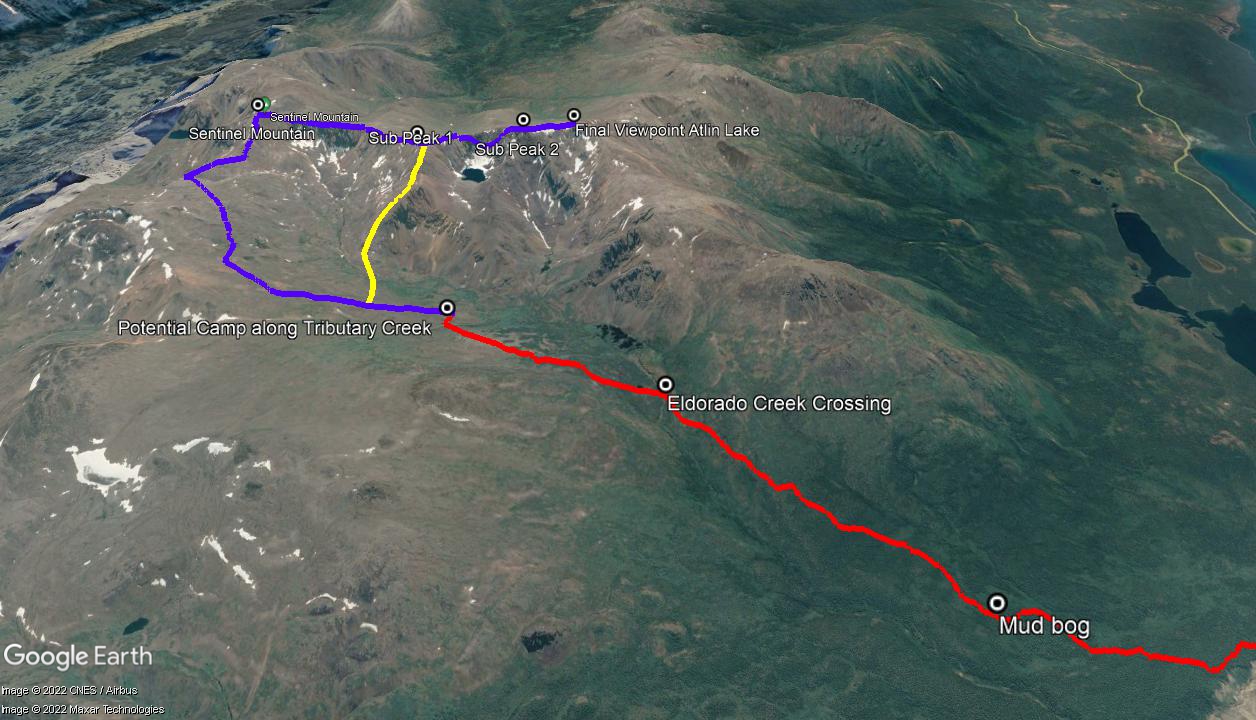
The alpine of the Eldorado Creek Valley is a beautiful area south of Atlin, near Sentinel Mountain in the Johnson Range. This is recommended as a backpacking trip with 1-2 nights in the alpine and adding on a side trip up Sentinel Mountain and its extensive ridge. The views along the ridge are stunning with a glimpse of Atlin Lake and the icefields beyond. Add 8-10 km return and another 500 m elevation gain if you are hiking Sentinel Mountain and its ridge.
From Atlin take the Warm Bay Road 15.4 km. As you cross the McKee Creek bridge, the parking area and trailhead sign are on the left for Eldorado Creek Trail.
From the parking area, follow the road off to the left. Shortly after you come to a fork in the road, take the road to the left (there is a small yellow hiking sign). Walk down the road for about 100 m and watch for another small hiking sign that indicates a hiking trail to the right.
Follow the hiking trail until you join up with an ATV-size trail heading left. This trail goes steadily uphill. There is a lot of soapberry along this part of the trail and therefore higher bear activity mid-July to mid-August.
After 2.8 km from the trailhead, there is a muddy boggy section. Just before this there is a smaller trail that detours around the boggy section to the right (watch again for the yellow signs). Continue up into the subalpine and you will reach Eldorado Creek (5.5 km from the trailhead).
Cross the creek and pick up the ATV trail on the other side that heads up the valley. The trail is a bit more overgrown here. The trail eventually ends at the first of several open grassy meadows. Pick your way east, staying high to avoid any of the thicker brush and treed areas.
Hike until you cross a small creek with a gravel bank, flowing from the northeast. You may find good camping here or continue higher into the alpine at the head of the Eldorado Creek Valley. It is about 2 km from the Eldorado Creek crossing to the start of the good camping spots.
Hike until you cross a small creek with a gravel bank, flowing from the northeast. You may find good camping here amongst the wildflowers. You can also continue higher into the alpine at the head of the Eldorado Creek Valley, traversing the open meadows with sparse trees. Here there is good camping along either side of Eldorado Creek. If you camp higher up the valley, you are closer to the beginning of the Sentinel Mountain hike. It is about 2 km from the Eldorado Creek crossing until you reach the start of some good camping options.
There is plenty of wildlife in the area. Marmots abound with their sharp whistle sounding through the alpine. Caribou are common in the area along with sheep on some of the grassy hills and ridges above, and the Mountain Goats claim the high ridges of Sentinel, as evidenced by their wool clinging to the rocks. Also watch for curious White-Tailed Ptarmigan on Sentinel Ridge.
EXTENDED HIKE - Sentinel Mountain & Ridge
It is well worth doing the side trip to Sentinel Mountain (altitude 1,928 m), either as a long day trip from the trailhead or as a side trip from a basecamp up in the alpine of Eldorado Creek. From the trailhead up to Sentinel Mountain and back is 22.4 km (return) and 1,140 m elevation gain. You can also add on some of Sentinel Ridge and come down a different way to the valley for a loop (see yellow line on the Google Earth image as a suggestion). This loop option does not add much distance, just a bit more elevation gain as you hike another sub peak along the ridge. Hiking further west along the ridge is also worth it to get better views of Atlin Lake.
From the Eldorado Creek alpine as shown on the GPS as 'potential camp', head up the ridge that is to the east, with small rocky mounds and outcrops on top. From here it is a nice traverse southeast and south towards the base of the rocky peak of Sentinel Mountain. The main climb of Sentinel from the ridge, is about 200 m elevation gain over large talus and steep slopes, but it is not overly technical. Just take your time. From the top of Sentinel Mountain, you can see down to the meandering creek of Wilson Creek, and the rolling hills, rocky peaks and alpine lakes. Either head back down from here, if just doing the mountain, or continue to do the ridge hike.
To continue hiking the ridge west to gain better views of the surrounding mountains and Atlin Lake, head slightly downhill from Sentinel Mountain along the beautiful narrow, rocky ridge. There is a little bit of exposure along this section of the rocky ridge, but that just adds to the excitement and there is ample room to feel safe. After this you start going up to the next small sub peak along the ridge, with a mix of talus and alpine tundra. There is a great view down to a beautiful alpine lake on the north side of the ridge on the Eldorado Creek Valley side.
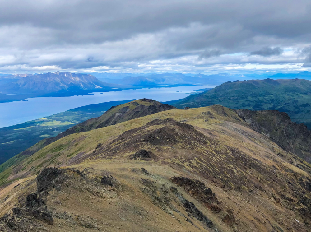
Continue along the ridge to the next sub peak. You should be able to see the Burdette Cabin down in the valley on the south side of the ridge (see the Atlin Alpine Society). From the second sub peak, continue down to another smaller sub peak with a final viewpoint over the expansive Atlin Lake. You can even see across to the Llewellyn Glacier to the southwest. All in all, it is about 3 km from the top of Sentinel Mountain to the viewpoint at the western end of the ridge.
From this point the ridge splits to the southwest and northwest. The northwest ridge would connect back down to Eldorado Creek, which you could follow down essentially to the Eldorado Creek Crossing and ATV trail. You are losing a lot of elevation this way and getting into some subalpine vegetation with more shrubs and trees, but it could be worth it if you are just doing a very long day hike from the trailhead. Otherwise consider heading down the ridge shown on the Google Earth map (yellow line).
The Eldorado Creek Trail gives you access to so many options to add on your own adventure.
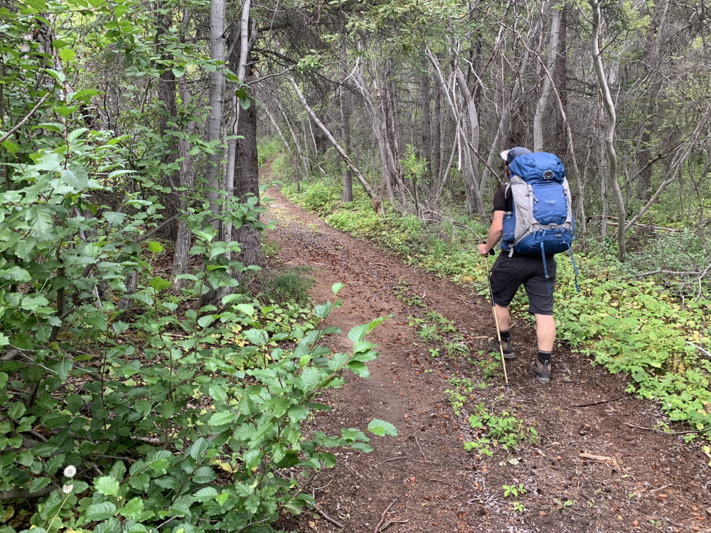
Hiking up the ATV trail.
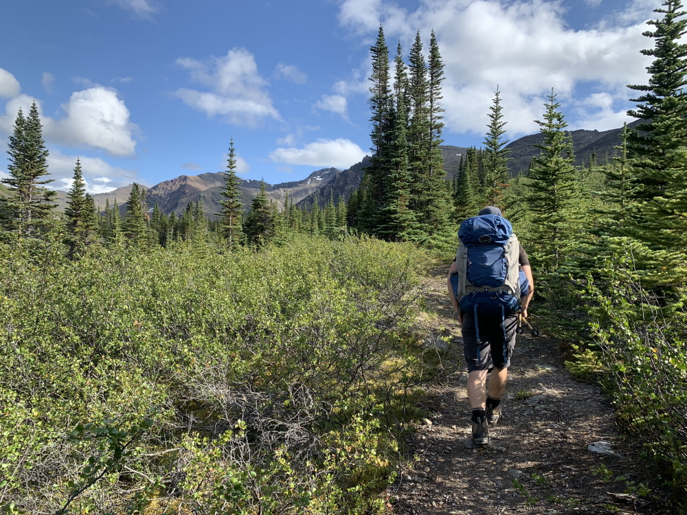
Reaching the sub-alpine when the views start to open up.
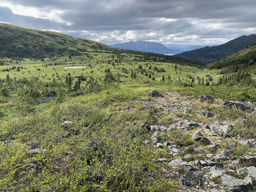
Reaching the sub-alpine, looking back down the Eldorado Creek Valley after crossing Eldorado Creek.
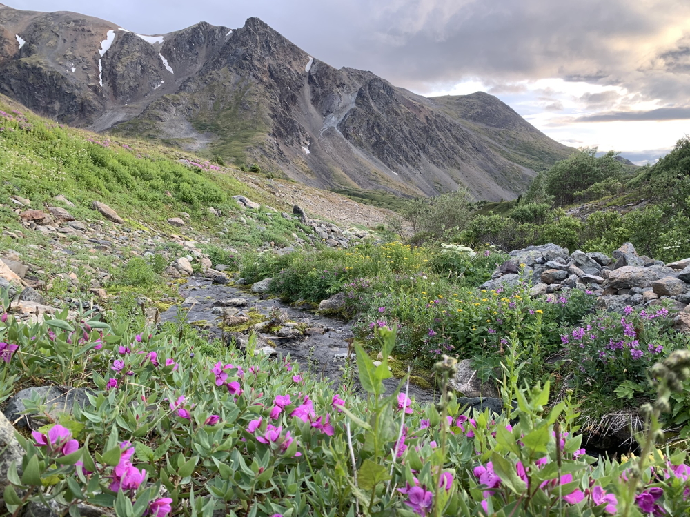
Wildflowers abound in the alpine.
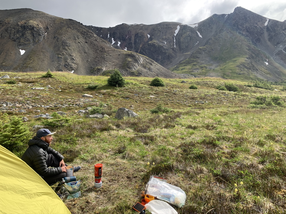
After about 7.5 km from the trailhead you reach some great camping spots in the alpine.
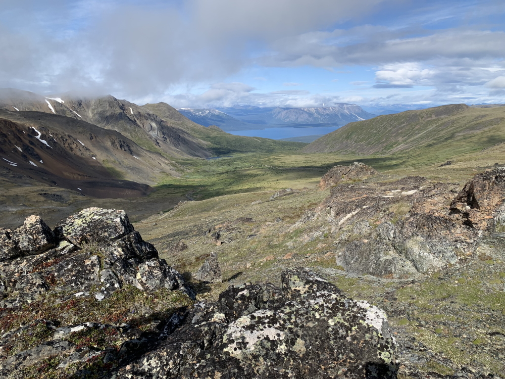
Looking back down the Eldorado Creek Valley after hiking the ridge to the east, on the way to Sentinel Mountain.
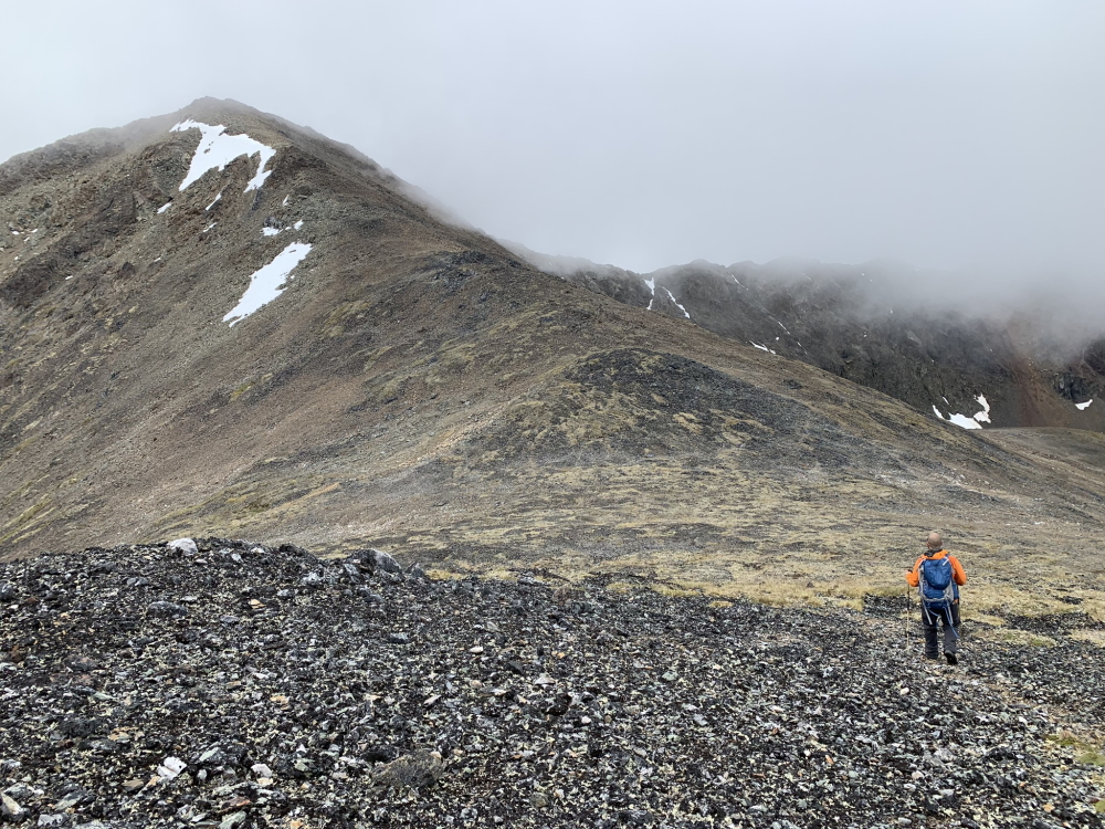
Nearing the final climb up Sentinel Mountain.
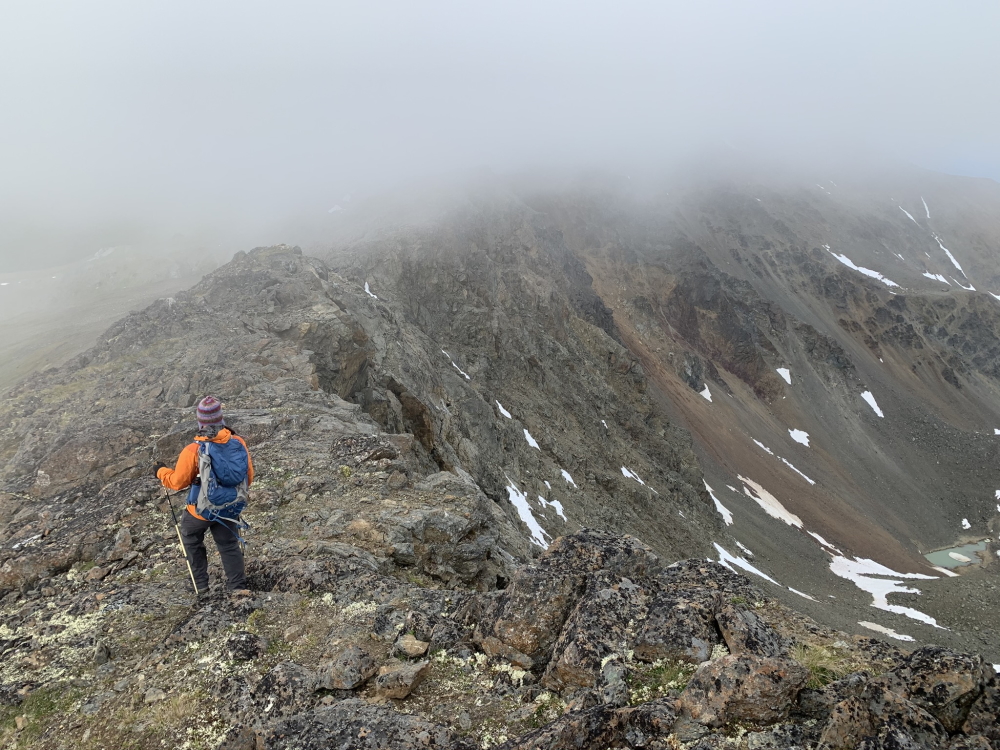
To hike the ridge from Sentinel Mountain, hike down slightly to reach the rocky ridge. Fog is common in the area, but adds to the ambience.
Ridge walking (photo credit A. Cooper).
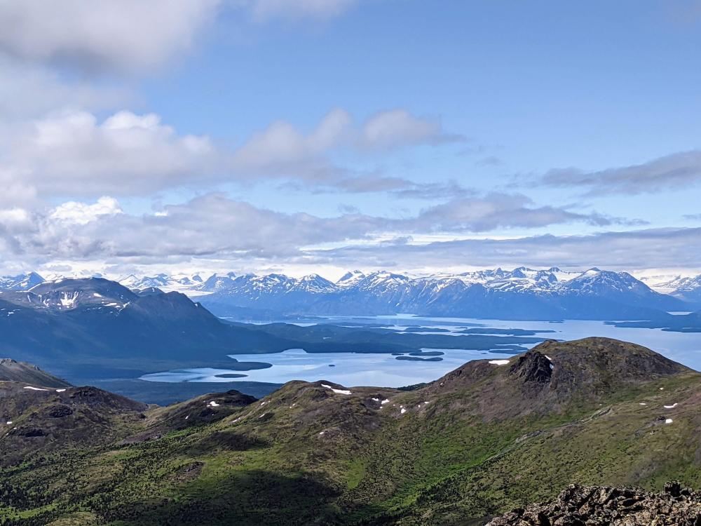
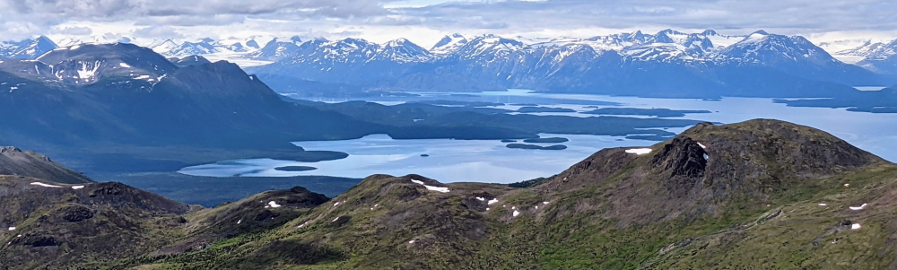
Following the ridge west you get better and better views of Atlin Lake with Llewellyn Glacier in the distance (photo credit M. Pratt).
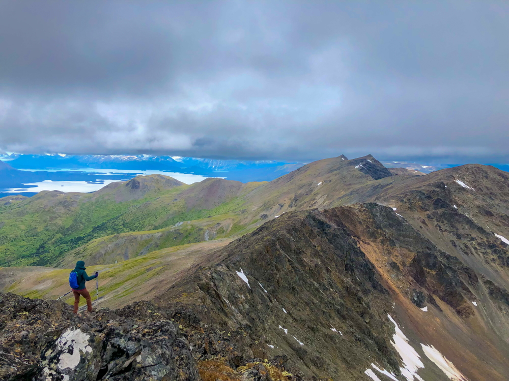
Views looking north along the ridge (photo credit A. Cooper).
Sharina September 7, 2025
We headed out this weekend for an overnight at the last minute. This was such a lovely hike and a beautiful valley to camp in. No signs of bears other than a couple of piles of ~2 day old scat full of crow berries. Saw some mountain goats skylined on sentinel ridge and a beautiful sunset. Looking forward to coming back and getting up on the ridge!

Isabelle B. July 12, 2025
Hiked to the alpine of Eldorado Creek Valley yesterday and spotted a HUGE mama grizzly with a cub closed to our camp. Lots of porcupines on the trail as well. Otherwise, conditions are good. Didn't do the summit or ridge (decided to bug out...it sleeps better not knowing what is lurking around 😆)
Danial June 23, 2025
June 22, 2025
From the trailhead all the way to the first creek crossing is pretty dry! Just the current heat wave and bugs.
After that, there is a lot of snow in the meddowy upper treeline-alpine.
Most of the snow can be bypassed by hugging the left of the climber, but crossing it in some areas is unavoidable. Given the heat, it was more of a treat. Lol
Lots of avalanche signs across the whole range, in fact, when we got to the base of Sentinel itself, we heard a noise but we couldn't see what it was(maybe a big rockfall, maybe an avalanche).
Sentinel itself doesn't have enough snow to avalanche,e but sections of it have pretty deep snow and cornices. We ascended from the left of the climber again and managed to connect some rocks. We saw footprints that were way to close to the edge of the cornice, which was not good. Once we were 2/3 of the hill up the mountain was bare.
For the decent we came down on the rocks towards the middle of the mountain and the snow in between, although sinky, but was supportive.
I wouldn't say we wish we had snowshoes, but it could have been easier to attempt the last push to the summit super early in the day when the snow is firmer with potentially microspikes.
The rest of the ridge is too dicy to go on from the Sentinel mountain itself but you can gain it and hike it from the first creek crossing. It would be pretty nice. Still have to watch out for some big cornices though.
Josie June 19, 2023
Update Eldorado Trail with Sentinel Ridge
On Saturday we started off with 6 girls and a dog. Fairly early we saw fresh bear poop and a bear print in the mud. Lucky the bear print was coming down the trail and not going up. The trail up to is in a good shape and not very difficult. Just follow the yellow signs (and definitely follow the detour sign to avoid the muddy section). We saw plenty of different animal poop along the way from bear, moose to porcupine. After 5.5km from the trailhead in the forest we crossed the Eldorado Creek (roughly ankle to mid-calf deep), we had to walk roughly another 2kms to the alpine through bush scrubs to cross another creek. After we crossed the creek we found an wide open plateau which is perfect for camping. After we set up our tents and had dinner we went for an evening stroll a little bit further up. The next morning our group split. 3 girls went back down and myself and 2 other went up to explore the ridge. At this point you can’t do the complete loop on top as there is still to much snow overhang. We walked along the ridge for maybe 2 hours and the views were amazing in all direction.
Please be very careful as there are many bears in that area. The girl from my group who went down earlier just told me that a truck stopped when they arrived at their cars to let them know a huge bear just walked up the trail and they saw a grizzly on the side of the road not to far from the trailhead.
My dog had also an unpleasant encounter with Mr. Porcupine. She was lucky and only got a few quills which I removed quickly.
Yukonhiking.ca says: There is a fair bit of soapberry along this part of the trail and therefore higher bear activity mid-July to mid-August.
CKM September 20, 2022
Gem of a hike!!! Beautiful spot to camp in the alpine, right by a nice water source, and the Sentinel ridge hike has really amazing views of the surrounding valleys, Atlin lake, and distant glaciers.
Eldorado trail has a good amount of elevation gain and some drawn-out uphills. The trail is marked and is extremely well kept (Thanks Atlin Alpine Society!!!). Sentinel ridge is a classic ridge walk. Open and rocky but nothing technical, just need to be comfortable with heights and walking on boulders. If you aren't comfortable with scree walking back down the way you came might be more preferable then dropping off sub peak 1. Really awesome "moderate" hike, could be someone's first ridge hike but is also interesting enough for folks that are used to something a bit more challenging. Lots of opportunity to explore other ridges and mountains in the area. There were a few dogs on the ridge hike with us and the dogs made it but maybe opt to leave your furry loved one at home if they are prone to running off- the ridge is a bit narrow in some spots and if your dog runs off the cliff side of the ridge they won't be running back up.
