Total Distance: 17 km
Return Time: 5 hours
Elevation Gain: 692 m
Difficulty: Moderate
Region: Whitehorse
Traditional Territory: KDFN, TKC
The Dream Trail accesses the northwest end of Grey Mountain, high above Whitehorse. It is the final linkage to the main Grey Mountain Trail. This trail is an ongoing project built by the Youth Achievement Centre, BYTE - Empowering Youth and the City of Whitehorse over the last few years. It is a multi-use trail for hikers, runners, and mountain bikers, so be sure to share the trail. The distances and times here are for a there and back trip. You can also decide to continue along the ridge to link up to the Grey Mountain Trail for a longer hike, but you may want to look at dropping a second vehicle higher up the Grey Mountain Road or coordinate a shuttle with friends back down to your vehicle.
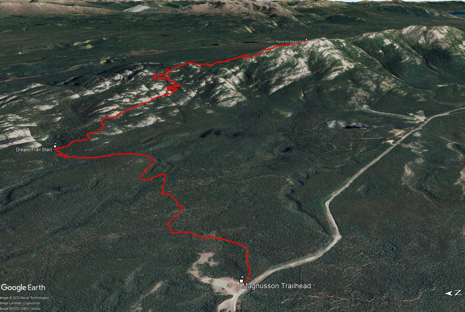
From the S.S. Klondike in Whitehorse, cross the bridge onto Lewes Blvd and make a left at the second set of lights onto Alsek Road. After 400 m, make a left at Grey Mountain Road (there is a sign indicating the cemetery and Grey Mountain viewpoint). Follow the Grey Mountain Road for 2 km until you reach the Magnusson Parking Lot on the left. This is just a short ways after the Grey Mountain Cemetery. The trailhead is at the trail map kiosk.
The first 3 km of the hike links a series of mountain biking trails to reach the actual Dream Trail. Take the main trail that leads from the trailhead kiosk - known as Magnusson Green Trail. After about 700 m on Magnusson Green you will take a right onto Boogaloo Heights. Follow Boogaloo Heights and then Downtown Boogaloo for another ~800 m until you reach the Go-T Trail. Take a left onto the Go-T Trail and follow this for 1.4 km until you reach the bottom of the Dream Trail.
The Dream Trail then climbs steadily through the forest with easy switchbacks. While the trail is in the trees for the first half of the hike, you do get some nice views of Whitehorse along the way. The trail wraps along the iconic white and grey rocky outcrops of Grey Mountain as you gain elevation.
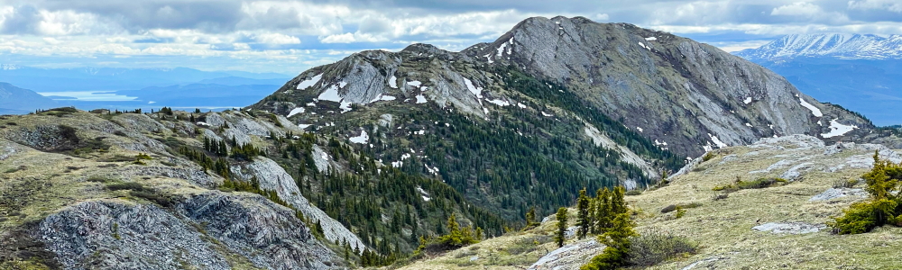
Once in the alpine the trail follows along the ridgeline and takes you to a beautiful summit, one of the lower summits along Grey Mountain. You get some great views of the rest of Grey Mountain towards the southeast.
Here you can return the same way you came, for the return distance/time described on this trail. Alternatively, you can link the top of the Dream Trail to the rest of the Grey Mountain trail (see that hike description for details). If you choose to do this, you can either hike the whole ridge and hike down the Grey Mountain Road to your vehicle, get a shuttle from a friend, or leave a second vehicle up higher along the Grey Mountain Road and take a short cut trail (e.g. Money Shot) to cut-off a portion of the hike along the road. Note the trail linking the Dream Trail and main Grey Mountain Trail is slightly less developed, so some route finding skills may be necessary if you choose to add on the full ridge.
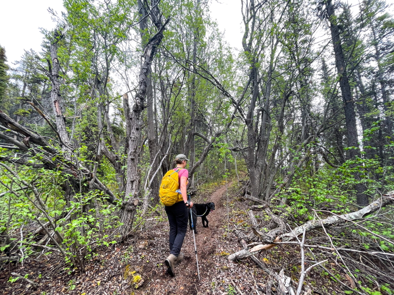
Starting out on the Dream Trail.
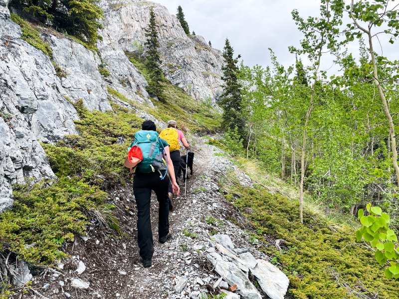
The trail has some sections along the beautiful iconic rocky outcrops of Grey Mountain.
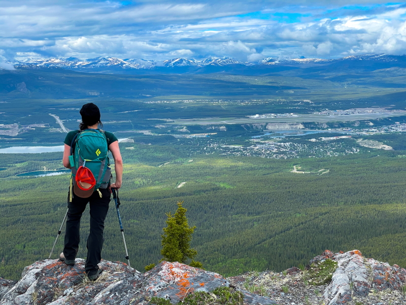
Views of Whitehorse open up once you are out of the trees.
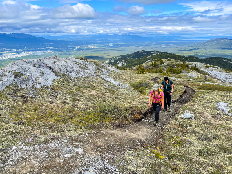
Hiking along the open ridge trail is a 'dream'.
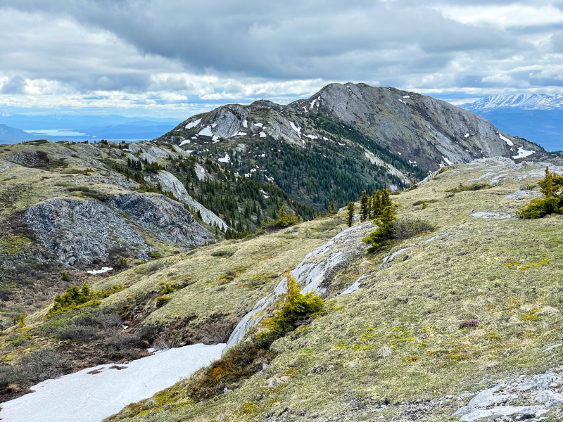
At the end of the Dream Trail you get a beautiful view of the rest of Grey Mountain to the southeast.
Shailyn October 1, 2025
Hiked this with a friend on September 30th. This is a great end-of-season option as it typically has less snow than other taller hikes. No snow that day. Lots of other trail runners, mountain bikers and hikers on the trail. We hiked beyond the summit, which I highly recommend. I think hiking beyond to where the distinct trail finishes is the prettiest part of the hike. 20.2km return. 6.5 hours with lots of breaks. No signs of wildlife.
Mike July 23, 2025
Hiked down The Dream on July 20 2025. Spectacular experience. Views heading north/down were great, recommend this direction. Trail is in perfect shape with just one huge tree fallen across it. There's even a bench at approx the halfway point, so plan on that for a break/snack!
Note that there is absolutely no signage saying "The Dream" anywhere. The Dream routing in Trailforks is very accurate. The Trailforks line for "Grey Mountain Summit Trail" is not accurate, and as the description above notes you will have to just figure it out in sections. There's a bunch of options, but even if you wind up backtracking a bit it won't be too much. The trails to connect The Dream to Magnusson parking lot are only partially signed, again Trailforks is the perfect solution for this.
Shailyn June 4, 2024
Hiked the dream trail on June 2nd. Almost fully now free except a couple smaller patches in the sub alpine that were easy enough to go around. This was my second time on the trail and it truly is stunning. We walked to the end of the trail, 20km return - so perhaps more work has been completed on it since the trail description? Can't wait to see how the trail continues beyond that point some day.
YT June 14, 2022
Kylie, please note that The Dream is not a “purpose built mountain biking trail”.
All trails built on public land within the City of Whitehorse are multi-use, and while it has been built (superbly) with a keen eye towards making it bike friendly, all non-motorized users may enjoy it equally. Also, all users (wheeled or otherwise) should recognize their impact on the trail during wet weather and act accordingly.
Kylie June 14, 2022
Please don't encourage people to hike this purpose built mountain biking trail right now. A lot of money and hard work builds this and people are ruining by not fixing big deep foot prints. Trail workers then cannot extend this trail as they have to fix the problems caused for people going to early. Please note when you guys post a "new" trail, it gets heavily used. This trail is not ready as it's not dry. Thank you