Total Distance: 16 km
Return Time: 8.5 hours
Elevation Gain: 1375 m
Difficulty: Very Difficult
Region: Kluane
Traditional Territory: CAFN
This is a fun hike for those looking for something more challenging. This route follows the same trail as King's Throne but takes you to a higher, more rocky summit with some amazing views. It is definitely not for those scared of heights or rock scrambling, as you get a heavy dose of both of these and at many times it feels more like a 'climb' than a 'hike'.
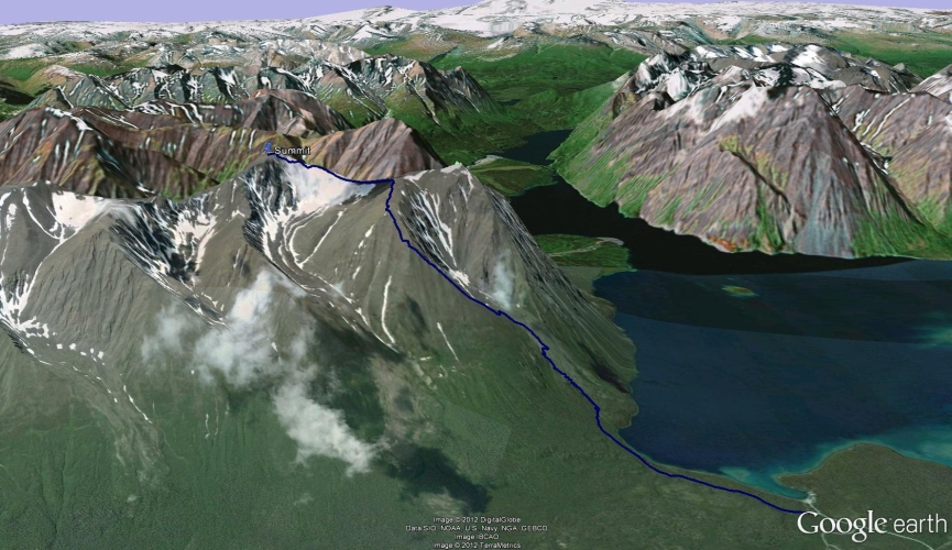
Drive south of Haines Junction along the Haines Highway for 32 km. Turn right at the Parks Canada Kathleen Lake Campground. Drive past the actual campground entrance and park at the trailhead for the Cottonwood and King's Throne Hiking Trail, there is a small pullout with signage on the left.
Note: Dalton NW7 refers to the unnamed peak which is 7 kms northwest of Dalton Peak.
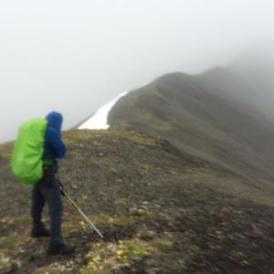
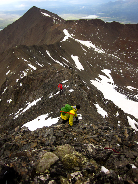
The first three quarters of the trail is the same as the King's Throne hike, starting off along the old mining road that follows through the forest and along Kathleen Lake. You will reach a fork in the road and a sign showing King's Throne to the left and Cottonwood Trail to the right. Take the left trail which leads steadily uphill, eventually turning into switchbacks that take you up and out of the trees and onto the steep, loose rocks of the rock glacier. There is a well-marked trail all the way to the seat of the King's Throne (an elevation gain of 500 m). From the seat of the throne, a trail leads steeply up the left (southeast) ridge, if you're facing the mountain.
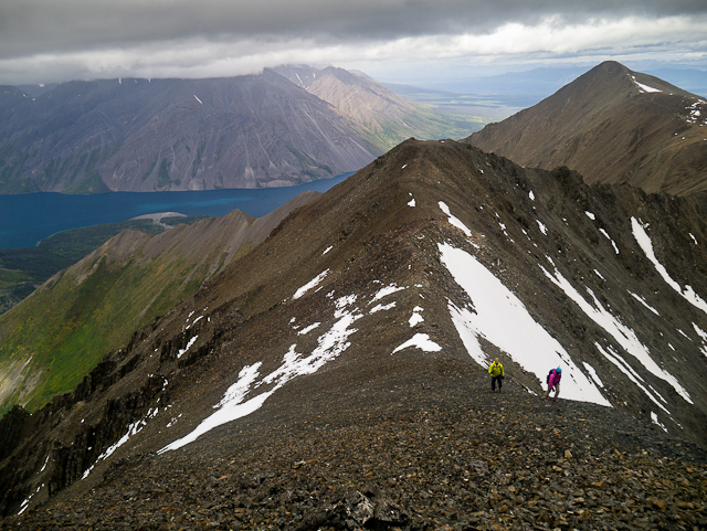
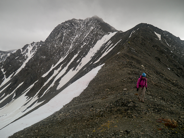
The hike up the ridge is steep and winding for another 690 m elevation gain over approximately 2.3 km, but eventually mellows out as you approach the saddle between King's Throne and Dalton NW7. From the King's Throne trail, you will need to drop down to your left slightly to gain the ridge to Dalton NW7 (directly south). There is a gentle approach to the base of the rocky ridge that leads to the summit; this approach is often flanked with snow on the east side which remains all year round.
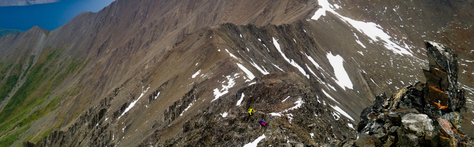
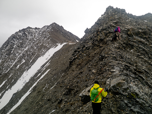
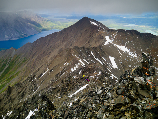
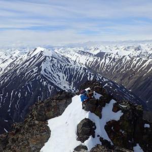
The route climbs up steeply to a smaller sub peak and then slightly down and along a narrow ridge until the final climb up to the true summit (2,112 m). There are some technical sections where you will have to use your hands and ensure proper footing (ropes are not necessary). There is also a lot of loose rock, so give your hiking partner(s) lots of space. The views from the top are amazing as you enjoy the same view as the summit of King's Throne looking down Kathleen Lake with the added benefit of being closer to the other peaks of the Dalton Range.
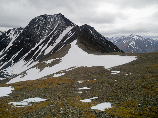
The ridge to the summit as seen from the saddle between King's Throne and Dalton NW7.
Scrambling around the rocky outcrops on the ridge.
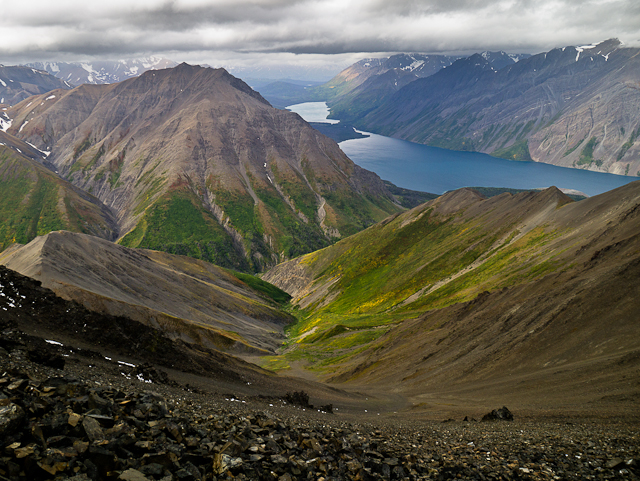
Amazing views west down Kathleen Lake and Louise Lake.
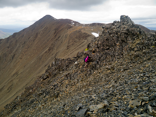
Climbing up to the sub peak.
The ridge mellows out briefly between the sub peak and the summit.
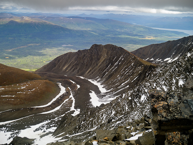
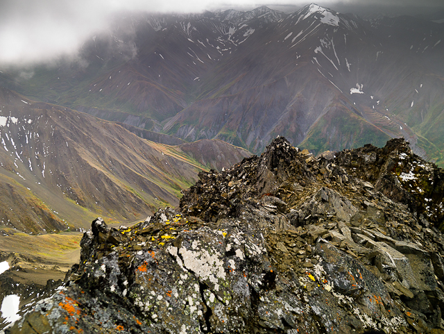
The view to the east with rocky moraines below.
The final scramble before the summit.
The view from the summit looking south into the Dalton Range.
Descending the ridge with the summit of King's Throne in the background.
Back on the saddle.
Zac July 2, 2022
Hiked on July 1, 2022. No snow on the entire route. The scramble was beautiful! Didn't feel too sketchy at any point and the exposure wasn't too bad. Super fun ridge to scramble across, but take your time as the rocks are very loose; helmets are definitely a good call.
A.B. July 4, 2021
Hiked on July 3, 2021. Much of the ridge where the trail branches up to Dalton is broader than it looks from afar. Lots of loose rocks to look for in that section - plenty of rocks that appear solid are rotten. Some scramble sections are exposed, but finding good footing is easy enough.
Completely clear of snow, and with clear visibility we had a great view of distant mountains on the range. 8hrs25m total at a steady, moderate pace, including 45m for lunch.
Hiking poles were helpful to manage the loose dirt and scree on the descent down the normal King's Throne route, but no other special gear needed for Dalton.
Randi Newton July 31, 2018
Went up Dalton last weekend, it was well worth the extra time from King's Throne! I'd say this is a moderate scramble, based on the loose blocks and little bit of exposure. A helmet is a good idea. I recommend heading up the right ridge on King's Throne instead of the normal route on the left to save yourself from backtracking if you'd like to summit both. The right ridge is an easy scramble but again there's loose rock and some exposure if you stick to the ridge proper so it shouldn't be attempted without scrambling experience. I can't really recommend it as a way down, it's too steep to be very fun.
Cata July 1, 2018
Hiked Dalton and King's Throne with my dog Nootka on June 28th. It was surprisingly not very windy. Fun hike to dalton, lots of loose rocks so gotta be careful with your footing. Great views from the top. 8 hours total doing both peaks at a chill pace.
Felix Ossig-Bonanno June 12, 2018
Thanks for this website! Thought i'd take David's cue and give a trail update...
Kings Throne:
Pretty much snow free. I got to the summit at around 11am. There was a good reset overnight so I had a nice crust to walk on so i'd recommend heading up early.
If you are heading up later you'll have a bit of snow to negotiate; either walk through it or with a bit of up and down you could avoid it completely.
Dalton NW7:
I'd recommend hiking this peak too if you are heading up. It only added an extra hour or so. There is actually less snow on this route than for Kings Throne summit, but it is on steeper slopes so harder to pass. I had to cut a couple of steps. Maybe bring an ice axe? - or just find a rock to make steps. That's what I did. Only a dozen or so steps on snow.
A bit of Class 2 scrambling towards the end... though i'm not overly versed in the North American scrambling scale.
Dana de Jong August 30, 2016
Did this with a friend on July 23, 2016 in the rain and clouds (and some brief light snow while on the ridge). The narrow ridge leading to the summit was pretty intense, especially with diminished visibility and slippery shale. I definitely recommend doing this one in good weather.