Total Distance: 75 km
Return Time: 4 days
Elevation Gain: 2314 m
Difficulty: Moderate
Region: Kluane
Traditional Territory: CAFN
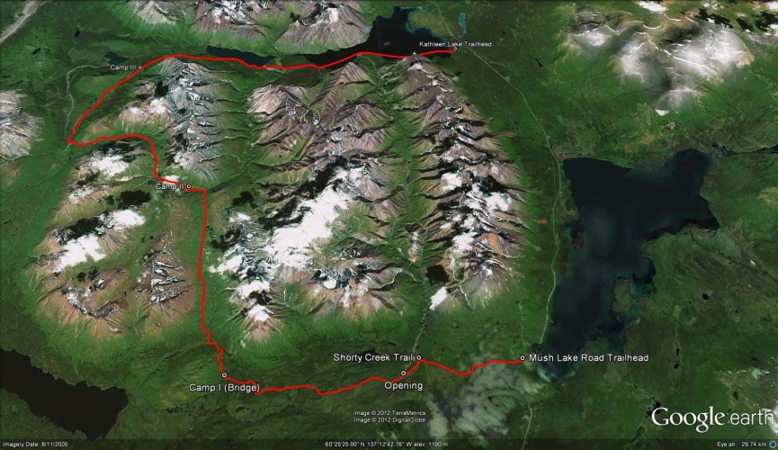
This multi-day trail circles through and around the Dalton Range in Kluane National Park. The trail can be hiked or skied from either end, although if you are skiing it, starting at the Mush Lake side allows you to keep the wind at your back when you reach Kathleen Lake. There is a mountain pass to climb during the middle of the trip, but the elevation gain isn't difficult. The view of the impressive Dalton Range mountains almost never leaves your sight.
To start from the Mush Lake Road, drive south from Haines Junction on the Haines Road for 53.4 km. At this point there is a small brown National Park sign on the right, pointing to the parking area and trailhead. Two vehicles are required for this trip (unless you want to hitchhike back to your vehicle at the trailhead), so leave one vehicle at the Kathleen Lake campground, which is the end of the trail.
Only the winter route has been recorded.
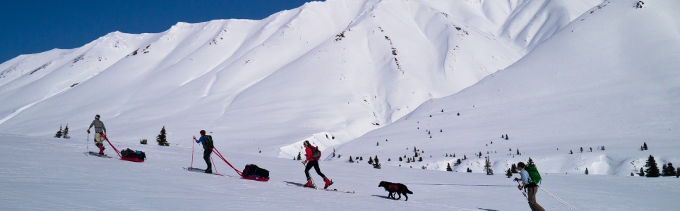
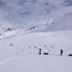
In the winter, this trail is best suited to ski touring. Nordic touring skis versus alpine touring skis are preferrable as the trail is a mix of flat terrain and gradual ups and downs. Nordic touring skis with directional fish-scales will suffice for most of the uphill sections along the trail, however half skins are great to have along for steeper sections. The route does travel through avalanche terrain so avalanche safety gear and training is advisable. Navigation tools such as a map and compass and/or GPS are a must in the winter.
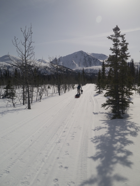
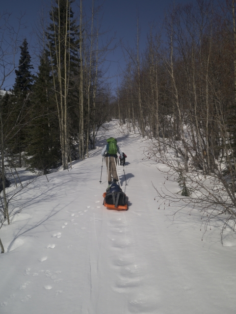
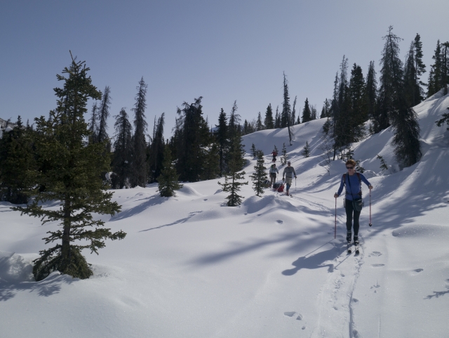
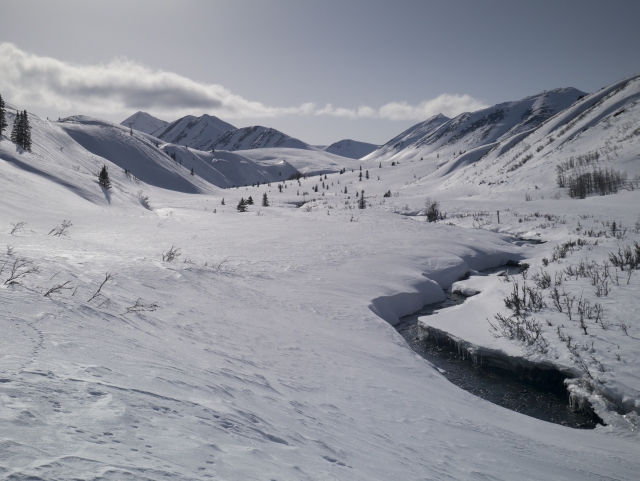
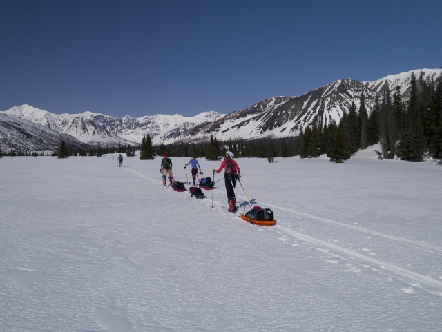
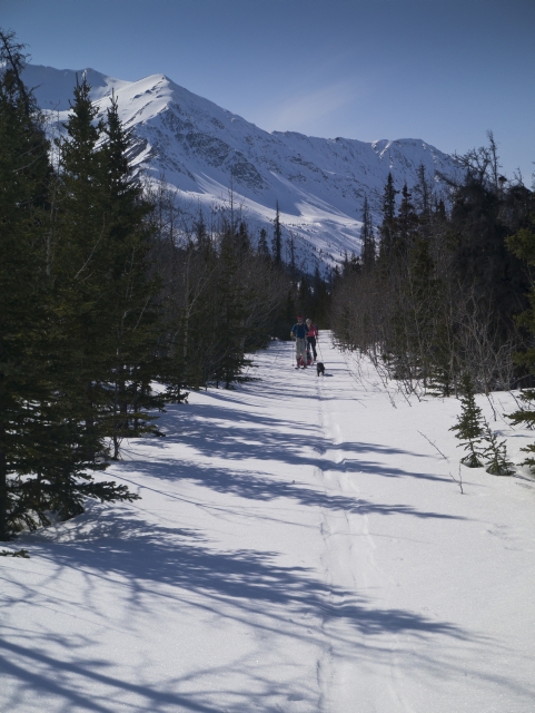
The route starts off on the Mush Lake Road, a wide 4x4 trail that is often track set and packed in the winter. The first part of the trail passes through mixed poplar and spruce forests with nice views of the surrounding mountains. The terrain is quite flat for the first 7 km following along the Alder Creek valley. There are occasional trail markers along the way at any major junctions. At about the 7.7 km mark, the trail turns slightly towards the northwest to follow along the mountain side. The terrain gets a little more hilly here and it's gradually up and down for the next few kilometres. At the 16.5 km mark the trail crosses Dalton Creek (there is an old bridge here). This is a good potential camping spot with access to the creek and it is also a good stop as the trail begins to climb up into the alpine after this. The Mush Lake/Cottonwood Trail junction is just a little ways further at km 16.8.
From the Mush Lake/Cottonwood Trail junction, take the right fork onto a narrower trail which begins to climb immediately for 1.6 km up the Dalton Creek valley. After about 200 m of climbing, the trail levels out and views open up around you as you gain access to the subalpine. Continue following the trail on the left of Dalton Creek. The route is gradually uphill through sparse trees towards a broad mountain pass (1,290 m at km 23.4).
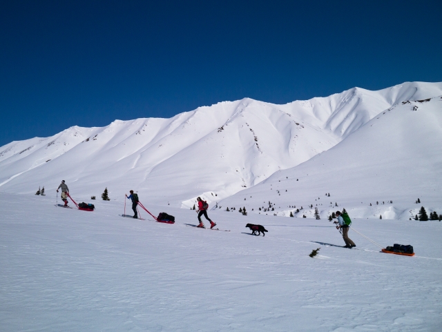
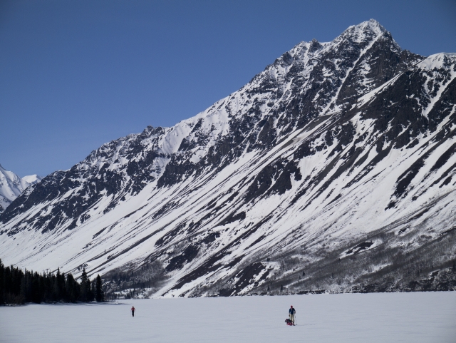
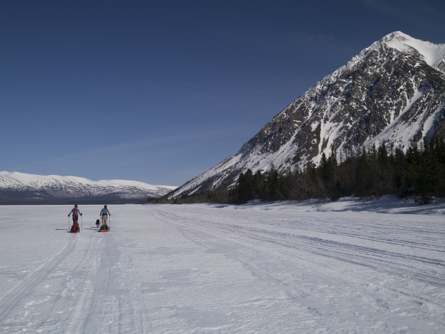
After reaching the pass, the route traverses a wide alpine plateau. Around km 24 you will need to either stay high or drop down into the gully of Dalton Creek. The summer trail goes through the gully, staying next to the creek, and this is an option in the winter as well; however, be weary that this is a potential terrain trap if an avalanche were to come down one of the many tracks on the mountain to the right (east). If you choose this route, spread out and travel through this area quickly. Alternately you may choose to stay high on the bank/ridge along the left of the gully. At the 30 km mark you will reach the end of the gully at the base of a large mountain where the trail takes a sharp left following along Victoria Creek. There is a nice open flat area near here offering good camping options near the creek with great views of the mountains around.
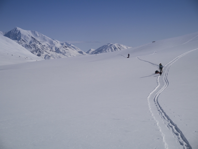
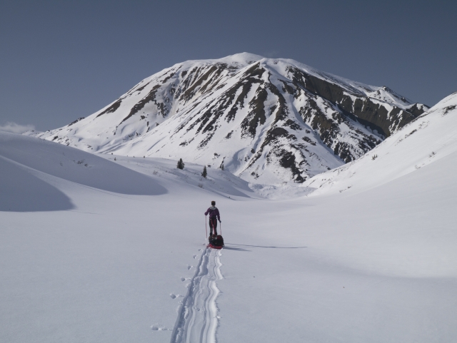
The trail continues along the right side of Victoria Creek until you reach an area where several small valleys converge. A trail marker will direct you to keep to the valley on the right. There is a gradual climb of about 200 m to a second mountain pass (1,249 m) at km 35.7 with a stunning view from the top looking down into the next valley. From this point you get a nice short downhill section (300 m) where you can finally get some turns in.
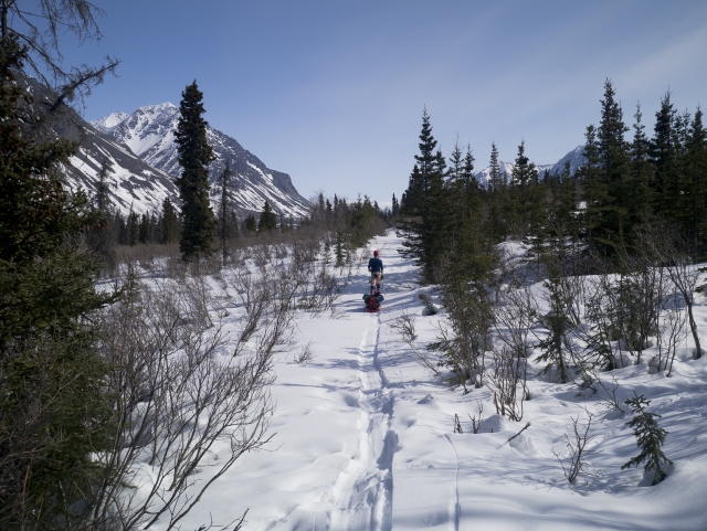
You will now be leaving the alpine, dropping down to a nice aspen and balsam poplar parkland. The route follows along this valley until coming to meet with a larger open valley at km 43. Now the trail follows along the right of Cottonwood Creek for a couple kilometres but then you will need to leave the main creek and head towards the smaller valley on the right towards Johobo Lake and the old Johobo Mine which is apparent on a prominent mountain in the distance with it's many exploration roads and mining trenches. In the winter it is easy to make a bee-line through the trees.
Once across Johobo Lake there is a cutline trail starting from the northeast end of the lake at km 50. There is a trail marker a little ways down this trail. Continue a short ways uphill to a potential camping spot with a large open area, access to a small creek, and views of Sockeye Lake and the Auriol Range to the north (km 51.5).
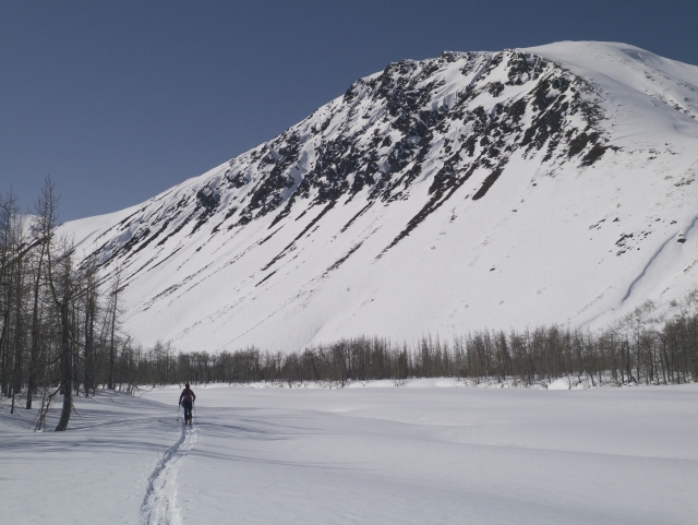
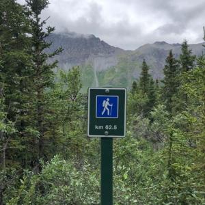
From this point the trail starts going gradually downhill traversing along the mountain side to the right (east), eventually leading to the east end of Louise Lake (km 60.7). This section of the trail is 9 km long with lots of ups and downs through the trees. It can drag on for a while so it is possible at some locations along the way to cut through the trees directly to the lake, for a flatter route if you so choose.
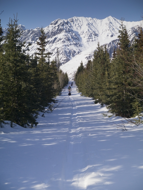
From the east end of Louise Lake find the trail marker and follow the trail through the trees for approximately 5 km until you finally reach Kathleen Lake by following a creek down to the lakeside (km 65.6). Once on the lake it is clear sailing from here on in terms of route finding, as you essentially follow along the south shoreline as directly as possible to the Kathleen Lake Campground (about 10 km).
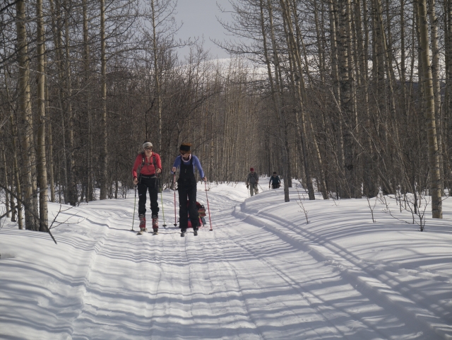
The route starts off on the Mush Lake Road, a wide 4x4 trail that is often track set and packed in the winter.
The terrain is flat for the first 7 km following along the Alder Creek valley.
After the Mush Lake Road/Cottonwood Trail junction (km 16.8), the trail heads uphill for 200 m.
Once in the subalpine it is easy going along Dalton Creek.
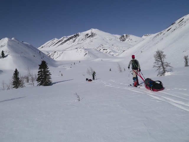
Enjoying the gradual ascent to the first mountain pass (1,290 m).
Traversing the alpine plateau.
Travelling through the gully towards the Victoria Creek drainage.
Arriving in the Victoria Creek valley.
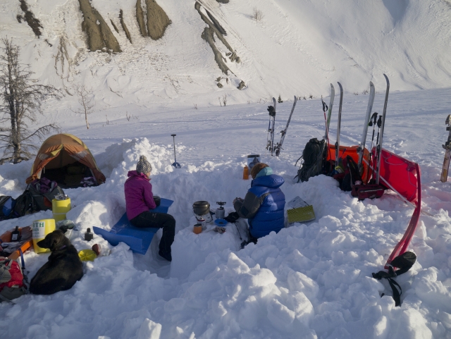
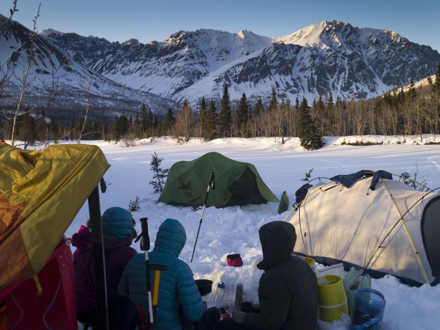
Setting up camp out of the wind next to Victoria Creek.
The trail continues along the right side of Victoria Creek until you reach an area where several small valleys converge.
After reaching the second alpine pass and descending 300 m you'll find yourself in a nice aspen and balsam poplar parkland.
Leaving Cottonwood Creek and heading towards Johobo Lake.
Once across Johobo Lake there is a cutline trail that starts from the northeast end of the lake.
Enjoying the view from camp towards the Auriol Range.
This section of the trail gradually descends towards Louise Lake (with many ups and downs) for 9 km.
To avoid some of the ups and downs along the trail, you can take a shortcut through the trees to Louise Lake.
After reaching the east end of Louise Lake the trail travels through mixedwood forest for 5 km.
After finally reaching Kathleen Lake, it is about 10 km to the Kathleen Lake campsite (the end!).
Brian April 2, 2024
March 29 - April 1, 2024, Fischer Transnordic 82 wax/skins. Camp 1: Dalton Creek, Camp 2: Cottonwood Creek, Camp 3: Victoria/Louise confluence. First time on the Cottonwood, spent 3 nights from Mush to Kathleen. As others have echoed, this route is best for a bc nordic setup, there are some nice sections to glide (particularly on Mush Lake Road, the descent into Cottonwood valley, Cottonwood flats and Kathleen lake) but I wore my kick skins the majority of this trip. Skiing solo with no pulk - wouldn't advise going with just a backpack mainly because it made downhills too difficult, it would defiantly hinder progress if snow is punchy.
Snow coverage is great - skiing over the next few weeks will be ideal if we continue with the melt freeze cycle. Some things to note: Dalton Creek is open at camp 1, Victoria Creek is open at camp 2 - no snowbridges left here so bring sandals to make this creek crossing easier, Cottonwood Creek is open, Camp 3 creek had no water (yet), there are some small open creeks as you get closer to Louise Lake and there is open water at the Louise Lk/Victoria confluence. Kathleen Lake is glare ice until about 2km out from the parking lot - makes for super fast double poling (travelling from Victoria/Louise to car in 2.5 hours - 15km). No signs of ice instability, you will encounter puddles if travelling late in the day/warm conditions though, they were frozen over in the morning.
Due to an incoming storm Day 2 was large, travelling from Camp 1 to Cottonwood Creek to avoid getting stuck in the alpine. This proved worthwhile as the next morning the mountains were obscured in whiteout conditions. Johobo Lake to Louise Lake is not to be underestimated, a long section of up and down with alders blocking sections of trail, had to dismount skis multiple times for sections of downhill. If were to complete again I would consider cutting down to Louise as opposed to sticking to the trail.

DKK April 10, 2023
April 7-10, 2023. Three of us skied counterclockwise as suggested, which was a good idea since the wind was fierce on Kathleen Lake. We were glad not to have taken pulkkas, since the snow was sticky in the afternoons and the Lake Louise section was littered with pulkka traps. Breaking camp early (leaving by 7-730) was good since snow got soft and slow around 2pm. Trail was generally very good, someone was a few days ahead of us. Fishscale skis worked well compared to wax/skins (although skin wearer liked them on the uphills). Creek crossings were easy, with little water and still lots of snow. No sign of bears. A few wolf tracks. Many moose tracks on the trail. Overall, a bucket list awesome experience!
Maya March 28, 2022
We just skied the loop in 4 days between March 24-27. It was great! Amazing winter trip.
We were a group of 3 with 2 pulks so we took turns with the pulks. We each had a light backpack as well. Since the slopes are not too steep and elevation gain is small overall, pulks worked very well for this trip. We had nordic skis (64, 110 and 120), and larger skis worked better in general. Snow was soft in the afternoon, I absolutely recommend bringing skins! We started our day around 9 am and wore skins during climbs and for part of the afternoon. We had two pairs of snowshoes in case something would go wrong with our skis, and they were useful at the camp at night.
We heard that another group skied the trail the weekend before us, but the snow that fell between our trips completely covered their tracks. Despite that, snow wasn't too deep for the skis and breaking the trail wasn't too hard overall for us.
We followed the camping spots proposed here and they were great. Especially Camp III, after Johobo Lake, was our favorite for the view. We found open water from the nearby creek at each camping spot.
We hesitated to bring our dog along and ended up leaving him at home. I think he could have done it but he would have needed snow pants, because snow would have been sticky on his fur (we have an aussie shepherd with long fur).
For us, day 3 & 4 were the longest in terms of time and kms, but day 2 was probably the hardest in terms of effort, due to the climb of Dalton Pass. On day 4, we didn't find the small portion of trail going down to Louise Lake, so instead of skiing on the lake, we stayed on the trail until we reached Lower Victoria Creek.
Great trip! I would do it again! I've never hiked the trail in the summer, but for me this more interesting as a winter trip. Have fun!
So September 17, 2021
Good to know: During the summer, there is camping restriction from km 46 to Kathleen lake. Camping is only permitted in designated spot.
Matt Hosford August 12, 2020
Did the route as a day trail run with a group of 4 on Aug 8th.
Started from the Mush Lake side, finishing at Kathleen.
Nothing major to report. Creek crossings were no higher than the knee, very few bugs (inexplicably) and we did not see any wildlife...although we were making a lot of noise and a bike group 2 hours behind us saw 3 bears. The pass and the lake areas are incredibly beautiful. Some mundane ATV trail sections.
Only thing to note about Parks Canada's and this site's description of the trail is the elevation gain (which is stated as 530m). All 4 of our GPS's recorded over 1800m of elevation gain. The trail constantly undulates up and down so just be aware that if you're on the summer trail, you'll be climbing well over 530m regardless of which side you start from.
It's a beautiful part of the Yukon and we're lucky to have a trail through it. Enjoy!
Cam July 17, 2020
This trail has a lot to offer in terms of terrain and wildlife!
We hiked from July 10th-13th from Kathleen Lake to Mush Lake road and had perfect hiking weather (cloudy with small breaks of sunlight and no rain). We didn't see anyone else on the trail outside of our group of five.
We walked through :
- thick forest (tonnes of mosquitoes, our head nets saved us!!!)
- some beautiful alpine (two mountain passes)
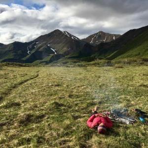
- open meadows and valleys (night two is spent in cottonwood meadows and was my favourite spot)
- and had many many creek crossings.
Important Notes:
We saw an abundance of animal droppings (moose, bear, horse) as well as many prints. Tonnes of bear activity! Fur on trees, scratched trees, and areas where bears have clearly dug up looking for roots.
Heard one baby moose, saw a baby grouse, and saw a big grizzly on the other side of Victoria Creek when we camped there the first night. The bear moved along and didn't give us any trouble.
Most of the research claimed the first Victoria Creek crossing from the Kathleen Lake side would be the hardest but it was actually the second Victoria Creek Crossing on our third day that was the most difficult. Nothing too crazy, a few inches under our waists and a semi strong current.
When you cross Vic Creek the second time you will have to cross Shrikes Creek less then a minute later, and then cross shrikes again less then 50 second later. Don't make the same mistake we did, keep your water crossing shoes on for this part.
There are WAY more creek crossings then described in the Parks Canada KM breakdown.
There was recently a landslide in the Kathleen Lake section of the trail. Parks Canada has cut a detour that is marked by pinkish marking tape. It is a steep, semi lengthy detour that goes up into the forest and around the slide, so be ready! FOLLOW THE PINK MARKERS! It truly is the best way.
General Rule: When in doubt look for marking tape or stone cairns.
Sometimes the trail is difficult to find, mostly in wash out areas by creeks, but if you take a few minutes to scout the area you will find the weathered trail again.
There is NO FOOT BRIDGE at dalton creek, despite what all the info claims!
Lastly: We found the KM breakdown to be a little off. We cross referenced with our Inreach tracker, my Gaia Maps app, the numerous Parks Canada KM signs, and the Parks Canada KM breakdown and the numbers never added up. The first day we hiked 18km to Vic Creek instead of our expected 14km, so from the first day onwards our daily KM breakdown was off.
Overall, a solid and beautiful hike. Would recommend to folks of all hiking levels as long as they are comfortable with creek crossings. Those looking for a more relaxing time can stretch the hike and shorten their daily KM.
Don't forget warm clothes for the alpine areas, a bug net, and a camera!
D Schmidt September 10, 2019
27 Aug 2019
The doom and gloom from some comments only adds to the attraction of this route; didn't see a soul for 4 days! Started at K Lake campground and headed down the highway in order to end back at the car. Great concept, but added 27km of pavement, so probably won't do that again. End-season trek ensured creek crossings were fairly easy, nothing past the knees after some searching. Used a mtn axe for stability. As with other comments, lots of bear signs, some rustling in the bushes, but no contact. Did see a lynx though, first for me.
The Parks Bear Barrels are great, and worth the extra weight. I hated packing around it's odd shape though.
Nav was fairly straight-forward with a few exceptions, mainly at creek crossings where it was difficult to determine where the trail continues on the other side. Again, part of the allure.
Description from parks office mostly accurate, nothing outrageous (1st 6 km were dry while I was expecting stream crossings).
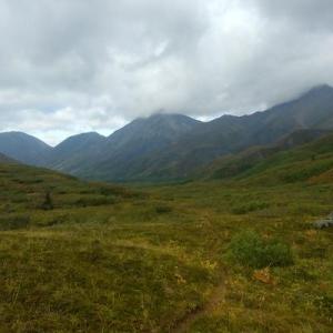
Photo taken on last day, looking back at Louise Lake in the distance. Awesome colours! Rained for 2 days. Recommend this trek for people who like how much it sucks, and wish it could suck more.
GC April 17, 2018
To add to Voyageur comment. You better have a plan B and C out there, repair kit or spare gear. Never know, you can break a biding or something ;). A way of communicating is a must; sat phone or Spot or In Reach...
Voyageur April 14, 2018
We skied the trail as a group of two with back country skies, light back packs and pulks from April 8-12.
Gear: We carried snow shoes as back-ups and they were really helpful at camp as they avoided us from sinking in hip deep into the snow when taking the skies off.
The trail was easy to follow and in places where there was no obvious trail it was easy to follow the ski/snow shoe tracks from former travelers. Although in the Alpine where none of these are visible it is highly recommended to bring a map or GPS device for route finding and avoiding the avalanche terrain that is mentioned in former posts. After crossing Victoria Creek we missed the trail leading to Kathleen Lk. which forced us to bushwalk for a bit (a real pain with a pulk). Kathleen Lk. was solid frozen with some softer spots but still safe for travelling.
We got water from creeks at camp I and camp II and spent an extra night at the Cottenwood Creek which was also open (no water at camp III.
Snow conditions: Due to higher temps during the day the snow pack got really soft especially on sun exposed aspects that made traveling quite exhausting. Early starts are recommended since it cooled down well enough at night to harden the snow. Since you are traveling through avalanche terrain carrying avi-gear and know how to use it is a must.
Wildlife: Bear tracks all along the trail was a proof that they are out again so taking bear spray and storing food away from camp was certainly a right decision.
Recommendations: Try to travel light, keep your gear in good shape and bring an essential repair kit. The combo pulk/light back combo seemed to work out for us. Bring enough fuel to melt snow in case creeks are frozen. Know how to read the map/track and be confident in rout finding, assessing avi terrain and ways to minimize the risks. Plan for an extra day since these mountains are sure worth spending more time to enjoy nature.
Peter Knamiller April 3, 2018
We skied the route over the Easter weekend, along with at least another 2 or more groups on the trail that weekend!
The trail conditions were very good, with little to no penetration resulting from the cold temps for this time of year. I would imagine that this could change very quickly if temps rise. There was good snow coverage the whole length of the trail, expect Kluane Lake, which still had very solid (2-3 foot) ice which was blown bare. We used skins on this section for less of the Bambi experience.
There was a group of snowshoers from Vancouver behind us the whole way and they were degrading the ski trail considerably, particularly in the softer parts as they were breaking through. I would not recommend this trail for snowshoers.
We found a good water supply at Camp 1 and 2 and no water at camp 3.
Regarding avalanche concern there was evidence of a couple older slides (2 weeks) near the end of day 2 where the route moves through an obvious terrain trap. We easily avoided this by traversing above the gully on the west side. I would recommend this route regardless of avalanche concern as it completely avoids the terrain trap and does not add any distance. There was also some more recent solar triggered slides along Cottonwood Creek which are likely to increase as the spring warm up hits. Watch for these and don't underestimate the avalanche potential for some of the micro terrain feature on the descent into the head of Cottonwood creek.
The trip was great with some beautiful alpine scenery.
Nicolas Lemieux April 3, 2018
PERSONAL SUGGESTIONS
Nordic skis vs AT vs classics vs snowshoes:
If the nordic skis with skins and/or half skins are best suited for this trip, I was quite happy with my AT touring set up, although mine is as light as it gets. I sure missed having scales in some places but it was great to open the trail, to drag a pulk up and to cross the icy lake at the end. One of us had classics with a backpack and made it through and even had some glorious moments but had to stay behind for the trail to be packed in the forest and to borrow snowshoes for the lake. There was another group of snowshoers that apparently had to be evacuated by helicopter out on Day 4. The snow is just too soft for snowshoing in many areas. Unless you make it a 6 days trip and are willing to burn lots of calories, I wouldn’t recommend it. Also, you’ll destroy the trail for skiers doing that.
Pulks vs Backpacks:
This is tough call. While it’s nice to have a pulk in the flat areas and to carry more gear to make the winter campaing experience more enjoyable, it can also be a pain in the uphill, downhill, sideway terrain, in the forest and it will be very hard to glide on the flat terrain. A lightish backpack would be ideal if you’re willing to sacrifice some confort. Something in between I think I would try another time is a mix of a backpack and pulling a small dry bag well tied in a crazy carpet that you can carry in your backpack if needed. But the grass always seems greener on the other side.
Glad we carried:
- GPS with topo maps loaded with the route
- Snowshoes for around camp and if skis brake
- Skins (a must we think)
- Shovels for the camp and avalanche safety
- Avalanche safety gear : most of the trail is OK but some sections can be a bit tricky
- Duct Tape (of course), zip ties and extra rope for pulks repairs
- A set of extra poles
- Sunscreen, lipbalm & sunglasses (you have to)
- Liquid gas stoves. Gas stoves don’t do well in the cold.
- Warm stuff. Night were quite cold.
- Booties for after ski
Maybe not next time:
- Wine : froze after the second night !
OVERALL RECOMMENDATIONS
This is an epic trail with some alpine feeling you can get without alpine touring equipement. A 4 days loop through the mountains of Kluane is quite tempting. Just bear in mind it’s not an easy one, and the conditions can make it harder. While we really enjoyed it, even if tiring, I previously heard few stories of the trail becoming a nightmare for some (snow too soft to ski in the afternoon, moose completely messing the forest trail, etc.). You’ll need to be fit for this, have some winter camping knowledge, be well prepared for all conditions, ideally be a group to switch trail breaking and be able to add extra day(s) if needed.
Voilà ! Hope it helps.
Nicolas Lemieux April 3, 2018
Our group of five is just back from an Easter trip on the Cottonwood. Here are few notes about the conditions of the trail, from Mush Lake to Kathleen Lake.
Day 1 : The first 7km was an icy crust of multiple snow machine tracks, which wasn’t great both for skiing and the pulks. The next kms were better although we had to put the skins on for the ups and downs in the woods with the pulks. There was open water at the camping spot (Dalton Creek).
Day 2 : The ascent makes you sweat and you can feel the weight of your pulk. There was again open water in the meadows above the first ascent. It could make another place to camp if you feel like putting extra miles/effort on the first day. The alpine is gorgeous and snow was great although there was a strong cold wind facing us. The terrain is curvy in few places so it tends to drag the pulk sideways. As the description states, at some point the summer trail enters into a terrain trap (gully) on your right. The wall can be tall and hazardous. We felt it was safer to stay on the ridge/bank on the left. Keep in mind though to head towards its right at the end where you’ll find a notch which seemed the only safe area to drop down. Although it’s a bit steep for xcountry skis and pulks, it’s safe for avalanches. Some of us went down sideway, some other transitioned to snowshoes. The creek was open and it’s a terrific area to camp.
Day 3 : We followed previous ski tracks which mislead us up high, far from the trail. Once we saw it was entering a gully that felt like another terrain trap, we backed down and headed towards the original trail. After the pass, the downhill section is quite nice although the pulks slowed us down on down semi-flat area and we had to let them go in a steeper section. Snow was starting to get soft in mid afternoon. There was open water at the bottom in the valley. This could potentially make another good place to camp if the bear are not out (see the Park information and camping recommendations). With the detour, it made up for a long day. There was no open water at the camping spot so we melted snow.
Day 4 : The snow was quite soft, even in the morning and even with previous tracks. In addition to that, moose tracks and lots of branches made it an obstacle course for the skis and pulks. It didn’t seem tempting to cut through Louise Lake tough as you would need to bushwalk downhill into lots of snow. Once passed gorgeous Louise Lake, we followed the route on our GPS but other parties seemed to have lost theit way a bit into the creek. While the first markers were easy to find, we didn’t see where it entered the forest but made it through with the GPS. No open water so we had to melt snow again to drink. Kathleen Lake (again amazing views there) was on bare ice and the strong wind was facing us the whole way, so don’t keep your hope too high to sail your way back. Three of us switched to snowshoes to get a better grip on the ice. It took quite a while to finally reach the camping parking. Like kayaking open waters, it feels like you’re not progressing much. Again, it made up for another very long day.
Avalanches
Although the snow seemed stable (no whumfs, no cracks), there were old avalanches in fews places.
Bear & Wildlife
No signs of bear. Annoying moose tracks on Day 4.
Sam V July 18, 2017
Hello Marc and Laura,
Thank you for your trip report.
I'm looking at more info on the cottonwood trail and would like to get in touch with you. Unfortunatly it doesn't seem to be able to get your contact info from the comment.
Would you be able to contact me at svigier at gmail.com ?
Thank you !
Sam
Marc and Laura July 2, 2017
Did the Cottonwood trail June 29th to July 2nd (3 nights - 4 days). Started at Mush Lake Road and finished at Kathleen Lake.
The Summer route is quite different than the route used in the winter. You can't rely on the Winter GPS data if you are doing it in the Summer. It is actually 85 KM long and it is highly suggested to get a detailed map and trail information from Parcs Canada before going. They suggest 4-6 days as well for the trail.
Overall, it was a great hike and offered great views!! Especially when you get to the second mountain pass (in the photo) or when you get to Lake Louise / Kathleen area. We didn't really know what to expect at first and thought it would be easy-going hiking after reading the description, but we soon learned that there are many obstacles to overcome if you go in the Summer. Just be prepared!
Throughout the years, I think Cottonwood trail hasn't been really maintained. Most of the trail markers have fallen down. Also, the trail can easily be lost at times. Kilometres 51 to 70 are a bit overgrown. If it's raining or it has rained the previous day, you will be wet in a matter of minutes going around the fallen trees and getting the branches out of your way.
The trail was also washed out in other areas. At the opening on Mush Lake Road, we had to bushwack to find the trail again. This happened a few times where we had to backtrack. After a couple of minutes looking, we would eventually find the trail, be very happy that we found it, and follow it until the next obstacle. There is also a landslide when you are following the shore of Kathleen Lake that you have to go around.
Several creek crossings. The hardest one in our opinion was the first Victoria creek close to Camp 2 (right after you do a sharp left turn). Current was strong and dangerous. We eventually found the safest spot to cross after bushwacking along the creek and we were able to make it to the other side. Water level was upper thigh (if you are 6 ft tall) to waist (if you are shorter).
Victoria creek after Louise Lake on your way to Kathleen Lake was quite high as well. Around the same water level as the first one, but wider. It was very stressful to find a safe spot to cross. I considered just using my air mattress and swimming across the lake to prevent me from crossing the creek that looked more like a river... We ended up running out of options and we didn't want to back-track 60KM so we decided to go for it and made it.
Third challenging creek was Goat creek. Another group on the other side of the creek told us they had attempted it earlier but couldn't do it, but we were starting to get used to these creek crossings and we found a quite easy spot to cross. We were not back-tracking 75KM at this point!! Other than that, you will find about 20 other small creeks. If you don't want to get your boots wet, it would be a good idea to have Crocs or Sandals for these crossings.
The creek crossings and challenges only made us appreciate it more when we had a nice trail to follow. PS we lost one of our hiking sticks in Louise Lake if somebody finds a blue Black Diamond stick somewhere, please let me know!! Good luck and have fun!!!
Anthony DeLorenzo April 7, 2015
We skied the trail this Easter Weekend. Mixed bag of snow conditions but generally good going. We were skiing with packs but there were two groups behind us towing pulks so there is likely a good trail put in now. Many creeks were open for water sources.
First day was a half day ski and we camped at Dalton Creek not far from treeline. Next day we pushed through the passes and camped in the Cottonwood valley. Day three we had all-time conditions down Cottonwood Creek and through the meadows to Johobo Lake but from there the old mining road was totally bombed out by moose. In hindsight we should have cut down to Louise Lake but we pushed through the road and camped at Victoria Creek which was mostly snow-free. Final day was less than two hours to get to the vehicle, we had a raging tailwind on Kathleen Lake pushing us across the bare ice.
We saw one grizzly bear out roaming around at the top of Dalton Pass, lots of moose sign and countless ptarmigan everywhere.
Parks Canada crews have been working hard on this trail the past couple of years with volunteers from the Contagious Mountain Bike Club to clear the trail, the result is that there are very few deadfall on the cut trails now.
Amy March 23, 2013
Are there any creeks big enough to be open this time of year?
Anthony August 28, 2012
We mountain biked this trail on August 25. Generally the trail is in good condition.
Not too grown in through Dalton Pass and down through the Cottonwood valley, wildflowers were spectacular and late! Lupins at the end of August and Fireweed still in full bloom.
Deadfall is becoming an issue on the old mining road. From about km 52 to 78 there are 40-50 trees down that require climbing over/under/around. Also quite a few on the singletrack trail that climbs from Kathleen Lake and eventually joins the King's Throne trail.
We saw an incredible amount of bear scat, tracks and diggings, many of them fresh. Luckily no bear sightings but I sure wouldn't sleep well if I had to camp out there. Make lots of noise and keep your bear spray handy!
Creek crossings were all quite low, the deepest crossings of Victoria Creek were mid-thigh or lower.
