Total Distance: 6 km
Return Time: 3 hours
Elevation Gain: 764 m
Difficulty: Moderate
Region: White Pass
Traditional Territory: TRTFN, CTFN
The moderate slopes on the side of Fraser Ridge offer good skiing and amazing views. The angle is fairly gentle, and since the ridge is wide open and doesn't have a lot of bumps or trees, it's easy to find a route both up and down.
From Whitehorse, drive south to the Carcross Cutoff and turn right onto the Klondike Highway. After roughly 70 km from Carcross (about 1 km before Canadian Customs), there is a small pullout on the east (left) side of the highway. Park here.
Only the winter route has been recorded.
From the pullout, cross the highway and head over to the trees. Looking up at the ridge, you'll see a gully up to the right that separates Fraser Ridge from Log Cabin. You'll want to stay on the left side of this gulley. There are a number of routes you can choose to take up, and the one described here will take you to the high point at the top of the ridge.
Pick your way through the trees, which should be sparse and easy to navigate through. Once you are through the trees, just start zig-zagging your way up the slope to the top of the ridge.
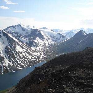
When you get further up the slope, if you want to ski up to the high point, you may need to head left to avoid the steeper section directly below the summit (as indicated in the image below), then start traversing to your right (northeast) once you reach flatter terrain. From on top of the high point, you can see over to the Chilkoot Trail and Lindeman Lake. A little ways further up the ridge is a radio repeater.
To descend, ski the open slopes back down to treeline.
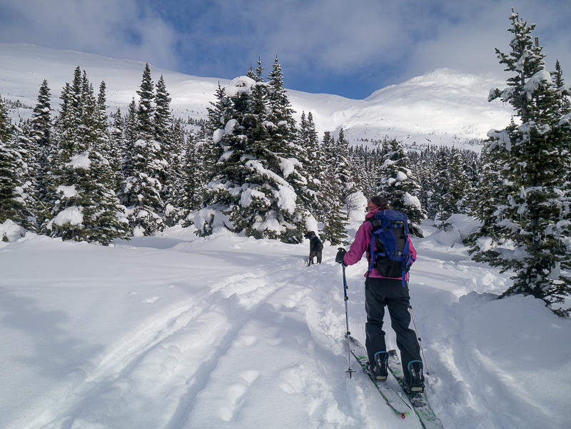
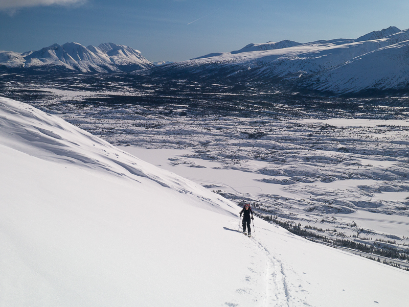
Starting the route through the trees. The gully is just below the notch up on the ridge - stay to the left of it.

It doesn't take long to pick your way through the trees, and the view starts opening up.
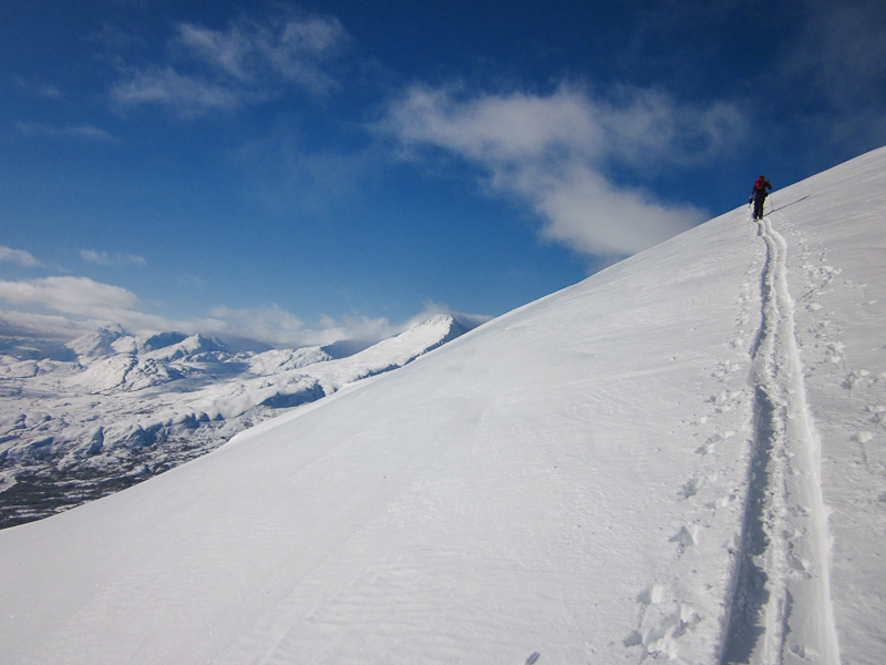
The ridge is wide open and it is easy to find a route up.
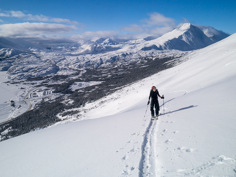
Looking east. Keep zig-zagging your way up the slope.
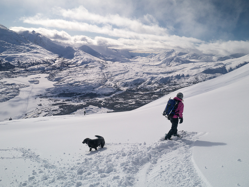
The slope gets a little steeper in places, but is still fairly gentle.
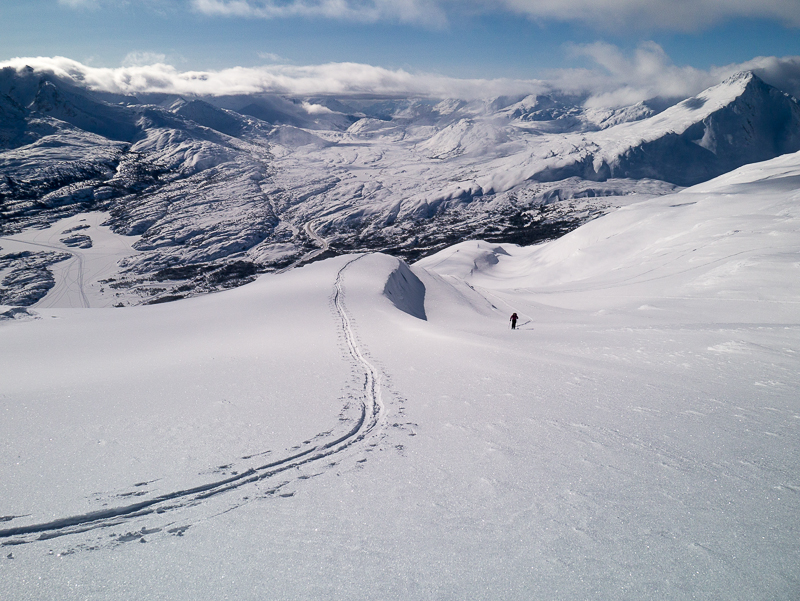
Nearing the top of the ridge, heading towards the high point.
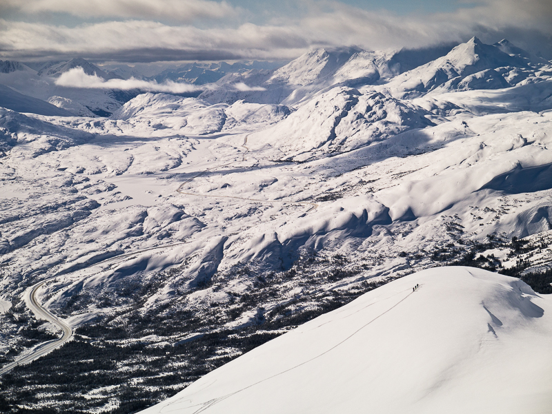
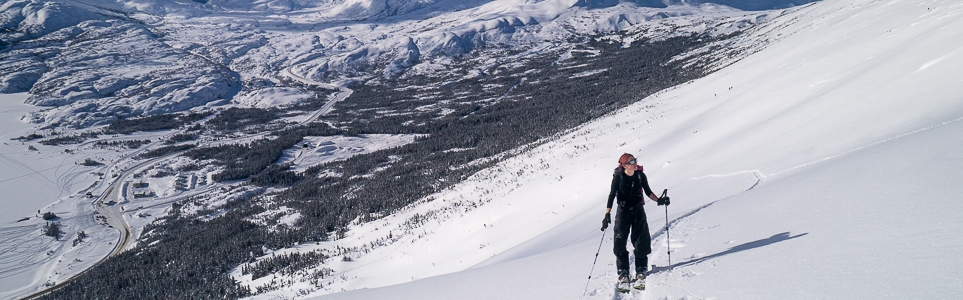
Skiers in the foreground have chosen a more westerly route to a lower point on the ridge. Looking up the White Pass.
Time to enjoy the ride back down!

Marilyn Smith July 27, 2021
Has anyone hiked here recently? Wondering if there is an obvious trail head and route in the summer.
Janine August 21, 2020
Anyone hiked this recently?
Sue Gleason October 28, 2017
Has anyone hiked the Fraser Ridge lately? Just wondering about the trail conditions and snow cover. Thanks, Sue
Terry Joss June 18, 2014
Amazing hike, one of my favorite. Summer hike is just as great as winter. Route I take is just short of Fraser Lake before (pipe bridge crossing). Head up to avalanche slope, its obvious from plateau. Take the 3rd ridge that's facing the hwy up to top, then it's either right at the top or left, your choice. Excellent view of the notch, sawtooth range etc.