Total Distance: 6 km
Return Time: 3 hours
Elevation Gain: 821 m
Difficulty: Moderate
Region: White Pass
Traditional Territory: TRTFN, CTFN
A great year-round destination - most popular with backcountry skiers and splitboarders in the snowy season, but also a great summer hike. Stellar views from the top overlooking the White Pass Area as well as the Chilkoot Trail. According to the BC Gazetteer, there is no official name for this mountain, but other common names include Shallow Peak and Mount Halcyon.
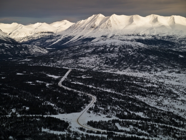
From Whitehorse, drive south to the Carcross Cutoff and turn right onto the South Klondike Highway. After 114 km there is a large parking area on your right, just after crossing the railroad tracks. This is the Parks Canada Log Cabin Mountain parking lot for the Chilkoot Trail National Historic Site. To get to the trailhead there is a road immediately to the left at the entrance to the main parking lot. Follow this to a smaller parking area at the end. There is a large sign at the trailhead with avalanche terrain information. Note this road may not be plowed in the winter, and you will have to park your vehicle in the main Log Cabin parking lot.
Check the Fraser webcam below before you head out! In the winter, check weather conditions on the Yukon Avalanche Association website.
Current conditions at the Canada border, Fraser Camp, BC. Refresh this page to update the images.
| South View | East View |
|---|---|
;?>) |
;?>) |
The trail starts from the avalanche sign (at the upper parking area) through the trees and continues along a cutline to treeline. There are several spur trails at the beginning but stay on the most defined trail, which sticks to the right until you find the obvious cutline through the trees.
The cutline takes you straight up to the treeline and should take about 20-30 minutes with 200 m elevation gain. This part of the trail can be wet as there are a few small streams that crisscross the trail. The trail is also rough in spots, with roots, stumps and overgrown areas.
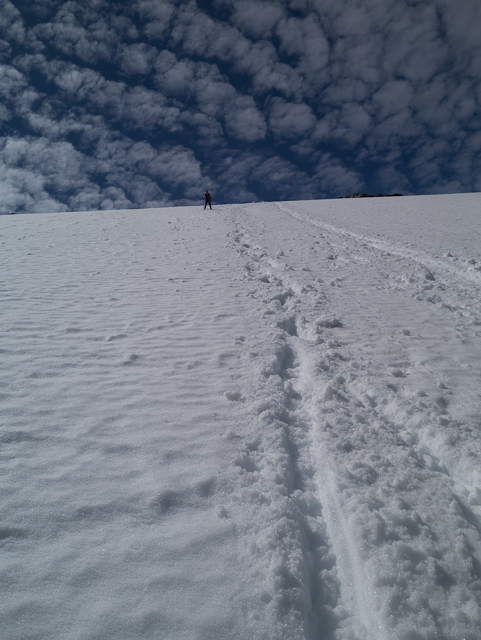
Once in the alpine there is no obvious trail - so you will need to pick your own way up avoiding as many trees as possible (note these are mostly hidden in the winter). There are some small ridges that provide easier walking. You should be aiming for the left (south side) of the main rock face near the top. Being in the White Pass area you will likely encounter snow along the way up, and if comfortable, hiking straight up the snow patches can be a quick and easy way up!
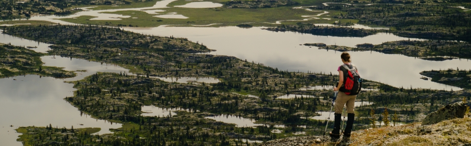
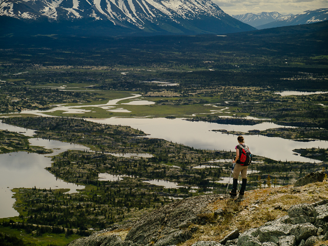
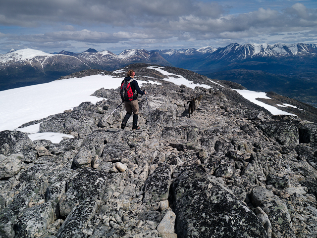
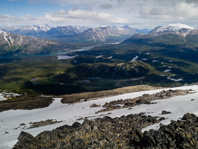
Once on the first false summit, things flatten out to a rocky plateau, and you will need to continue another 500 m to the true summit, which lies to the southwest. The summit is marked by some survey markers and an old wooden tripod marker. The views are stunning from the top looking north to Lindeman and the south end of Bennett Lake where the Chilkoot Trail ends. Looking southwest towards towards the White Pass you can see the beautiful Shallow, Bernard and Summit lakes; Fraser, Feather, and Taiya peaks; Mount Cleveland and Carmack off in the distance; and the tips of the Sawtooth Range. The amazing peaks and glaciers of the coast range are inspiring! Return the way you came up, and take advantage of any snow for a fast and easy descent.
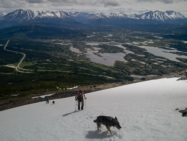
The trailhead is the same as for the summer route described above. The trail is well used in the winter and should be easy to pick up by finding the ski tracks which will lead up the cutline. Once at the treeline pick the safest route up following the various ridges and less steep approaches. Don't simply rely on following other tracks or people in front of you. Pick the best and safest route you are comfortable with. The signage at the trailhead identifies a few features to avoid, such as the gully that runs down the right (northeast face) and several convexities.
There is some fabulous skiing on the mountain, and it's a relatively quick hike up, with lots of space to enjoy fresh tracks.
Please review the signage at the trailhead before entering the area if you are not familiar with the avalanche terrain. Also review the avalanche bulletin and browse the Yukon Avalanche Forum for the latest information on conditions before you head out. Make sure to have all the appropriate avalanche safety gear and know how to use it.
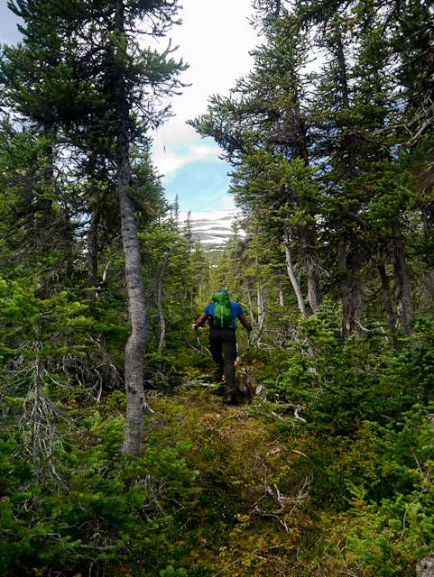
Hiking up the cutline through the tangle of roots and stumps.

Reaching the main treeline and picking a route up through the alpine.

Following along one of the small ridges leading to the top.
Great views along the climb, looking east to Maud Lake and the Tutshi River.
Taking advantage of a snow patch for easy climbing.
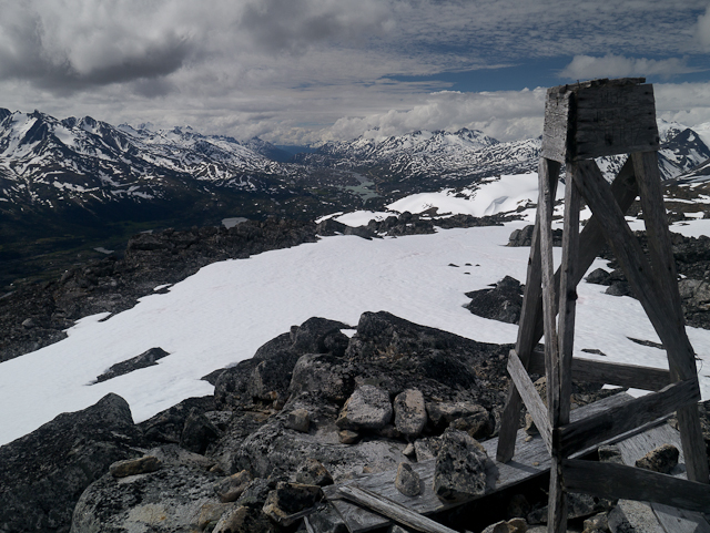
The summit marker looking southwest towards Summit Lake and the peaks of the White Pass area.

Soaking up the views. There can still be plenty of snow around, even in late July!
Descending back down along the summit plateau.
The view looking north to the Chilkoot Trail with Lindeman and Bennet lakes.
If you didn't hike with your skis in summer you can still enjoy a fast descent by boot skiing or bum sliding!
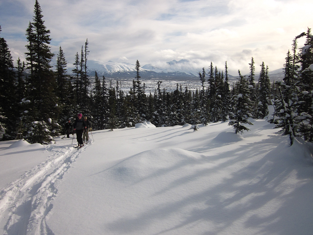
Skinning up the trail through the trees in the winter
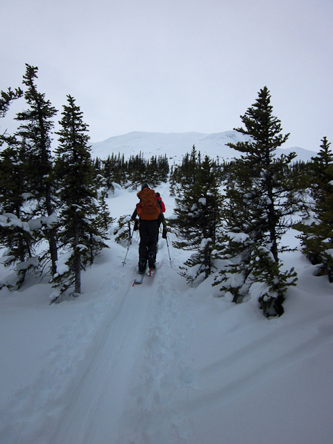
Hiking up the cutline.

Picking a route up in the alpine as visibility deteriorates (a common occurrence in the winter).

Enjoying some fresh tracks through the light powder.
The view looking northeast towards the mountains around Tutshi Lake.

Jodie July 26, 2025
Tried to hike this today. The trail was very difficult to find. After a few false starts, found a trail that was very defined for about 5 minutes and then just disappeared. Went around in circles for about 15 minutes and decided to hike yo the lake at nearby Paddy Peak instead.
Yolande June 19, 2018
I hiked this trail last July and, using these directions, had no problem following the cut line up to tree line. The views were wonderful and though I ended up bushwacking a bit coming down, I did manage to intersect the cut line back to the parking lot.
So on Father's Day thi year, I thought it would be great to bring my husband and 15 year-old daughter here as they would love the hike up and the view also. However, we hit a couple barriers. One is that although we found the beginning of the cutline, we couldn't find the part of the trail that heads up and through the trees to the tree line. This really puzzled me so if anyone has additional trail scouting hints to share, that would be much appreciated. We ended up bushwacking to tree line. Secondly, there is still a fair amount of snow on the top third of the mountain (on that NE side). So unless you like that sort of thing, it's probably rushing the season. It was very windy with low clouds rolling in and out so there wouldn't have been a view. Note also that in the two hours we spent bushwacking up and down, a bear had walked on the trail just a few hundred meters up from the parking lot as evident by the fresh scat. Lots of flowers on the blueberry shrubs so could be a good year.
kyliestravel January 30, 2018
hiked this on saturday - the cut-line tracked had been toured up throughout the winter and was easy to spot, but I definitely didn't notice it in November - as it is very narrow.
Got about half way up but the -28 temps and winds, wre too much - plus the icy bits were tricky to get traction. Enjoy some turns down. Its tricky coming out - as couldn't find an alternate way really without battling many trees - so you end up on this super icy narrow tracked path down.
kyliestravel November 14, 2017
First time hiking this on Saturday (snowshoeing I should say). I wanted to check out what was happening with the conditions and well, didn't get out of the alpine! I tried utilising this information and the White Pass book information to no avail. There are 2 avalanche signs, not one. There is one at the main parking lot area and then there is one down the closed-off road up the hill a bit. I started from there. I walked almost 2 hours, traversing a lot, up and down keeping a creek to my right, following a bearing of 220. I didn't get out of alpine, even after many diversions and bushwhacking....I guess these instructions are only useful in summer when a path can be identified on the ground or in winter once someone else has already made a trail :/ bit disappointing as could only look at the snow quality in the treeline.
Colorado Peaks July 30, 2017
@ Adventurer I will be hiking in September
Adventurer June 18, 2017
Anyone hiking this in September?
Marko Marjanovic January 2, 2013
Log Cabin was very wind affected this weekend. Almost no snow in some places due to the wind. Hard slabs and faceting in most places.
