Total Distance: 12 km
Return Time: 4 hours
Elevation Gain: 905 m
Difficulty: Moderate
Region: White Pass
Traditional Territory: STC
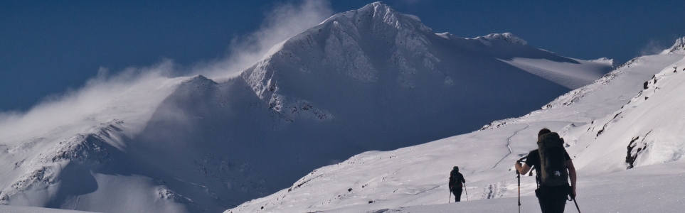
The Mount Cleveland area offers lots of varied ski terrain, from simple to advanced. The route described here is a traverse to the southeast peak, 2 kms from the true Mount Cleveland, and highlights the simple and intermediate skiing terrain. When the snow is good, there are some fantastic runs down into an open bowl or the glacier. The view from the top of this peak is amazing, and is worth the climb all on its own.
From Whitehorse, drive south to the Carcross Cutoff and turn right onto the South Klondike Highway. After 71 km on the S. Klondike Highway you will reach Canadian Customs. Another 12 km past customs there is a pull-out on the right-hand (west) side of the road. This is the same trailhead as for Feather Peak and International Falls.
Only the winter route has been recorded.
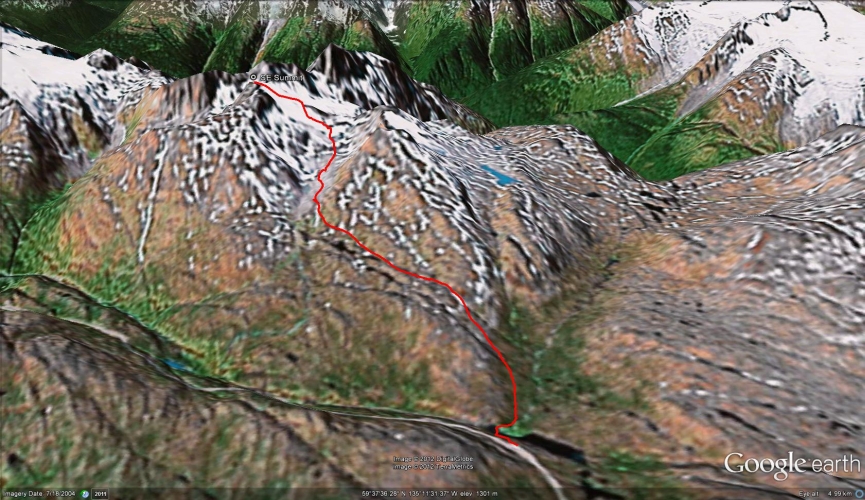
This is one of a few routes to the saddle below Cleveland SE2 (SE2 refers to the peak 2 kms southeast from Mount Cleveland). Start by descending 50 meters from the parking area down to the flat area below. You can either leave your skins on for the short descent, or put them on at the bottom.
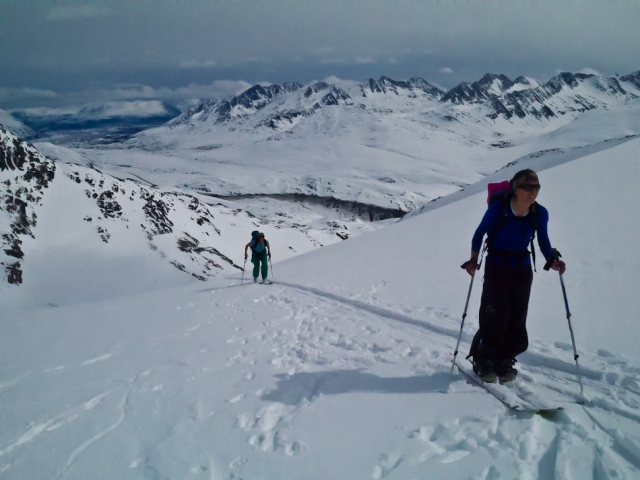
Head north briefly on the flat section (away and to the right of the steep cliff in front of you) and then start ascending very gradually up to the west (this part follows the same route as Feather Peak). After about 500 meters there will be somewhat of a depression or gulley on your left. Angle left to follow this gulley towards Mount Cleveland. Don't walk up the gulley as it is a terrain trap if there was an avalanche, but rather walk up the open hill to the right of the gulley.
Continue walking gradually southwest towards the prominent peak. At the top of the open hill, you will hug the side of another hill and there may be small gullies to your right and left. Stay on the higher, flat ground and continue contouring towards the prominent peak in front of you. At this point, the route is fairly flat. Eventually, when the peak is nearly right in front you, you will have to descend and contour to your right (west). You are aiming for the lowest point of the saddle that is below and to the right of the peak in front of you.
When you are below the saddle, you will have to ski up the open bowl by picking a route up to the top. There are a few very small ridge features that you can follow up. There is also a halfway point that flattens out where you can rest briefly.
Once at the top of the saddle, the views open up in every direction. You can walk to the summit of Cleveland SE2 and to other short viewpoints. If you are standing at the top and looking south towards Skagway, the two connected peaks right in front of you are also part of Cleveland and the two higher peaks in the background are part of Mount Carmack. When you get to the top of the saddle and look further to your right (north-west), you will be looking at the real summit of Mount Cleveland in the distance (and Cleveland SW1 closer to you).
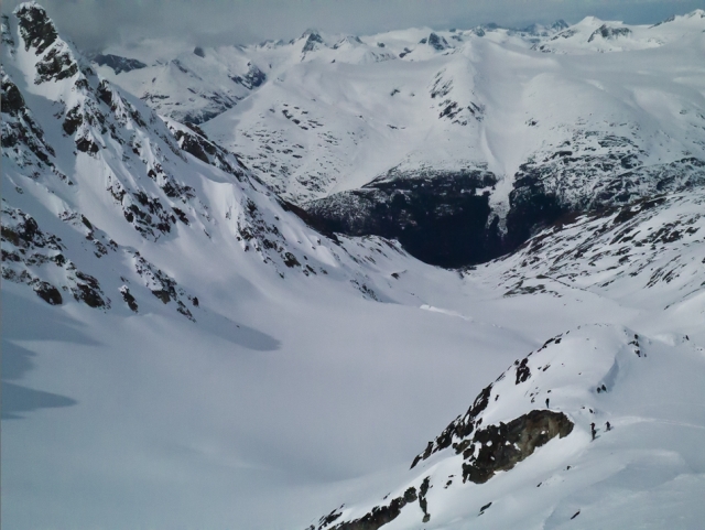
From the saddle, there are a few places to ski down. The most common places are the bowl that you just skied up, and the glacier to the north-west (on the other side of the ridge to your right as you were climbing up to the saddle). Be aware that even though they are covered for the most part, there are crevasses on this glacier. The return trip back to the parking area is somewhat of a traverse, and takes roughly 1 hour.
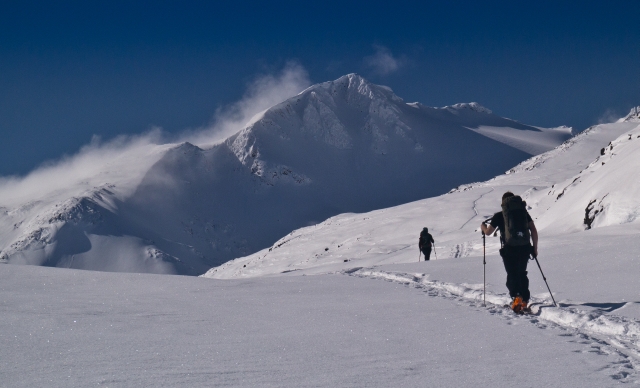
Most of the route is along gentle terrain. Mount Cleveland SE2 summit in the background.
As you traverse your way, stay above the small gullies.

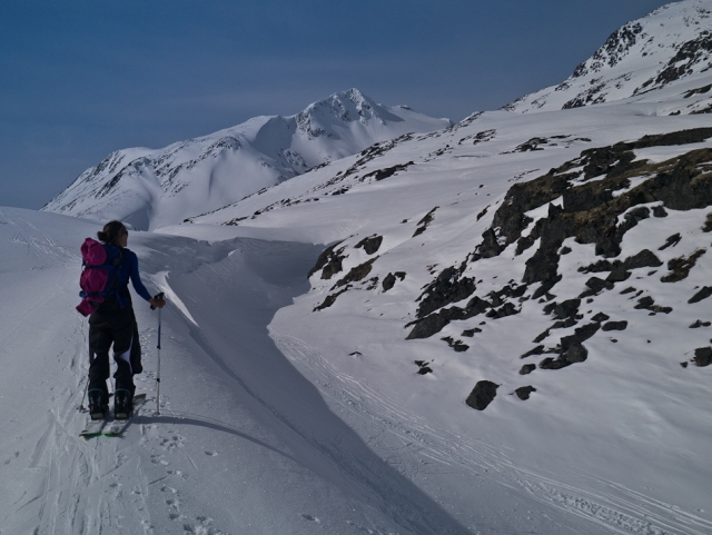
You will descend a little ways, and then traverse right around the rocks. Your destination is the small saddle below the peak.
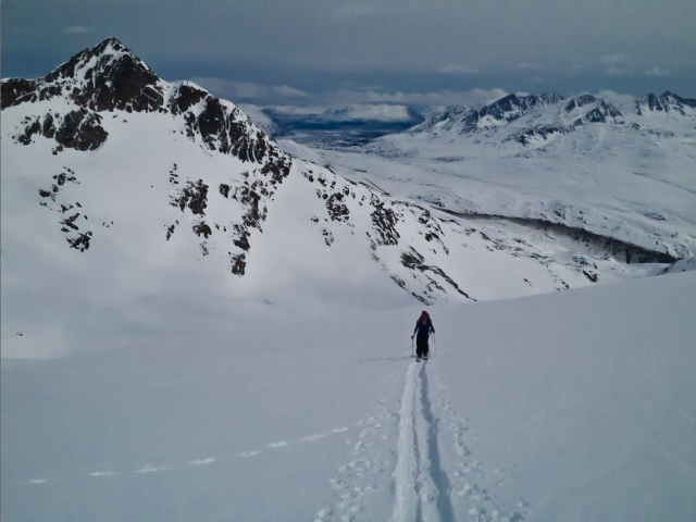
The steeper section of the route, with Feather Peak in the background.
There is a small reprieve on the steeper section before climbing to the saddle.

After the reprieve, on the way up to the saddle and the peak.
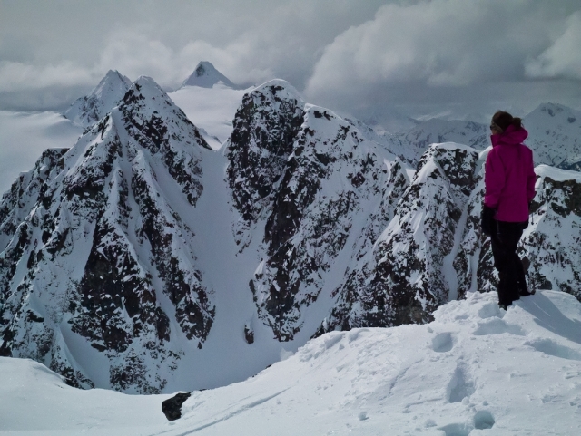
The view from the summit with the peaks of Mount Carmack in the background and other peaks of Mount Cleveland in the foreground.
A skier prepares for the descent from the saddle.
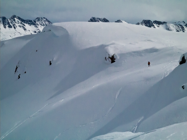
Skiers (bottom right of photo) choosing a route down the glacier on Mount Cleveland. The glacier makes its way down towards the Chilkoot trail.

The true summit of Mount Cleveland.
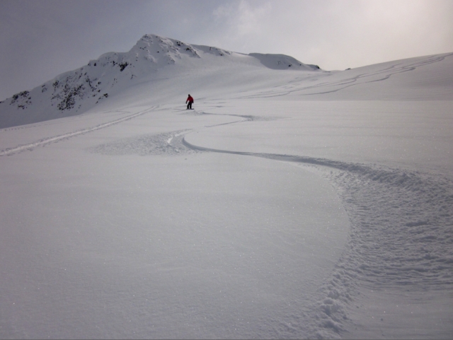
Snowboarding down from the saddle on soft snow.
Karl T. August 13, 2018
This is almost certainly a Winter-only hike. Attempted this last week and ended up on the wrong side of Feather Peak (close the the larger lake) that was extremely steep. All the other peaks, including the hike described here, were not free of glaciers making it impassable in the Summer time. By the way, it says here that this is a 4KM round trip. Feather Peak is a 10KM round trip. Both start at the same trailhead. But Feather Peak is the closest peak of the two. Does not make any sense that Feather Peak is almost 3 times the distance as this one when it's the closer peak of the two (and has essentially the same elevation gain). Just that information should ring a bell. Would not recommend.
Yukon Hiking April 10, 2018
Hi Cristina,
Check out the Yukon Avalanche Association website (http://www.yukonavalanche.ca/) for any recent observations as well as the following Facebook pages, Yukon Backcountry Snow Sharing Network & ACC Yukon. Make sure you are equipped with avalanche safety equipment and training as the route passes through challenging and complex avalanche terrain. Enjoy!
Cristina Ramos April 8, 2018
We would like to hike this with snowshoes next weekend. Has anyone been there recently? What are the conditions of the trail?
Thank you!
