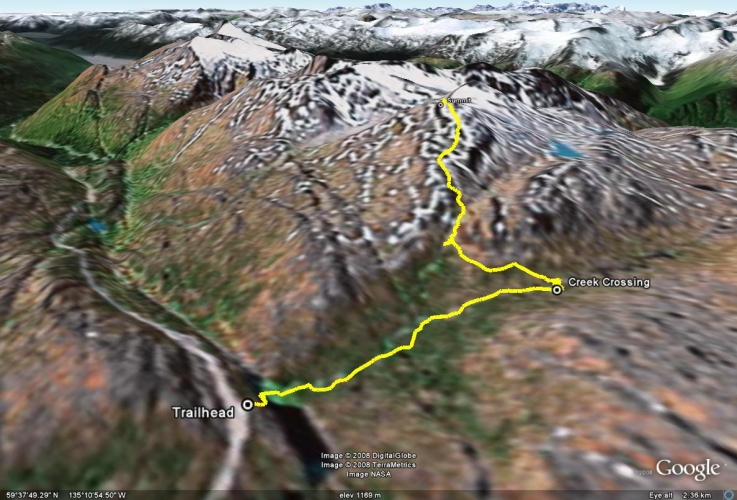
Total Distance: 10 km
Return Time: 6 hours
Elevation Gain: 820 m
Difficulty: Difficult
Region: White Pass
Traditional Territory: TRTFN, CTFN, STC
This route starts in the sub-alpine and follows along a creek with cascading waterfalls. Along the entire trail you get an amazing view of the mountain scenery all around you. The peak is rocky and feels like a proper mountain summit. Feather Peak is also a great area for a range of winter activities.
From Whitehorse, drive south on the Alaska Highway to the Carcross Cutoff and turn right onto the South Klondike Highway. After 71 km on the South Klondike Highway you will reach Canada Customs in Fraser, BC. Another 12 km past Customs there is a pull-out on the right-hand side of the road. The pull-out has a lake below it and a waterfall. This is the same trailhead for International Falls and Mount Cleveland.
Follow a very steep, rough trail from the pull-out down to the lake. You'll need to cross this lake, which can change depth depending on the time of year and even time of day, but shouldn't be higher than waist-deep.
There is a trail that is marked on the right side of the creek. It follows along the creek, passing a few waterfalls along the way. After 2 kms, the trail markings end and you must find your own route. You should head south by crossing the creek and make your way to the col between the two ridges.
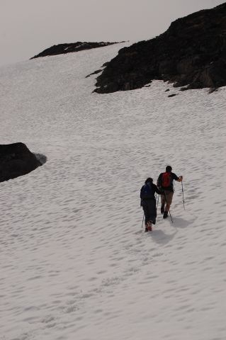
You will find a creek between the two ridge humps. Follow up this col, and cross the creek either at the bottom or top of the col. Make your way up to the obvious, diamond-top Feather Peak. Some scrambling is required near the peak. Depending on the time of year, you may need to walk across snow. Be carefull not to walk on any snow bridges that cross creeks, as they may collapse.
If you want to avoid crossing so many creeks and have good route-finding skills, you can start the trail by crossing the lake and hiking up the left side of the creek instead. This way, you can avoid 2 major creek crossings. Head straight up towards the saddle between the 2 ridge humps. You will have to find your own route this way, but since you are starting in the sub-alpine, trees and shrubs aren't too much of a problem.
Feather Peak is a favorite destination in the winter for skiiers, snowboarders, and snowshoers. There is often a trail leading from the parking area up the mountain, packed down from both people and snowmobiles. On powder days, you have to break your own trail, and then reap the rewards!
The winter trail is different than the summer trail. You can head straight up to the notch from the parking area because there is no creek to worry about. Above the notch, you can continue up to the peak, or stay to the right and continue along the flat section below Feather Peak to explore behind it.
Snowshoeing - If you don't mind a little uphill, there is a lot of terrain to explore on snowshoes here. If you have the energy (and daylight hours), you can reach the summit of Feather Peak. Otherwise you can snowshoe up as far as you like and soak in the vistas.
Nordic Ski Touring - There are a few steeper sections which may require you to remove your skis and walk with your boots, but otherwise you can tour around the area. If you ski above the notch (the narrow chute you can see from the parking area), you can continue along past the right (north) side of Feather Peak and look over the valley from above the Chilkoot Trail.
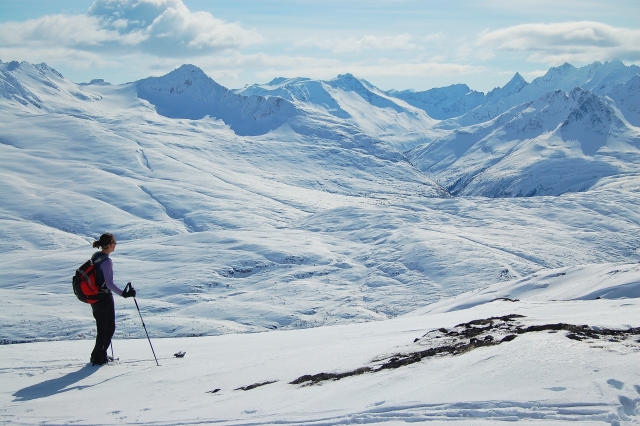
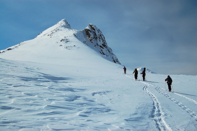
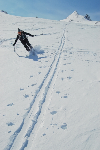
Alpine Ski Touring / Splitboarding - The area between Feather Peak and the connecting peak behind it to the northwest is a great place to get some downhill turns. It takes roughly 3 hours to get to the top, and then you can ski up and down the bowl from there. To get to the saddle, first ski up to the notch in the saddle that you can see from the highway. Then continue along the flat section to the right (north) of Feather Peak. At the end of the flat section, you will start to climb gradually. Stay to your left along the side of Feather Peak. A large bowl will open up and you can cut left (southwest) up to the saddle between Feather Peak and the peak behind it. You can ski down from the saddle, or climb a little higher on the connecting peak.
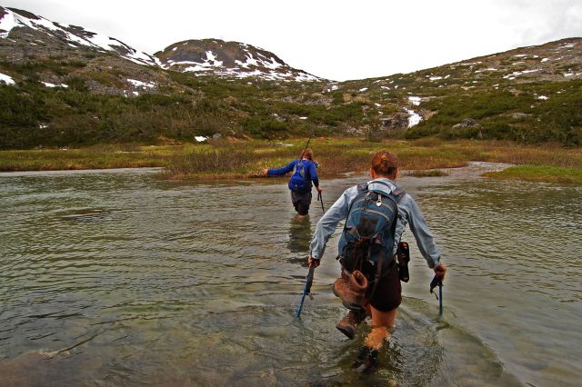
The trail starts with a cold lake crossing.
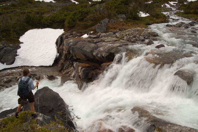
There are a couple of waterfalls along the trail with refreshing mist.
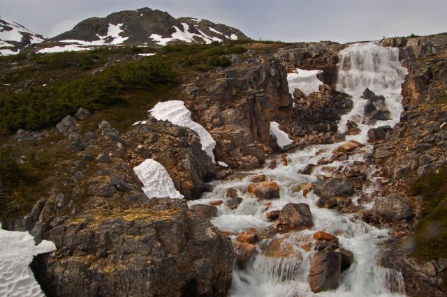
Cascading waterfalls along the creek. The trail climbs up the saddle to the left of the big hump.
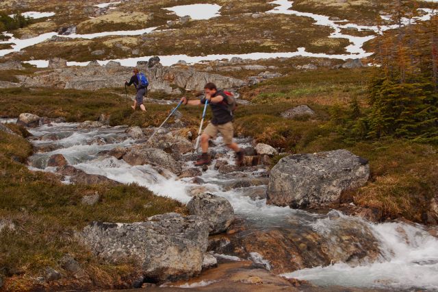
Numerous creek crossing enroute. This don't-try-this-yourself creek jump can be avoided by making your own route on the left side of the creek.
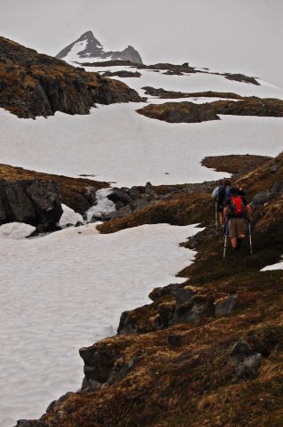
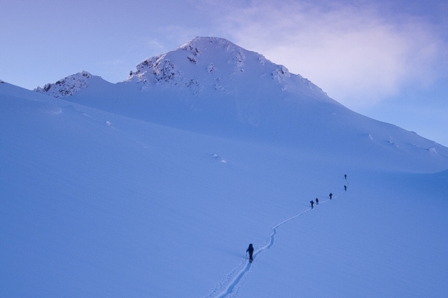
Hiking up the col with feather peak in the distance.
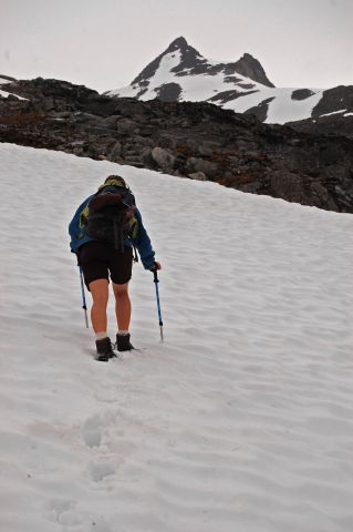
Even in July, lots of snow can be present.
Carefully walking up the snow towards the peak.
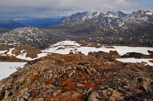
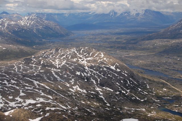
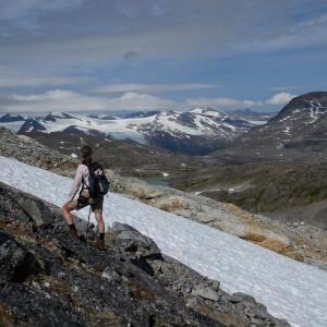
A view of the valley, looking towards the trailhead.
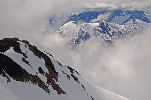
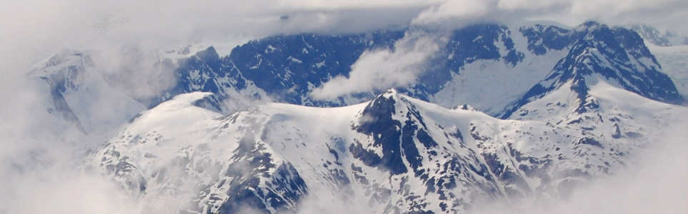
Majestic, blue peaks, hiding behind the clouds.
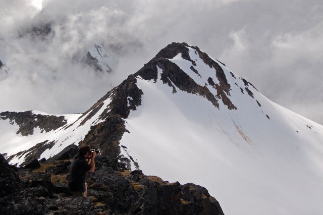
Taking quick photos here and there before the clouds move in.
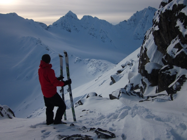
Looking towards Canada from the peak which is actually on the USA side of the border.
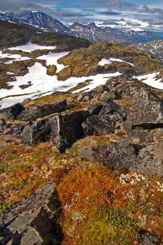
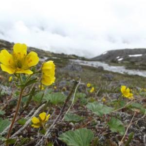
Colourful lichen and beautiful mountain scenery.
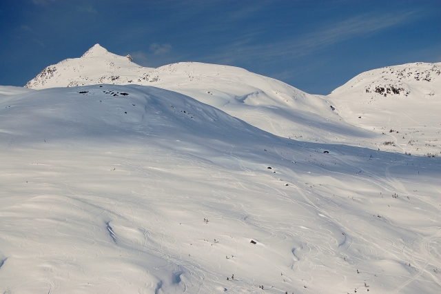
Everything below Feather Peak is covered in snow, so picking a route is easy.
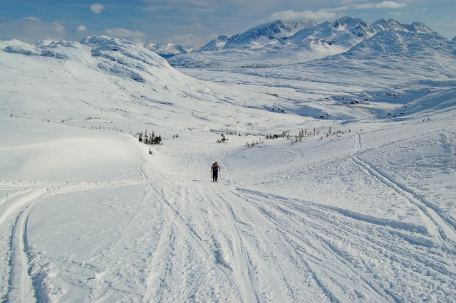
Climbing up to the notch.
A view to the east.
The summit is a little harder to climb because of the rocks, but it is still obtainable.
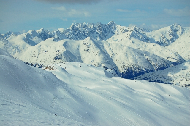
A view to the west behind Feather Peak. This area is a great spot for backcountry skiing.
Skiing up to the bowl between Feather Peak and the connecting peak behind it.
Looking east from the saddle behind Feather Peak.
The descent.
Lawrence Purdy August 4, 2014
Thanks to excellent weather, about 5 hours round trip yesterday. The trail from the pullout to the waterfall was in good shape, with easy crossing of the initial pond/stream below the road. Lots of mosquitos on the slope above the waterfall. Not much snow walking required. The scramble up to the summit was straightforward, and the views from there were terrific.
David Raithby July 19, 2013
Great hike up the valley last week. Didn't go up the mtn but the falls and the flowers were wonderful!
harlan meade/ Joanna Pollock August 29, 2012
September 26th:
Great conditions! Blue Sky! Some nesting grouse along the trail but that was the only wildlife seen!
Snow slopes are hard packed/ icy in some spots..making for tough step kicking. There seems to be more snow than last year..
On the 27th, conditions worsened and the temperature dropped quite dramatically with snow above 6,500-7000 feet from the White Pass to Whitehorse.
Keith Lay December 11, 2011
Could you tell me why this summit has the name Feather Peak? Does the name appear on any topo map? Google Earth does not have a name for it either. In the early eighties we called it "Border Mountain" and used to camp just below its summit at a tiny lake/pool. Interesting to learn there is now an actual "trail" for part of the route.
Keith Lay
Harlan Meade September 1, 2011
Bear/ Wolf sighting during the evening (while trying to overnight)
harlan meade August 15, 2011
August 15
Conditions: No snow until approximately 6500-7000 feet above sea level. No bear sightings. Trail down to the lake is now marked with orange flagging tape.
harlan meade July 22, 2011
July 21st conditions:
Access to water: Nothing after the Southwest col stock up before attempting the peak. Good drinking water is readily available before this point.
Trail: dry / snow free * It seems like there is a pack of attack/ guard grouse on the trail. They are pretty aggressive and will require some deviating...or else. Do they make grouse spray?
Alpine/ Peak: Attack grouse on the Col. Lots of deep snow towards the peak – ice axe/ gaiters are recommended. The snow is fairly solid with the except near rock .. use you poles or ice axe to test snow depth.(some snow has ice underneath it so plant your feet carefully) Additionally, watch your footing on algae covered rock
Peak: snow free/ some loose boulders
