Gold Hill Alpine
July 21, 2022 by Marko Marjanovic
Location: Annie Lake
2 weeks hiking in Tombstone Park, that was our original plan. But the highway was closed due to a wildfire, so we had to make alternate plans closer to home. We settled on spending 4 days exploring some of the alpine in the Annie Lake area.
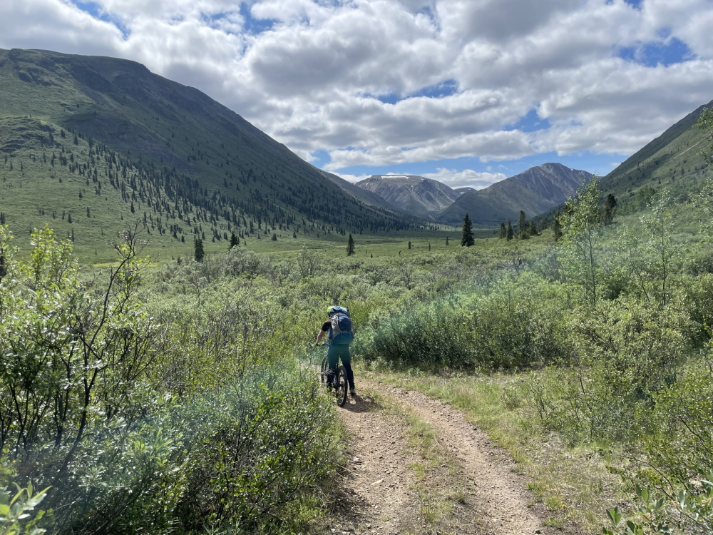
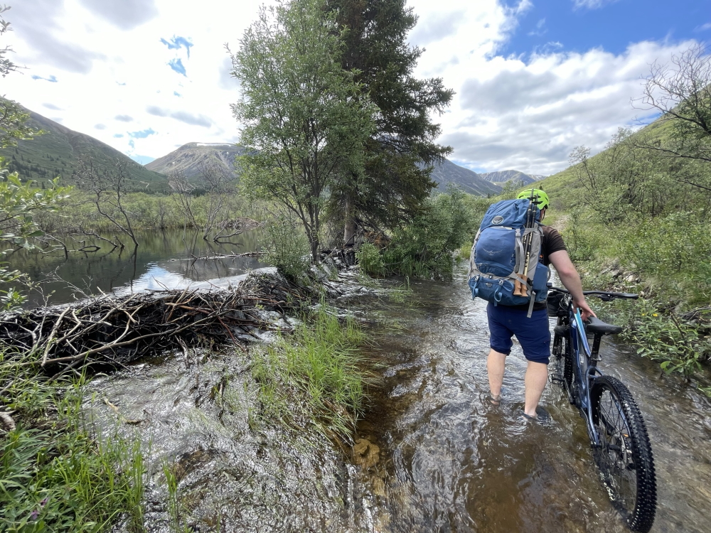
We had just bought a couple of electric mountain bikes, so we intended to use them on the mining roads that are scattered around Annie Lake in order to gain the alpine. The only problem was, we had never used them on anything other than a paved street, let alone with overnight backpacks.
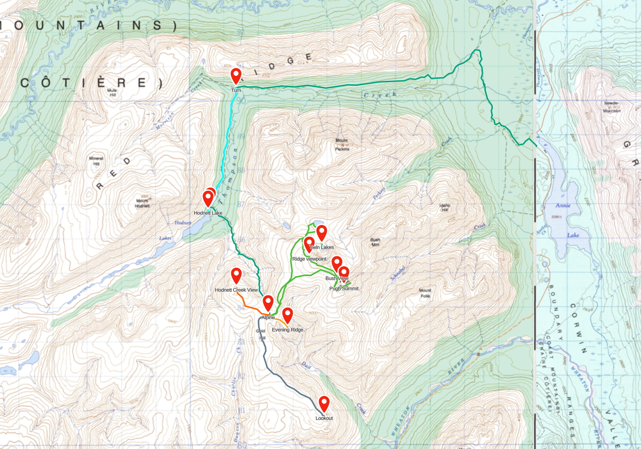
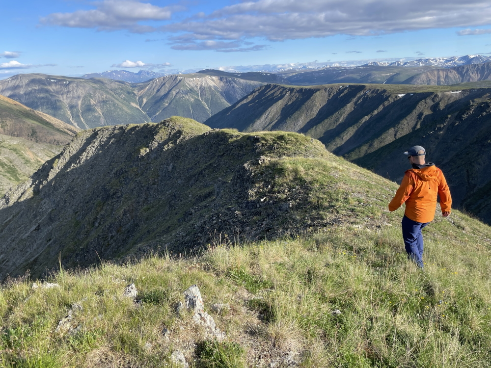
Our objective was labelled Gold Hill on our map. It seemed like a good staging area where we could explore and climb a few peaks from base camp. The route followed the road to the end of the Red Ridge trail, then turned left along Thompson Creek to Hodnett Lake. At Hodnett Lake, we were to turn left again, ditch the bikes, and hike up the mining road to the alpine. The total distance from the truck to our camp would be 20 kms with 1000 m of elevation gain.
A few minutes into the ride, I biked across what looked like wet mud, but turned out to be an incredibly deep mud hole. My bike came to an abrupt stop. I put one foot down. It sank about 12" into the mud. I was stuck. My hiking partner was laughing so hard he couldn't assist me right away. Eventually I tossed him my backpack. I still couldn't move. My only option was to fall over, and then get him to take my bike as I crawled out of the mud. I had to douse myself and my hiking boots and socks in a nearby creek in order to get the plethora of mud off of me. Not the greatest start.
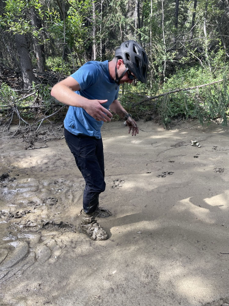
Mud. So much mud.
At the top of the saddle, we reached the Gold Hill alpine. Fresh water was our only concern, so we dropped our packs and searched around until we found a picturesque little stream from snowmelt that had just enough water.
We setup camp, then did a little evening jaunt up a small, orphaned ridge near camp. We called it Evening Ridge (since we hiked it each evening from camp). We sipped scotch on the ridge as we looked down towards the Annie Lake road near Tally-Ho.
From Pugh Peak, we had originally planned to follow the ridge to Bush Peak. However, there were well over 100 sheep between us and Bush Peak along the ridge. We felt it would be wrong for 2 hikers to displace over 100 sheep just because we wanted to hike to a peak where they spent most of their lives. We walked a small distance along the ridge to Bush Peak and back around.
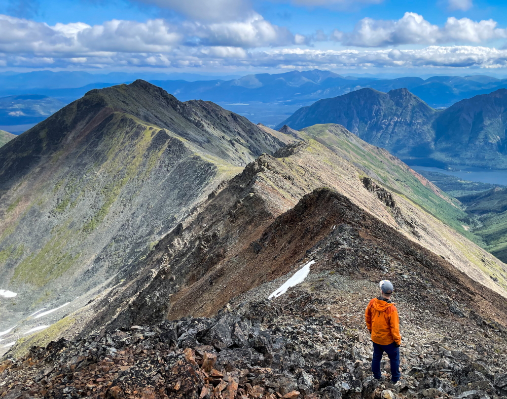
The ridge to Bush Peak from Pugh Peak.
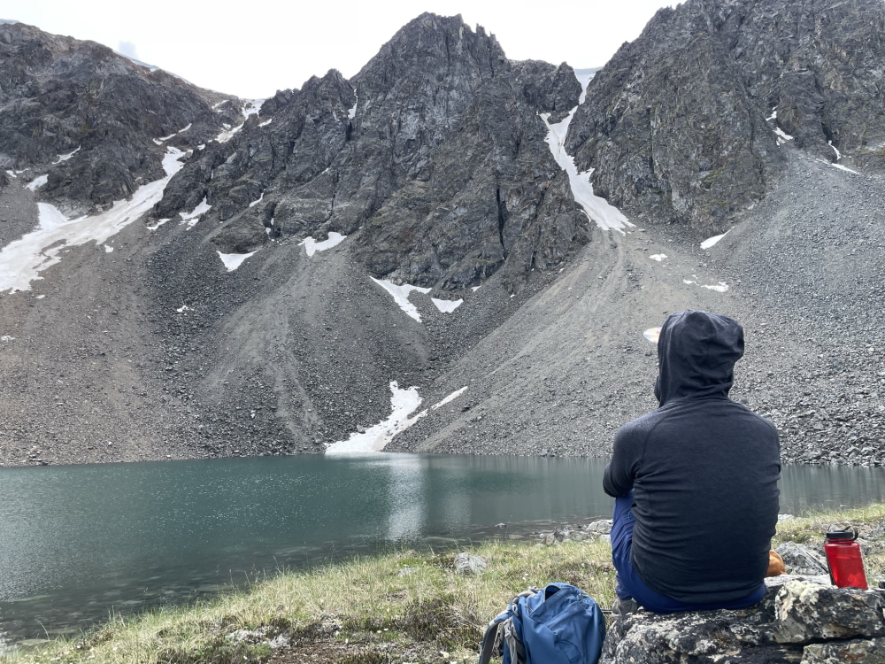
We sat beside the smaller lake, directly below the cirque, and listened and watched as rocks fell down the steep slopes. After some time, we climbed back all that elevation we had lost and headed back to camp.
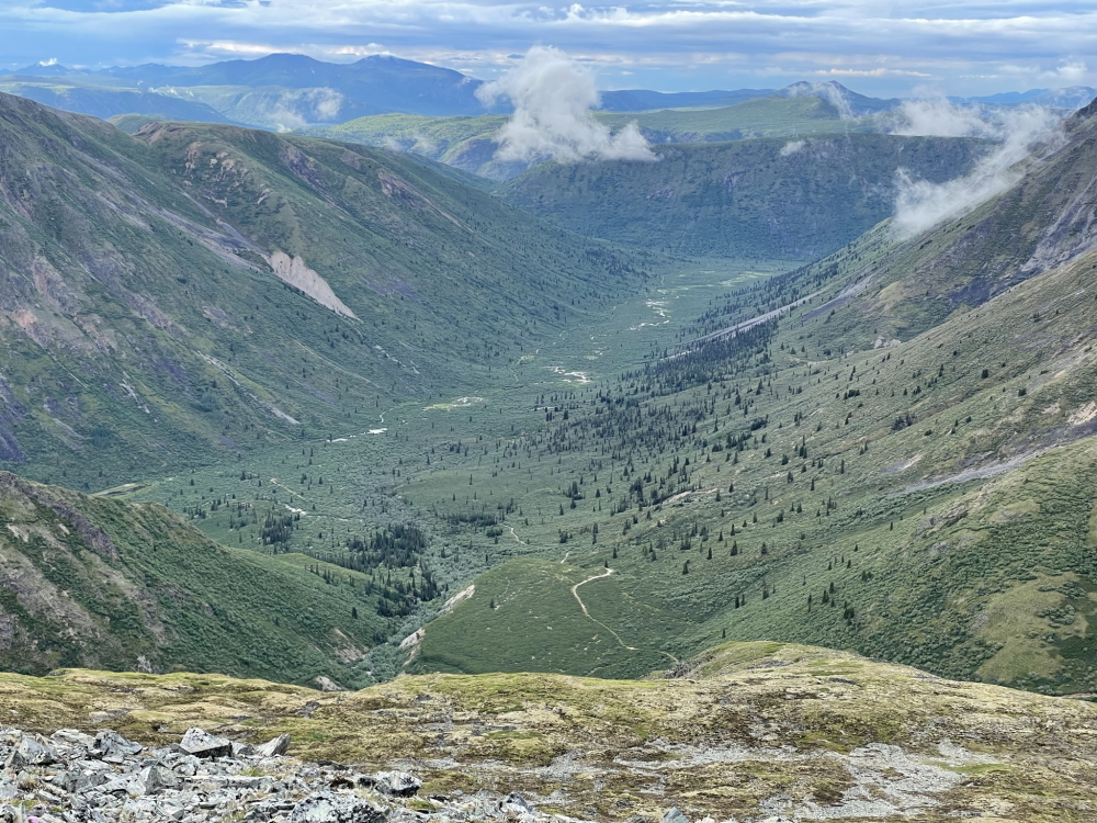
That morning we hiked out to a plateau that overlooked the Annie Lake Road and Tally-Ho Mountain. It took longer than we expected but the views were worth it. We hiked back to camp, packed up and hiked back down the mining road to our bikes.
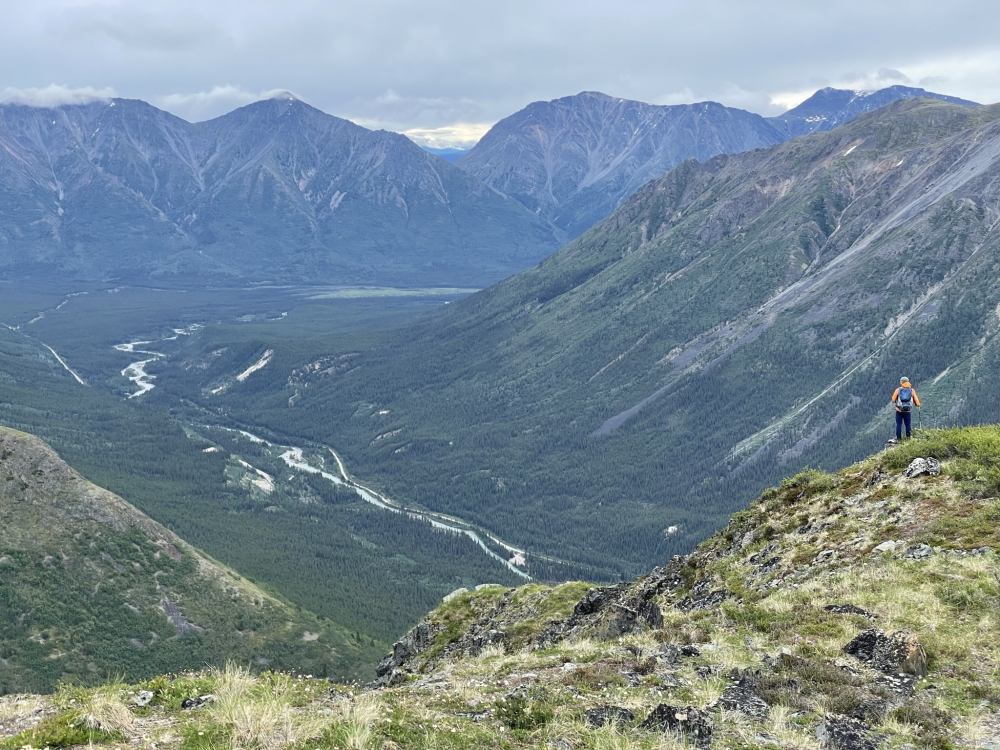
The view of Annie Lake from the alpine plateau walk.