Total Distance: 5 km
Return Time: 2 hours
Elevation Gain: 128 m
Difficulty: Moderate
Region: White Pass
Traditional Territory: CTFN, TRTFN
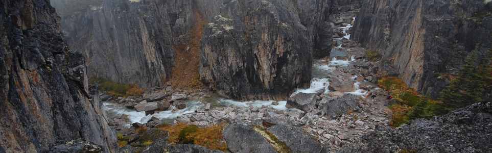
This route takes you to a dramatic viewpoint into the narrow, rocky canyon of Summit Creek. It is a beautiful trip in both the summer and the winter. After the canyon, the valley opens up and you can continue as far as you like, with many options to explore - left, right and center. This route is rated as MODERATE for summer, as there is tricky route finding through the trees and around the small lakes and creeks.
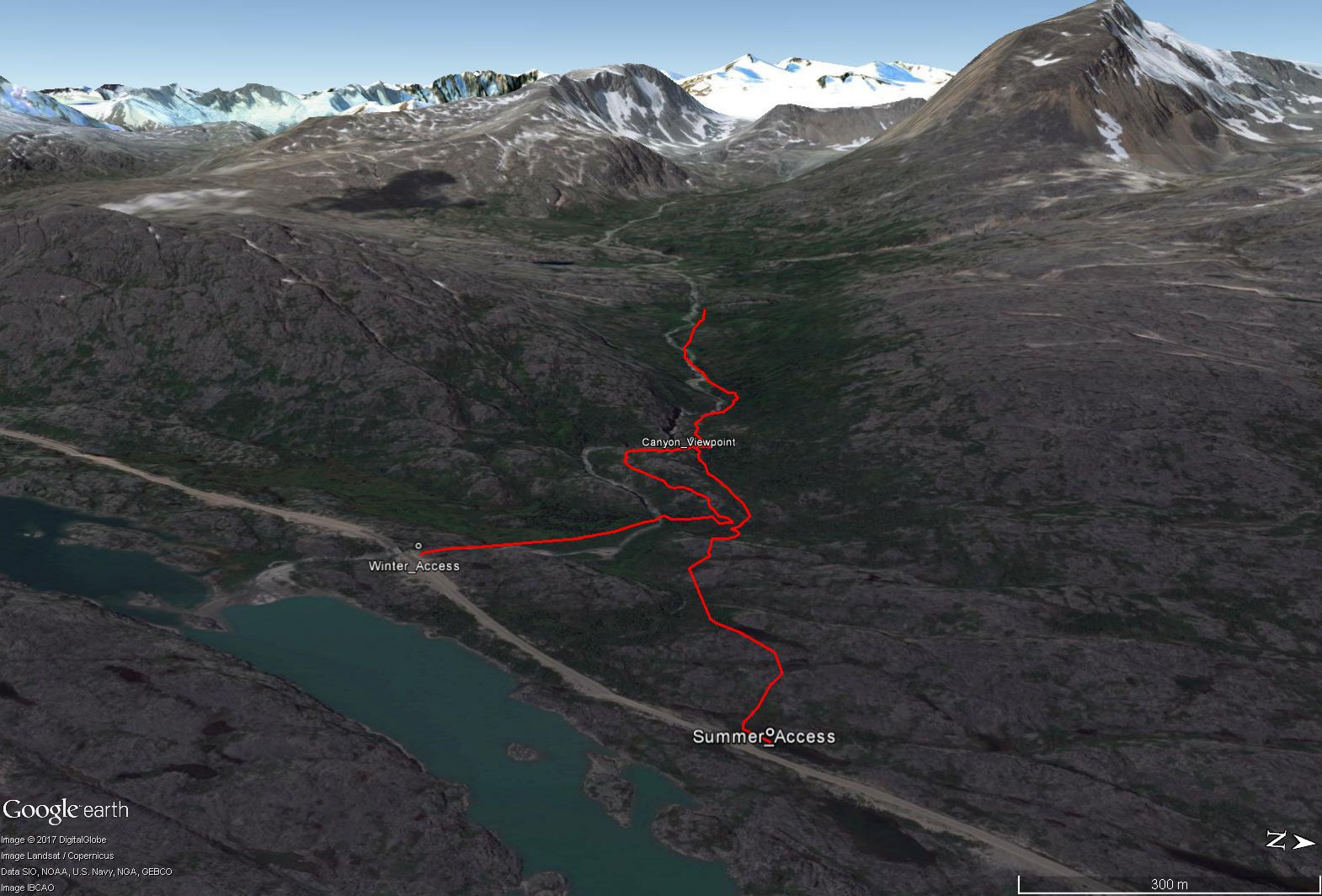
Drive towards Skagway on the South Klondike Highway. For the summer route, there is a pull-out about 6.3 km after Canada Customs (Fraser, BC) on the west (right) side of the highway. For the winter route go to the next pull-out, 7.2 km after the Canada Customs, just before the bridge over Summit Creek.
Doing this route in the summer takes a lot more route finding than in the winter, as the trees are no longer covered in snow and there are many small tarns (lakes) and creeks to navigate around/across. You may want to allow a bit more time for the route described.
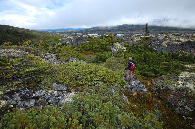
From the summer parking area, head west from the highway. You will immediately have to walk around to the left of a small tarn. Continue heading west-southwest over the undulating rocky landscape around several other tarns, avoiding the trees and bush as much as you can. After about 700 m of hiking, you will near a small lake, which is just to the north of Summit Creek, downstream of the canyon. Follow around the north (right) side of the lake through the stunted trees. Then, head towards a small stream which doesn't have many trees lining it. Following the stream up the slope is easiest as you avoid most of the bushwacking.
Eventually you should reach a very scenic viewpoint over top of the canyon at a large bend in the creek (after about 1.2 km from the highway). There is a little spot here where you can actually scramble down to the creek bottom if you want to explore. From the viewpoint you can continue following the creek upstream, picking your way across the rocks and stunted trees above the canyon. The canyon eventually ends and the valley opens up, with many opportunities to explore further if you like, or just hang out and have a picnic.
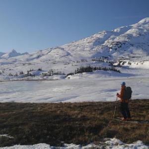
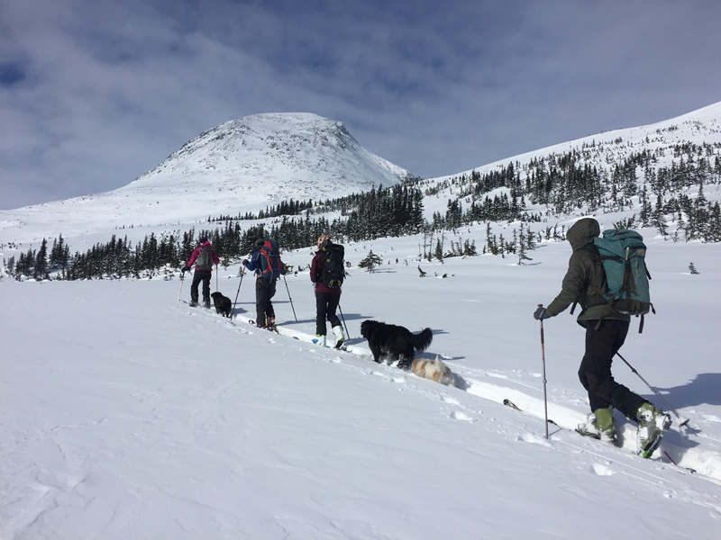
From the winter parking area, head northwest from the highway, following along the right side of the creek until you drop down a little to a wide open, flat meadow. Ski across the meadow, heading due north until you reach a small treed slope. The downstream end of the Summit Creek canyon should be to your left (west). Pick a safe way up the slope, switchbacking your way up through the trees.
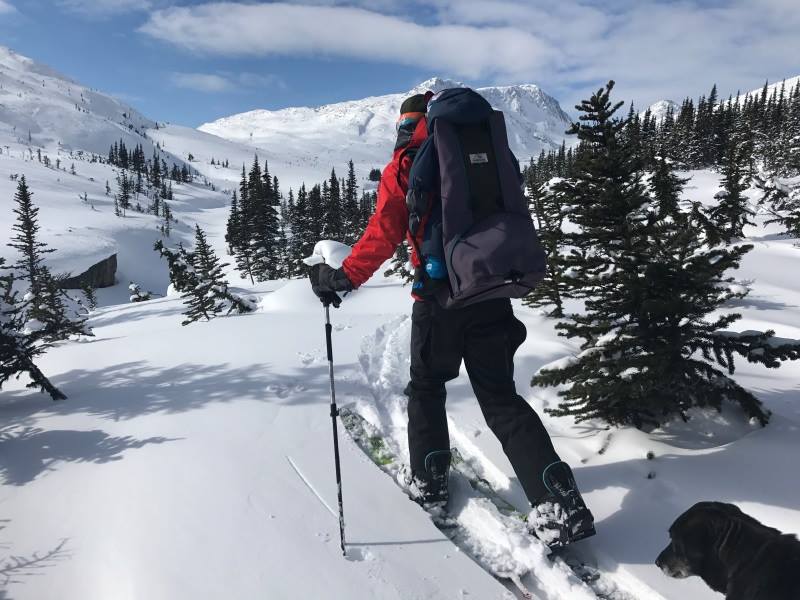
The slope mellows out into a wide open ridge, and now you can head west and gradually uphill, to get closer to the creek. There is a great viewpoint into the canyon at a dramatic bend in the creek, at ~1.2 km into the route. The route then follows along the right/north side of the creek (going upstream), which requires switchbacking up another small treed slope from the viewpoint. It's then easy going from there, following along the creek (make sure to keep your distance from the canyon walls).
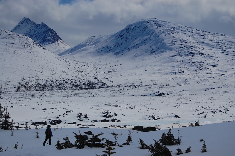
Shortly after the viewpoint, you'll reach the upstream end of the canyon, where the valley now opens up. The trees also become a little sparser. After about 2.5 km (from the parking lot) there are some great spots to stop for lunch or a snack. You can either head back the same way you came from here, or there are several options if you want to explore farther or get some downhill turns.
OPTION 1 - For a longer ski or snowshoe tour, you can follow along Summit Creek itself as far as you want, heading west up the valley. The elevation gain is very gradual and the views expansive. If you go as far as the glaciers in the headwaters, add another 3-4 km (one way).
OPTION 2 - You can also follow a valley to the south that goes behind Summit Creek Hill (from the highway) towards the Feather Peak Area.
OPTION 3 - For some downhill laps, there is a nice slope that extends along the north side of the valley (after the canyon ends). The trees on the slope offer some shelter and the snow can be quite good, as this slope is safe from the north winds that commonly ravage the mountains of the White Pass Area.
NOTE - For skiing Summit Creek Hill, refer to that trail page, as we recommend staying on the left/south side of the creek at the start.
Looking back down the trail towards the highway. You will have to pick your way around the stunted trees and rocky ledges.

There are quite a few little tarns that you will have to navigate around.
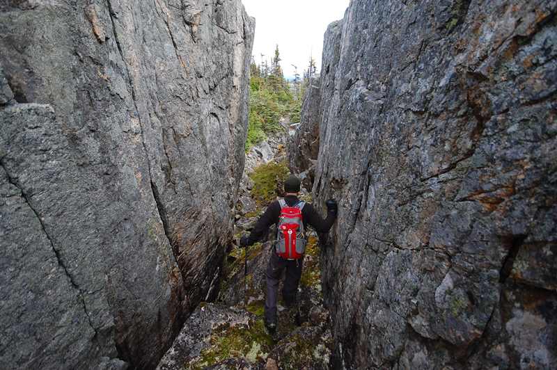
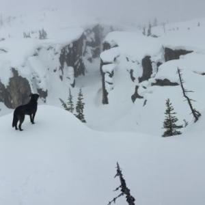
Sometimes the easiest way around the rocky cliffs is through them.
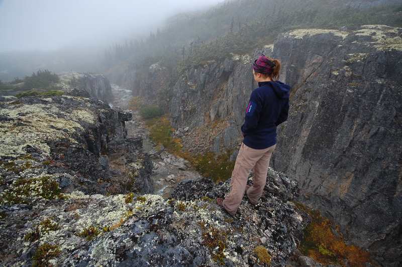
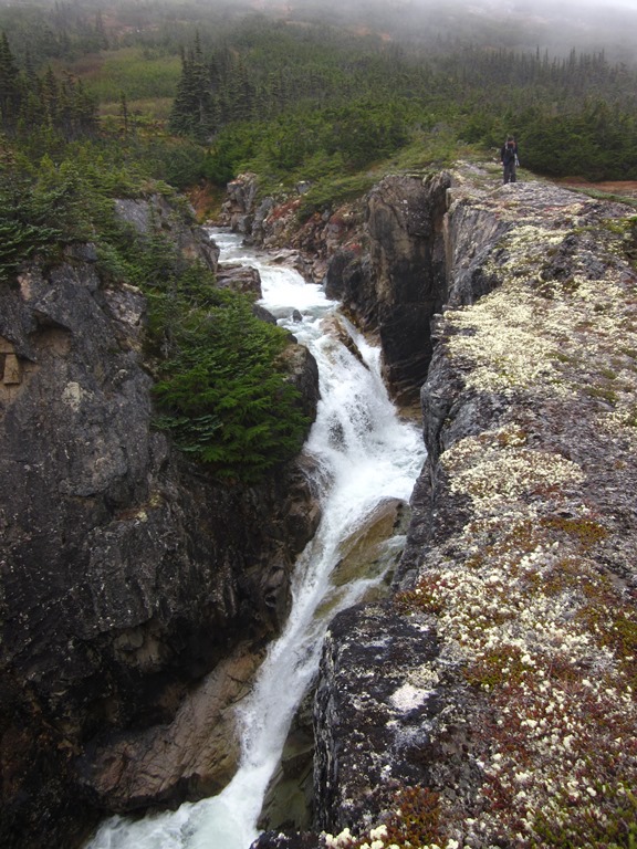
Looking down the first section of the canyon.
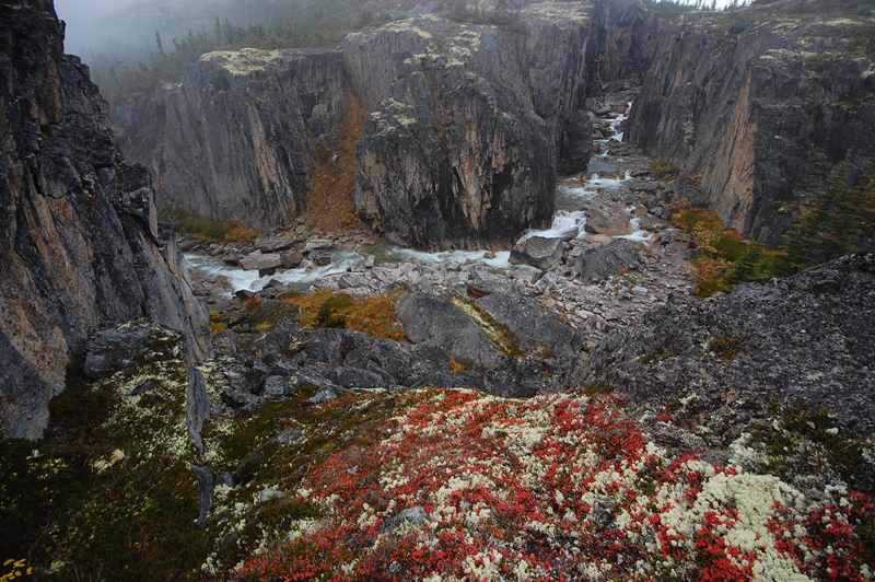
You can walk down to the creek at this bend.
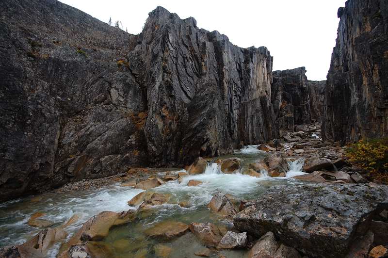
Rocky canyon walls, towering above the roaring creek.
The sides of the canyon are relatively open to walk along.
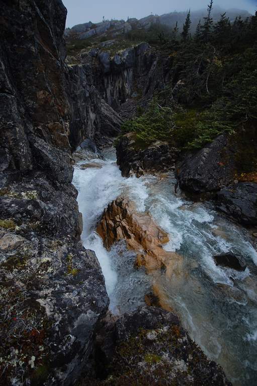
Deep pools and falling water.

Looking down the canyon towards the highway.
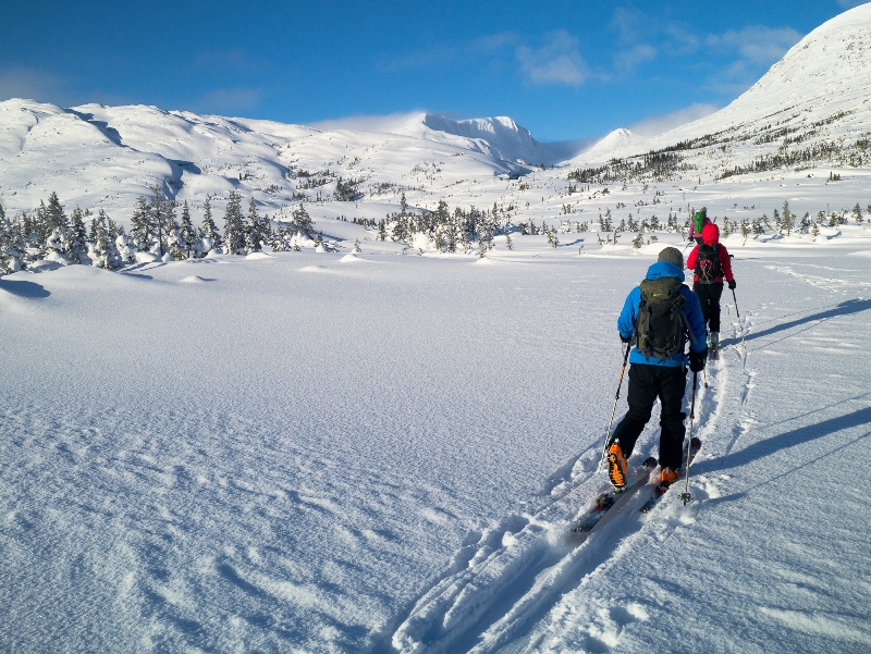
Heading out from the trailhead across the flat, open meadow.

Looking up the canyon from the viewpoint.
Continuing up the creek from the canyon viewpoint.
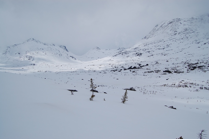
The Upper Summit Creek valley is wide open, perfect for ski touring.
The small slopes on the north side of creek are often sheltered from the wind, with the potential for some powder turns if you are lucky.
The view towards the east side of the highway on the way back to the parking area.
Michele August 28, 2019
Did the hike on August 28. Beautiful views of the canyon. Very rewarding. I wouldn't describe it as an "easy" hike as we had to fight our way through thick bushes, scramble up and down rocks, cross streams etc. Of course, there was probably more water than usual after the rain we had the last few days. The blueberries were unbelievable. Huge and plentiful!
Marko Marjanovic April 7, 2015
On March 28th we skied up Summit Creek and it was still in good condition.
Stephanie April 2, 2015
Has anyone been there lately? How is the trail looking?
Is it icy?
Marko Marjanovic January 26, 2014
We skied up Summit Creek this weekend under endless blue skies and warm, sunny weather. The above freezing temperatures meant the creek was running and some of the smaller lakes were open. There were also quite a few open patches of grass and lichen. It definitely felt like spring out there.
The snow was consolidated and supportive, but not icy, making the skiing really easy and fast.