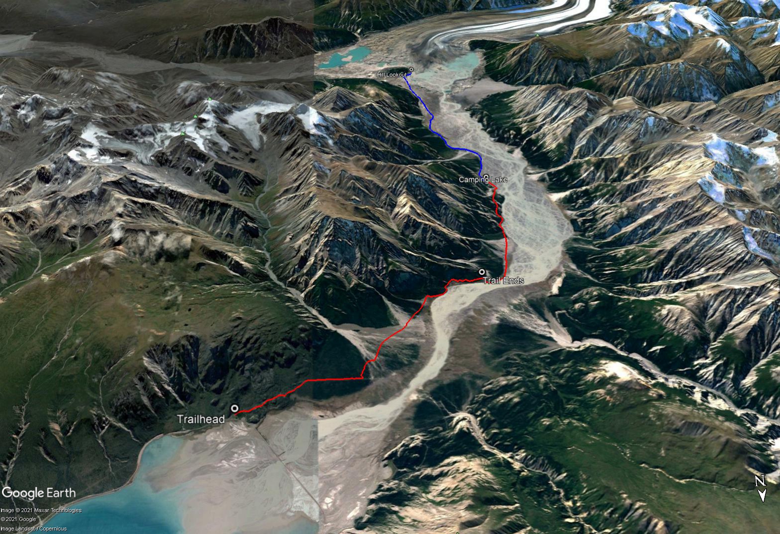
Total Distance: 51 km
Return Time: 3 days
Elevation Gain: 60 m
Difficulty: Easy
Region: Kluane
Traditional Territory: KFN, WRFN, CAFN
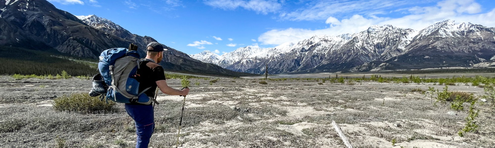
This trail leads you along the east side of the Slim's River, where you can camp beside a lake and do a day hike towards the Kaskawulsh Glacier. The distance to the camping spot (15 km, 4.5 hours) is shorter than on Slim's River West Trail, and there are no large creeks to cross, making it for an easier option. However, you can't get as close to the Kaskawulsh Glacier as you can on Slim's River West. It is still a fantastic location to camp and day hike with Kluane mountain vistas, and you can see the Kaskawulsh Glacier from camp.
From Haines Junction, continue on the Alaska Highway north for about 67 km, and look for a road to a pullout on the left, just before the bridge and the Thechal Dhal (Sheep Mountain) Visitor Center. Park at this pullout. You will see signage for the trail as well as other backcountry information. There is a road that continues from the pullout for many kilometres that hikers used to be able to drive, but the gate is now closed due to several washouts, so you won't be able to drive any further.
Note: Parks Canada requires registration for backcountry trips in the park.
Start by walking down the old road. You will gain 40 m of elevation over then next 1 km, then you will lose it all over the next 2 km. Some years, the road can be very wet, and you may have to remove your boots if any streams are rushing across the road.
After 3 km, the road will end ahead of you. Just before it ends, look for a trailhead sign on your left. This will lead you to a trail through the forest.
After 500 meters, you will reach wide expansive alluvial fan of Vulcan Creek. This one has sparse trees for the first half of it, so look for cairns and flagging tape as you navigate across it. Depending on the year, the creek may be flowing through small streambeds through this area.
After about 1 km across the alluvial fan, it will open up and you should look for large rock cairns to guide you across to the other side. Here, you may find Vulcan Creek running in many braided channels. Depending on the time of year, you may need to put on creek crossing shoes/sandals to cross. At the other side, look for a cairn near the trees that will lead you again to a trail through the next section of forest.
At the other end of this forest section, you will find another alluvial fan that is bushy. Follow the trail which will cross the alluvial fan, and then will head slightly to your left towards the forest edge. You will climb a little up and through the forest.
At the end of this forested section, you will come to a steep, eroded cliff overlooking a marsh. Do not try to climb straight down the bank. Instead, angle to the left down the bank and look for a trail in the forest that leads around the marsh. Don't try to cross the marsh, as there is a nice trail in the forest around the marsh.
Once you are around the marsh, continue on the trail through the forest for about 1 km until the trail seems to abruptly end at a treed alluvial fan. At this point, aim directly towards the Slim's River (to the north) to avoid any bushwhacking.
When you reach the river's edge, follow it upstream (west and then south) for about 2 km, across another alluvial fan. This alluvial fan is about 1 km across, and you should look for cairns in order to find the trail at the other side of it that leads into the forest.
Once you find the trail at the edge of the forest, you will be following it as it eventually climbs up a bank that overlooks the river and offers nice views back the way you came. The trail will then lead down to a small lake surrounded by marsh (not suitable for camping) and you will briefly go through a small marsh before climbing up again.
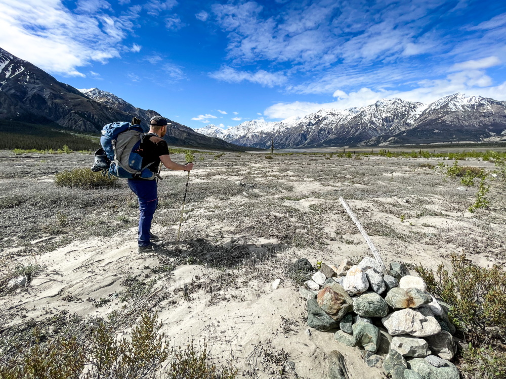
Follow the trail through some high open slopes before you descend to another alluvial fan with a knoll ahead. On the other side of the knoll is a lake which is a perfect camping spot. At this point, walk along the river's edge around the knoll. At the other side of the knoll, you will reach the lake. The lake is 15 km and about 4.5 hours from the trailhead. You can either camp at the lake, or hike around the next point along the river's edge to more camping spots. You will be more exposed ahead than camping at the lake.
EXTENDED HIKE OPTION
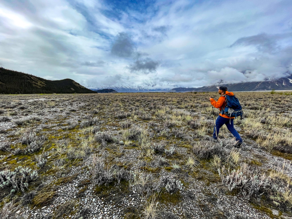
Use an extra day from camp to do a hike towards the Kaskawulsh Glacier. The return distance is included in total distance for this hike. You can simply follow along the river's edge for a few kilometres until the river bank widens into a large expanse, at which point you can walk wherever you want, heading south.
There is a hill and a natural viewpoint of the Kaskawulsh Glacier ahead, which is 10.5 km (one way) from the lake. When you reach the base of the hill, ascend a few meters on the right side of it for a good lunch spot. To this spot and back to the lake will be 21 km and around 7 hours.
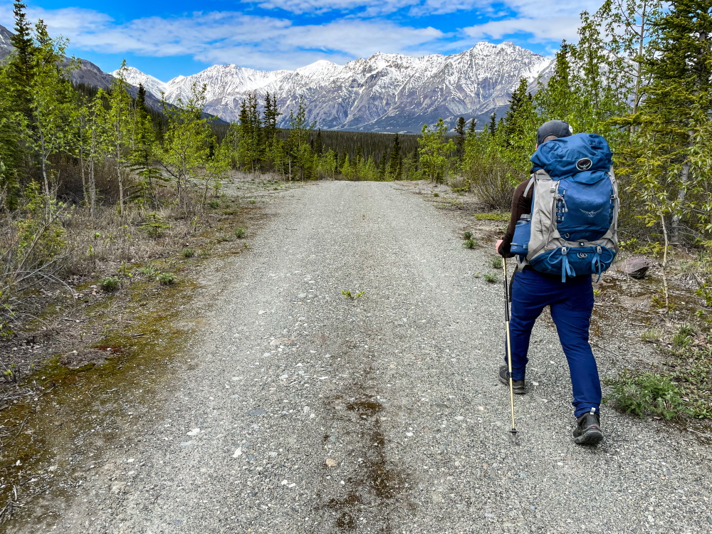
The trail starts by following an old road.
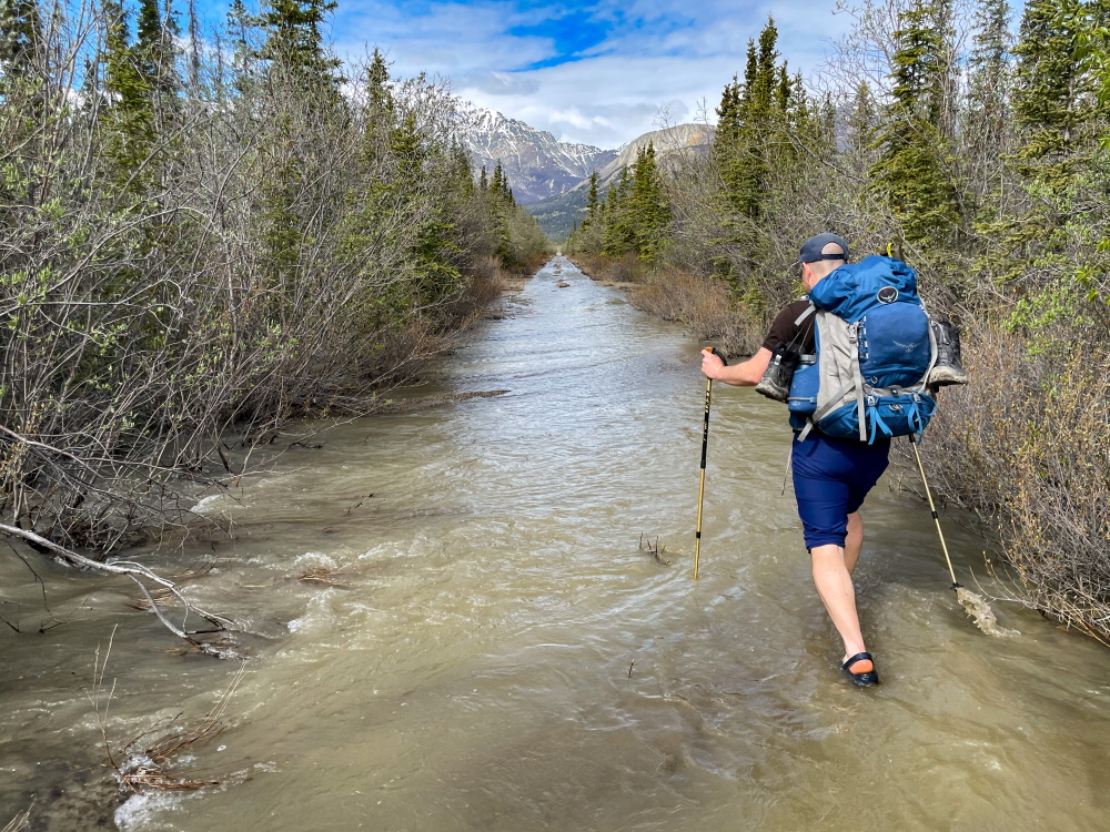
The road can turn into a creek, so be prepared to get your feet wet.
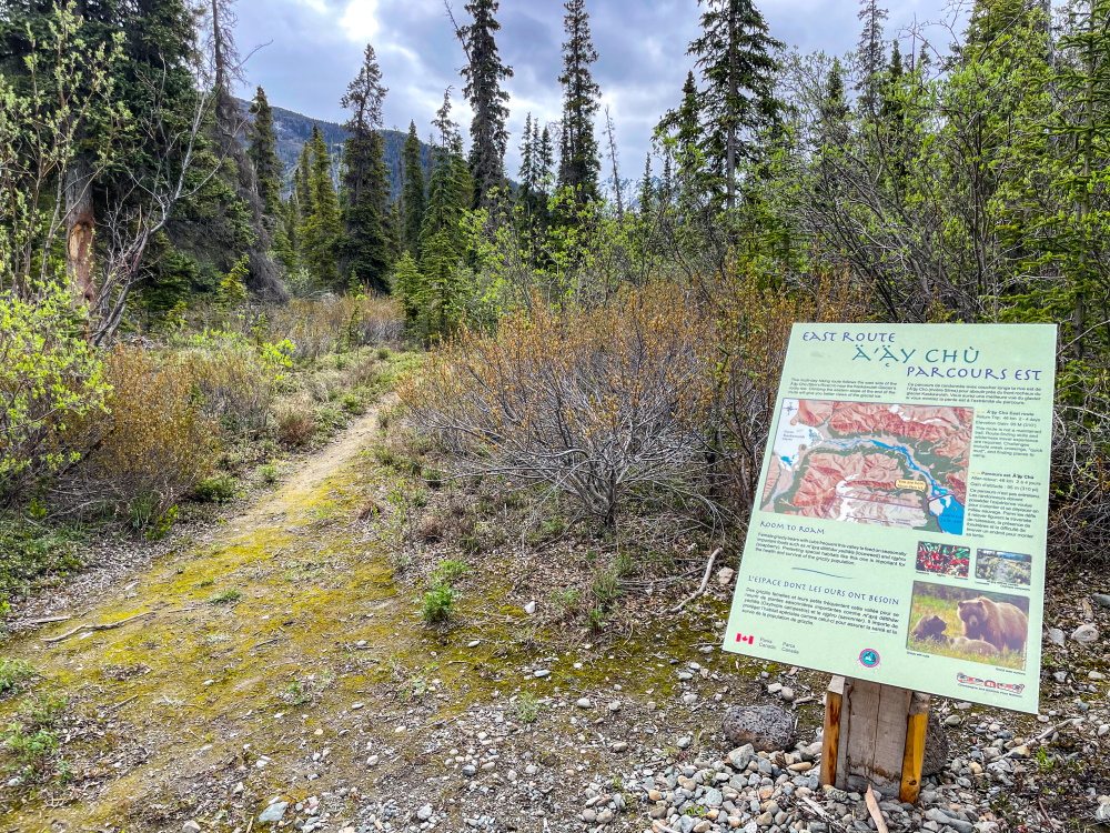
Trail sign near the end of the old road.
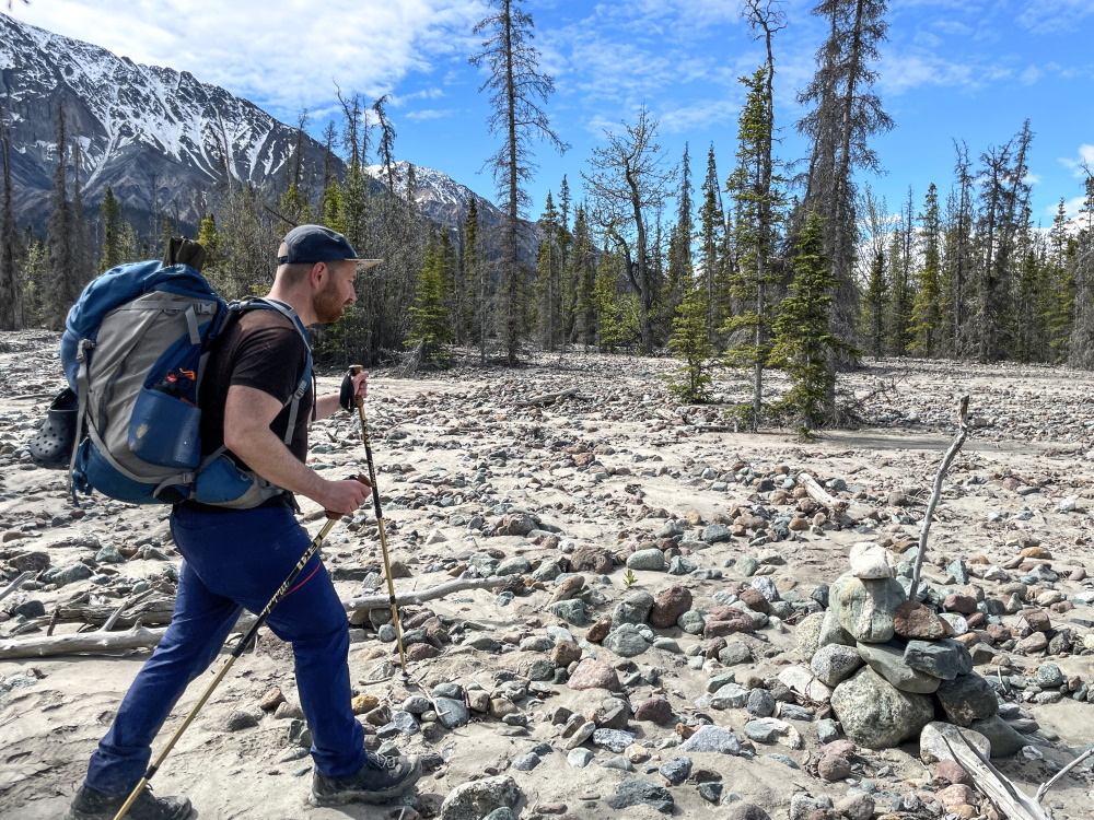
Treed alluvial fan with cairns.
Open alluvial fan with cairns.
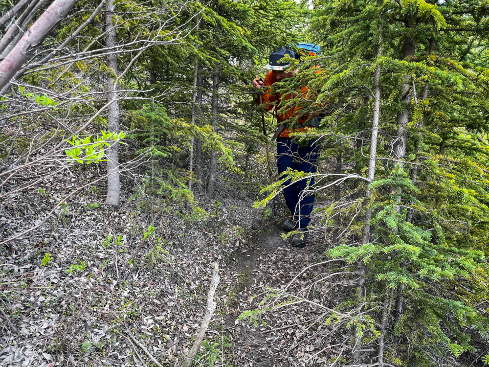
The trail is overgrown and tight at spots, but thankfully not very often.
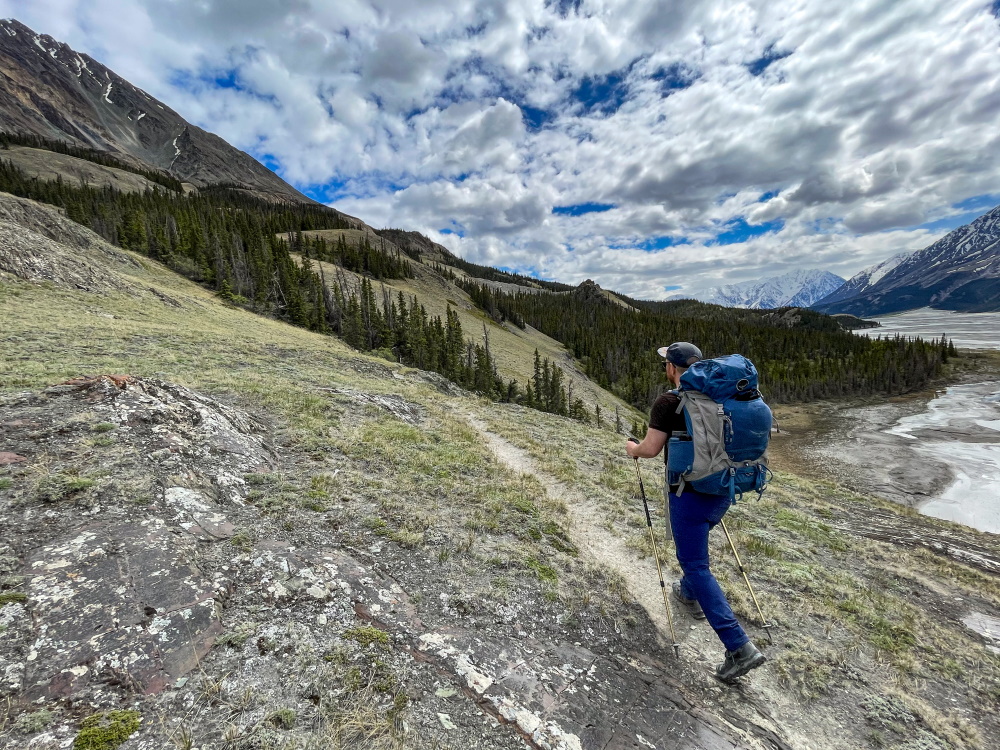
Hiking up high through the open slopes.
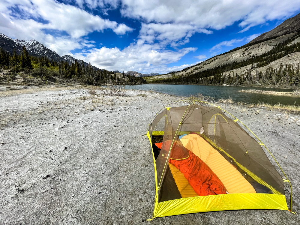
Camping beside the lake at 15 km.
Hiking to the glacier from the lake is flat and easy.
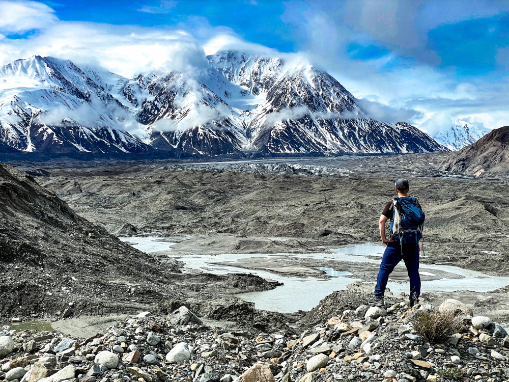
Your reward from the viewpoint on the hill by the Kaskawulsh Glacier.
LM July 24, 2025
Did the hike in the beginning of July as an out and back day hike - it's very easy to lose the trail, I had the route on my watch which helped a lot. About 7.5km in the bank had slumped and was impassable without a significant backtrack. I turned around at that point. I don't think thos trail is being maintained at all at this point.
MC July 29, 2024
We hiked the trail to the camping site, stayed overnight, hiked a little but towards the glacier, stayed a second night, and hiked back the next day. The trail was a bit hard to find on the way in to avoid the marsh, but it was easier to find on the way back. It was much nicer than walking through marsh terrain. The camping site was a little windy. On our way back, we saw a bear that was just curious and did not follow us. (Photo is the camping site)

MC July 29, 2024
We hiked the trail to the camping site, stayed overnight, hiked a little but towards the glacier, stayed a second night, and hiked back the next day. The trail was a bit hard to find on the way in to avoid the marsh, but it was easier to find on the way back. It was much nicer than walking through marsh terrain. The camping site was a little windy. On our way back, we saw a bear that was just curious and did not follow us

Eric June 24, 2024
FYI- Walking our dogs on the access road and had an upset coyote(?) barking and follow us for a while. About 500m from the parking lot.
solo August 5, 2021
Good to know: Vulcan creek in the first alluvial fan can be an intense creek to cross. It can be knee deep with fast current, but that creek is changing a lot, so sometimes it seems like there is no creek and the road is flooded and other times, it is one raging chanel.
Hikey McHike Face August 4, 2021
Backpacked July 31-August 2, 2021.
The usual recommendations- pack bugspray, test your equipment before starting, have a GPS (and know how to use it) or Topo map at the minimum, bear mace, good boots, change of socks...
The trail is hard to find, the beginning is washed out. Their are some markers but they are easy to lose sight of if you haven't hiked it before. The fan crossings would also be challenging without a GPX track to follow - some cairns but not always visible.
LOTS OF BEAR ACTIVITY! Be loud and, keep the dog on a leash and be ready for an encounter. We didn't see any but multiple times came across fresh scat/paw prints. A bear came within 50 meters of our camp at night, fresh scat and tracks behind the tent. Respect them and they will respect you.
Glacier was anti climactic at this time of year, silt and black rock covered most of the ice.
Overall 3.5/5 - will hike the West side next time to compare.
