Total Distance: 5 km
Return Time: 3 hours
Elevation Gain: 504 m
Difficulty: Moderate
Region: Atlin
Traditional Territory: TRTFN
Ruby Mountain is a beautiful and accessible hike near Surprise Lake, northeast of Atlin, BC. It is part of the Atlin Volcanic Field, and red coloured tephra adorns the summit and flanks giving it that red 'ruby' look. The route is straightforward and the hike is less than 5 km return with about 500 m elevation gain. There are some rocky sections and a bit of exposure at the top to add to the excitement. Watch for Dall's sheep and caribou in the area and give all wildlife a wide berth.
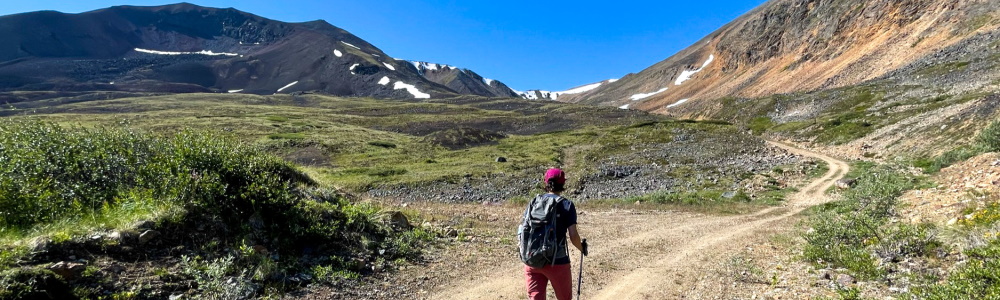
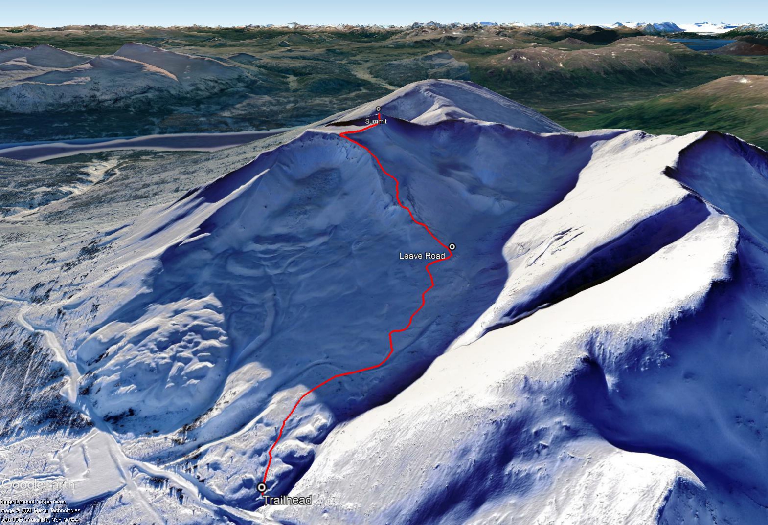
Coming into Atlin from Whitehorse via the Atlin Road (Highway 7), turn left at the T-junction onto Surprise Lake Road. Drive this road for 20 km until you reach Surprise Lake, you will pass Pine Creek Falls and all the placer mining activity. Once near the outlet of the lake, continue following the main road that winds left and across the bridge over Pine Creek and the lake outlet. Keep right immediately after the bridge at the T-junction, staying on the main road. Follow this for another 6.5 km. After 6.5 km, the road heads left up the Ruby Creek drainage. Continue for another 5.9 km until you reach a gate. Just before the gate, there is a rougher side road that heads up to the left. This is the trailhead. Up to this point the road is quite well maintained and driveable in all vehicles. If you have good clearance and 4-wheel drive you can drive up the rougher and steeper side road if you want.
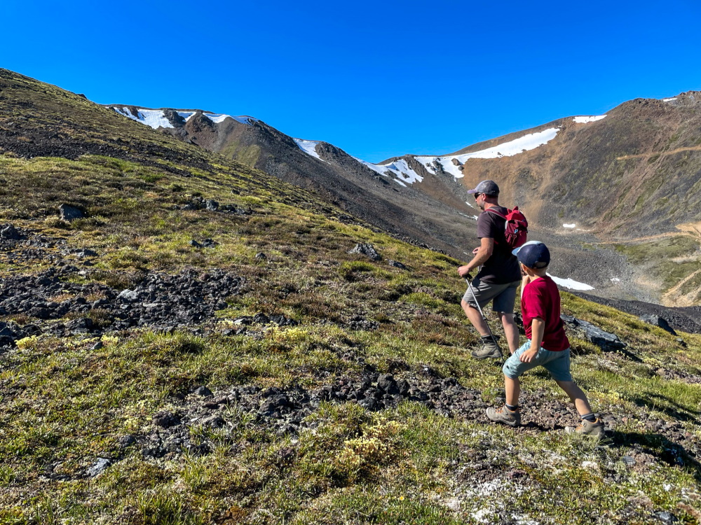
From the trailhead, follow the road up into the mountain valley. The elevation gain is gradual and the views are wide open of the surrounding mountains and the valley below. After 1.2 km of hiking the road, you will see a vegetated ramp on your left that leads up to the base of Ruby Mountains' north-facing ridge. Leave the road here and traverse the alpine to the base of the ridge.
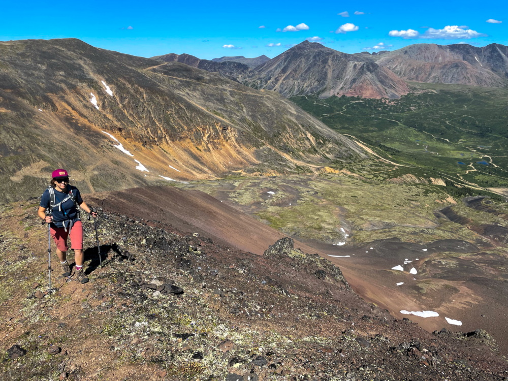
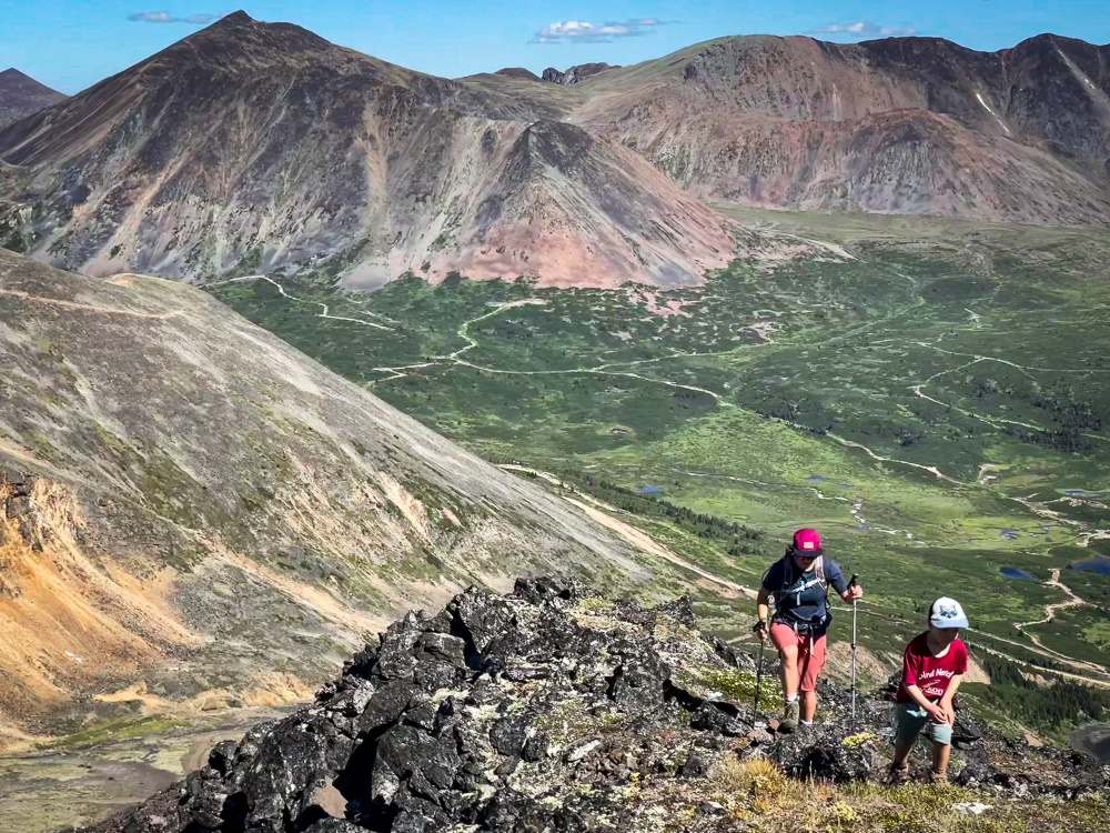
Hike up the ridge staying on the vegetated areas as much as possible to avoid the looser rocks. There will be some hiking on talus slopes but you can avoid a lot of it. At one point, soon after starting the climb, you'll have the option to either stick right or left on the narrow ridge. The left (east) side is a lot easier, as it is less steep and you can pick up a light trail that leads up to a grassy alpine plateau. Once you reach this point, you should traverse to the right (west) to pick up the last stretch of trail to the summit. There is a summit marker on the top.
The 360 degree views are beautiful on a clear day. You can clearly see Surprise Lake and Atlin Lake and all the surrounding mountains. Mount Leonard and Mount Barham are prominent peaks in the area to the northwest and north, respectively. There is a huge amount of mineral exploration that has taken place in the area, with many roads, criss-crossing the mountainsides and the Mount Leonard area still has some active exploration.
Follow the same route down, or if you are looking for a longer day hike, you can continue from the summit and head down along the west ridge, and then following the ridge to the right (northwest - north) to meet up with the exploration roads that zig-zag down the parallel ridge (to the northwest) of Ruby Mountain.
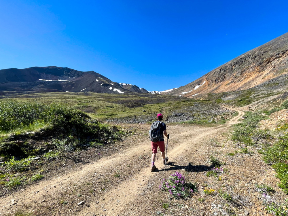
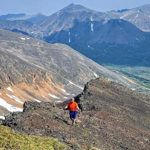
The start of the trail follows a mining road to the base of Ruby Mountain (the dark mountain on the left of the photo).
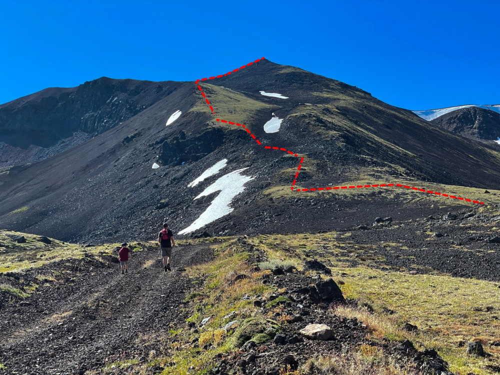
Following the left ridge up, you can avoid most of the rock by sticking to the vegetation.
Hiking up the base of Ruby Mountain on the vegetated slope.
There is a bit of a trail near the summit that you can follow.
Approaching the rocky summit of Ruby Mountain.
Keith Cruz August 19, 2024
Hiked this trail on August 17, 2024. Great hike! It's a ways off from Atlin (about 32 km) but the drive is pleasant - there are some potholes and blind turns so just take it easy. When you come to the T-junction, make a left. The bridge has a sign, "Surprise Lake Dam". Cross that and head right. You should be able to follow the rest as per description above.
You must park by the gate (which says private property); the road to the base of the mountain is inaccessible by any vehicle now, but the walk is not far and its a moderate grade.
Per Jay's recommendation below, i took the right side of the mountain (in red in the pic), and it was much easier than the left. The right side has more vegetation and less talus rocks; although you will still have to deal with talus rocks at some point nearer the summit. Just don't go too far on the right--it's a steep scree slope. The view as you summit is great throughout. Just stunning! worth the drive out.
I prefer Ruby Mountain over Monarch mountain, but both are great.

Jay August 5, 2024
Hiked this Aug. 4, a great little day hike. There is a faint trail to the right of the route suggested by Yukon hiking, we found this much easier to do than staying to the left.

Haley July 29, 2024
Chill hike with a great effort-to-reward ratio and easy terrain. We hiked on July 28 and there was hardly any snow. The road up was in quite good shape but nice to have 4x4 for the potholes. The hike up is relatively straightforward. Don't be tempted by the ATV trail switchbacks on the opposing mountain face, stick to the photo route for the uphill. We decided to cross the ridge and come down on the other side on the way back, which was easy to do and provided a few more views. Total was 617 metres and 7.5 km on our GPS track.
Aaron Weber July 1, 2024
We did this hike on June 24. There was still snow on the slopes of the mountain off the trails, but it did funnel you towards one of the two ridge options. The one on the left is definitely easier than the one on the right, which is steeper and needs more scrambling. The top was snow-free and had incredible views over the valley. We spent 3 hours on the trail, including 2h15 of active hiking. Excellent lunch stop at the top.
The road to the start was in good shape, 4wd not necessary at that time of year, and any crossover/SUV could easily make it, just watch for the potholes. As others (and the hike description) note, the 4x4 road is blocked off (and the front part cut out now in addition to the boulders). Lots of room to turn around and park before the gate.

Jess June 6, 2024
Skied this 6/1/24. Good snowpack, great corn conditions. Was able to dodge all lava rock. Won't be ready to hike without skis/snowshoes for quite some time I imagine.

Sven August 5, 2022
Lovely hike. Following the ridge on the left is good advice. Spectacular views.
Kylie July 3, 2022
The 4x4 road has boulders and cannot be driven. These have been purposely put there. Very busy when we came down. Beautiful, steep hike
Liz B September 20, 2021
My partner and I hiked Ruby Mountain on Sept 19. The trailhead was easy to locate using the directions provided. Someone has placed boulders at the beginning of the trailhead road so driving up it is no longer an option.
Our hike was snow free up until we left the road and began walking up the ridge, then we were walking through 2-6" of snow. Even with the snow, the walking was relatively easy (not too slippery) and route finding was no problem. Sticking to the left side of the ridge while walking up is definitely the way to go as it's more gradual, more vegetated and makes for easier walking overall compared to the right side.
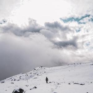
I'm 7.5 months pregnant so we are a bit slower than usual but it took us 1h 45mins up and 1h 20mins down. Views from the top were excellent! We did get totally clouded in and snowed on hard for about 20 minutes at the summit but that system eventually passed by. Just a reminder to bring lots of warm layers for September hiking!
We walked up to the summit and back down the way we came but I would love to go back and spend more time exploring the ridges and other mountains nearby!