Total Distance: 9 km
Return Time: 5.5 hours
Elevation Gain: 751 m
Difficulty: Difficult
Region: Tombstone
Traditional Territory: THFN, NNDFN
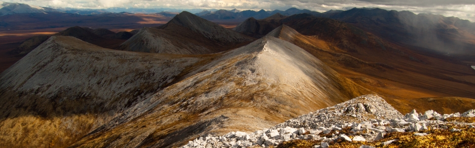
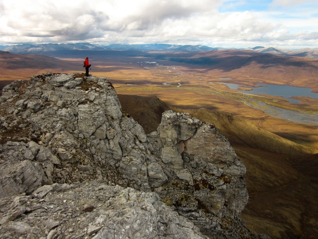
If crossing the Blackstone River doesn't deter you, then great views and interesting rock formations are your reward on top of Pilot's Peak. Tall rock columns are scattered around the summit, and the rounded grey ridges behind Pilot's Peak are spectacular.
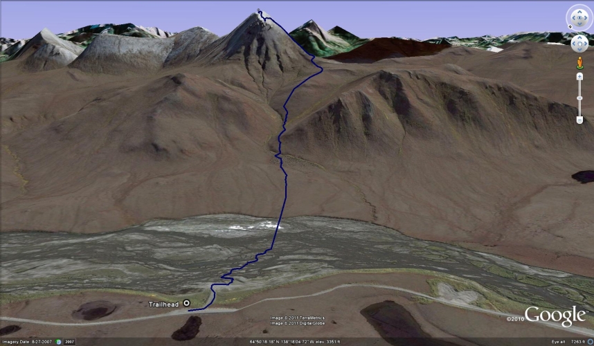
Drive to kilometre 117.5 of the Dempster Highway and look for a road on the right (east) side which leads down to the Blackstone River. You can park just below the highway and walk down to the river.
NOTES ABOUT BAKCOUNTRY TRAVEL OFF-TRAIL IN TOMBSTONE TERRITORIAL PARK:
This is a route, not a trail. It is advised that you are experienced in route finding, backcountry travel, and are well prepared and self-reliant. Choose durable ground and spread out to prevent creation of new trails on the fragile tundra vegetation and permafrost. Avoid wet or muddy areas where possible and stick to higher group and follow ridgelines.
Registration is mandatory for camping within the park. Please visit the Tombstone Interpretive Centre to acquire the correct park permits, and receive up-to date information on trail conditions, closures and wildlife activity.
Park approved bear-resistant canisters are mandatory (only hard shell, not soft bags) for all backcountry camping. Dogs must be on a leash at all times and fires are not permitted.
----------------------
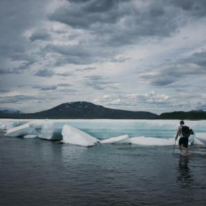
The Blackstone River is braided at this spot, but can still be difficult to cross. In the spring, or after heavy rain, it's probably worth avoiding this hike as crossing the river would be dangerous. Even late in the year when the river is low, expect water up to your knees.
Being braided, the river is wide here and takes about half an hour to get to the other side. If you have rubber boots, or even better, hip waders, then you can wear them to cross the river and leave them on the other side for the return trip. Otherwise, some sort of sandals or water shoes are recommended.
On the other side of the river, climb up the bank and head across the tussocks towards a small group of trees at the base of the slope. Walk around the left of the trees and cross a small stream so that you are on the right (south) side of it.
Follow the stream up the slope until it forks into a 'Y'. Cross the right branch and walk up the slope, heading slightly to the right (south).
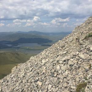
Make your way to the ridge on the right (south side) of Pilot's Peak. When you reach the steep section below the peak, keep on the right/south side of the ridge so that you can avoid most of the sharp, loose rocks, which are difficult to climb on. Climb straight up until you reach a section below the summit that flattens out a bit. Explore the northwest edges of the summit here where tall columns of rock are standing upright. Then, head up to the summit for an amazing view of the rounded, grey ridges behind Pilot's Peak. Follow the same route back to your vehicle (which is, unfortunately, on the other side of the river).
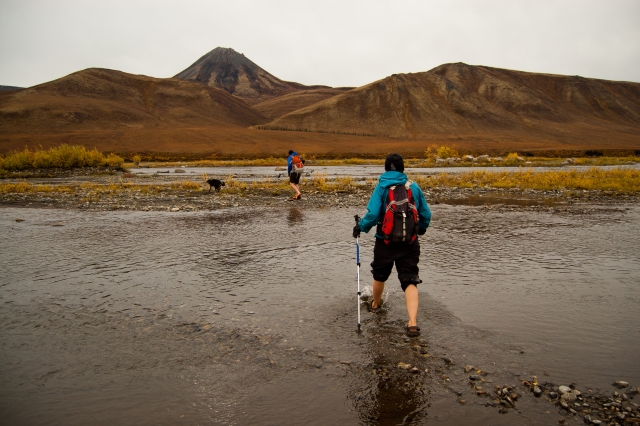
The first thing to do on this trail is cross the Blackstone River (Pilot's Peak in the background).

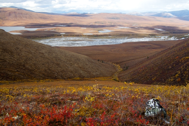
After crossing the river, walk on the tussocks towards the valley between the two ridges.
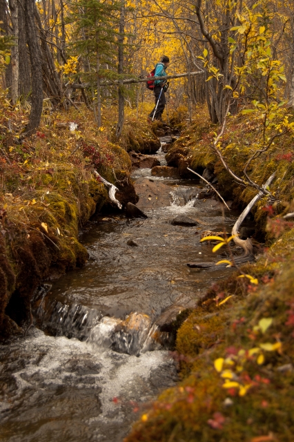
At the trees, cross the little stream to get to the right (south) side of it.
Looking back down from the slope above the river.
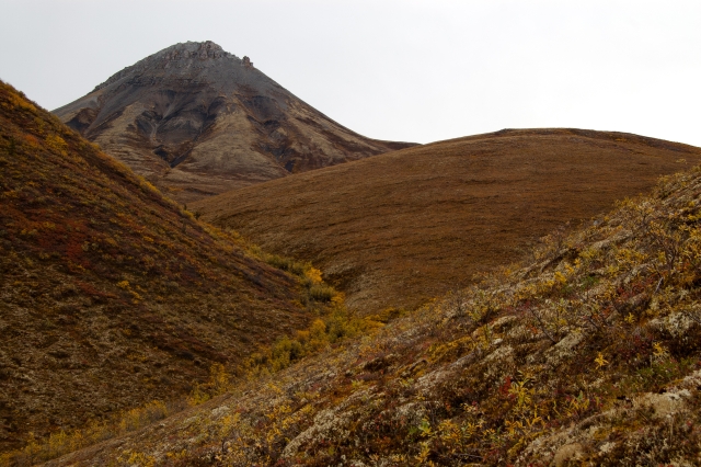
Looking up the slope towards Pilot's Peak.
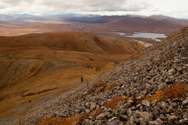
Hiking up the rocks on the right (south) side of the peak.
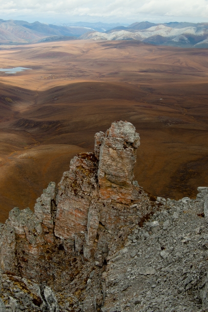
Tall, upright rock columns give this peak its distinctive look.
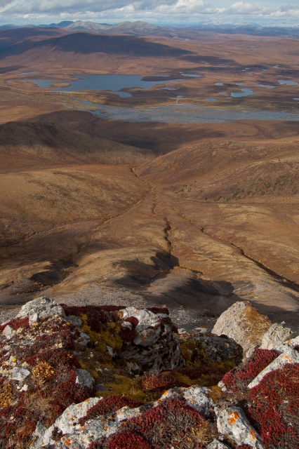
The view looking south down the Dempster Highway.
Looking down the steep west slope of the peak.
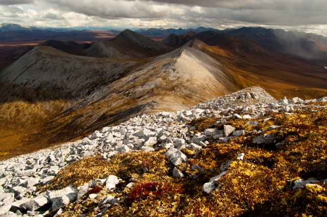
A view of rounded, grey ridges behind Pilot's Peak can be seen the summit.
Arsh August 12, 2022
Great hike! One of the better ones on the Dempster. Would recommend waders for the stream crossing. Side note...and this is a long shot. I lost my phone on this hike. It's near the part of the hike where the stream forks into a "Y". If anyone miraculously sees a galaxy s10 on the hike please email akgrewal@mcmaster.ca. Thanks!
Mack June 27, 2021
Did this hike as a party of two on June 18th. There were still huge ice chunks on the river, but we were able to pick our way around them. It was mostly knee deep with one short part up to the upper thigh and the water wasn't too fast, just very cold! From the river on it was smooth sailing on the tundra, we kept to the right side of the willows going up and the summit views were amazing.
Rob August 20, 2019
Did this as a party of two on the August long weekend, it's a fun trail with some great views. When crossing the river we had better luck slightly upriver of where the marker is on this map -- it is wider, more shallow and had fewer deep or sketchy spots to cross.
Jonathan June 25, 2018
Did this as a party of two in early July 2017. Water level was no problem crossing the Blackstone. A very beautiful and enjoyable hike. When you get to the loose rock near the top, watch for fossils. They are everywhere. Remnants of ancient ammonites and other shell fish. An extra bonus on a great trip.
Marc July 8, 2017
Did this July 6th. The river was actually the fun part of the trail (and the summit). Water level was very low (up to knees) with no strong current. Took 4 hours round trip. Nice challenging hike and pretty straight up. We always stayed on the left side of the creek (on the way up) and only crossed it at the Y to stay again on the left side of the right creek and it was a way easier option in our opinion than going accross twice. Lots of trees and tall bushes around the creeks! Last part was steep up to the summit and demanded lots of work.. On the way down, we were excited to have to cross the river again.