Total Distance: 4 km
Return Time: 4 hours
Elevation Gain: 714 m
Difficulty: Difficult
Region: Kluane
Traditional Territory: CAFN
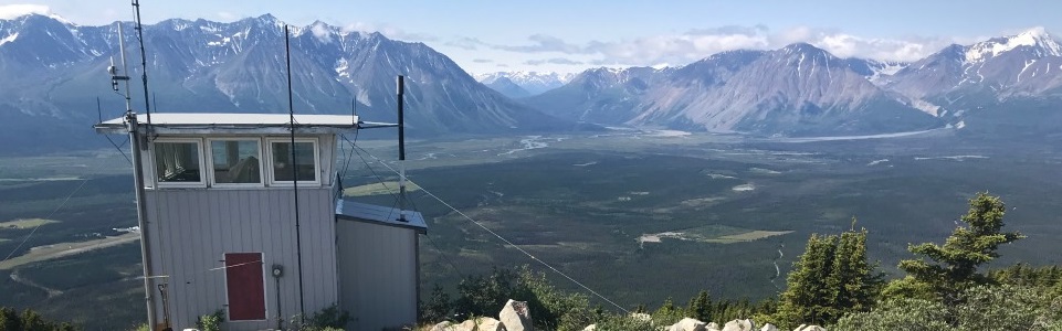
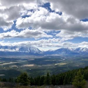
A very steep hike with rewarding views of Pine Lake and the Kluane Front Ranges. There is some infrastructure at the top including a heli-pad, fire-lookout tower, and various communication towers.
NOTE: This hike does pass within Category B Settlement Lands of the Champagne and Aishihik First Nations. Please respect their rules and land.
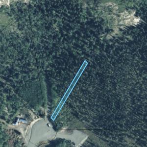
From Whitehorse, drive north on the Alaska Highway towards Haines Junction. About 4 km before you reach Haines Junction, you will see a sign for Pine Lake Subdivision on the right (this turn is just past the turn for the Pine Lake Territorial Campground). Follow the Pine Lake Road for 2.7 km to the very end (staying on the main road). It will end at a large cul-de-sac where you can park.
NOTE: This is a residential area, please be respectful of where you park, and keep well away from driveways. The trail starts at the northeast end of the cul-de-sac, and utilizes a 'walkway' easement between the property lines - be sure to keep dogs on a leash when near residential properties.
Note: This hike is not within Kluane National Park & Reserve.
There is a trail the entire way up the mountain, but be warned it is very steep and during the latter half of the hike you are basically following a cutline for cables straight up. It is not recommended for those with a fear of heights or steep trails. Also note if you are hiking during the heat of the summer, the route is quite exposed with little shade and there are no water sources along the way. After or during a rain, the trail would also be very slippery and dangerous.
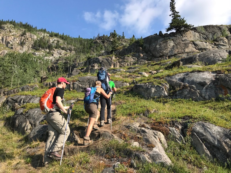
The route starts out through the trees and is relatively flat. But it is not long until you start up through some rocky sections to a small plateau below one of the main rock climbing faces on the mountain. The trail heads north contouring along the base of the mountain and then basically goes straight up the mountain. This is where you harness your inner mountain goat! Hiking poles are a must.
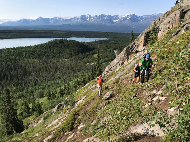
After a short section of climbing you will reach a bit of a break in the elevation and some shade in the trees. The trail now contours towards the west as you have now reached the top of the first rock bluff. Eventually the trail picks up a cutline (keep right at the fork) where you follow a cable the rest of the way up in a northwesterly direction. One of the steepest sections of the hike is along this section, and you will need to carefully scramble up (and down on the way back). There is a good lookout and resting spot with shade just before the top, with a fire pit. There is now only 0.5 kms (and 130 m elevation) left until the top.
Once at the top, the heli-pad offers a nice vantage point to enjoy the 360 degree view. Please respect the communication infrastructure and buildings on the summit, these are private property.
Hiking up amongst the rocks to the small plateau and main rock climbing access point.
The trail is very steep in many places so bring hiking poles to steady yourself and harness your inner mountain goat.

Eventually the trail changes to a cutline, where you will follow some cables all the way to the top.
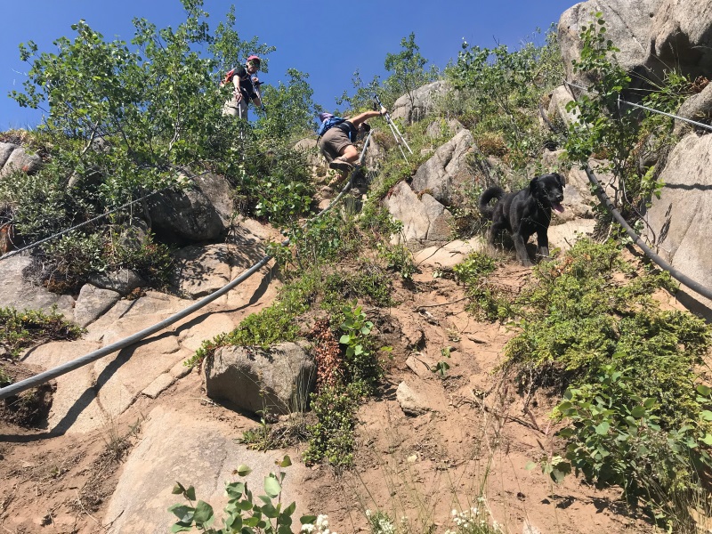
Looking up the steepest section of the route.
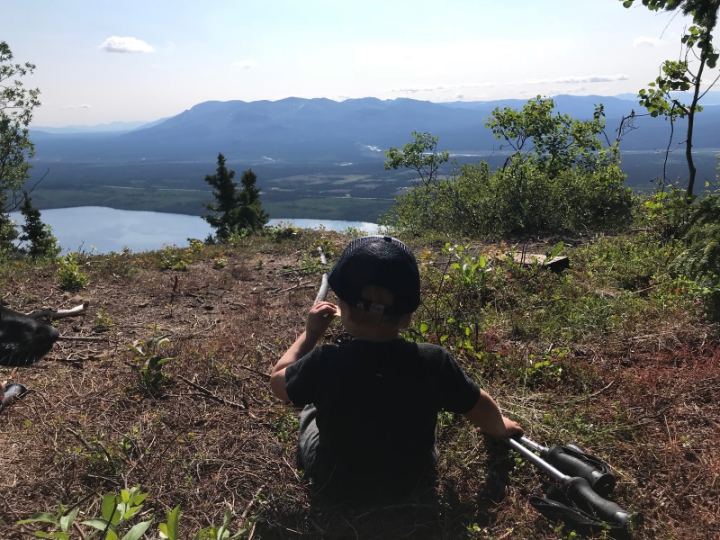
There is a good rest stop and lookout before the last hike to the top.
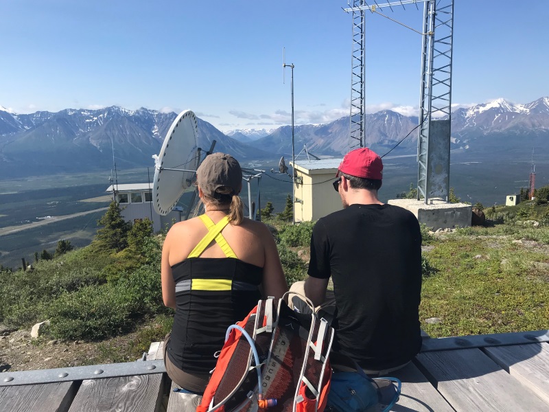
The heli-pad offers a good lunch spot to enjoy the view of the Kluane Front Ranges.
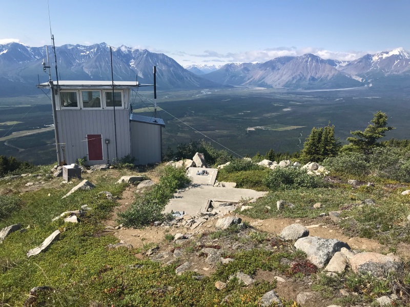
A view of the firetower and the Dezadeash and Alsek River valleys.
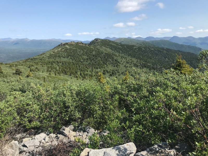
The view looking northeast.

Khush May 26, 2025
Hiked Paint Mt on May 25th. Saw a giant moose as soon as we turned onto the Pine Lake subdivision rd. Barring a few sketchy sections that required scrambling, trail is in pretty good condition. No water source, so if you are bringing your doggo, make sure to carry lots of water (we brought 4L together and still ran out towards the end). Snow patches in the last 500m were a respite for the dog. We took 5 hrs altogether and that included a power nap at the helipad. Can see Kathleen lake, King's throne, Alsek Valley, Mt Archibald, Mt Martha Black from the top.
Shailyn May 27, 2024
Hiked on May 26th.
Snow-free all the way with snowy patches around the top.
Since I have done this one a couple times I knew it would be a pole hike - and I can't imagine being able to do it without.
There were no signs of wildlife, and it is a lovely day out. Took us 4.5 hours with a nice long lunch and exploration at the top.
YT August 29, 2023
Hello May.
The trail up Paint existed prior to your moving there and is all on public land.
The pathway is on a public use corridor between the zoned residential lots, all which were created and surveyed in 2011. Please see attached image for clarity.
If you're having issues, perhaps post some signage to ensure hikers stay on the trail, and perhaps a friendly reminder that all dogs must be under control, whether leased or fenced.
May August 25, 2023
Hello, The hiking trail for Paint Mountain Yukon should not be up as a hiking trail. The trail went up when there was no one living in that area. There are people living here now and the trail is now in between 2 peoples houses and it is very intrusive. The people living here have to now deal with numerous strangers walking through their property on purpose or on accident at all hours and people camping when they are not allowed to and leaving food with has currently attracted 2 bears in that area. The people living there are very uncomfortable which is understandable. There has been many very close calls with off leach dogs with neighbours dogs because the hikers think it’s a public area, it is not Paint Mountain is a residential area and I ask you to please take down this trail. There is so many great hiking trails in the Yukon like the parks. Please take it down. Thank you.
KKJ October 11, 2022
Trail is in good condition but recent conditions have made for some slippery sections/ erosion.
Trail can be completed in way less time than the estimated four hours but moist conditions require caution.
Dave May 13, 2020
Warning: This is not an official or maintained trail. There are no appropriate high-angle rescue resources outside Kluane National Park. Mountain goat at your own risk.
Maya December 16, 2019
Beautiful winter hike! Sometimes slippery but the view on Pine Lake and on the mountains is worth it.
Emma May 18, 2019
Hiked Paint Mountain today. The view is so spectacular from the top! The description is not kidding about harnessing your inner mountain goat though, wow the trail is steep in some places!! My GPS watch registered approx 5km round trip? Took 2.5hrs (including 20 min rest at the top). Make sure you watch yourself on the way down, it is quite slippery in sections. Great little hike, well worth the effort!

