Total Distance: 24 km
Return Time: 2-3 days
Elevation Gain: 775 m
Difficulty: Moderate
Region: Kluane
Traditional Territory: KFN, WRFN
Nines Creek North leads up the Nines Creek North valley towards Nines Peak, an impressive glaciated mountain. The alpine area at the end of the valley is great to explore, and there is a pass that overlooks the Duke River and the mountains beyond. Although there a few creek crossings, this is a great overnight hike.
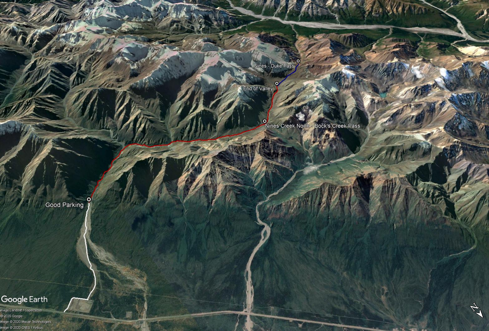
Drive 97 km north of Haines Junction on the Alaska Highway. Continue 9 km after the Congdon Creek Campground, look for a gravel road on your left. Take this road and follow it around the gravel pit. The road bends right after 400 m, and after another 400 m look for a road on your left, before the end of the gravel pit.
The road can be driven 4.3 km to a suitable parking spot, even in a small car. If you drive any further, you may end up in an active mining area, so best to park your car before this.
NOTE: This hike is within the Kluane Wildlife Sanctuary and not in Kluane National Park & Reserve.
The return distance is from the parking spot to the end of the Nines Creek North Valley (not to the pass above the Duke River). This can be done as a very long day hike, but is more suitable as an overnight trip so you can explore the area. There are options to camp earlier, near the small Pass to Bock's Creek.
Start by hiking along the rest of the mining road. From the parking spot, you will soon reach the main mining area, and then shortly after you will be forced along the left bank of the creek.
Continue following the mining road when you can. There are a few short sections that require you to go into the trees, but there are paths through them.
Eventually the creek valley will widen and you can walk on the rocks beside Nines Creek. Then you will come to a point where two valleys meet in a 'Y'. The left branch is Nines South, the right branch is Nines North.
You will have to cross the creek in order to go up Nines North. Choose the best spot. When hiking up Nines North, the left side of the creek offers good hiking, but there are still a few sections where you either have to cross the creek or ascend up the forested bank above the creek to get around any canyon sections or during high water.
Water levels always vary. To cross Nines North, it is usually best to switch to creek crossing shoes. In times of high water levels, it may be impassable, so time your trip accordingly.
Continue up the creek valley. From the trailhead, it is about 9.6 km to a pass on your right that leads to Bock's Creek. There is a small vegetated area to camp below the pass (about 4 hours from the parking spot). From the Bock's Creek Pass area, it is another 2.4 km to a vegetated alpine area at the top end of the Nines Creek North Valley (about 12 km total from the parking spot). There is good camping here too.
EXTENDED HIKE
From here you can add a nice side trip up a pass that overlooks the Duke River and the mountains beyond. It is 2 km up to the pass from the end of the valley (and 340 m elevation gain). Head to the right side of the valley up a steep scree slope. To reach the pass, head up a steep scree slope, to the right side of the valley.
LOOP OPTION
See the Nines Creek Connector route on the website to connect Nines Creek North to South. Note to hike the connector route from the north fork to the south, you will have to backtrack down the valley slightly to find the pass that you will be going up.
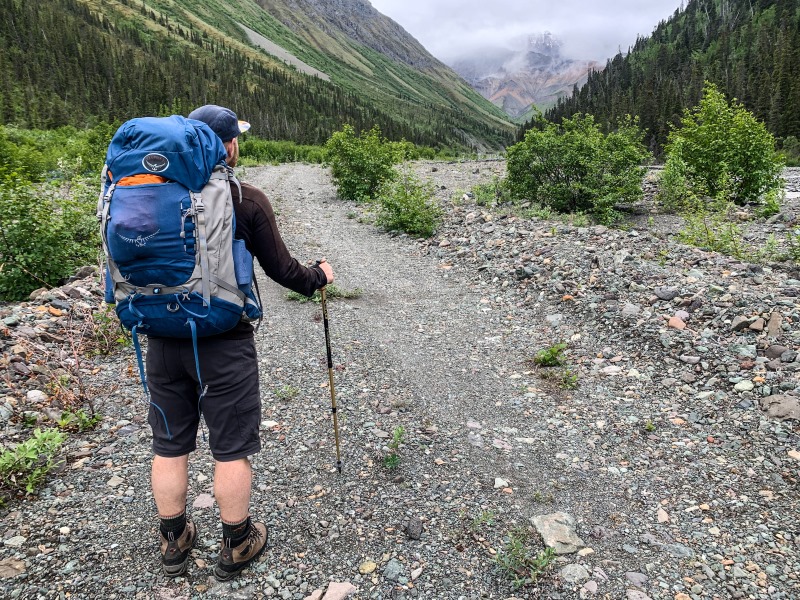
The mining road from the parking area.
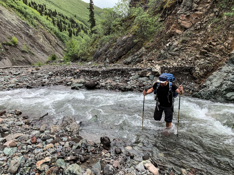
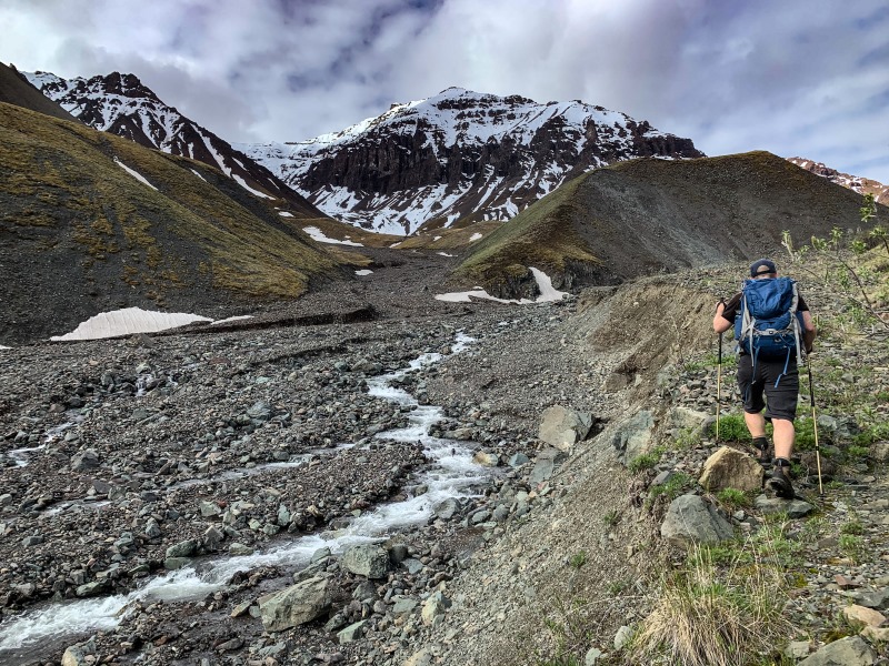
Crossing Nines Creek North.
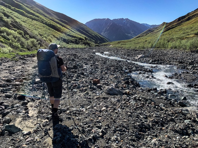
Looking back down Nines Creek North from a few kilometers in.
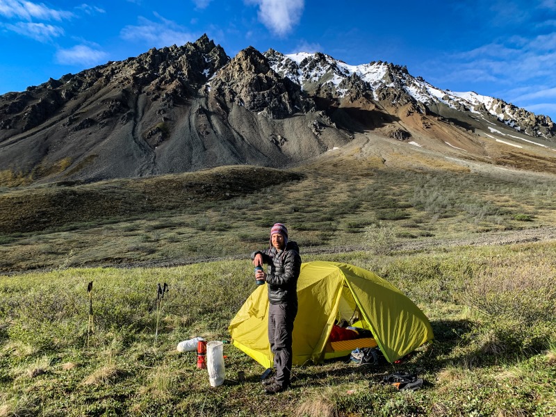
Camping at the pass that leads to Bock's Creek.
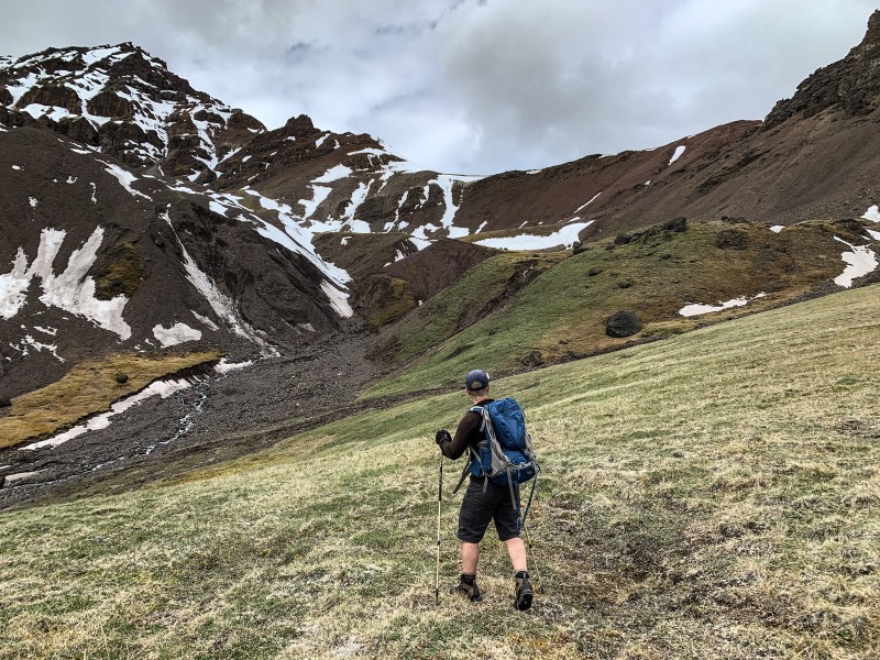
Hiking further up the Nines Creek North Valley.
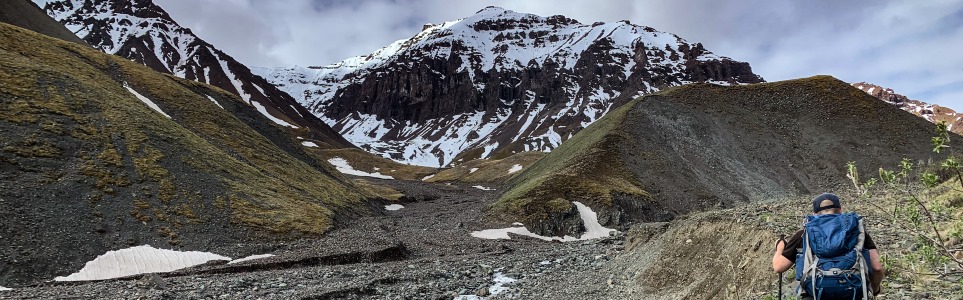
At the end of Nines Creek North Valley. You can hike up this pass to get a great view down the Duke River and beyond.
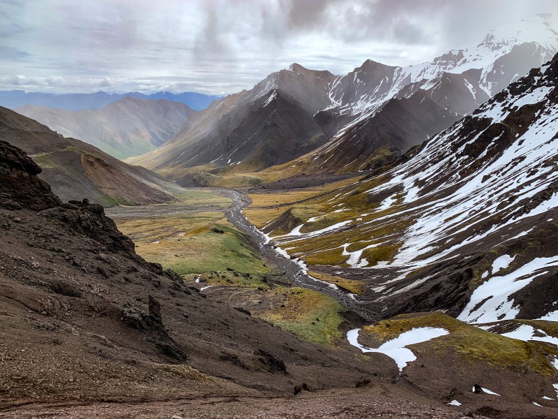
Looking back down the Nines Creek North Valley from the pass.
Pamela Battiston July 11, 2026
I have done Nine’s creek south-connector-north on the weekend on 1-2-3 July 2026 and I have lost my dog leash. In case someone find it : it is a retractable orange leash. Around my hips on this picture (best view of the connector by the way 😉)
Contact me on Facebook if you find it! Thanks a lot !

Ben August 6, 2025
The mining road extends all the way to the junction between Nines North and Nines South creeks and is similar condition the whole way. There is a lot of room at the end to turn around (or even park well out of the way of any mining). One could drive all the way, drop packs, and then drive back to the first spot to park off the side of the road. This will save you the initial road walk with your heavy packs (which isn’t an interesting walk)
Sheila August 6, 2025
Did this hike early August spending one night at the pass to Bock’s after a late start, and one night at the beautiful end of the valley. Highly recommend bringing sturdy river sandals for the multiple creek crossings; I hiked most of the way in them and crossed at my leisure, though my very tall companion jumped the creek in his boots when forced by its pinging back and forth between canyon walls. Your shoes will fill with fine gravel but I found it easier to shake them out periodically than switch or risk soaked boots. The rocks in the creek bed are endlessly fascinating. No bears but lots of interesting spiders and butterflies; sheep; and a golden eagle soared over us at the pass overlooking the Duke.
Jasmin July 27, 2021
Did this hike on July 24th, 2021. We ended up leaving quite late and so only made it to the bottom of Bock's Creek pass to camp. We planned to get up and hike to the final pass in the morning but woke up to rain and low cloud so decided just to head back. Be prepared for lots of creek crossings and reasonably tedious walking on the creek bed. I ended up hiking several kms in my camp sandals because it was too much to put my shoes back on between all the crossings. After a night of rain the creek was much higher in the morning than when we went up, but it was still reasonably easy to cross (except for our dog who got swept off his feet a couple times). We saw several sheep and a bear so definitely bring your binoculars to check out the surrounding mountains!
