Total Distance: 13 km
Return Time: 5.5 hours
Elevation Gain: 993 m
Difficulty: Moderate
Region: Haines
Traditional Territory: CIA
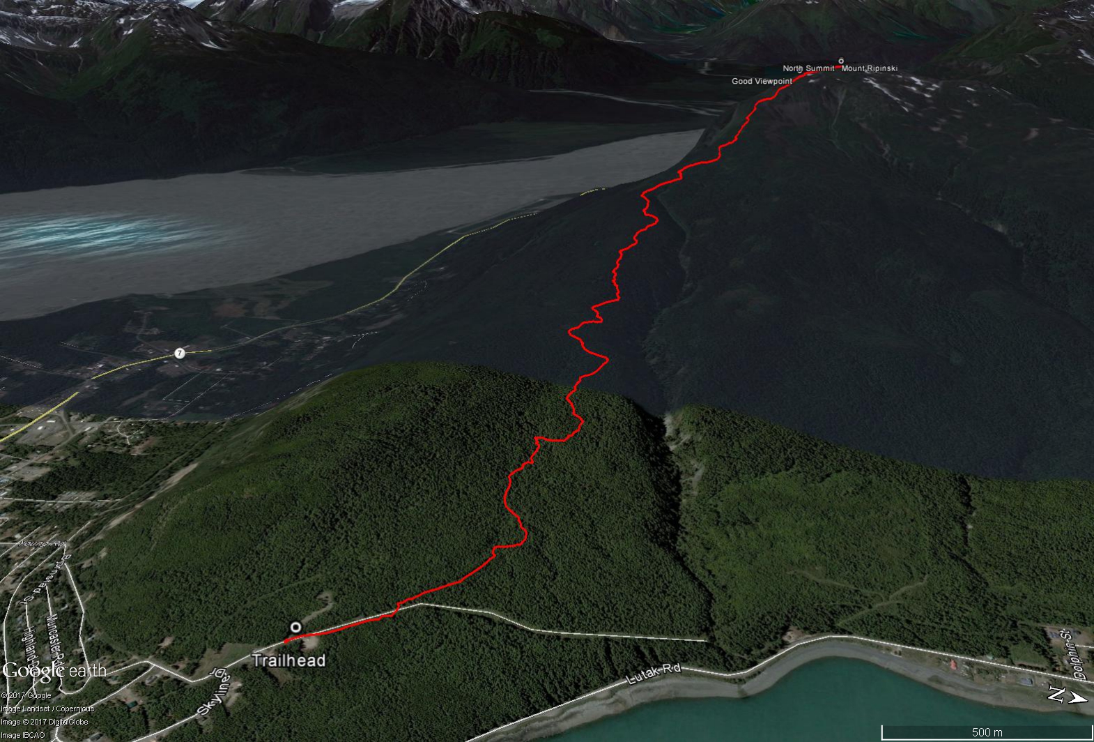
Mount Ripinski is a prominent ridge within the Takshanuk Mountains, which rises northwest of Haines, Alaska and runs along the Haines Highway. While much of the hike is in the trees, once you reach the first bit of subalpine, the views over the Haines area are pretty spectacular with glacier covered peaks and the many inlets of the Lynn Canal. There are actually three potential access routes to the summit, the route described here is via Young Road and the most gradual and forgiving of the three.
From Main Street in Haines, drive until you reach Second Avenue. Take Second Avenue north until you reach a fork in the road with Young Road and Lutak Road. Take Young Road as it winds up and around, through a residential area, following the hiking signs for the Mount Ripinski Trail. The road ends at a large parking area and the trailhead is at a wide 4x4 road along a powerline.
From the parking area, follow the rougher 4x4 road (marked by a trail sign) that leads northwest from the parking area. After a minute or two you will see a narrower trail, marked by another trail sign, off to the left. Follow this trail that leads into the forest. Shortly after entering the forest you will pass a trail kiosk on the right.
The first part of the trail is well maintained and relatively flat with some boardwalks, but do not be fooled as you have to fit in nearly 1,000 m of elevation gain during this hike! The trail eventually starts climbing, but it is not too steep (and far easier than the Piedad Road trail). There are mostly long, gradual switchbacks with the occasional short burst of straight up hiking.
The route is easy to follow for the most part, with a worn trail and trail markers and flagging along the way. There are also several trail signs at any major intersections, and you need to continue to follow the signs for the 'North Summit'. You will pass by signs for a radio tower, a skyline ridge trail, and the Piedad cut-off trail. Note if there is any snow on the route, which there can be during the earlier part of the hiking season (May and early-June), you have to be pretty diligent in watching for any signs of the trail (bare areas, trail markers, and footprints). It is easy to lose the trail in the snow. In general, while in the trees the route stays relatively close to the deep gully on the north side of the ridge (as shown in the Google Earth image). You will not see many views on the way until you reach the subalpine.
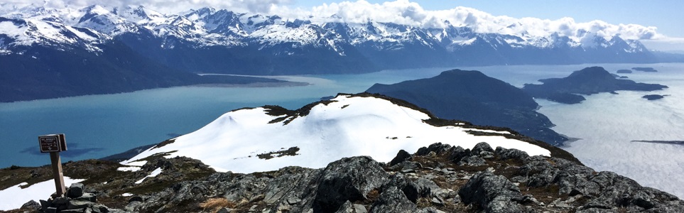
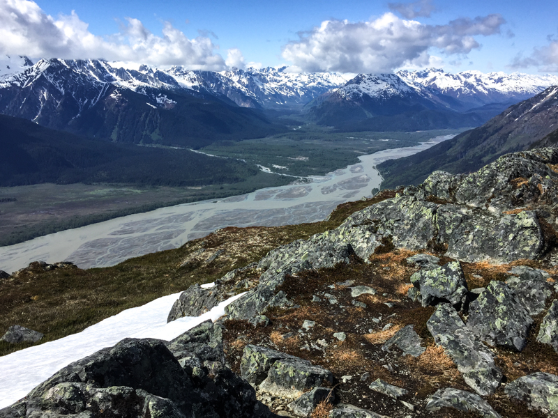
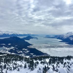
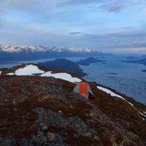
Once in the subalpine, as the trees start to thin out, there are some open meadows with your first views of the surroundings. Up ahead on the trail you may also see the top of a ridge, this is the first of two false summits. The next false summit looks quite rocky with a rough trail leading straight up. At the top of this you will get a great view over Haines (as described as the 'Good Viewpoint' on the GPS download). It is not much farther to the true North Summit (450 m distance and 50 m elevation gain), which has a marker on the top. From the North Summit you get a great view over to Chilkoot Lake and further up the Chilkat Valley. Enjoy the views and then return the way you came up.
If you are looking for a much longer day hike, there is an option to continue from the North Summit further on the ridge to Peak 3920 (Shakuseyi Peak) and the Seven-Mile Saddle, which then loops down to the Seven Mile trailhead on the Haines Highway.
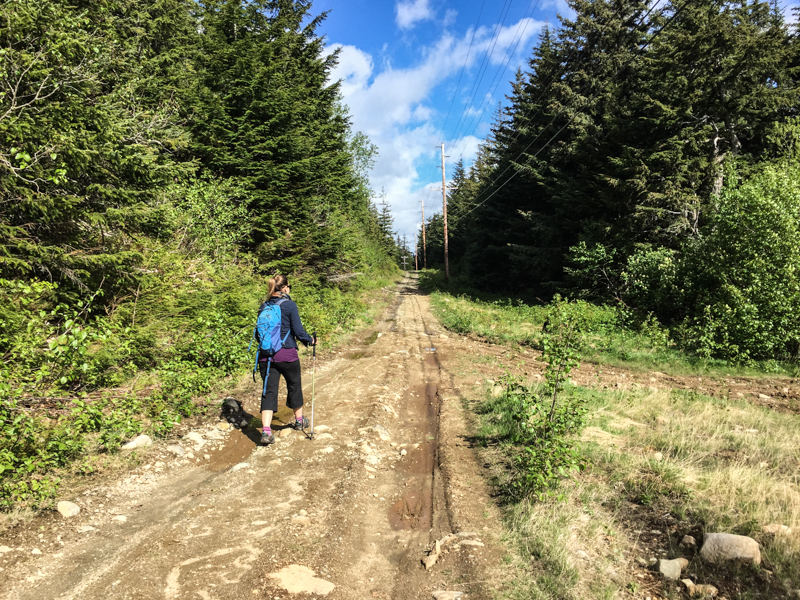
Starting out on the trail from the parking area, following the powerline.
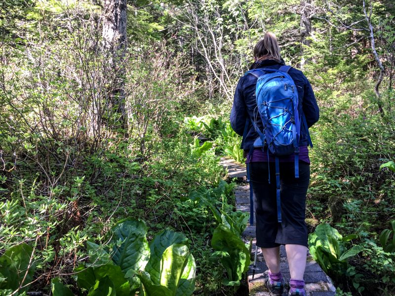
There are few boardwalks and stairs during the first part of the trail.
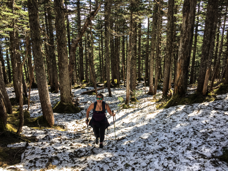
If you attempt this hike in May or early-June, expect some snow and be very diligent in watching for signs of the trail, as otherwise it is very easy to get lost.

A steep snow climb up towards the first false summit.
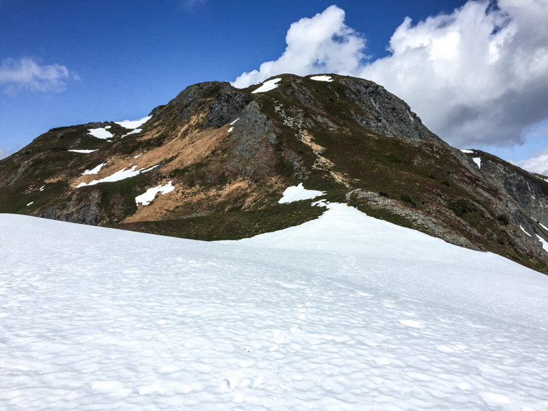
The steep rocky climb up to the second false summit.
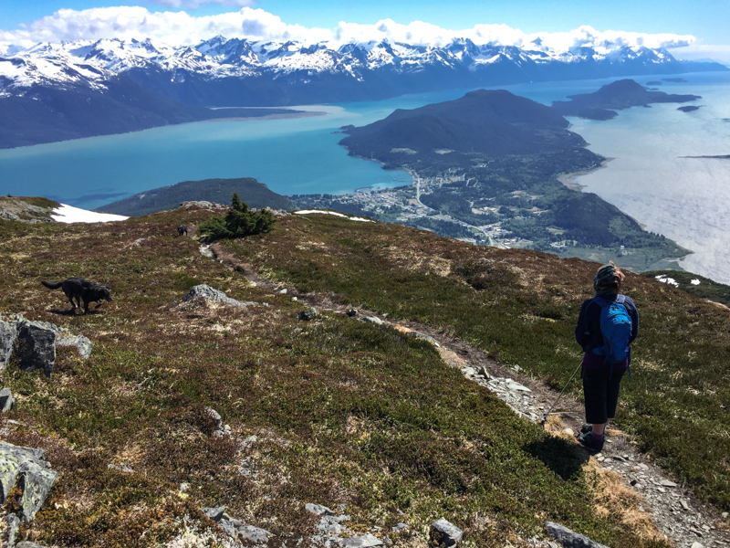
The first good view from the second false summit, looking over Haines with the Chilkat Penninsula below disecting the Chilkoot and Chilkat inlets.
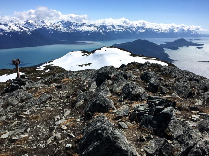
The view from the North Summit.
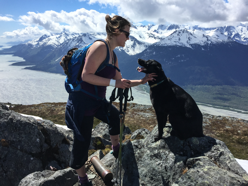
Hiking buddies on the summit.
The view west up the Chilkat Valley from the summit.
Emma June 24, 2026
Did this hike June 22 with an early morning start. Didn't see another soul on the trail. It was a wonderful hike, with incredible views! Highly recommend. Most of the trail was dry, but there was a fair amount of snow on the ascent up to first false summit and the valley in between the 2nd false summit and true summit. Very manageable though with just hiking boots. 2 dogs with us and they did great. Several water sources on the way up for them to dunk in/drink from (but I would still recommend bringing lots of extra water for pups). Bug spray would be your friend in the treed section.
Kyle June 5, 2019
I did this hike at beerfest this year. Very epic views. Lots of room at the summit to roam around and explore more. Some snowy patches at the top, fine with hiking boots but your feet might get wet. Took about 3 hours in total.

Sara D. March 29, 2019
Amazing hike! Hiked this on March 2, 2019. Took about 4.5 hours. There was a bit of ice on the trail from the beginning and then packed snow towards the top. No snowshoes or crampons needed though. A must-do when in Haines!
Felix Ossig-Bonanno June 12, 2018
Great hike! Started at 7-mile saddle and camped on top of Rapinsky. Hiked back into town in the morning. There was still a bit of snow between the peaks (Jones gap), but nothing crazy.
E Hoefs April 1, 2018
Terrific hike! Did this yesterday (Mar 31/18) in about 4hrs. No snowshoes or crampons needed but some icy patches. Descend with caution.
