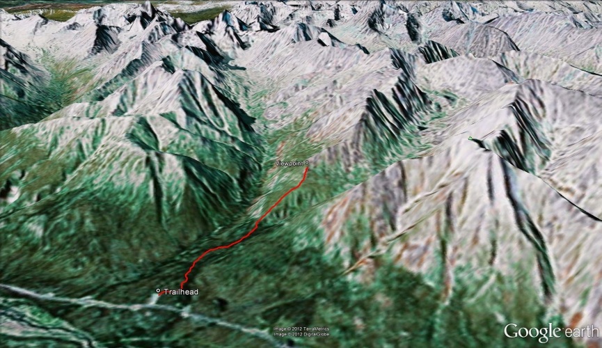
Total Distance: 5 km
Return Time: 2-3 hours
Elevation Gain: 423 m
Difficulty: Moderate
Region: Tombstone
Traditional Territory: THFN
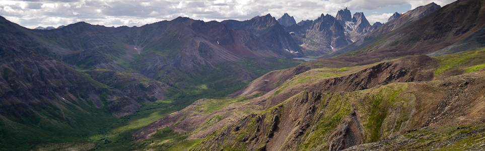
This is one of the most popular trails in Tombstone Territorial Park, and for good reason. Within an hour you get a view of Mount Monolith at the end of Grizzly Valley. The trail is well established, and you can continue along the ridge towards Grizzly Lake for as long as you like.
At kilometre 58.5 up the Dempster Highway, there is a road that leads to a large parking area on the left (west) side of the highway. The trailhead is signed at the highway, so you can't miss it. The parking area has many parking spots and an outhouse.
You can easily pick up the trail at the end of the parking area in the trees. The trail is very well established (for Yukon standards) and there is a voluntary hiker registration box not long after you enter the trees.
The trail meanders through the forest, gently sloping upwards. Cairnes Creek runs close to the trail at the beginning, and the ground can be muddy at times. Soon the trail starts climbing a little steeper, and the trees start to get smaller and thinner until they finally give way to sub-alpine shrubs.
Continue walking until you get to a small opening with piled rocks, just before you would really start to climb up the ridge. From this spot, you can get a view of Mount Monolith directly to the west.
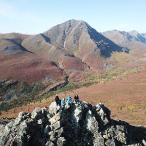
At this point, you can continue along the ridge or turn around and follow the same route back out. If you want to continue, the trail gets quite steep at first before slowly mellowing out again as you gain access to the top of the ridge. The trail along the ridge is still very well established.

The beginning of the trail is through the trees on a well defined path.
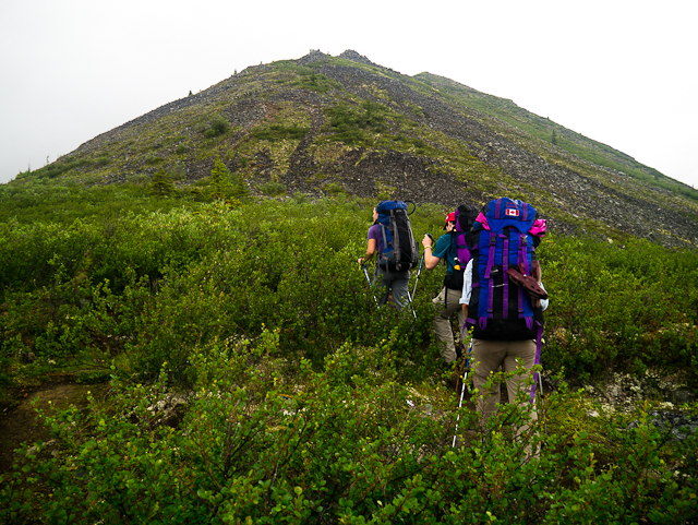
Shortly after, you will leave the trees and enter the brush. The first viewpoint is just before you would start to really climb up the ridge.
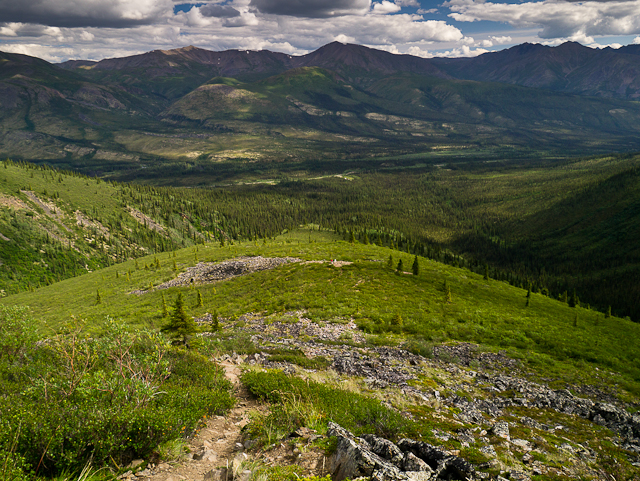
Looking back down the trail from above the first viewpoint.
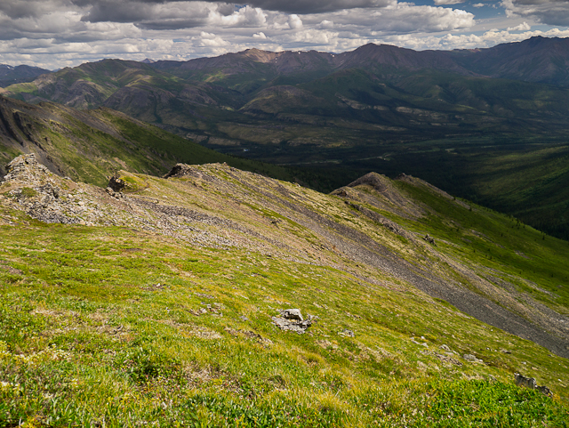
If you decide to go up the ridge, you can continue for as long as you like.
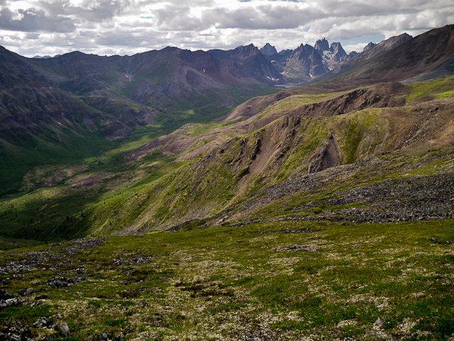
Mount Monolith and Grizzly Valley.
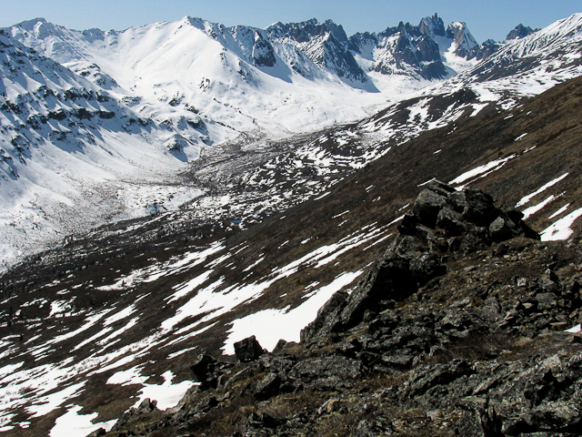
Mount Monolith and Grizzly Valley in the spring.
KP July 5, 2020
Did this June 15th, 2020. Loved this hike, and wish I had begun it earlier in the day so I could have spent more time hiking the ridge past the GPS trail. The most fun hike I did in either Tombstone Territorial Park or Kluane National Park during my Yukon travels.
Kyle September 3, 2019
Hiked on Aug 27, great easy trail with nice fall colours at this time.
Rebecca May 22, 2017
beautiful view if you go up to the top it is worth the extra effort. We went May 26th 2017 patches of snow remain as you come up to the view point it is still hikable but keep an eye on the trail
Fabio June 20, 2015
I hiked this on 2015-6-18 with excellent weather conditions. The description provided here is accurate. I would definitely not stop at the first viewpoint but continue another 20' of steep climb to get to the second one, as the views are rewarding. I saw a moose that was having breakfast just at the side of the trail, in the middle part with shrubs. To note, in places shrubs have grown and make the passage pretty narrow (especially is one uses hiking sticks)
Alex Campbell April 23, 2014
Snowshoe'd up to the Mount Monolith viewpoint over Easter weekend. Snow conditions were great early in the morning and degraded in to a bit of a mush as it warmed up. Trail was navigable for most of the way, with a few exceptions with drifts. There's still tons of downed trees (albeit much of it bucked up) from a big wind storm last fall, but overall things looked great!
