Total Distance: 4 km
Return Time: 1.5 hours
Elevation Gain: 210 m
Difficulty: Easy
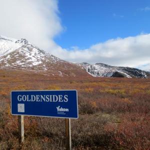
Region: Tombstone
Traditional Territory: THFN, NNDFN
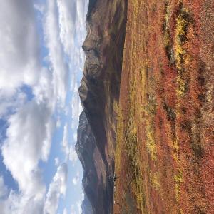
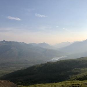
This is one of the most popular trails in the park. It is close to the Tombstone Campground and is an easy walk that provides great views down along the Dempster Highway, the North Klondike Valley to Tombstone Mountain, and the mountains and ridges to the west.
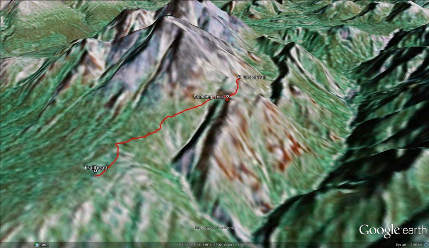
From the Tombstone Campground, drive north on the Dempster Highway to kilometre 74 and look for a sign with Goldensides trail on it on the east (right) side of the highway. Turn right here and drive up to the microwave tower and park (be sure to leave space for maintenance vehicles). You can also walk to the trailhead from the Tombstone Campground.
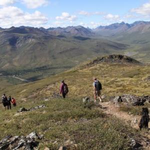
From the trailhead sign, follow the well established path (for Yukon standards!) as it meanders through the shrubs. The trail is easy to follow and it makes its way up to a small ridge below and to the north of Goldensides Mountain. After 1.5 kms, the trail forks, where you can take the path to the right to the top of a rocky platform with an interesting vertical rock column.
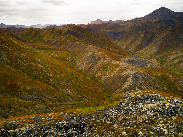
Back to the fork, the path to the left continues up to the end of a small ridge where you get a fantastic view of the valleys, mountains, and ridges to the west. Mount Chester Henderson is on the immediate right (south), and Mount Robert Henderson is the peak in the distance at the far end of the same ridge.
When you are ready to return, follow the same route back out. On your way back, the view to the west is still amazing, as you will be looking down the North Klondike Valley all the way to Tombstone Mountain. You can see the top of Mount Monolith in the distance as well.
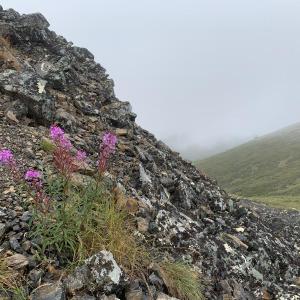
Note, it is possible to scramble up to the summit of Goldensides from the end of the trail, but Yukon Parks does not recommend it, as the vegetation on the sides and summit of Goldensides are quite fragile. To get to the top, you have to scramble up the steep, rocky south side of the mountain and then continue a little further to the highest point where you get a 360 view of the area.

Goldensides Mountain. Boardwalks cover the muddy sections of the trail, which goes below the right shoulder of the mountain.
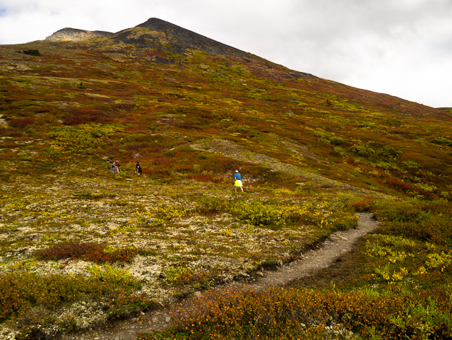
The trail is easy to follow and the elevation gain is gentle.
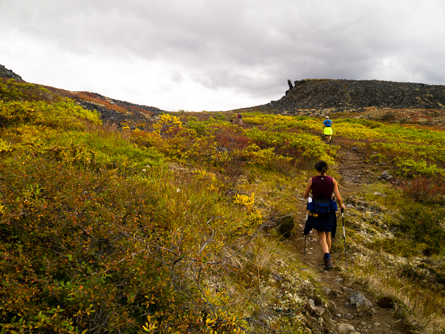
A fork in the path leads to a small rocky platform with an interesting vertical rock.

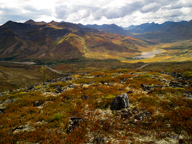
Looking south down the Dempster Highway towards the campsite and interpretive centre.

A view of Mt. Monolith and Tombstone Mountain to the west, at the end of the North Klondike valley.
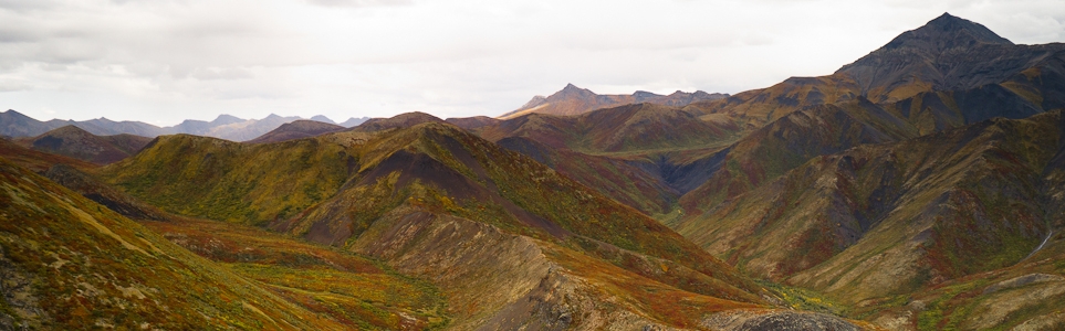
A panoramic view to the west from the rocky platform.
A view to the east from the end of the trail.
Theresa Soulliere August 17, 2021
The weather is beginning to change and fall colours are right around the corner. Hiking this trail even in cloudy weather is amazing, as you end up in the clouds by the end.
Cheryl T February 28, 2021
The colours of this park in the fall were spectacular!
JCM July 6, 2019
Did this trail on June 30th at 10pm. It is really nice, easy trail with rewarding views. Perfect if you are just driving through or are looking for something shorter.
Murray Lundberg August 9, 2017
I hiked Goldensides twice last week - the first time on a cloudy evening with a Yukon Parks interpreter, and the next brilliant sunny day with 2 geologists from the Yukon Geological Survey. It's an excellent trail, with spectacular views the reward for a moderate effort.
Shailyn July 19, 2017
Took my visiting brother up to tombstone for the day. I always find this trail to be super scenic for little physical work. The trail was in great shape. Friendly hikers and marmot at the top.
H. September 12, 2015
Hiked this trail on the long weekend. Great views, easy walk up the side of the mountain.
Some snowy/muddy patches.
Fabio June 20, 2015
I hiked this trail on 2015-6-19, the weather was excellent and the views amazing. I would like to point out that the small sign on the road indicating the secondary road leading to the microwave tower is on the east side, not west as described here. Also, I cannot figure the elevation diagram shown here, as the trails gently raises of about 100 m to the first ridge. In other words there is no dip after the start.
I highly recommend it to anyone
Doug Moyer September 10, 2014
really nice, well marked trail. The elevation map here shows a drop of 200 meters at the start, I thought it was closer to a 20 meter dip starting from the microwave tower parking lot.
MorningStar Leon September 7, 2012
I didn't get to hike anything like the trails I wanted to this summer, because while I was training for the Yukon River Trail marathon I had angina pain and now I'm waiting for bypass surgery. But the doctors have all been telling me I'll be training and climbing mountains again NEXT summer, and I can't wait.
