Total Distance: 7 km
Return Time: 4.5 hours
Elevation Gain: 873 m
Difficulty: Difficult
Region: Tombstone
Traditional Territory: THFN
This long ridgewalk offers varied vistas, neat rock formations, and opens up many options for exploring the surrounding area. From the viewpoint up on the high ridges you get a birds-eye view of Alpine Lakes and Fold Lake. And if the weather permits you can even push on to the summit of Fold Mountain (1,973 m).
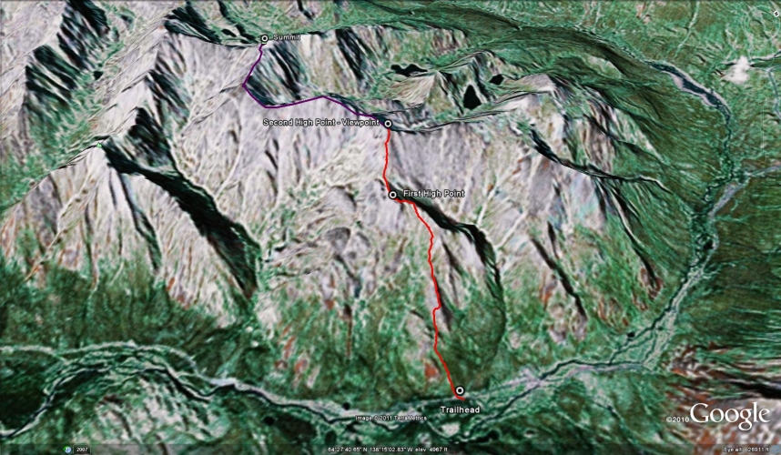
Drive to kilometer 65.5 of the Dempster Highway, just north of the Highway Maintenance Camp. Park safely off to the side of the road.
NOTES ABOUT BAKCOUNTRY TRAVEL OFF-TRAIL IN TOMBSTONE TERRITORIAL PARK:
This is a route, not a trail. It is advised that you are experienced in route finding, backcountry travel, and are well prepared and self-reliant. Choose durable ground and spread out to prevent creation of new trails on the fragile tundra vegetation and permafrost. Avoid wet or muddy areas where possible and stick to higher group and follow ridgelines.
Registration is mandatory for camping within the park. Please visit the Tombstone Interpretive Centre to acquire the correct park permits, and receive up-to date information on trail conditions, closures and wildlife activity.
Park approved bear-resistant canisters are mandatory (only hard shell, not soft bags) for all backcountry camping. Dogs must be on a leash at all times and fires are not permitted.
----------------------
The hike starts with a short bushwack through the willows. There is a small stream that winds through this area so pick your stepping spots carefully. Once through the willows it is much easier walking up the slope, as the dwarf birch is much shorter. As you work your way up the slope, avoid the rocky outcrop above you, and aim towards a small gully on the right where you'll be able to most easily access the ridge. Some steeper rock scrambling is required to get up to the ridge.
Continue along the ridge as it wraps around and up to the first real high point you can see (after 662 m elevation gain). You can avoid the ups and downs of the ridge by walking just below it to the left (south). There is a large rock cairn on the top of this first high point.
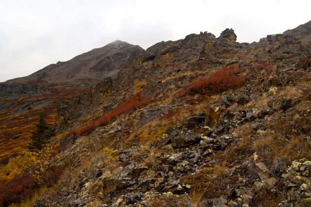
From this point, you will continue down along the ridge to the west and then up to a second high point (another 211 meters elevation gain). This climb can be a little steep and gets narrower and rockier towards the top as you work your way up to your right. There are some neat rocky pillars along the way and great views down into the valleys on either side.
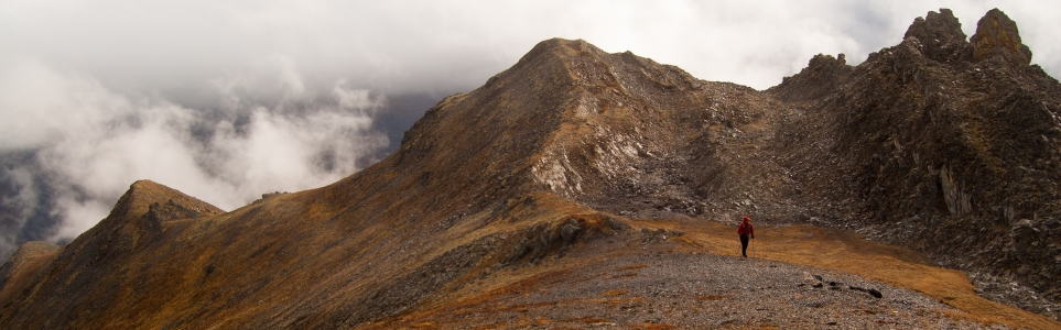
After reaching the second high point on the ridge, you are rewarded with a 360 degree view, including a glimpse of both Alpine Lakes and Fold Lake. This point offers a satisfying turnaround spot, but if you wish to continue to the summit of Fold Mountain follow the west ridge for another 3 km and 80 m elevation gain. There is also the option to follow the right, northeast ridge to meet up with the Alpine Lakes Viewpoint route that actually returns to the Tombstone Park Campground (at km 71 of the Dempster Hwy). Distance and time for this route not included.
The trailhead, a wall of willows, as seen from the highway km 65.5.
Climbing up the slope to access the main ridge (some rock scrambling required).
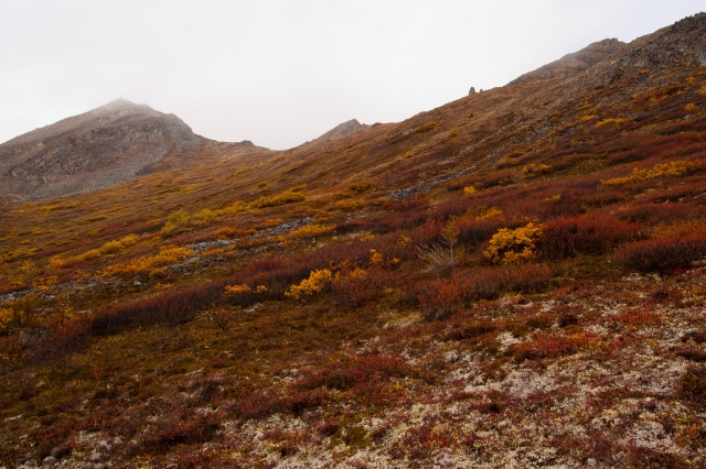
Looking towards the first high point along the ridge.
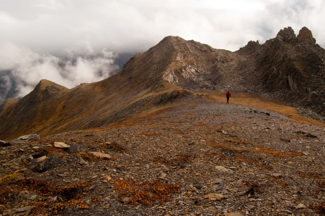
Traversing the ridge from the first high point, towards the second.

Climbing up to the second high point on the ridge.
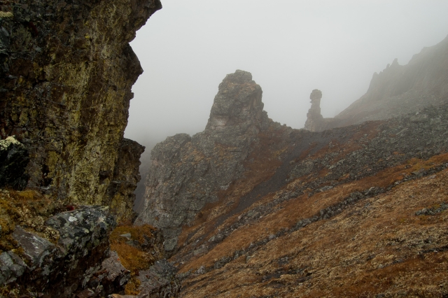
Neat rock pillar formations along the way.
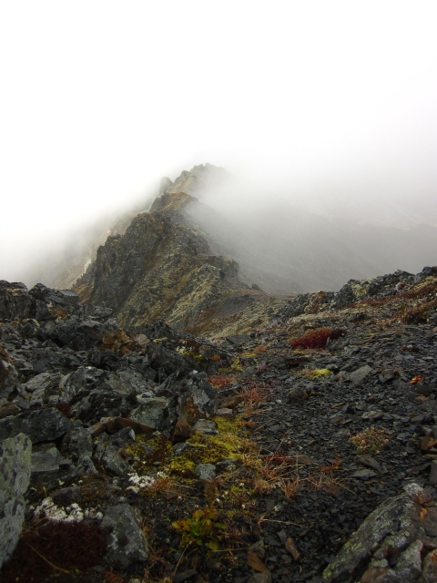
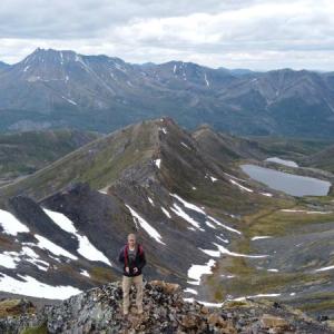
This ridge continues to the summit of Fold Mountain (hidden in the clouds), as viewed from the second high point.
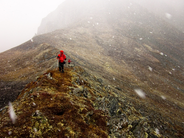
Rapidly changing weather can mean snow at any time of year.
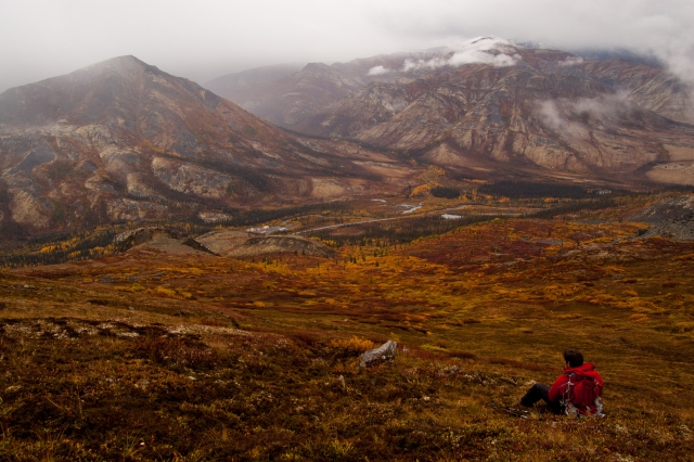
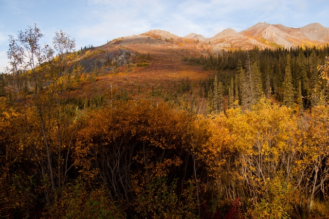
Taking a break amongst the beautiful fall colours.
Kyle July 9, 2020
A challenging hike but worth the effort.
The creek at the start is quite large with the amount of rain we’ve had this year. There is no trail which makes it tough for sure. The willows and bushwhacking were 8 feet high and accounted for a good portion of the hike. Once near the top the mountain is very rocky with lots of steep landslides. Takes a bit of brainstorming to get around the tough parts to the summit. Once summitted though great 360 views of the snowy peaks, fold lake and the alpine lakes. You have the option of exploring closer to fold lake on one end and the other end you get nearer the alpine lakes which you can also descend on and end your hike near the campground this way.
KP July 5, 2020
Did the trail on June 16th, 2020. A challenging but worthwhile hike. Unlike the nearby Grizzly Ridge, the elevation gain is far more constant. Saw a caribou from afar during my ascent.
As with many of the Yukon trails labeled 'difficult', there is no real maintained trail. I would resist the urge to cut through the willows to meet up with the GPS trail as that will add considerable time to your journey; instead walk almost all the way to the highway maintenance camp and then begin the trail roughly where the trailhead is indicated on the GPS trail. The one advantage of cutting through the willows directly from the parking area is that you can more easily avoid the stream near the trailhead.
