Total Distance: 82 km
Return Time: 4-6 days
Elevation Gain: 2452 m
Difficulty: Moderate
Region: Kluane
Traditional Territory: CAFN
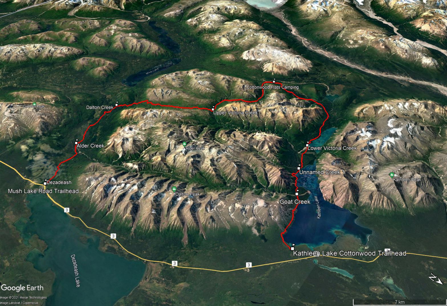
This trail is a beautiful multi-day trek in the southern portion of Kluane National Park, starting and ending at either Kathleen Lake or Mush Lake Road. The trail itself is a combination of single-track trail, old mining roads, and a 4-wheel drive road. The trail traverses spectacular lakeshores, mountain passes, creek valleys, wildflower meadows and alpine plateaus. It involves multiple creek crossings, some which can be significant depending on the conditions. There are no established backcountry camping facilities, though Parks Canada does designate some parts of the trail as 'no camping zones' due to significant bear activity. Registration with Parks Canada is required. Note a large portion of the hike is along old mining roads, with limited views, though the scenery along the lakes, expansive meadows, and alpine sections of the trail (Cottonwood Pass and Dalton Pass) make up for it.
The trail is a partial loop and the start and end of the trail are ~ 22 km apart on the highway. Therefore, either a shuttle drop-off or second vehicle drop is required, unless you want to hitchhike back to where you started. Note if starting the route from Kathleen Lake (as described here), you can drop a second vehicle up the Mush Lake Road.
To reach the Kathleen Lake Trailhead, drive south from Haines Junction on the Haines Road for 32 km. Turn right at the Parks Canada Kathleen Lake Campground sign. Stay on the main road that leads towards Kathleen Lake (ignoring the road to the left that goes to the campground) and look for a sign that says Cottonwood Trail / King's Throne Trail. Park where the sign indicates on the left. Here you will find the old mining road that is the trailhead.
To start from the Mush Lake Road (or to drop a vehicle there for the finish), drive south from Haines Junction on the Haines Road for 53.5 km. At this point there is a small brown National Park sign on the right, indicating the parking area and trailhead. The Mush Lake Road is driveable in most vehicles with good clearance to at least the Alder Creek crossing (7.5 km up the Mush Lake Road). It is worthwhile cutting off those 7.5 km of the trail if you can manage the drive. If you are driving to Alder Creek, ignore any side roads that lead to private property or the Shorty Creek Trail (about 2.8 km on the right). You will see a large log trail marker for 'KM 7.5' of the Cottonwood Trail at the alluvial fan of Alder Creek.
NOTE: This description is based on doing the trail from Kathleen Lake to Mush Lake Road. This ensures you hit the most significant creek crossing (Lower Victoria Creek) early in the trip. This direction also has easier uphill sections and leaves the largest elevation change as a descent on the last day (from Dalton Pass to Mush Lake Road). Since the trail is a partial loop and the start and end of the trail are not close to each other, see Driving Directions about dropping a second vehicle.
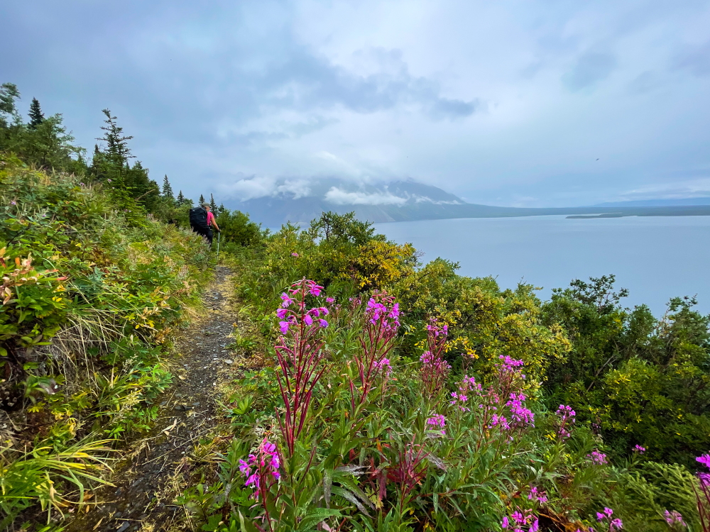
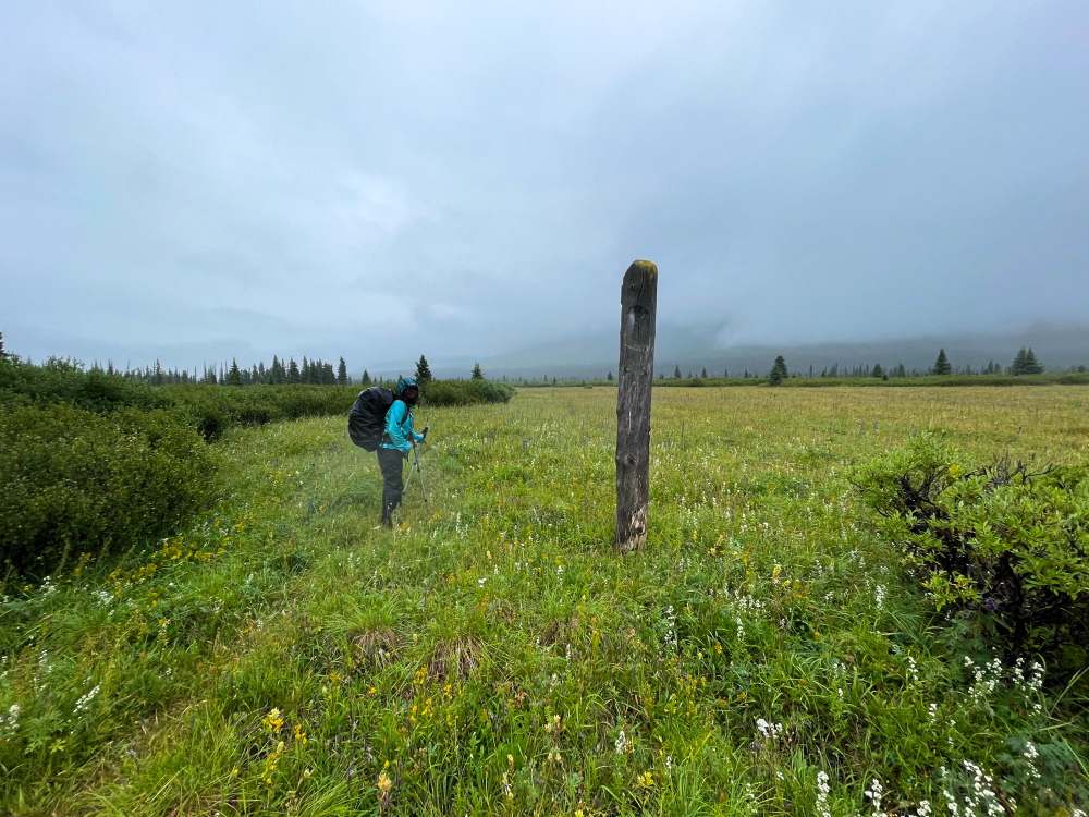
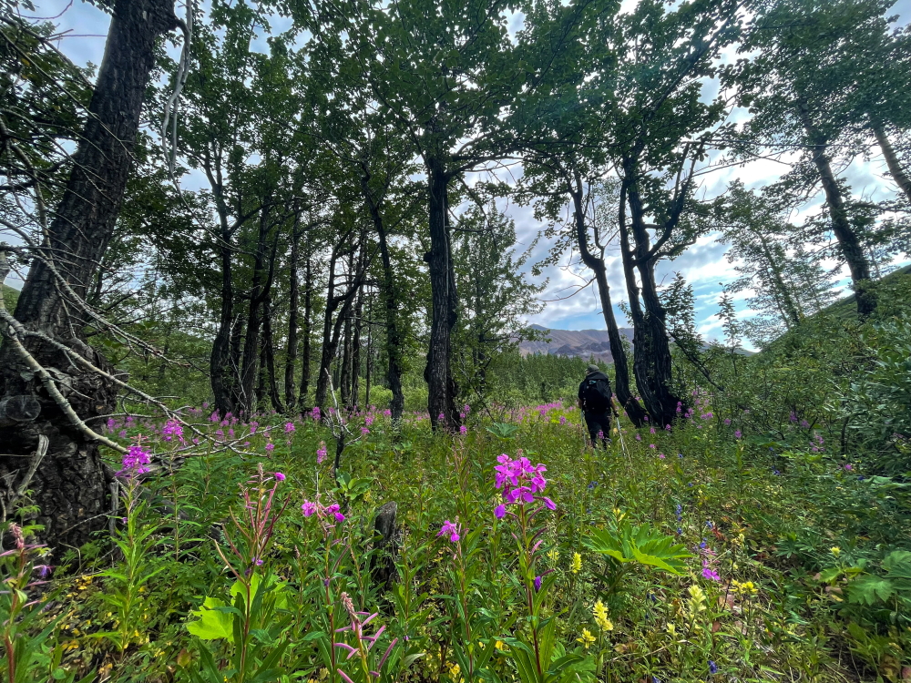
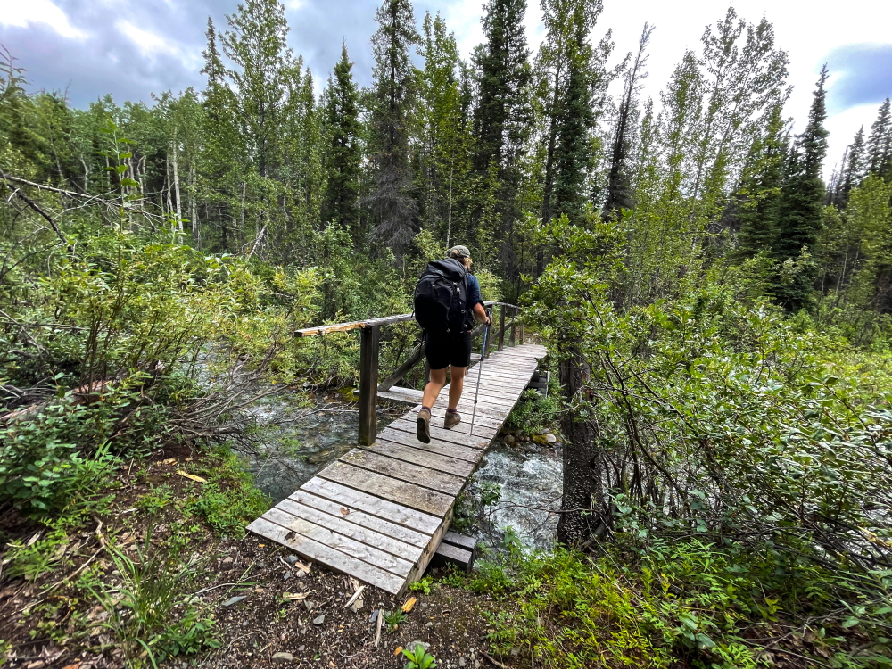
Starting at the Kathleen Lake trailhead, follow the old mining road for the King's Throne & Cottonwood trails. After 2.2 km, the Cottonwood Trail forks to the right onto a single-track trail (the King's Throne trail keeps left). This section of the Cottonwood Trail takes you along the forested slopes of King's Throne with views of Kathleen Lake. There is a bit of gradual up and down through the forest and you cross a few small rocky avalanche tracks. After a total of 5.3 km from the trailhead, you'll reach one of two big talus slopes. Follow the worn trail over the rocks and watch for rock cairns. You get some nice views of the lake and surrounding mountains here. After the second, larger talus slope, the trail then switchbacks down to the shores of Kathleen Lake.
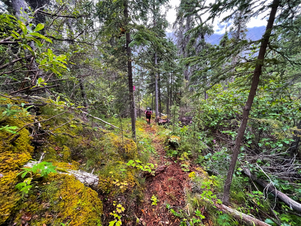
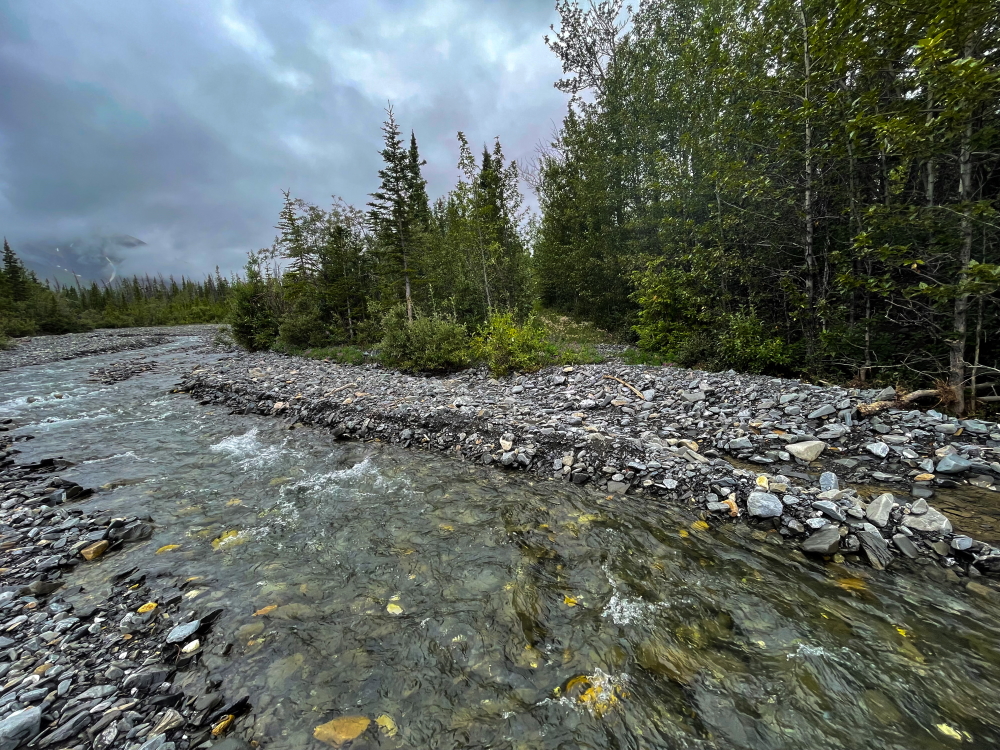
Follow the trail along the lakeshore for a short while and then pick up the trail again that leads into the forest. This part of the trail is an old mining road. You'll reach the first creek crossing, 8.1 km from the trailhead - GOAT CREEK. NOTE there is NO CAMPING allowed here, due to bear activity. You will need to continue another 5 km to an Unnamed Creek for the first possible camping spot. The crossing of Goat Creek is quite braided where the trail comes out of the forest, or you can go slightly upstream to find an even better crossing. Pick up the mining road on the other side that goes through the forest again. After another 1.5 km you'll reach the lakeshore again. The trail then follows near the lakeshore for a while until you reach a section where a more recent LANDSLIDE has taken out the shoreline. Look for a detour up to the left here.
This detour trail is not very pleasant and is less developed, but easy to follow with flagging. It is steep and rooted, and about 1 km long with 100 m of elevation gain. At least you get a nice view looking west over Kathleen and Louise lakes at the top. The detour eventually drops back down to the lakeshore and along another section of old mining road until you reach an UNNAMED CREEK crossing. Camping is allowed here though there is not a lot of space. It is only another 4.2 km until you reach Victoria Creek where there is nicer camping. This Unnamed Creek is smaller than Goat Creek, but you may need to still use creek crossing shoes so you don't get your boots wet.
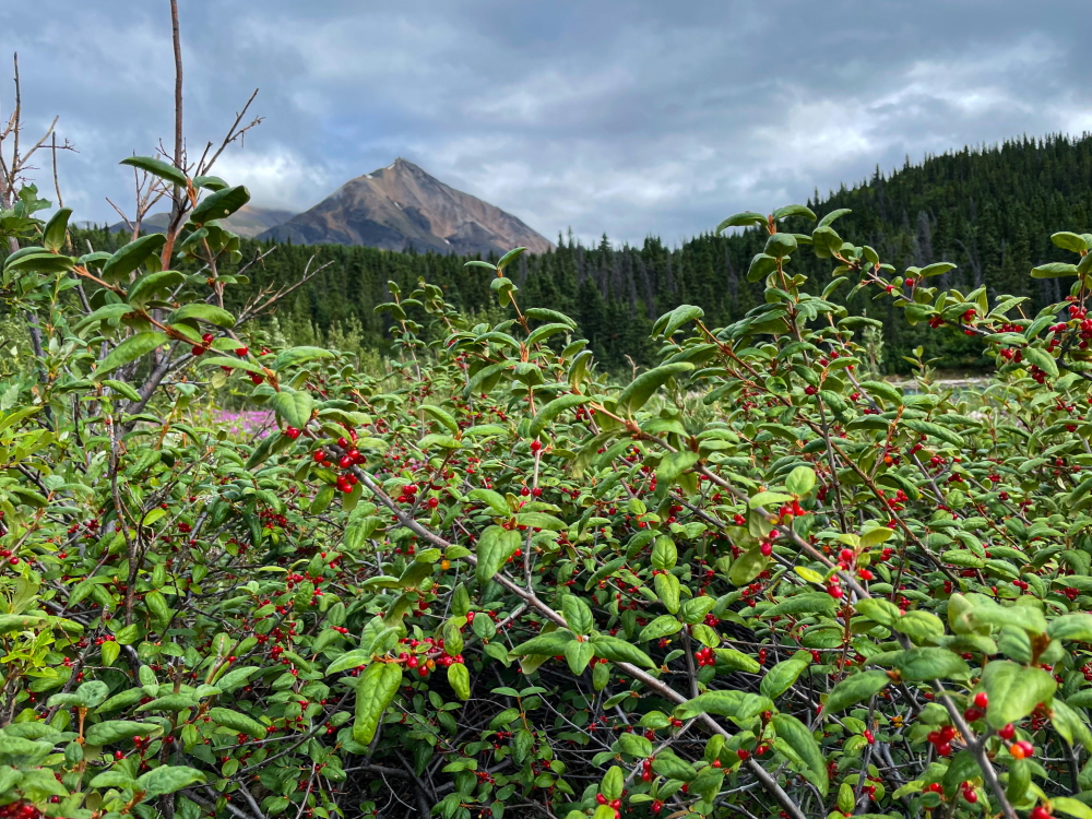
Now the mining road will traverse a section of land between Kathleen and Louise lakes. You will pass a lot of poplar stands, meadows and soapberries galore! There is a lot of bear activity here; hence, why there is no camping allowed until you reach Victoria Creek.
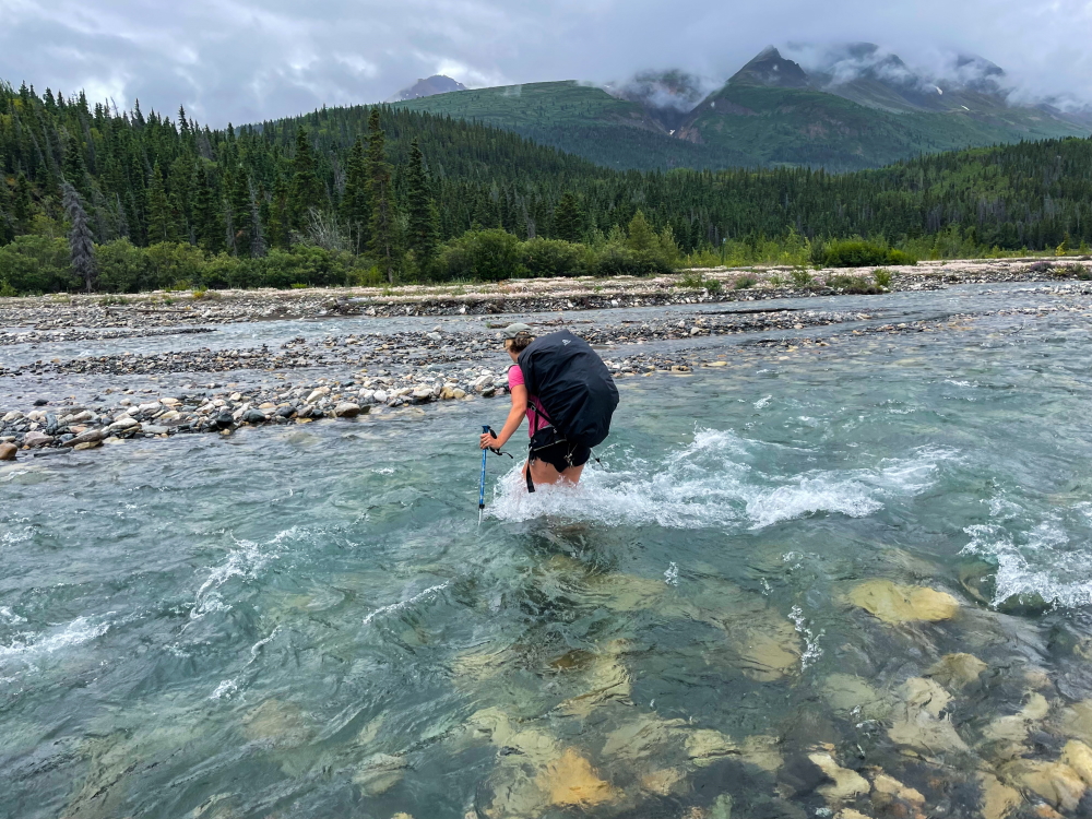
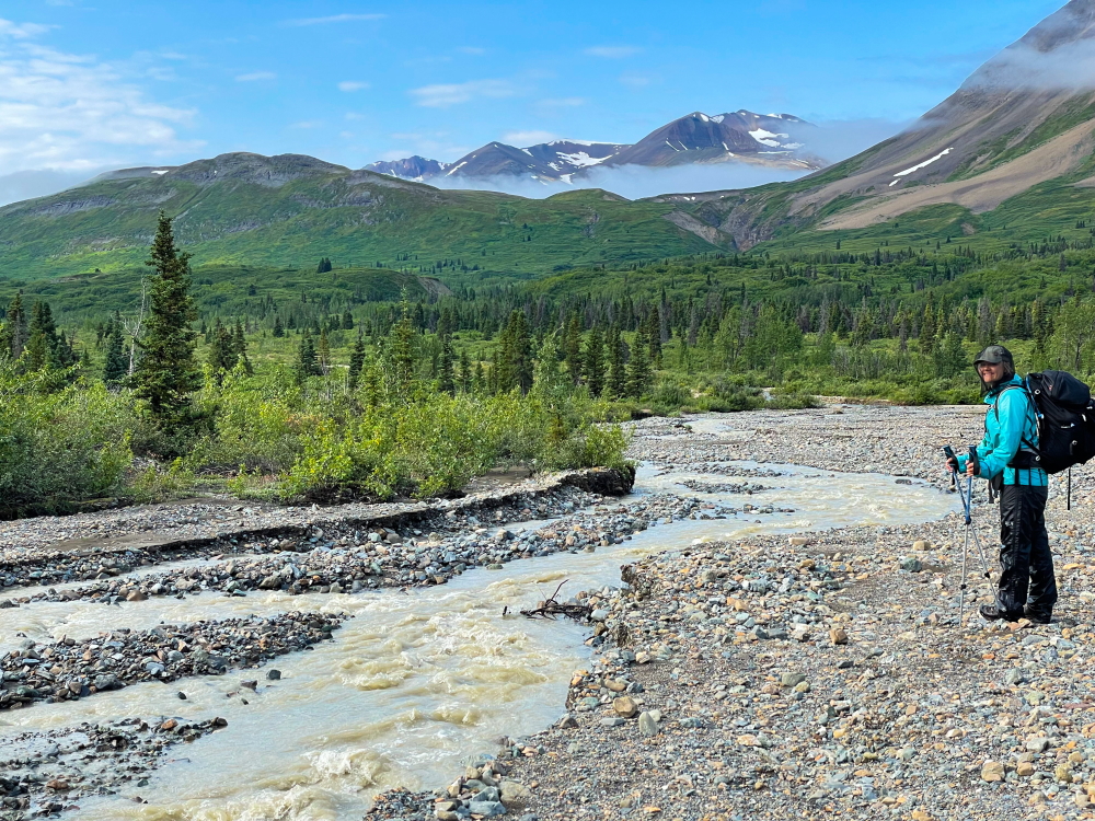
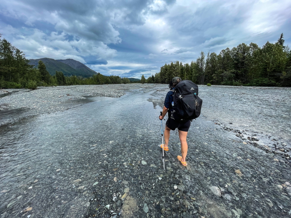
You will eventually reach the extensive open alluvial fan of LOWER VICTORIA CREEK. This is about 17.3 km from the trailhead. Follow any trail markers you see southwest (downstream) for about 100-200 m to find the best crossing of the creek. This crossing of VICTORIA CREEK is the major creek crossing of the trip. Look for the safest crossing and watch for trail markers on either side of the creek. During our trip in August 2021, we still found the safest spot to cross was up to thigh-high at the time. Hiking poles and water shoes are a big help for crossing safely.
NOTE: There is NO CAMPING after Victoria Creek until you reach Cottonwood Flats (another 18.7 km), so Lower Victoria Creek is a good destination for Day 1 or Day 2 (if you camped at Goat Creek). The expansive alluvial fan has great camping options as well as down by Louise Lake. If the creek looks doable in the afternoon/evening, go ahead with the crossing and camp on the other side. Otherwise wait for the morning when the water levels are usually lower (as lower nighttime and morning temperatures result in less snowmelt runoff). Exception would be if you expect rain overnight.
Once safely across the creek, pick up the trail on the other side, which is marked with trail marker posts. The old mining road leads into the forest. There is a bit of elevation gain up and down along the road as you contour the edge of the mountains. The views are few and far between for the most part, but you may still catch glimpses of the surrounding mountains. There are a few small creek drainages that flood the trail along some portions. Depending on the rainfall these may require detouring through the bush a bit.
The trail eventually contours to the left (south) towards and above Sockeye Lake. There is another smaller creek crossing of an UNNAMED CREEK (~10 km from the Lower Victoria Creek area). After that creek crossing the mining road continues south above Johobo Lake and eventually past the old Johobo mine site on the mountainside (to the east). You can see the old mine workings on the mountain side. There is a flat boggy and muddy section shortly after this, which may be possible to cross in your hiking boots depending on recent rainfall.
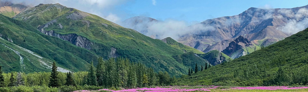
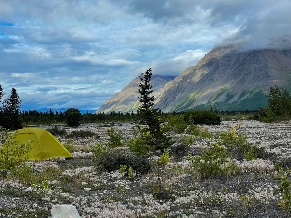
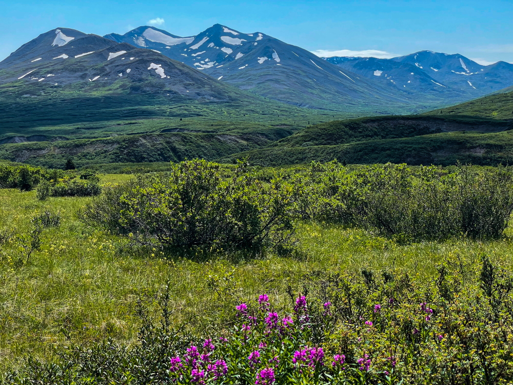
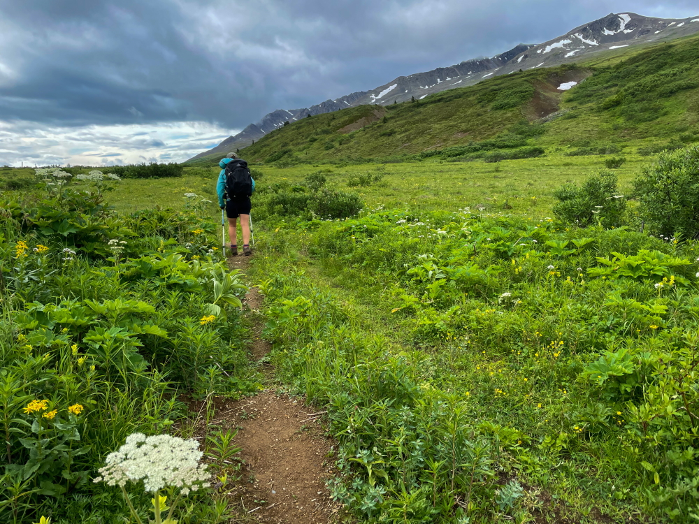
The trail continues through mature spruce forests and lush bush after that. There is another UNNAMED CREEK about 5.4 km from the previous unnamed creek, which has created a deep wash out. The creek is easy to hop across and the trail continues on the other side. After another 2.1 km on the mining road, you will leave the wider mining road and head down to the right (southwest) on a single-track trail. This gradually leads downhill to COTTONWOOD FLATS. Before reaching the official start of the flats, you'll reach a marshy area and tiny stream. Get water here as there is no water at the flats. Once you reach the open grassy meadow of the flats with wildflowers and nicely spaced spruce trees, you are in the designated camping area between the 'KM 46-49' markers of the trail. The views open up of far away mountains to the northwest towards the Kluane Range with Mount Archibald and Mount Cairnes, as well as the closer mountains all along the Cottonwood Creek Valley (Campsite Peak area). Find a suitable camping spot anywhere.
From the flats, continue on the trail which leads into a mature spruce forest. It is less than 1 km through the forest until you reach the crossing of a TRIBUTARY OF COTTONWOOD CREEK. Look for the trail marker on the other side and cross wherever is easiest. Most of the time you can use rocks to jump across without needing to use creek crossing shoes. From there you will start to head east up the valley, through a short section of forest and then the trail opens up into the first expansive meadow. Note the 'Cottonwoods' are actually balsam poplar (Populus balsamifera spp. balsamifera - a relative of the black cottonwood trees found further south).
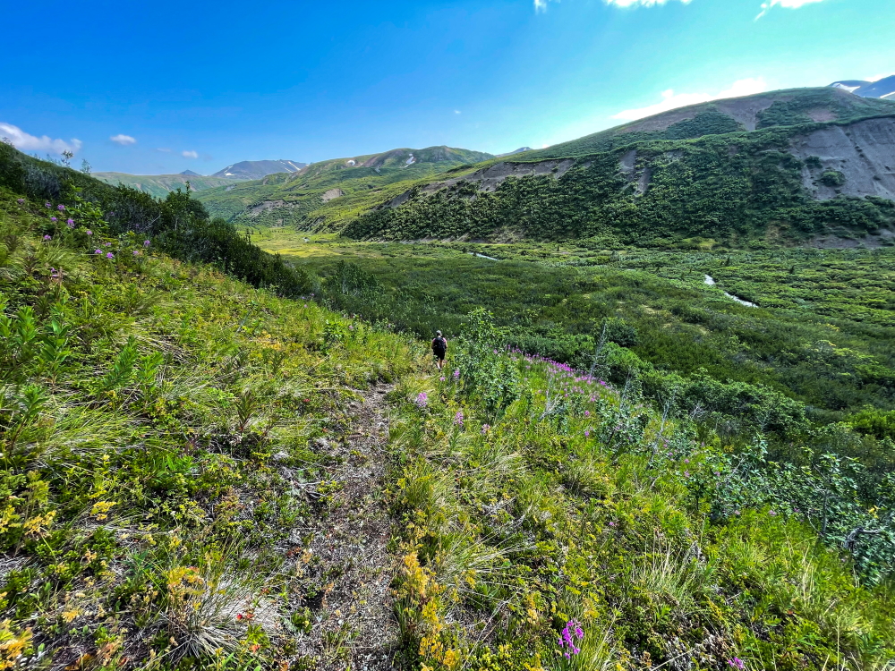
As you continue east up the valley, you are in one of the most spectacular parts of the trail - the COTTONWOOD MEADOWS! The most expansive meadows of fireweed, yellow paintbrush, delphinium, monkshood you've ever seen go on and on amongst poplar groves. It is easy walking, and very gradual following the trail, as you approach the beautiful mountains at the head of the valley. This extensive meadow and poplar grove section extends for about 5 km.
There is a trail marker for 'KM 42' of the trail. This is shortly after the trail crosses a small tributary of the creek that you've been following up the valley (on your left / to the north). Now the trail is sandwiched between these two creeks, as the trail continues heading east. There are a few sections where you're in a gravel floodplain, amongst the poplar trees. Late in the summer this is quite overgrown, but try to keep to the trail and keep going east (don't cross any creeks). Eventually towards the head of the valley, the trail will turn southeast (right) and gain more elevation as you climb to the pass. You will soon cross the small tributary that has been on your right and continue to follow the trail.
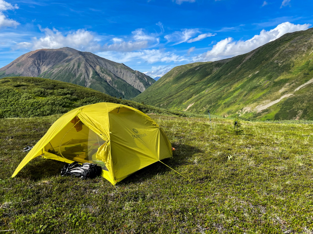
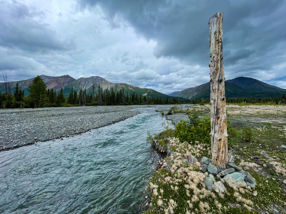
The trail starts gaining more elevation now and stays on the left (northeast) side of the valley and eventually reaches the subalpine of COTTONWOOD PASS. Make sure to look back and admire the view of the mountains behind you. The trail goes through alpine rocky/gravelly areas, and becomes less defined where you'll need to watch for cairns and tracks. It gradually heads right (south) and then straight again down the pass. You'll reach a nice little UNNAMED CREEK draining from mountains to the left. This is part of the headwaters of Upper Victoria Creek. There is decent camping here with water and nice views if you are taking your time on the trail. This is about 10 km from the Cottonwood Flats camping area.
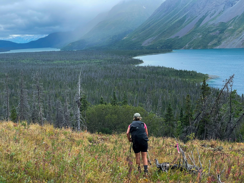
The trail continues from here, now down from the pass. You'll get great views of the mountains now to the south and southwest. The trail will drop down about 100 m into the UPPER VICTORIA CREEK VALLEY. You'll pick up an old mining road again here in the valley at the confluence of Beloud Creek and Victoria Creek. Follow this trail downstream (east). There are suitable camping areas all along this section, with the creek as your water source, but it is in a narrow valley and if you can make it a bit farther it is worth getting up to the next alpine area in Dalton Pass.
Hike down the old mining road beside Victoria Creek for 2.7 km, until you reach a small fork in the trail. Note you will be gradually losing some elevation here and dropping into more bushy vegetation. Take the fork to the right that leads to the UPPER VICTORIA CREEK crossing. You will see trail markers on either side of the creek for the best crossing area. The creek is not braided here but does not have as much volume of water as the lower section you crossed earlier in the trip.
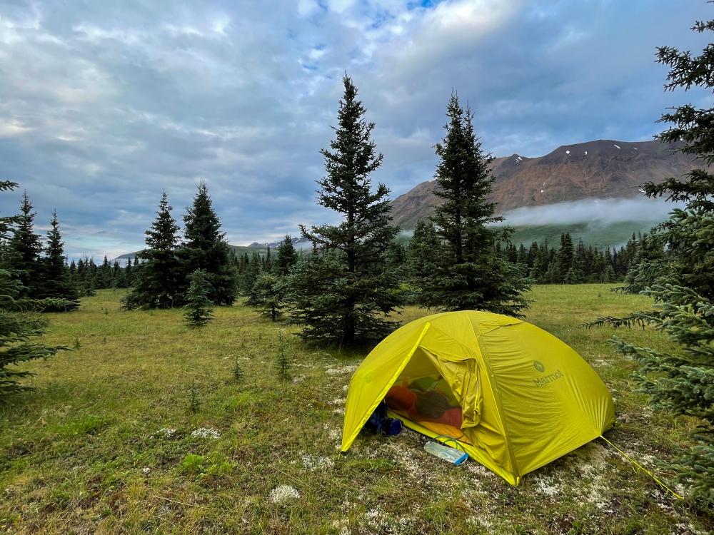
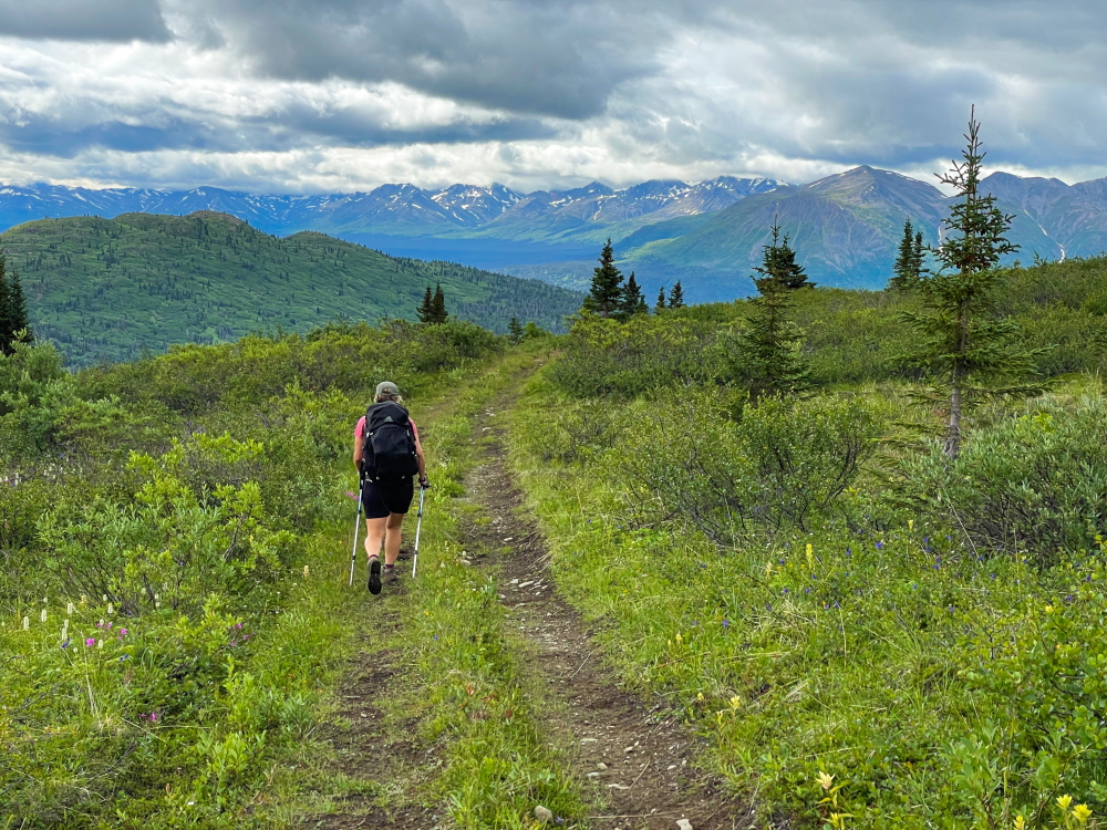
After crossing Upper Victoria Creek, the trail heads up the next narrow valley on the right. You'll soon cross another smaller creek (Shrike Creek) and pickup the old mining road again heading south. You should be able to find an easy crossing without putting on creek crossing shoes. The mining road shortly crosses Shrike Creek again and immediately switchbacks to the right and up the slope to the west. It is easy and gradual from here as the trail traverses south across the slope. This section takes you up to Dalton Pass. After about 2.5 km of hiking on the old road after crossing Shrike Creek (for the second time), you'll reach the alpine and start to find many good camping spots off the road. There are many small streams that cross the trail - good water sources along the way or for your camp. You can keep going further as there is good camping for the next 2 km with meadows and streams and mountain views opening up to the southeast leading up to the 'KM 27' Marker and DALTON PASS. This area also offers good opportunities to explore the accessible mountains to the west for some side trips.
Once you reach the actual pass, the road starts to head gradually down the valley where you will start to follow above Dalton Creek. Heading into the subalpine and eventually back into the forest. The old mining road drops about 460 m elevation down to meet the Mush Lake Road. It is just over 10 km from the 'KM 27' Marker to the trail junction with the Mush Lake Road ('KM 16.5' Marker). Head left on the MUSH LAKE ROAD and shortly you'll meet DALTON CREEK. There was no footbridge to be found when we did the route, but the crossing is wide and not too deep.
From Dalton Creek to the next creek crossing is about 4.5 km. There is a footbridge on the upstream side of this UNNAMED CREEK. From here it is another 5 km to the Alder Creek crossing. The Mush Lake Road is easy walking with some gradual ups and downs.
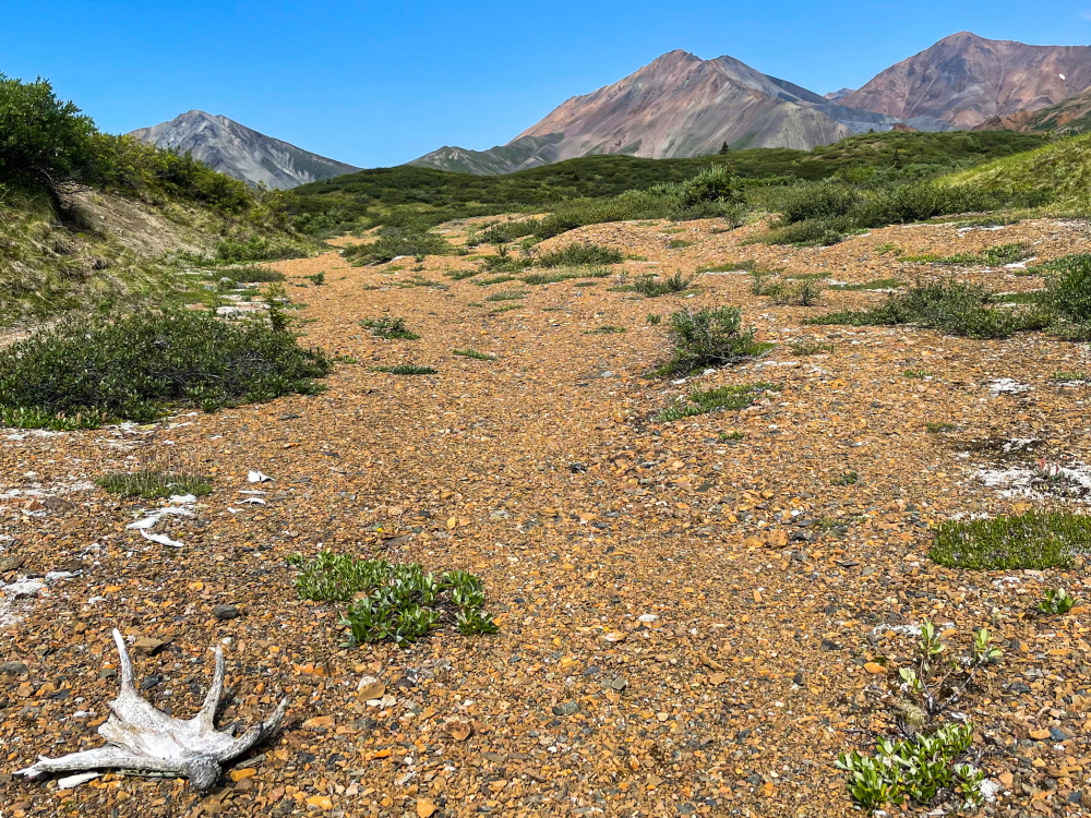
The ALDER CREEK crossing has many branches extending about 300 m across the gravel floodplain. The channels likely move from year to year. It is the most significant crossing along the Mush Lake Road, but with so many branches, it is not too deep. If you dropped a second vehicle on the other side of Alder Creek this crossing is the last challenge of the trail. The KM 7.5 Marker is on the other side of the creek.
Hike or drive the last 7.5 km back to the highway, the trailhead of the Mush Lake Road.
See winter route page.
Starting out from the Kathleen Lake trailhead above the lake.
The landslide detour trail between Goat Creek and the first Unnamed Creek is steep and rooted.
Views looking west of Kathleen Lake and Louise Lake after the landslide detour.
The first Unnamed Creek crossing, 13 km from the Kathleen Lake trailhead (5 km from the Goat Creek crossing).
Soapberries abound along the trail between the first Unnamed Creek and Lower Victoria Creek. No camping is allowed in this section due to bear activity.
The Lower Victoria Creek crossing is the most significant creek crossing of the trail. See tips for timing your crossing in the route description and check on conditions leading up to your trip.
There are ample camping areas in the alluvial fan of Victoria Creek and near the shores of Louise Lake. Note there is no camping allowed after this until you reach the Cottonwood Flats (18.7 km from Lower Victoria Creek).
The start of the Cottonwood Flats (designated camping area), is an expansive meadow doted with spruce trees, grasses, wildflowers and nice views.
Great camping with mountain views at Cottonwood Flats, though there is no water source here (see notes about filling up with water before reaching the flats).
Reaching a tributary of Cottonwood Creek before heading up the valley to the northeast, where you will find the expansive wildflower meadows.
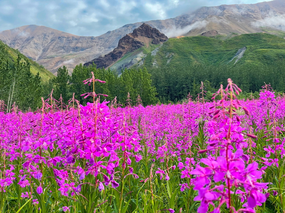
The 'Cottonwood' Meadows go on and on for kilometres as you approach Cottonwood Pass. The fireweed should be in full force in early-August.
The meadows are dotted with open poplar groves. The namesake 'Cottonwoods' are actually balsam poplar (Populus balsamifera spp. balsamifera - a relative of the Black Cottonwood trees found further south).
The trail goes through rocky alpine areas after Cottonwood Pass, where you'll need to watch for cairns and tracks. There is a small unnamed creek in this area too, so it is a good camping spot if you're not trying to make it closer to Dalton Pass.
The trail crosses alpine meadows heading down to the Upper Victoria Creek valley with views of Beloud Peak and Virgin Peak.
Descending down to the Upper Victoria Creek valley to pick up the old mining road again.

The crossing of Upper Victoria Creek is not braided, but there is less volume of water than the downstream crossing.
Once passed Upper Victoria Creek and Shrike's Creek, you start to gain elevation again up towards Dalton Pass. There are many options for camping in the alpine here, with abundant little creeks as water sources.
Hiking towards Dalton Pass through beautiful alpine meadows. This area has side-trip options for hiking some peaks if you have extra time.
As you hike down from Dalton Pass towards Mush Lake Road, the views to the south open up.
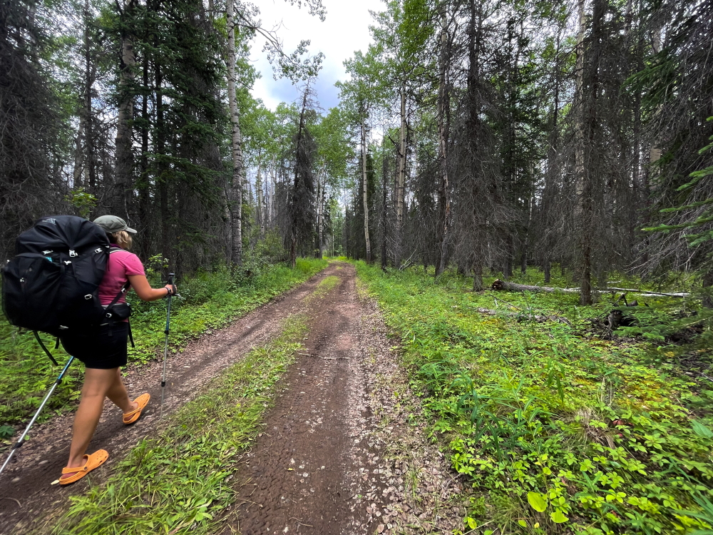
The final stretch of the trail is along the Mush Lake Road. It is very easy walking with gradual ups and downs and a few creek crossings.
There is a small footbridge over an unnamed creek after the Dalton Creek crossing.
The crossing of Alder Creek is very braided and expands across a gravel floodplain area that extends about 300 m.
On the other side of Alder Creek is the KM 7.5 Trail Marker. You can drive the Mush Lake Road 7.5 km from the highway to this area and leave a second vehicle for the end to shorten the hike along the road.
Pippa Lawson October 4, 2022
If you want to camp after Dalton Pass and before Mush Lake Road (as we did), there are not many good options once the road descends into higher bushes. As Parks notes, there is an old camp partway down in the trees, just off the road. The camp is located in a long, relatively flat, open and grassy stretch with no water source. Despite a remarkable bear stomp (worth a detour to see!), there was no recent sign of bear activity when we were there in late July. The closest/easiest water source, if you camp in that area, is just a few hundred meters down the road where Dalton Creek runs right up against the road, well before Mush Lake Rd.
Anthony May 20, 2022
Obviously Parks Canada wants you to stay off the slide but the far easier option is a short scramble up and over the base of the slide rather than the extensive detour. This is quite doable even if you are carrying a bike. There are a couple of obvious use trails and some old flagging.
