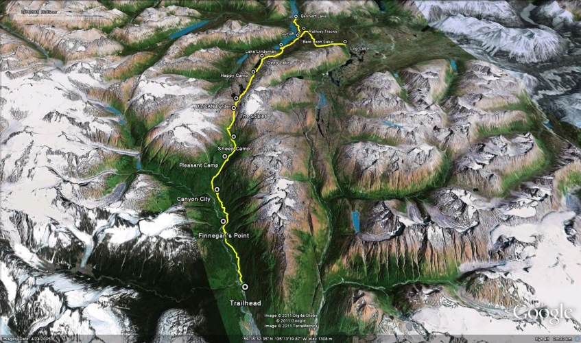
Total Distance: 53 km
Return Time: 3-4 days
Elevation Gain: 3654 m
Difficulty: Moderate
Region: White Pass
Traditional Territory: STC, CTFN
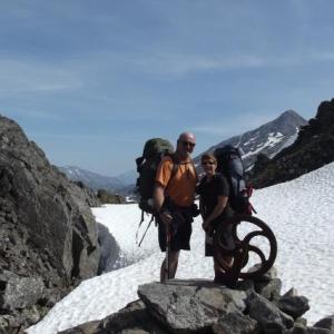
Follow the stampeders' trail on the infamous Chilkoot Trail. The trail wanders through a diverse landscape - from wet coastal rainforest, up to the rocky alpine and then to dry, lichen covered forests. There are campsites along the trail and facilities are provided at every site. Note registration is required with Parks Canada (Yukon) or the National Park Service (Alaska).
You can either take a shuttle from Skagway, or drive to Dyea yourself. If you choose to drive, head out of Skagway and look for the sign for Dyea, about 1 km out of the Skagway town center on the left. Follow the Dyea Road for about 6.5 km to the Dyea Campground. You must park at the campground parking lot, as overnight parking at the trailhead is prohibited. Walk out of the campground and turn left. A couple hundred meters ahead is a bridge over the Taiya River. To the right of and before the bridge is the signed trailhead.
If you plan on camping along the trail, you must book ahead of time. Check the Parks Canada website for details.
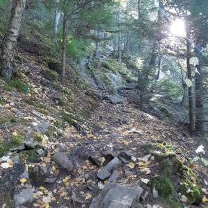
The trail begins through coastal rainforest. It starts with a steep climb and a few ups-and-downs. The trail stays quite flat with very minimal elevation gain.
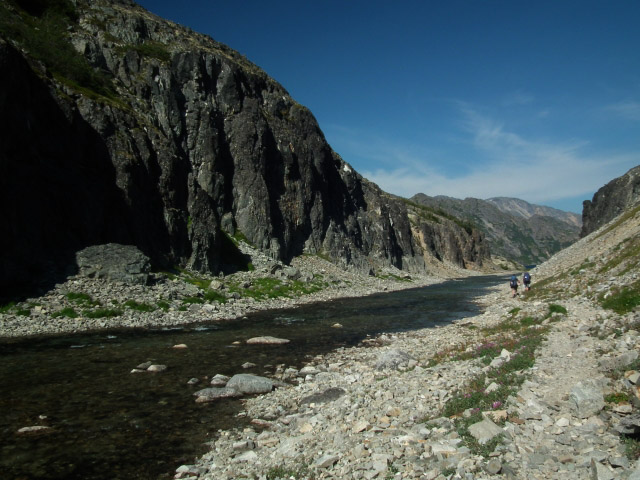
The trail stays in the forest following along the Taiya River. Every so often the trail comes right to the Taiya River, offering a less obstructed view of the surroundings.
After 7.7 km, you will reach Finnegan's Point, the first campsite on the trail. Because this campsite is so close to the trailhead, it is mostly used by hikers starting later in the day.
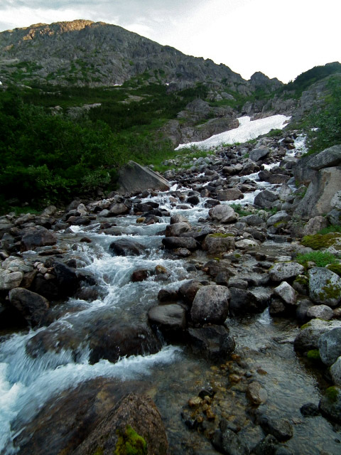
From Finnegan's Point, the trail continues along the Taiya River and through the forest. There are a few glimpses of glaciers, high up in the mountain tops.
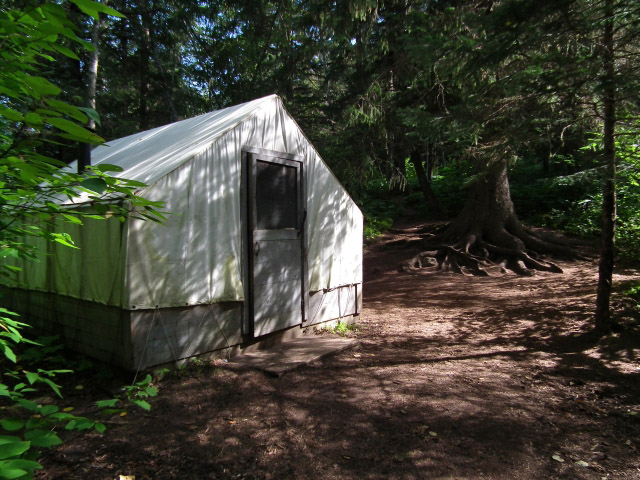
After another 4.4 km from Finnegan's Point (a total of 12.1 km), is Canyon City, the second campsite on the trail. The Canyon City campsite has the same amenities as every other campsite (a cooking shelter, tent pads, outhouse, and food cache) as well as a small cabin with bunks and a table and chairs. A small suspension bridge leads to the remains of Canyon City as a quick side trip.
The trail after Canyon City starts to climb steadily upwards. There are a few more glaciers that can be seen on the way to the next campsite, Pleasant Camp. Pleasant Camp is 4.7 kms from Canyon City (a total of 16.9 km from the trailhead).
From Pleasant Camp the trail gradually leads up through the forest (for 3.4 kms) and over a suspension bridge towards Sheep Camp (a total of 20.3 kms). Sheep Camp is a very popular camp as it is the last camp before climbing the Golden Stairs. It can be a full day to the next camp, so most people stay here before going over the Chilkoot Pass. The park ranger usually gives a talk in the evening about the route ahead.
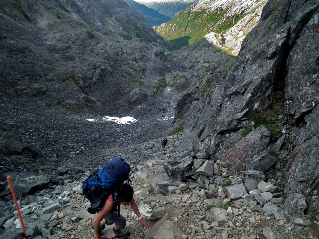
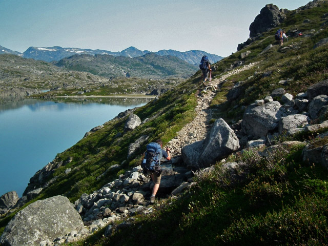
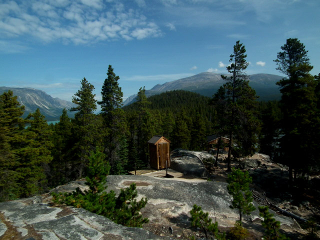
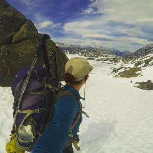
As you leave Sheep Camp, you also start to leave the forest behind as you climb gradually up the valley. The terrain starts to turn rocky as you follow a stream up to the Scales (4.6 kms from Sheep Camp). At the Scales you will find an assortment of rusted old relics from the goldrush. The Scales was a place to weigh the miners' loads and is your rest area before climbing the Golden Stairs.
It is only about 1.5 km from the Scales to the Canada/USA border, but it is almost straight up... the Golden Stairs. Don't sweat it, it's not that bad. You don't have to carry a ton of supplies up there. Take your time carefully scrambling on the boulders up to the border.
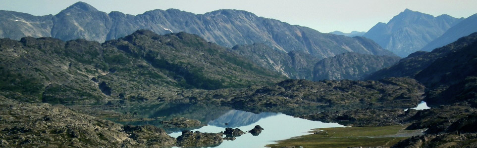
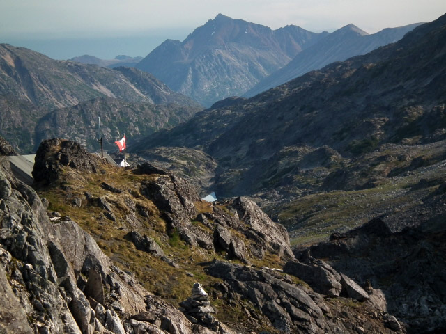
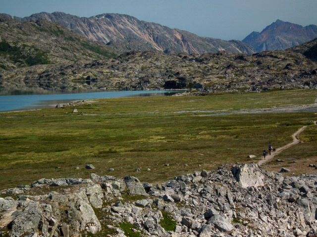
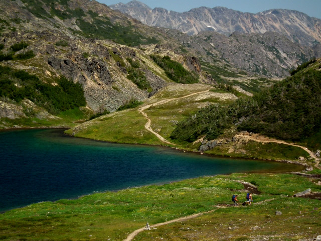
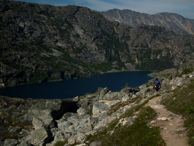
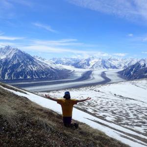
At the border you will be rewarded with an amazing view overlooking Crater Lake (if the weather is good). Snap some photos and head down towards the lake - you will be following along the right side of it. Take a dip if it is a hot day, or continue along to Happy Camp, about 6.5 km from the border. The walk to Happy Camp has some slight up and downs and has a gorgeous subalpine landscape.
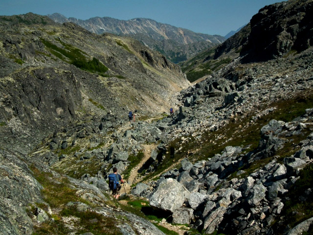
Happy Camp is nestled in a rocky subapline valley beside a nice river. From here, you will follow between and above the rocky cliffs that flank the river towards Long Lake and the Deep Lake campground. There is some elevation gain before you finally descend to Deep Lake (4 km from Happy Camp).
After Deep Lake you will enter ito a more dry, mostly pine forested landscape. You will follow lichen and rock covered ground as you walk to Lindeman Lake (4.8 km from Deep Lake) and Bare Loon Lake (4.9 km from Lindeman Lake).
About 500 m after Bare Loon Lake you will come to a slight fork in the trail. Going straight will lead you to Bennett Lake (6.4 km from Bare Loon Lake) where you can catch the White Pass & Yukon Route train back to Skagway, or hire a floatplane to take you to Whitehorse.
Going right at the fork will take you on the Bare Loon cut-off trail which will lead you to the railway tracks which you can follow to the Log Cabin parking lot. From the fork, it is just under 2 km to the railway tracks and then another 8.5 km to the Log Cabin parking lot. Note that Parks Canada closed the Bare Loon cut-off trail in 2011. In addition, walking along the railway tracks is illegal. Parks Canada wardens are enforcing this closure and fining individuals. Use this cut-off trail at your own risk.
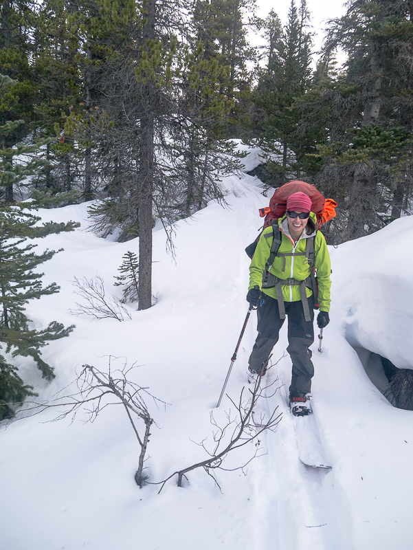
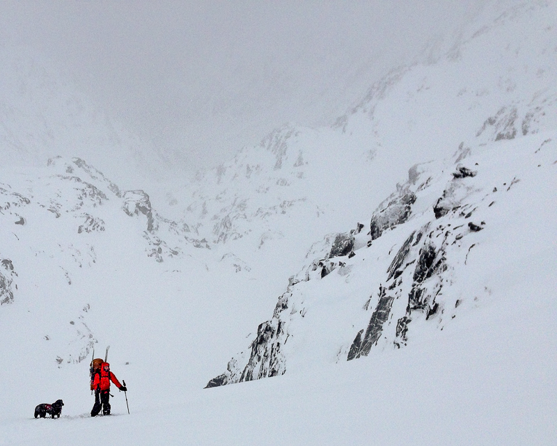
If you want to avoid the crowds, then skiing the Chilkoot Trail in winter is one way to do just that! The avalanche danger is higher than in the summer, as the snow may not have consolodated, and in many cases, it may still be snowing. Make sure you are well equiped for assessing avalanche conditions and rescue before attempting this ski route. The Golden Stairs is the largest concern, and is around 35 degrees in angle in some spots.
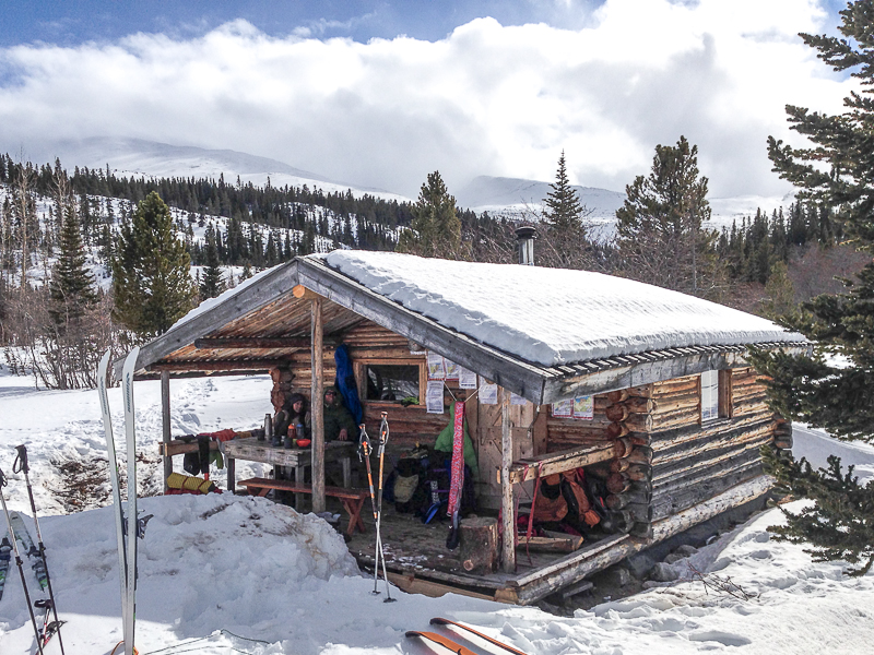
There are numerous day-use shelters along the way that are a great way to warm up and dry off. Most shelters have a wood stove (except for Happy Camp). Lindeman, Happy Camp, Sheep Camp, Pleasant Camp, Canyon City, and Finnegan's Point all have shelters (either cabins or wall tents). The shelters are meant for day-use only, but the temptation of sleeping in a warm, cozy cabin may be too much to resist.
The best direction to ski the Chilkoot Trail is to start at the Log Cabin parking lot and ski it in reverse to Dyea. This way, you're essentially skiing downhill the whole way. You can expect about the same amount of time as in the summer (3-4 days).
There are two ways to get to the cabin at the far end of Lindeman Lake. You can either take a shortcut through the trees and across Bare Loon Lake, or you can ski most of the way to Bennett Lake and then ski the whole length of Lindeman Lake. Both ways take roughly the same amount of time: going to Bennett Lake is longer but straightforward, and taking the shortcut is shorter but requires some route finding.
Starting at the Log Cabin parking lot, follow the railway tracks for about 8.3 km. Keep an eye out for a sign on your left that says No Trespassing On Railroad Property. If you want to take the shortcut, head into the trees at this point. Otherwise, keep following the railway towards Bennett Lake.
If you take the shortcut, you will want to aim towards the lakes and streams that lead to Bare Loon Lake. Once you are at Bare Loon Lake, you will need to ski a bit further before trying to descend to Lindeman Lake (you can also follow the Chilkoot Trail to the camp at Lindeman, but there are lots of ups and downs and the trail is hard to follow). One way to descend to Lindeman Lake is to follow a creek gulley, which is about 700 m west of Bare Loon Lake. This requires a bit of bushwacking.
Either way, once you're on Lindeman Lake, everything is much more straightforward. Ski to the camp at Lindeman City, which is not quite at the end of the lake. Note there is a creek that empties into the lake at this location so give it a wide berth, as the ice is thinner here and there can even be open water. You can expect a minimum of 5 hours to reach the cabin, and upwards of 8 hours if you have a lot of fresh snow to plow through.
From Lindeman Lake, you need to find and follow the Chilkoot Trail to Deep Lake. The trail gains some elevation and then stays on the northwest side of a tall canyon. Be careful traversing along the canyon side, as there's a nasty drop over the cliffs if you were to slip or cause a small avalanche.
When you reach the start of Deep Lake, you can ski all the way across it and connect to Long Lake as well. Continue across Long Lake and then pass through a canyon that connects to Happy Camp.
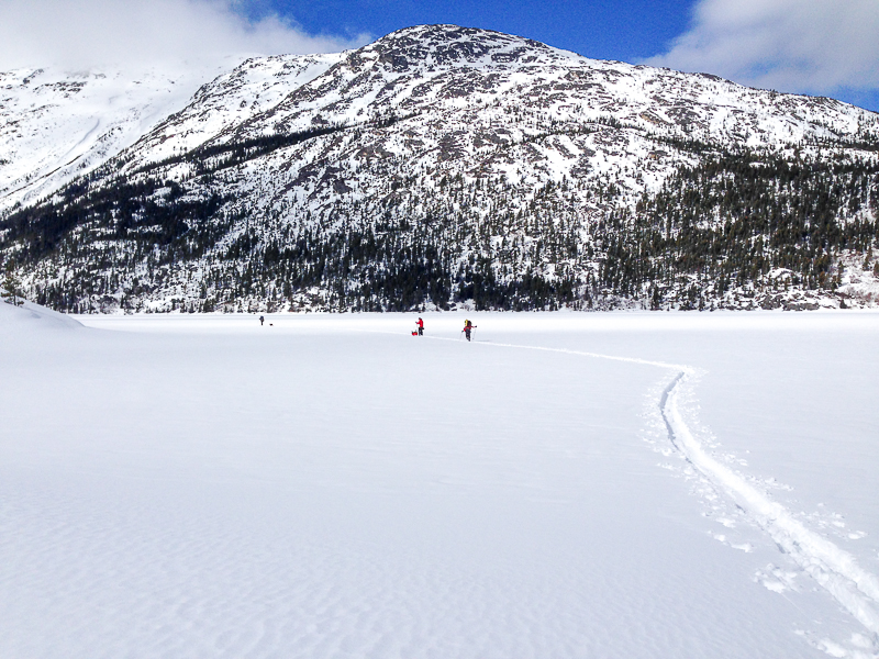
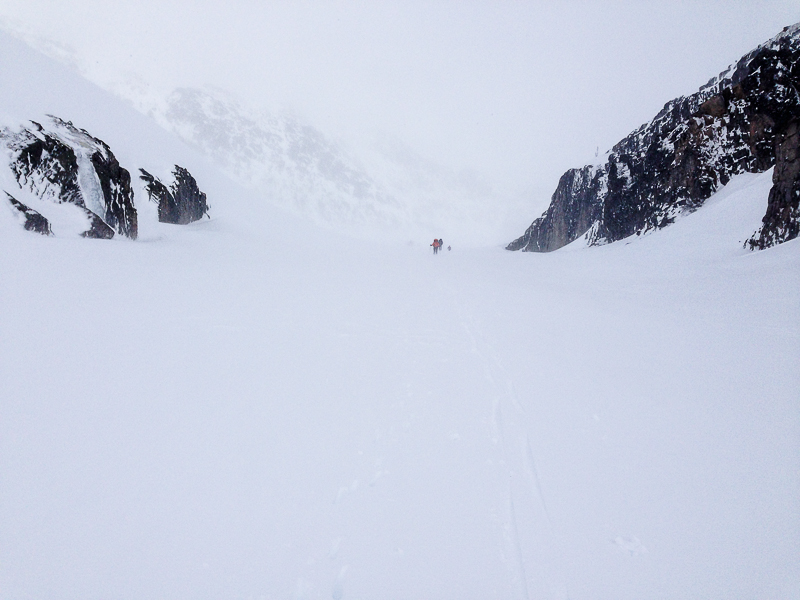
From Happy Camp, continue through more canyons all the way to Crater Lake. Ski across Crater Lake until you reach the end and are forced to ascend a small slope up to Chilkoot Pass. Thankfully the slope isn't very steep, but you must know where the Pass is so that you climb the right slope (a GPS comes in handy here)! There is a somewhat obviously col (low point) that you should head for.
Once you are at the top of Chilkoot Pass, you have to descend the Golden Stairs. There is a real avalanche danger here. In a whiteout (which is pretty common in the area), it is difficult to see the definition of the slope. It doesn't get overly steep, perhaps 35 degrees, so ski slowly and one at a time until everyone is safely at the bottom.
Skiing from the bottom of the Golden Stairs to Sheep Camp is a nice open, gradual downhill. You can enjoy the ski for about 4 km down to Sheep Camp. From Sheep Camp, it is difficult to find the trail at times. You will be in the forest at this point, and the going can be slow.
From Pleasant Camp to Canyon City, again you may lose the trail at times. Sometimes it can be faster to find your own path and not follow the trail.
From Canyon City to Finnegan's Point, you may have to alternate between skiing and hiking, as the trail meanders up and down through the forest.
After Finnegan's Point, you'll be following an old wagon road, which is flat and wide and is easy to ski. The final few hundred meters just before the trailhead at Dyea are some of the worst. You will have to carry your skis up over 100 meters of elevation gain that seems relentless, and then back down again to the Dyea trailhead.
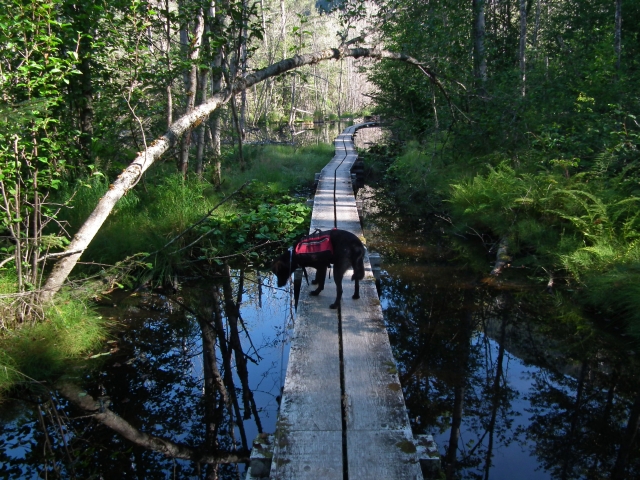
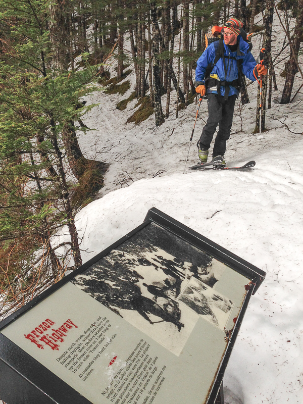
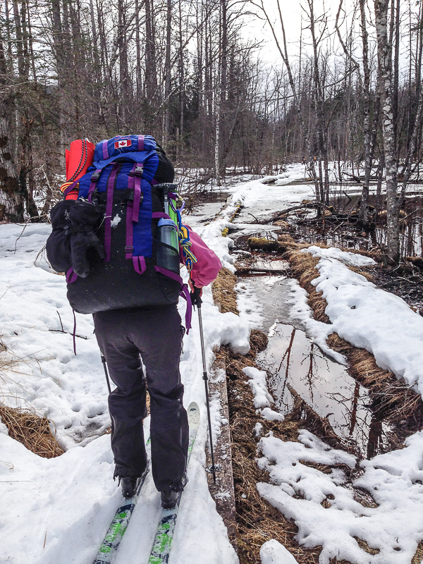
The first section of the trail can be quite wet, hence the boardwalks.
The first camp you reach is Finnegan's Point.

Inside the cabin at Canyon City.

Glaciers start to appear in the mountain ridges as you walk beside the Taiya River.
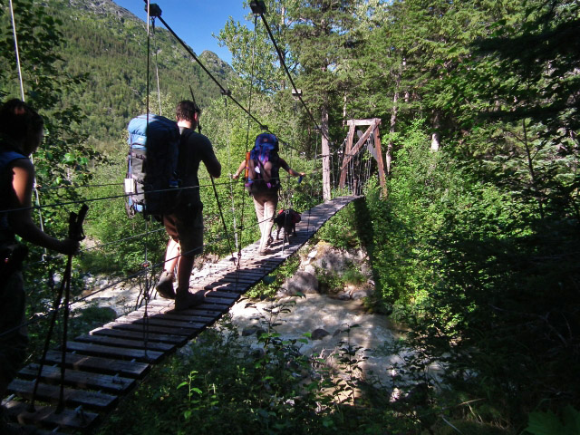
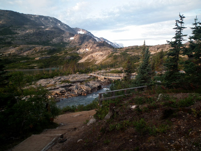
Suspension bridges help you cross the larger creeks.
After Sheep Camp, you leave the forest and the view opens up.
Looking down the famous Golden Stairs.
Canadian Customs hut and a sweeping view at the border.
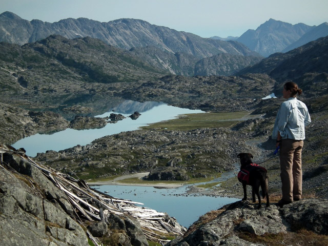
The beautiful Crater Lake just after the border.
The trail meanders beside Crater Lake for a while.
After climbing for the past 25 km, the trail finally flattens out.
The landscape is vastly different on the Canadian side of the trail.
An easy to follow route in the beautiful alpine.

Entering Happy Camp.
The trail follows along the water's edge between rocky cliffs.
As you approach Long Lake, you will be high up above it.
The entrance of the Deep Lake campsite.

Definately not a suspension bridge.
The facilities at the Bare Loon Lake campsite.
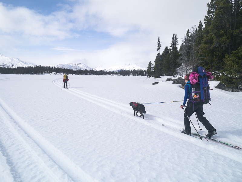
Skiing across Bare Loon Lake.
If you take the shortcut, there is a bit of travel through the forest between Bare Loon Lake and Lindeman Lake.
On Lindeman Lake.
The cozy cabin at the far end of Lindeman Lake.
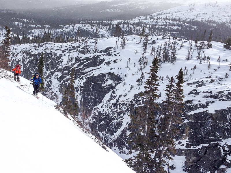
The slopes above the canyon between Lindeman Lake and Deep Lake should be traversed carefully.
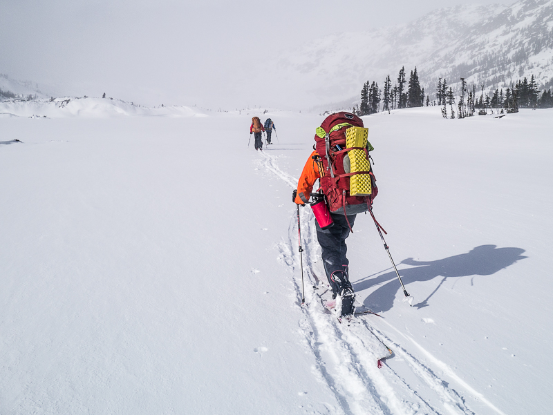
Skiing across Deep Lake.
The canyon section after Long Lake.
At the top of the Golden Stairs (in a whiteout).

Easy skiing down to Sheep Camp.
The trail through the forest has lots of ups and downs and less snow.
Depending on how late in the season it is, you might have to slowly ski on top of some of the boardwalks.
Yukon Hiking May 24, 2022
NOTE for the 2022 season the Chilkoot Trail cannot be hiked from the US to Canada, due to COVID restrictions. It can be hiked either on the US side only or the Canadian side only. Registration is still required.
Alfie May 19, 2022
I would like to this trip starting from the Canadian side. Do you need a passport to cross over into the US? Is there a border crossing station in Dyea that you need to check into once you crossed over to the US? Are there border patrols checking for permits and documentation?
MJB October 15, 2019
I hiked about 1.25 hours in (and then back) on the Chilkoot Trail starting in Dyea (Skagway) on October 8th, 2019. Even though there was quite a bit of snow in the Yukon on the day I drove in, there was none on the Alaska end of the trail. I stopped in Skagway and spoke with a park ranger first, who said bears were active in the area, even in town. The trail itself was in good condition. It was not muddy or slippery. The first hour is all steep uphill and downhill and then it levels out. I had very good hiking boots and a trekking pole, and that was very helpful. I did slip a couple of times, mainly because of all the rocks and tree roots. I had bear spray with me but didn't see any wildlife other than a vole and some birds. I did not see any people on the trail at all.
Andy July 17, 2018
I'm planning to do the Chilkoot in late August, from Dyea. I want to leave my car in Log Cabin, hike to Bennett from Log Cabin to catch the 3:15 (Alaska time?) train to Skagway, and then hike back to Log Cabin over a few days.
Because of travel schedules, this is the way I need to do it, but I'm coming from several hours away the day I need to get the Bennett to Skagway train, and want to make sure I leave enough time to hike from Log Cabin to Bennett to get the train.
Any sense of how long / hard / safe this is?
kyliestravel June 28, 2018
Great weather to hike on the Summer solstice. Still loads of snow from the last bit of the golden stairs and mostly back down to happy camp. Expect your feet to get wet! If it isn't snow, it's raging water.
Super quiet and mellow, utter sunshine perfection. The trail on the skagway side is still being constructed, the Taiya was overflowing from the rapid warming temps.
Don't take the cut off! It's horrid! The day the trains weren't running and my initial plan of taking Fraser notch (too much snow). So i took the cut off. The bridges have purposefully been ripped apart and moved off the water crossings. At one point I was waste deep in fast-moving water trying to wade across to bush whack. Then you spend what feels like forever hiking the train tracks out with terribly wet feet.
Take the train - this trail is totally not worth it and almost ruined the lovely hike.
Felix Ossig-Bonanno June 12, 2018
Good trip. Interesting progression from rainforest to alpine and then desert like sand dunes.
We did this trip from the 28th-31st of May. Still quite a lot of snow. We had snow shoes on before the Scales. talking them off now and then as we climbed up to the pass. From the Pass to Happy is all snow (I'll attach a pic from here). Then intermittent snow to Deep Lake. Snow was really isothermal. My friend post holed to his waist numerous times when crossing short patches where we didn't put snow shoes on. I had to help dig him out. Dog did great tough ;)
Even with snow shoes on you'd sink in quite a bit in spots.
The train wasn't running because a rock took out a bridge near Skagway so we got to ride on the back of a work train and then got driven back from Log Cabin. The train company refunded us. I think it is back running now.
Daniel October 29, 2017
I did this hike over the Thanksgiving weekend and didn't meet any single soul. If you don't want to experience the nowadays gold rush during the summer and still to have some good weather do it in October. The only thing I want to mention here is the current situation on the connecting trail between the Chilkoot trail and the railway. The fork that is about 500 m after Bare Loon Lake is not obvious anymore, so be careful. We missed it and had to go back. It seems that rangers want to abandon this trail - they removed the boardwalks over the creeks and local beavers used the material for their dams so the flat part is now under water so be prepared to get wet. But at least we had some fun, walking on the railway was not anymore.
Carlos July 26, 2017
Went over the saddle from Fraser Lake last weekend. From the saddle, you're looking down on the Chilkoot Trail and Crater Lake, about 300 meters below. It was a straightforward descent, keeping a small stream on our left and a line of trees to our right, zig-zagging down to meet the trail. Took us 6.5 hrs to go from the parking lot at Fraser to Happy Camp on the Chilkoot, with numerous stops to soak in the awesome scenery under sunny skies. We followed our path back to the saddle and took a little less time. Stopped to make coffee at the saddle and scared off a beautiful grizz on his way towards us from Fraser Lake. We were downwind and he got pretty close before we saw him but when we made some noise, he was more scared of us and ran off the way he'd come. We learned that there are trails on both sides of Fraser Lake but we've always taken the southern trail.
Joanne July 24, 2017
Last Summer, we hiked out using the tracks. It is an extra 7Km from Bennett Lake (the end of the trail) back to the highway. They are pretty long and boring KM's but better than paying for a train. I don't see how anyone would be giving out fines. It's just a railway and nobody is there. Parcs Canada even recommended me to hike out this way.
Kaitlin Normandin July 24, 2017
Wish I read this whole article before I booked permits! Originally planned to hike out from Bennett along the railway tracks to Log Cabin, supposed to finish this Sunday and there's no train out. Are people still being fined? I called Parks Canada and they said they weren't the ones fining people. Any other suggestions in terms of routes out?
Jim haver November 28, 2016
The With my two children Christopher and Stephannie we did chilkoot in 1978. What great trip with children. Ages 12 and 10. Real great c hildren to endure. Today it still excitement for them. And at 78 today. Invokes great memories.D.
Jo October 2, 2016
Did a day trip to the summit cabin at the pass from Fraser (Bryant) lake and back on Sun Oct 2nd. There's a good trail all the way around the left (south) side of Fraser lake and then good travel all the way to the col at GR 894191. I found sticking to the talus slope on the North side of the drainage allowed us to avoid all the moraines, scree and boulders and made for good travel. From the col, find the path of least resistance down. We headed in a NW direction aiming for a treed rib and sticking to the main drainage all the way down to meet up with the Chilkoot trail at GR 881195. We continued to the summit cabin for soup and headed back the same way. This is a great trip and a great altenative way onto the Chilkoot trail from the Canadian side. I believe it would be possible to walk down to Long lake on the way back and find a way back up and over Fraser ridge for an extra rewarding circuit of the most scenic section of the Chilkoot trail. Amazing route with spectacular views!
Jo September 16, 2016
Just came back from a 4 day trip Sept 12-15th on the Chilkoot trail with a group of students. Rained on day 1 and then probably got over 20 mm rain overnight. We camped at Finnegan's and encountered a nasty mudslide with a raging river where the trail should've been. Had to bushwhack through devil s club down to the main drainage to find a safe ford across. We had to hike/swim through a lot of wet and muddy sections and found Canyon city flooded with water running all the way around the cabin, below the picnic tables and bear poles. Decent ford there too just to get across back on the trail. More rain all the way to Sheep camp. Things improved somewhat after that, rain slowed to a mist but in the clouds and no visibility up to and across the pass. The wardens said water level was at its peak and the trail probably impassable from Dyea that day (Wed). Made it to Happy camp drenched but content. Decent day out from Happy all the way to Bennett and a nice, warm and dry evening in the cabin there. Some well deserved rest for our students/troopers who enjoyed the challenge and rewards the Chilkoot has to offer. Great trip!
MeghanM December 22, 2015
Hi Isa,
Did this route in the winter on nordic touring skis (as described here in reverse -> BC-Alaska) two years ago (I think it was early April). Still a lot of snow, with avalanches still a concern as well as a mixed bag of weather (whiteout blizzards, rain, snow, sun).
Must have excellent route finding skills as the 'trail' is non-existent under snow and is even harder to find and keep on while in the trees on the Alaska side (a GPS is a must). In terms of the skiing terrain, there are uphills as well as downhills (likely not great for just regular cross-country skis). I would recommend this winter trip to experienced winter backcountry travellers. And having done the trail in the summer helps!
As a summer hike this route is absolutely doable for most people (experienced and not). It is still a multi-day trip but you can take as much time as you need. The trail is well marked and the campsites are well maintained.
Isa December 18, 2015
Planning to do the trail in late March 2016. Does anyone have experience with winter conditions? I have done a couple of hikes in the Alps (always late summer) and started cross-country skiing this season (thus beginner). In some trail descriptions Chilkoot sounds like a super tough hike, in others absolutely doable. Any comments on that?
FrozenFella November 1, 2015
Regarding dogs on the train, this is from the WP&YR website regarding their hiker service:
"$25 Fare per Dog
While we do permit dogs on our Chilkoot Hiker Service trains, we unfortunately are not able to permit dogs on any of our connecting bus services. Exceptions are made for service animals."
http://wpyr.com/excursions/hikers-service/chilkoot-hiker-service/
Ruth May 19, 2015
Has anyone done the trail in early June? I'm wondering what the conditions might be.
Leah May 2, 2015
My friend and I did this hike at the end of July 2014.
Best hike of my life! The US side was wet and chilly but the Canadian side was hot and sunny!
The trail is much easier then I thought it was going to be. The golden stairs however did give me a fright as I have a bit of a height intolerance. Stay on the boulders. I don't recommend hiking up to the side of them because of the shale. The boulders give you plenty of grip, which helps due to the heavy packs everyone wears. There are about 5 false summits before you get to the top. Use the outhouse! Best view in the world while on it!
Take 5 days and really enjoy it. There's so much to see. I recommend 2 nights in Lindeman city as it's just beautiful and the beach is nice to lounge out on.
This hike should be on everyone's bucket list at least once!
Travis April 7, 2015
We took our dog on the trail last year and were able to take her on the train with no issues.
Anthony DeLorenzo April 7, 2015
WP&YR will not take dogs on the train. Alpine Aviation will fly your dog out with you if you go that route. Cabin Fever Adventures offers boat service to Carcross, I don't know if they'll take dogs in the boat.
Meghan M March 27, 2015
Hi 'T' - We brought our dog on the trail and it was not a problem at all. They do require that dogs be on a leash at all times so if you can handle that then you're good. The only exception was they allowed you to take your dog off leash for climbing the golden stairs as it's definitely tricky (and dangerous) otherwise! The only other thing to look into is if you're taking the train back - what the deal is with dogs.
T March 25, 2015
Just wanted to know what people though about dogs on the trail. We hike quite often with our dogs and are thinking of bringing them on the trail. Any thoughts advice
Jennifer H August 13, 2014
Just returned from 5 days on this trail and have to say it was definitely worth all the hype, the planning, and the sweat!
There was A LOT of bear activity during this time (first week of Aug) with fresh scat every ~100m, grizzly prints in the mud and frequent bear diggings near the trail. So be prepared and know how to stay safe!
I was really pleased with the rangers on both sides of the border. Very informative, helpful, and genuinely concerned about your safety. The ranger at the Canadian summit was especially awesome. When our group arrived at the shelter, she brought over hot water in thermoses to help us warm up.
Disappointed about the train/out-trail situation. Feels like a big cash grab for WPYR and Parks Canada... hoping an alternative to this will be available in the future.
Andre August 4, 2013
Nous venons tout juste de marcher le sentier en 5 jours. C'est un sentier vraiment extra.
Du côté américain il a quelques bonnes montées, dont la fameuse passe, mais rien de vraiment trop difficile si on a la forme. Le côté canadien est définitivement le plus intéressant avec ses paysages à couper le souffle. La passe du col n'est pas la partie la plus difficile du sentier mais demande d'être à l'aise avec la sensation du vide. Le sentier est bien balisé, le personnel fait vraiment un très bon travail de ce côté.
Il y aurait des améliorations à apporter aux toilettes du côté américain et à la capacité d'accueil à Sheep Camp. Du côté canadien, les installations sont très biens mais à Happy Camp la capacité et les installations sont nettement insuffisantes. Au lac Bennet, là où tous arrivent, il y a un grave problème de capacité d'accueil. Les campements sont insuffisants, il manque de tables et d'abris pour manger en cas de pluie et, comble de tout, il n'y a qu'un seul emplacement pour les eaux usées. En résumé, les installations du lac Bennet font vraiment dures et demanderaient d'être améliorées d'urgence.
Tout cela pour dire que le sentier Chilkoot est un superbe sentier mais les installations auraient à être mises à niveau pour la quantité de gens qui le fréquente.
Sue August 1, 2013
Yes. Parks Canada is fining people they catch on the cut-off. We just did the trail last week and heard some of the workcrews on the American side letting people know.
sam July 29, 2013
Has anyone heard anything about hikers being fined $300 for using the cut off trail at bare loon lake? Hoping to hike the chilkoot in a day but not wanting to get fined.
Anthony DeLorenzo September 10, 2012
We hiked the trail in about 44 hours from September 7-9. There were only a few groups on the trail, a perfect time to do it! Empty campgrounds meant that we slept in the cabins at Pleasant Camp and Lindeman (upper).
Our dog didn't like the golden stairs too much but he made it through. Without the trail markers we ended up off-route a fair ways but fortunately we managed to re-locate the trail at the top.
The new Parks Canada cabin at Bennett Lake is awesome, we're definitely planning to come back for a winter trip.
No trains running so we flew back to Whitehorse with Alpine Aviation. There were a couple of people at Bennett trying to hitch a ride with a White Pass work train but I think they had no luck with that and may have ended up having to hike out to Log Cabin.
http://www.flickr.com/photos/delorenzo/7968057458/in/photostream/lightbox/
Niko Helm September 8, 2012
Just finished my first season working on the trail. Had an AWSOME summer, met lots of great people and loved hiking around all the time. Yesterday was the last day parks Canada operated the trail for the season so I'm gonna miss it, I plan on going back next summer for sure.
David Raithby September 4, 2012
Had a beautiful five day hike the end of July. Perfect weather going over the summit. I wrote a tour description on my blog at through www.davidraithby.com for those interested in some additional details. One more off the bucket list