Total Distance: 6 km
Return Time: 3 hours
Elevation Gain: 590 m
Difficulty: Moderate
Region: Tombstone
Traditional Territory: NNDFN, THFN
This is a fun ridge walk up to Angelcomb Peak. It is short and offers great views up the East Blackstone River and the peaks and valleys to the east of the Dempster Highway. This area is important sheep habitat, and Yukon Parks discourages using this trail, especially during lambing season from May 15 to July 1st. Please drop by the Tombstone Interpretive Centre for more information about this sensitive area before you decide to hike it.
Drive to kilometre 81 on the Dempster Highway and look for a road on the right (east) side with a yellow gate at the end. Park here, but leave room in front of the gate for highway maintenance workers.
Walk past the gate to the gravel pit and head right, where a trail leads up to a gentle slope. The trail is well-worn and should be easy to follow once you reach it. You'll be out of the bushes quickly and walking up this lower slope to a rockier ridge.
When you reach the ridge, the trail gets steeper until you reach the top of the ridge. Follow the trail along the top of the ridge as it leads you to the base of the peak.
The final climb from the ridge to the top of the peak steepens again. If you lose sight of the trail here, just head straight up.
The summit is actually quite small and exposed, but there is still plenty of room to sit and soak in the views. To the west is the valley leading up the East Blackstone River. Below you to the northeast is Yakamaw Creek. The connected ridge to the south leads to Trapper Mountain. If you have time, you can walk to the higher peak of Trapper Mountain along the ridge. Otherwise, descend from the summit and enjoy a pleasant ridge-walk back down.

On the left is the peak and the ridge follows down from it to the very right of the photo.

Looking up towards the peak and the higher ridge from the lower, broader slope.
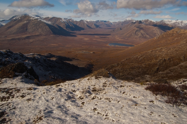
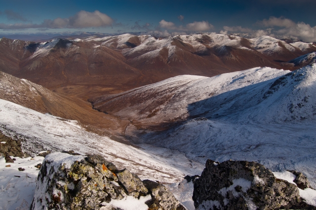
A view down the valley where the East Blackstone River runs.
Looking south down the Dempster Highway.
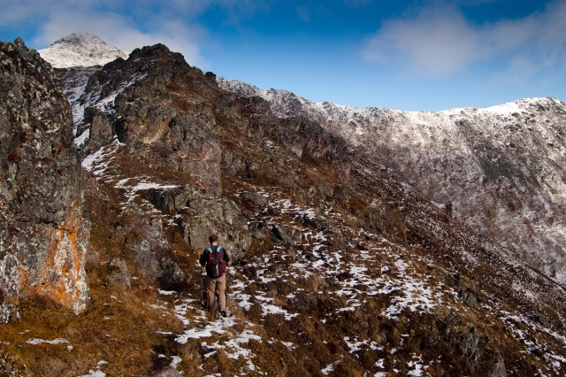
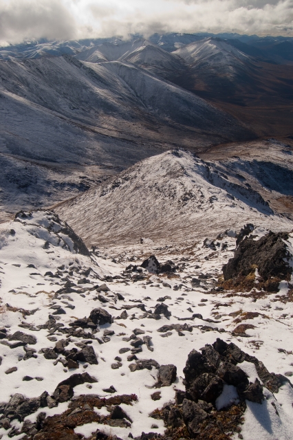
The trail to the upper ridge becomes rockier and steepens briefly.
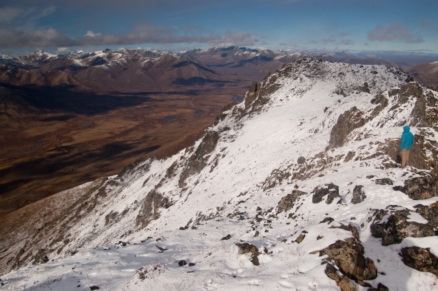
Looking down the ridge from the summit.
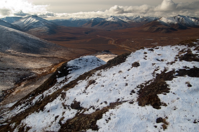
The view on the back (east) of Angelcomb.

Trapper Mountain is connected to Angelcomb along this ridge. If you have time, you can hike up to its summit.
Looking north from the summit.

Annie-Claude August 19, 2018
We went to Tombstone Park this weekend and asked at the interpretive centre about this hike. They said they had closed it to the public for a variety of reasons. Might be a good idea to check with Parks and maybe remove it from this site?
Darin and Charlene September 2, 2017
Loved the hike! Hiked Angelcomb September 1 in the afternoon under sunny skies. Saw two peregrine falcons hunting near the summit and had one rocket past us while diving for songbirds. Great view from the summit and saw 4 dall sheep in the northern bowl below us. Bring your touque for the breeze at the top.