Total Distance: 26 km
Return Time: 8 hours
Elevation Gain: 1025 m
Difficulty: Moderate
Region: Annie Lake
Traditional Territory: CTFN
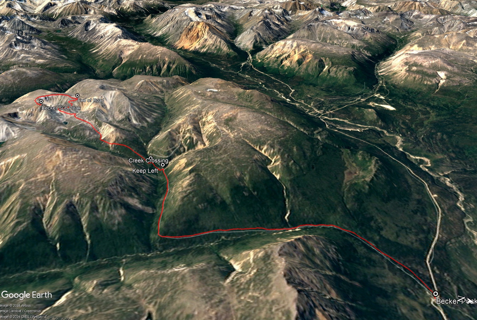
Becker Peak is just passed Tally-Ho and Mount Anderson on the Annie Lake Road. It is in a little mountain complex with Carbon Hill and Mount Bell. The route, like many hikes in this area, is via old mining roads. This road is in much better shape than some of the others in the area and can be partially driven or mountain biked/e-biked to cut off some of the time and distance. From up high on the ridge the views are stunning to the southwest of Mount Crozier and even as far as Radelet Peak near the BC border. Keep an eye for caribou in this area. Note this hike takes you to a more dramatic sub-peak of Becker Peak with great views. The true summit is a more rounded peak, another 1.3 km to the east.
From Whitehorse, drive south on the Alaska Highway to the Carcross Cutoff and turn right onto the South Klondike Highway. Drive south for about 17 km and turn right onto the Annie Lake Road. After 26 km on the Annie Lake Road, you will cross a bridge over the Wheaton River. Around 10.5 km after the Wheaton River Bridge you will reach another creek crossing over Becker Creek. The bridge has been removed and the trail starts on the other side of the creek. You can park here and cross on foot or find a suitable fording site for your vehicle.
Just after crossing the creek, follow the road that heads off to the left beside the creek. You could choose to drive more of this road or even mountain bike or e-mountain bike a portion of the road to make a shorter hike.
The road is flat for a while and then gains elevation very gradually as it follows the creek southeast. After 4.8 km, the road heads more west. After 6.7 km from the trailhead you'll see another mining road to the right. Keep left here and continue on the road.
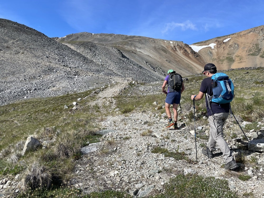
After gaining a bit more elevation you will cross a creek. Continue on the road as it takes you along a small sub-alpine ridge and eventually along the left side of a rockier ridge. The road continues up into an alpine cirque between two small lakes. Then it switchbacks up the mountain to the top of the ridge. This is where the road ends.
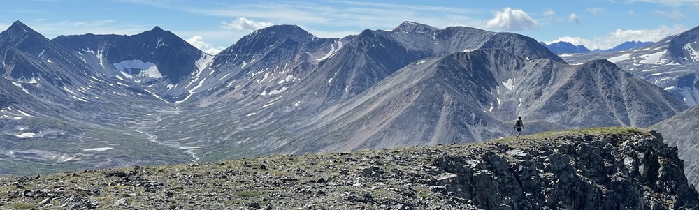
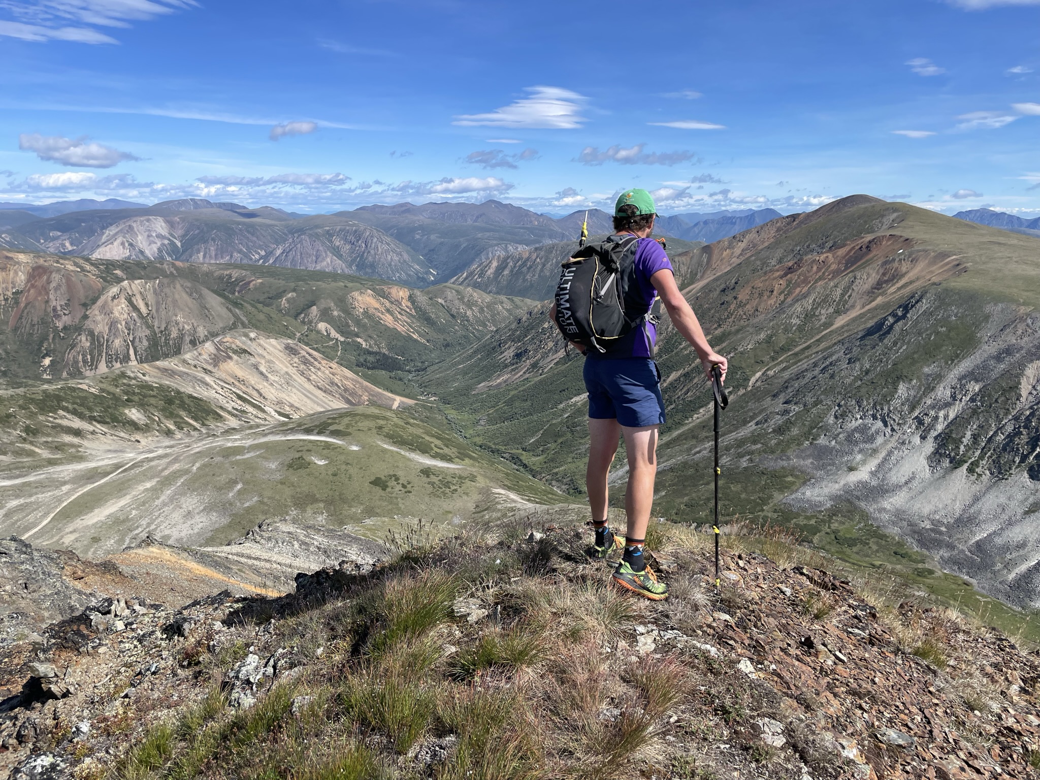
Follow the edge of the cirque to the east, and you will reach a dramatic rocky outlook. The views down the valley to the south are towards Crozier Peak. Further south-southwest are the rocky spires and snowfields of Radelet Peak near the BC border.
Head back the same way you came. Or consider an extended hike to the true summit.
EXTENDED HIKE
To hike to the true summit of Becker Peak, continue east across the alpine to the rounded true summit. Add another 170 m elevation gain and 2.6 km return to the hike.
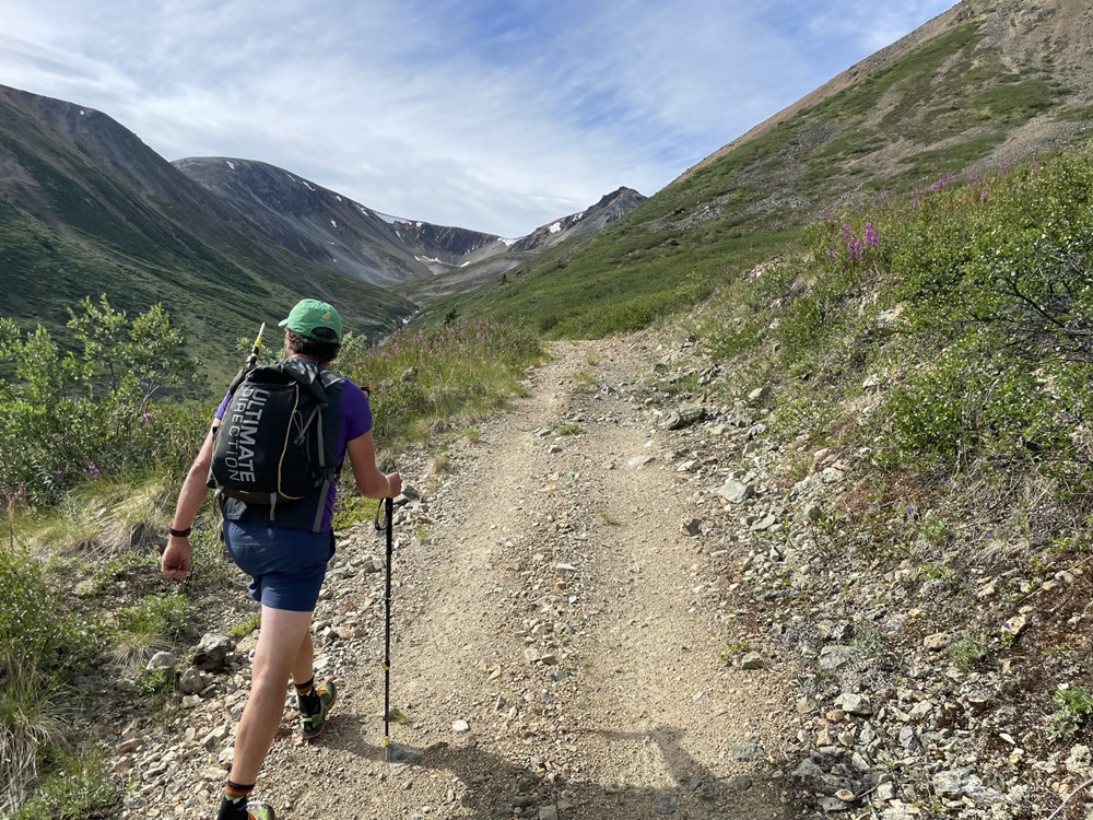
Following the road through the sub-alpine.
Reaching the base of the cirque near the alpine lakes.
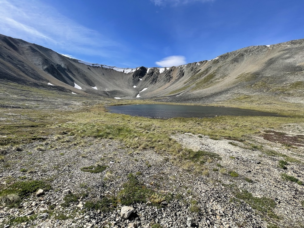
One of the small alpine lakes.
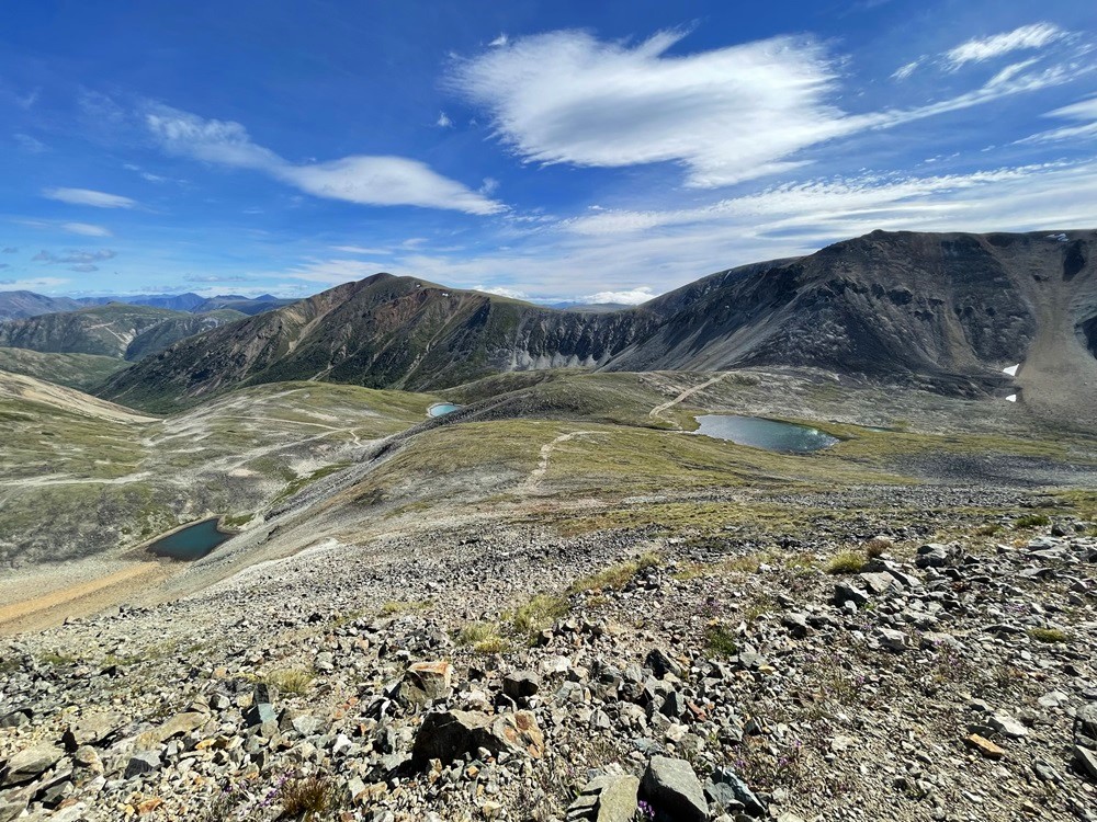
Looking back towards the alpine lakes while gaining the ridge.
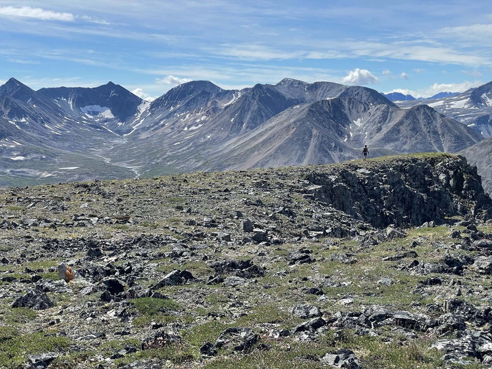
Nearing the top of the ridge. The rounded true summit of Becker Peak is in the background (left).
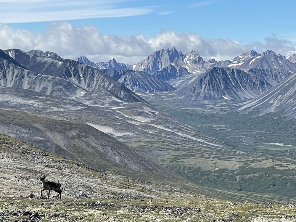
Watching a caribou climb up the other side of the ridge, with a backdrop of Radelet Peak to the southwest.
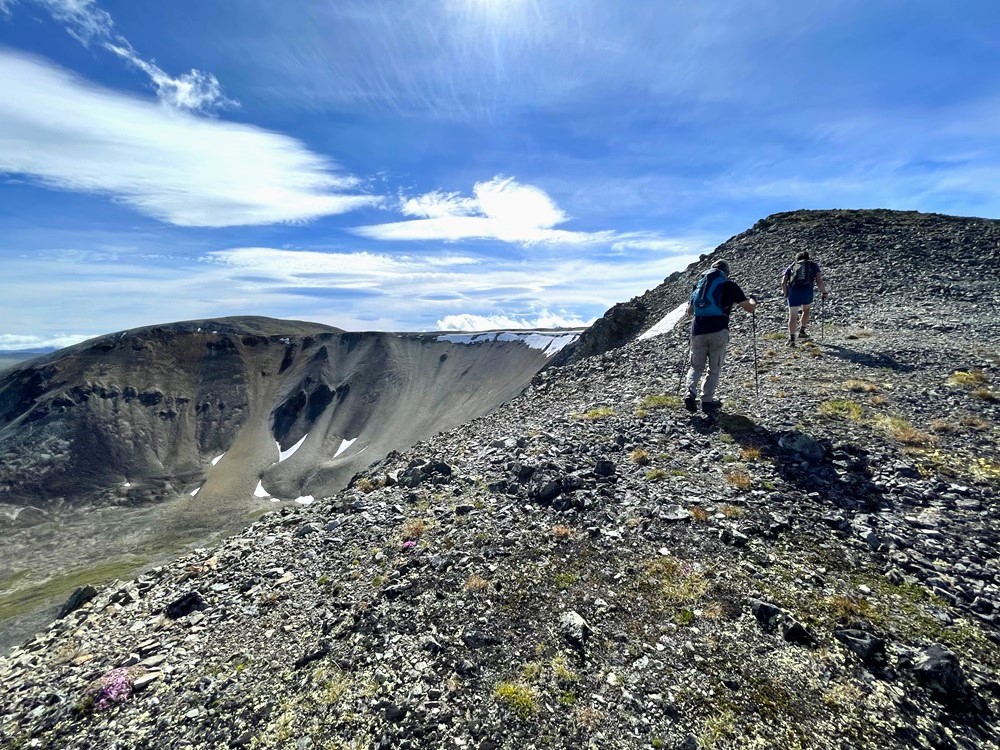
Nearing the rocky sub-peak of Mount Becker.
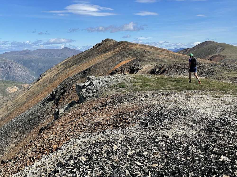
Views back down the valley from the sub-peak. Mount Bell is in the background (right).
Checking out more views to the south on the way back.
Andy M March 7, 2024
Thanks for adding this! Adding it to my spring bucket list 🙌